


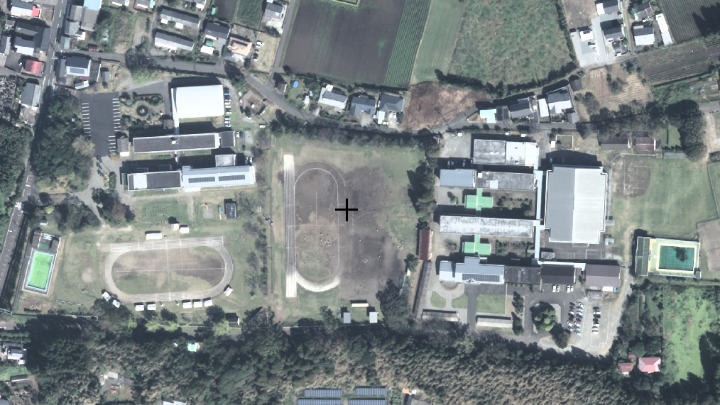


Tsunō, Japan
都農町
Tsunō is a town of 10,028 people in Miyazaki, Japan, founded in August 1, 1920.
Why visit Tsunō
Townapedia lists 2 parks and trails, 2 places to eat, 2 places to stay and 1 attraction in and around town.
Weather in Tsunō
Forecast from MET Norway (CC BY 4.0). Full forecast
About Tsunō
Tsuno (都農町, Tsuno-chō) is a town located in Koyu District, Miyazaki Prefecture, Japan. As of 1 October 2023, the town has an estimated population of 9,577 in 3997 households, and a population density of 94 persons per km². The total area of the town is 145.96 square kilometres (56.36 sq mi).
From the Wikipedia article Tsuno, Miyazaki (this version), under CC BY-SA 4.0.
Things to do1

Parks, trails and playgrounds2

Restaurants and cafes2


Where to stay2

History
The area of Tsuno was part of ancient Hyūga Province. The area was under the control of the Shimazu clan from the Nanboku-chō period, and was a contested borderland fought over many times during the Sengoku period. During the Edo period, it was part of the holdings of Sadowara Domain. The village of Tsuno within Koyu District, Miyazaki was established on April 1, 1889 with the creation of the modern municipalities system. It was raised to town status on August 1, 1920.
From the History section of Tsuno, Miyazaki on Wikipedia, under CC BY-SA 4.0.
Churches and places of worship1
Shopping1
Gas and EV charging1
Schools, colleges and libraries13
Healthcare4
Map of Tsunō
27 places. The map loads OpenStreetMap tiles when you open it.
Getting there and nearby towns
Miyazaki Airport (KMI) is the nearest airport with scheduled flights listed in OpenStreetMap, 43 km away.
- Kawaminami 9 km southwest, about 9 min by car
- Takajō 12 km southwest, about 12 min by car
- Takanabe 14 km southwest, about 14 min by car
- Hyūga 20 km north, about 20 min by car
- Tsuma 23 km southwest, about 23 min by car
- Shintomi 22 km south, about 22 min by car
- Saito 24 km southwest, about 24 min by car
- Kadogawa 26 km north, about 26 min by car
- Nobeoka 38 km north, about 38 min by car
- Miyakonojō 74 km southwest, about 1 h 15 min by car
Drive times are estimates from straight-line distance, not routes.
Local news
Headlines from INDB.
Reviews, tips and questions
Loading what members have shared...
Sources and licences
- GeoNames (CC BY 4.0): population, coordinates, regions and time zone
- OpenStreetMap contributors (ODbL 1.0): places, airports, map data
- Wikidata (CC0 1.0): elevation, founding date, time zone, website
- Wikimedia Commons (see each image): photos
- Wikipedia (CC BY-SA 4.0): overview and history text
Photo credits
- JR Tsuno Station 2009, ja:User:Sanjo, Public domain
- Tsuno JHS, 国土地理院, CC BY 4.0
- Tsuno High School 2011, ja:User:Sanjo, CC BY-SA 3.0
- National Hospital Organization Miyazaki-hospital, Waka77, CC0
- リニア実験線跡地 - panoramio, junichiro kawakami, CC BY-SA 3.0
- Tsuno-jinja minamitorii, Saigen Jiro, CC0
- Tsuno Shrine 2009 001, ja:User:Sanjo, Public domain
- Osuzuyama, アラツク, CC BY-SA 4.0
- Old linear motor car experimental line (4227216216), Yamaguchi Yoshiaki from Japan, CC BY-SA 2.0
- The abolished JR Maglevs experiment line , 旧JRリニア実験線 - panoramio, z tanuki, CC BY 3.0
- 東都農 - panoramio, shikabane taro, CC BY 3.0
- リニアモーター実験線跡地 Old Test line of JR Maglev - Solar Power Plant - panoramio, shunsaku hara (r265), CC BY-SA 3.0
- ISS064-E-29768 - View of Earth, Earth Science and Remote Sensing Unit, NASA Johnson Space Center, Public domain
- ISS064-E-29769 - View of Earth, Earth Science and Remote Sensing Unit, NASA Johnson Space Center, Public domain
- ISS038-E-46191 - View of Earth, Earth Science and Remote Sensing Unit , Lyndon B. Johnson Space Center, Public domain
- ISS055-E-65984 - View of Earth, Earth Science and Remote Sensing Unit, NASA Johnson Space Center, Public domain
- ISS055-E-65983 - View of Earth, Earth Science and Remote Sensing Unit, NASA Johnson Space Center, Public domain
- ISS039-E-17871 - View of Earth, Earth Science and Remote Sensing Unit , Lyndon B. Johnson Space Center, Public domain
- ISS038-E-46190 - View of Earth, Earth Science and Remote Sensing Unit , Lyndon B. Johnson Space Center, Public domain
- ISS039-E-17870 - View of Earth, Earth Science and Remote Sensing Unit , Lyndon B. Johnson Space Center, Public domain


Page built November 5, 2026. Spotted a mistake? Tell us or suggest a place.