
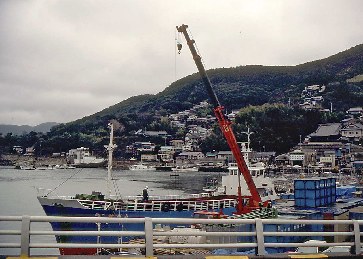


Tsushima, Japan
対馬市
Tsushima is a town of 28,502 people in Nagasaki, Japan, founded in March 1, 2004.
Why visit Tsushima
Townapedia lists 24 museums and landmarks, 8 parks and trails, 28 places to eat, 14 places to stay and 93 attractions in and around town.
Highlights include Yatate Yama, 有明山, Kaneda Castle and Shimizuyama Castle.
Weather in Tsushima
Forecast from MET Norway (CC BY 4.0). Full forecast
About Tsushima
Tsushima (対馬市, Tsushima-shi; Japanese pronunciation: [t͡sɨ̥.ɕì.mä̀, -ɕí.mä̀, -ɕí.mä́.ɕì]) is an island city grouped in Nagasaki Prefecture, Japan. It is the only city of Tsushima Subprefecture and it encompasses all of Tsushima Island, which lies in the Tsushima Strait north of Nagasaki on the western side of Kyushu, the southernmost mainland island of Japan. As of March 2017, the city has an estimated population of 31,550 and a population density of 45 persons per km2. Its total area is 708.61 km2, 17.3% of the area of Nagasaki Prefecture.
From the Wikipedia article Tsushima, Nagasaki (this version), under CC BY-SA 4.0.
Things to do93




81 more on the map.
Museums and landmarks24



12 more on the map.
Parks, trails and playgrounds8



Restaurants and cafes28





16 more on the map.
History
An Imperial decree in July 1899 established Izuhara, Sasuna, and Shishimi as open ports for trading with the United States and the United Kingdom.
On April 1, 1975, Toyotama Village was promoted to the status of a town. Mine Village was also elevated to the status of a town in the following year.
The modern city of Tsushima was established on March 1, 2004, from the merger of six towns on Tsushima Island: Izuhara, Mitsushima, and Toyotama (all from Shimoagata District), and Mine, Kamiagata, and Kamitsushima (all from Kamiagata District). Both districts were dissolved as a result of this merger.
From the History section of Tsushima, Nagasaki on Wikipedia, under CC BY-SA 4.0.
Where to stay14
Churches and places of worship14
Shopping9
Gas and EV charging3
Schools, colleges and libraries23
Healthcare5
Map of Tsushima
221 places. The map loads OpenStreetMap tiles when you open it.
Getting there and nearby towns
Tsushima Airport (TSJ) is the nearest airport with scheduled flights listed in OpenStreetMap, 9 km away.
- Iki 62 km southeast, about 1 h by car
Drive times are estimates from straight-line distance, not routes.
Local news
Headlines from INDB.
Reviews, tips and questions
Loading what members have shared...
Sources and licences
- GeoNames (CC BY 4.0): population, coordinates, regions and time zone
- OpenStreetMap contributors (ODbL 1.0): places, airports, map data
- Wikidata (CC0 1.0): elevation, founding date, time zone, website
- Wikimedia Commons (see each image): photos
- Wikipedia (CC BY-SA 4.0): overview and history text
Photo credits
- Tsushima1WP, Fg2, Public domain
- Photo taken on Tsushima-99, Immanuelle, CC BY 4.0
- Happy Science building in Tsushima-3, Immanuelle, CC BY 4.0
- Happy Science building in Tsushima-2, Immanuelle, CC BY 4.0
- Happy Science building in Tsushima-1, Immanuelle, CC BY 4.0
- Photo taken on Tsushima-120, Immanuelle, CC BY 4.0
- Photo taken on Tsushima-119, Immanuelle, CC BY 4.0
- Photo taken on Tsushima-94, Immanuelle, CC BY 4.0
- Photo taken on Tsushima-93, Immanuelle, CC BY 4.0
- Photo taken on Tsushima-92, Immanuelle, CC BY 4.0
- Photo taken on Tsushima-91, Immanuelle, CC BY 4.0
- Tsushima City Hall, まも, Public domain
- Photo taken on Tsushima-90, Immanuelle, CC BY 4.0
- Photo taken on Tsushima-88, Immanuelle, CC BY 4.0
- Photo taken on Tsushima-89, Immanuelle, CC BY 4.0
- Photo taken on Tsushima-79, Immanuelle, CC BY 4.0
- Photo taken on Tsushima-81, Immanuelle, CC BY 4.0
- IzuharaBanshoIn, Torbenbrinker, CC BY-SA 3.0
- Izuhara Elementary School, Tsushima City, Ackeyyama, CC BY-SA 4.0
- Ichinomaru of Shimizu Castle, Tsushima, Ackeyyama, CC BY-SA 4.0
- Kanata Castle, Ichii-no-Kido, haridashi-1, Saigen Jiro, CC0
- Mt Ariake Mt Nariai Mt Shimizu with Explanation, Ackeyyama, CC BY-SA 4.0
- Shimizuyama Castle (Tsushima), zenkei, Saigen Jiro, CC0
- Kanata Castle, tounan-sekirui-1, Saigen Jiro, CC0
- Kuta Junior High School, Tshushima City, Ackeyyama, CC BY-SA 4.0
- Banshoin (Tsushima), sanmon-1, Saigen Jiro, CC0
- Kuta Elementary School, Tsushima City, Ackeyyama, CC BY-SA 4.0
- Site of Kuwa Elementary School, Tsushima City, Ackeyyama, CC BY-SA 4.0
- Otsuki Elementary School, Tsushima City, Ackeyyama, CC BY-SA 4.0
- Site of Are Elementary School, Tsushima City, Ackeyyama, CC BY-SA 4.0
- Tsushima City Kechi Junior High School, Ackeyyama, CC BY-SA 4.0
- Tsushima City Ofunakoshi Junior High School, Ackeyyama, CC BY-SA 4.0
- Izuhara-hachimangu jinja Haiden, ChiefHira, CC BY-SA 3.0
- Izuhara Hachiman Shrine-32, Immanuelle, CC BY 4.0
- お手洗い キラリ 掃除を行いました。 対馬市 (28406150928), girakku, CC0
- Izuhara Hachiman Shrine-29, Immanuelle, CC BY 4.0
- Izuhara Hachiman Shrine-61, Immanuelle, CC BY 4.0
- Izuhara Hachiman Shrine-62, Immanuelle, CC BY 4.0
- Izuhara Hachiman Shrine-33, Immanuelle, CC BY 4.0
- Izuhara Hachiman Shrine-46, Immanuelle, CC BY 4.0


Page built November 5, 2026. Spotted a mistake? Tell us or suggest a place.