
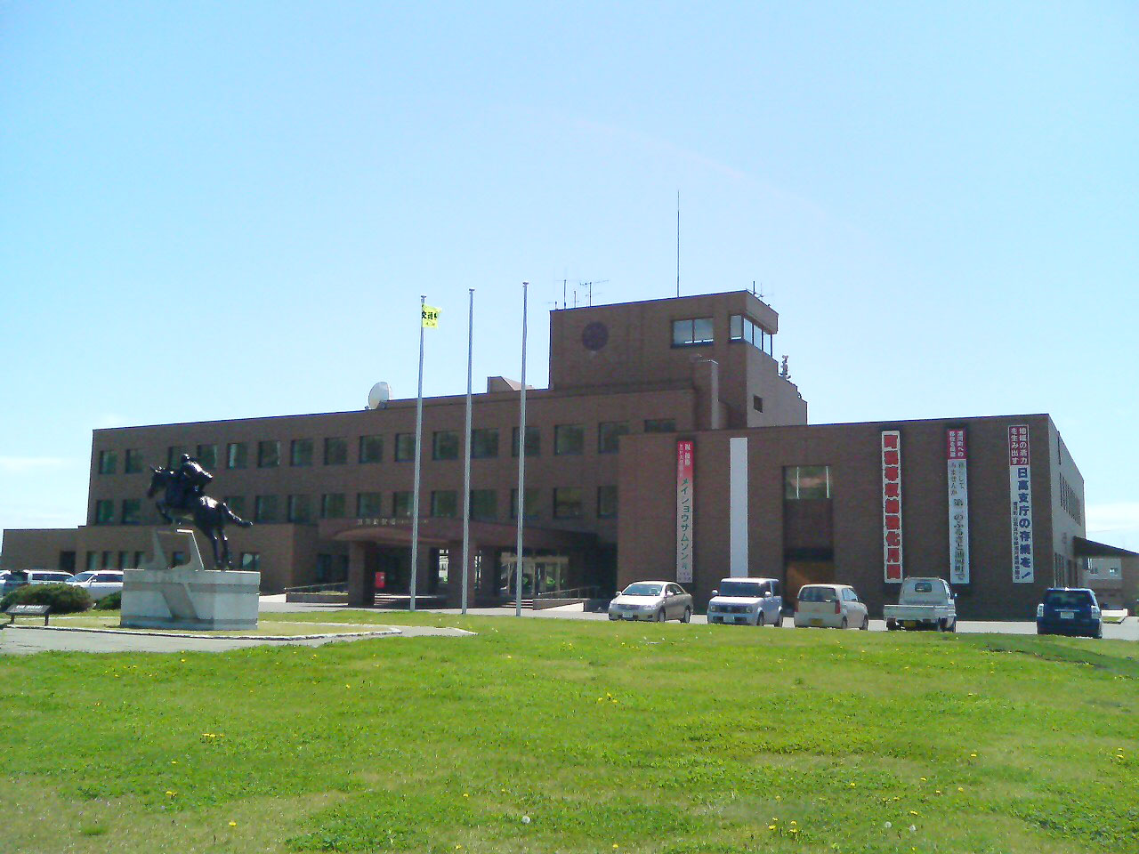


Urakawa, Japan
浦河町
Urakawa is a town of 12,800 people in Hokkaido, Japan, founded in April 1, 1902.
Why visit Urakawa
Townapedia lists 4 museums and landmarks, 17 parks and trails, 15 places to eat, 12 places to stay and 13 attractions in and around town.
Highlights include 浦河ふれあい牧場, 農産物直売所「畑のうた」, 浦河町立郷土博物館 and 馬事資料館.
Weather in Urakawa
Forecast from MET Norway (CC BY 4.0). Full forecast
About Urakawa
Urakawa (浦河町, Urakawa-chō) is a town located in Hidaka Subprefecture, Hokkaidō, Japan. As of 31 December 2025, the town had an estimated population of 11,048 in 6628 households, and a population density of 16 people per km2. The total area of the town is 694.30 km2 (268.07 sq mi).
From the Wikipedia article Urakawa, Hokkaido (this version), under CC BY-SA 4.0.
Things to do13

農産物直売所「畑のうた」
Farm and orchard · 2.7 km
15, 浦河町
Tu, Th, Sa 10:00-17:00


1 more on the map.
Museums and landmarks4



Parks, trails and playgrounds17


5 more on the map.
Restaurants and cafes15

マールワール
Restaurant · Curry, Pizza · 1.2 km
Mo,We-Fr 11:00-15:00,17:00-21:00; Sa,Su,PH 11:00-21:00; Tu off
喰処・呑処 天馬
Restaurant · Japanese · 4.4 km
Mo-Sa 11:00-14:00,17:30-21:00; Su off
ラーメン八雲
Restaurant · Ramen · 2.9 km
Mo off; Tu-Sa 11:00-14:00,17:00-20:00; Su 11:00-14:00


3 more on the map.
History
The area of Urakawa has been inhabited since the Jomon period. In the Edo period, Matsumae Domain is recorded to have built a Shinto shrine in what is now Urakawa in 1669. The Tokugawa shogunate established a horse ranch in 1858. More Japanese settlers arrived in the early Meiji period, and Urakawa was established as a village in 1902 under the second-class town and village system. Urakawa merged with two neighboring villages to form Urakawa Town in 1915.
From the History section of Urakawa, Hokkaido on Wikipedia, under CC BY-SA 4.0.
Where to stay12
Churches and places of worship21
Shopping9
Gas and EV charging13
Schools, colleges and libraries12
Healthcare11
Map of Urakawa
127 places. The map loads OpenStreetMap tiles when you open it.
Getting there and nearby towns
Tokachi-Obihiro Airport (OBO) is the nearest airport with scheduled flights listed in OpenStreetMap, 73 km away.
- Honchō 11 km east, about 11 min by car
- Erimo 34 km southeast, about 34 min by car
- Shizunai-furukawachō 40 km northwest, about 40 min by car
- Niikappu 44 km northwest, about 44 min by car
- Hiroo 45 km east, about 45 min by car
- Taiki 56 km northeast, about 56 min by car
- Sarabetsu 65 km northeast, about 1 h by car
- Naka-satsunai 67 km northeast, about 1 h by car
- Monbetsu-honchō 69 km northwest, about 1 h 15 min by car
- Biratori 72 km northwest, about 1 h 15 min by car
Drive times are estimates from straight-line distance, not routes.
Local news
Headlines from INDB.
Reviews, tips and questions
Loading what members have shared...
Sources and licences
- GeoNames (CC BY 4.0): population, coordinates, regions and time zone
- OpenStreetMap contributors (ODbL 1.0): places, airports, map data
- Wikidata (CC0 1.0): elevation, founding date, time zone, website
- Wikimedia Commons (see each image): photos
- Wikipedia (CC BY-SA 4.0): overview and history text
Photo credits
- Urakawa Town Office, ja:user:Kuriki, Public domain
- Urakawa Daikokuza - snotch 2, snotch, CC BY 2.0
- Urakawa Daikokuza - snotch 1, snotch, CC BY 2.0
- Lifting a Draisine at Urakawa Station (Hokkaido) 2015-06-10, sunoochi, CC BY 2.0
- Urakawa 20240916134635 (54275117759), inunami, CC BY 2.0
- Urakawa 20240916134624 (54275117809), inunami, CC BY 2.0
- Urakawa 20240916140322 (54274867246), inunami, CC BY 2.0
- Urakawa red cross hospital, アラツク, CC BY-SA 4.0
- Urakawa high school, (Dai-chant), Public domain
- Hidaka Line coast side, Takasunrise0921, CC BY 2.5
- 日高海岸 - panoramio, Yobito KAYANUMA, CC BY-SA 3.0
- JCG Asogiri-class patrol craft PC103 URADZUKI, 豊多摩之某, CC BY-SA 4.0
- Forget 6734, GEEK KAZU, CC BY 2.0
- ISS023-E-51069 - View of Earth, Earth Science and Remote Sensing Unit , Lyndon B. Johnson Space Center, Public domain
- ISS021-E-5222 - View of Japan, Earth Science and Remote Sensing Unit , Lyndon B. Johnson Space Center, Public domain
- ISS039-E-3827 - View of Earth, Earth Science and Remote Sensing Unit , Lyndon B. Johnson Space Center, Public domain
- ISS023-E-51068 - View of Earth, Earth Science and Remote Sensing Unit , Lyndon B. Johnson Space Center, Public domain
- 駆ける(Run), pakku, CC BY 3.0
- 日高昆布 - panoramio, Yobito KAYANUMA, CC BY-SA 3.0
- ISS045-E-74759 - View of Earth, Earth Science and Remote Sensing Unit , Lyndon B. Johnson Space Center, Public domain
- ISS045-E-74758 - View of Earth, Earth Science and Remote Sensing Unit , Lyndon B. Johnson Space Center, Public domain
- ISS066-E-160516 - View of Earth, Earth Science and Remote Sensing Unit , Lyndon B. Johnson Space Center, Public domain
- ISS045-E-74756 - View of Earth, Earth Science and Remote Sensing Unit , Lyndon B. Johnson Space Center, Public domain
- ISS066-E-160514 - View of Earth, Earth Science and Remote Sensing Unit , Lyndon B. Johnson Space Center, Public domain
- ISS066-E-160515 - View of Earth, Earth Science and Remote Sensing Unit , Lyndon B. Johnson Space Center, Public domain
- ISS066-E-160517 - View of Earth, Earth Science and Remote Sensing Unit , Lyndon B. Johnson Space Center, Public domain
- ISS045-E-74755 - View of Earth, Earth Science and Remote Sensing Unit , Lyndon B. Johnson Space Center, Public domain
- ISS045-E-74757 - View of Earth, Earth Science and Remote Sensing Unit , Lyndon B. Johnson Space Center, Public domain
- ISS026-E-33662 - View of Japan, Earth Science and Remote Sensing Unit , Lyndon B. Johnson Space Center, Public domain
- 北海道道1025号静内浦河線, Misei sen, CC BY-SA 4.0
- ISS044-E-54148 - View of Earth, Earth Science and Remote Sensing Unit , Lyndon B. Johnson Space Center, Public domain
- ISS023-E-11810 - View of Earth, Earth Science and Remote Sensing Unit , Lyndon B. Johnson Space Center, Public domain
- ISS038-E-7617 - View of Earth, Earth Science and Remote Sensing Unit , Lyndon B. Johnson Space Center, Public domain
- ISS023-E-11811 - View of Earth, Earth Science and Remote Sensing Unit , Lyndon B. Johnson Space Center, Public domain
- Japan National Route 336 (Shiogama Tunnel) 01, Mugu-shisai, CC BY-SA 3.0
- 北海道道348号野深荻伏停車場線, Misei sen, CC BY-SA 4.0


Page built November 4, 2026. Spotted a mistake? Tell us or suggest a place.