


Jurupa Valley, California
Jurupa Valley is a city of 107,011 people in Riverside County, California, founded in July 1, 2011.
Why visit Jurupa Valley
Townapedia lists 19 museums and landmarks, 61 parks and trails, 38 places to eat and 10 attractions in and around town.
Highlights include Rubidoux Drive In Theatre & Swap Meet, California Baptist University, Arlington Branch Library and Fire Hall and Fontana Farms Company Ranch House, Camp No. 1.
August is the warmest month, with average highs of 95°F; December lows average 43°F.
Weather in Jurupa Valley
Forecast from the National Weather Service. Full forecast
About Jurupa Valley
Jurupa Valley ( huh-ROO-puh; Spanish: [xu'rupa]; Serrano: Hurumpa) is a city in the Inland Empire region of northwestern Riverside County, California, United States. It was the location of one of the earliest non-native settlements in the county, Rancho Jurupa. The rancho was initially an outpost of the Mission San Gabriel Arcángel, then a Mexican land grant in 1838. Its name is derived from a Native American village that existed in the area prior to the arrival of Europeans.
From the Wikipedia article Jurupa Valley, California (this version), under CC BY-SA 4.0.
Things to do10


California Baptist University
School · 5.6 mi
University in Riverside, California, United States

Castle Park
Monument and historic site · 6.9 mi
Family amusement centre in California

La Sierra University
School · 6.6 mi
Seventh-day Adventist university in Riverside, California, United States

Riverside Fox Theater
Cinema and theater · 5.5 mi
Theater and movie theater in Riverside, California, United States

Museums and landmarks19

Arlington Branch Library and Fire Hall
Monument and historic site · National Register of Historic Places · 5.9 mi
United States historic place

Fontana Farms Company Ranch House, Camp No. 1
Monument and historic site · National Register of Historic Places · 6.4 mi
Historic house in California, United States

Harada House
Monument and historic site · National Register of Historic Places · 5.8 mi
Historic house in California, United States

Heritage House
Museum · National Register of Historic Places · 5.4 mi
Museum in Riverside, California, United States
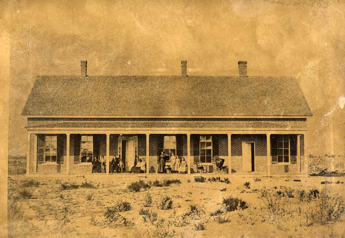
Jensen Alvarado Ranch
Monument and historic site · National Register of Historic Places · 3.0 mi
Human settlement in Jurupa Valley, California, United States of America
Masonic Temple
Monument and historic site · National Register of Historic Places · 5.6 mi
Masonic temple in Riverside, California

Mission Inn
Monument and historic site · National Register of Historic Places · 5.6 mi
Hotel in Riverside, California

Riverside Art Museum
Museum · National Register of Historic Places · 5.7 mi
Art museum in Riverside, California

Riverside Municipal Auditorium
Cinema and theater · National Register of Historic Places · 5.7 mi
Event venue in Riverside, California, U.S
Riverside station
Monument and historic site · National Register of Historic Places · 5.9 mi
Former railway station in Riverside, California

Victoria Avenue
Monument and historic site · National Register of Historic Places · 6.9 mi
Street in Riverside, California, United States of America
Bono's Restaurant and Deli
Monument and historic site · National Register of Historic Places · 7.2 mi
7 more on the map.
Parks, trails and playgrounds61


Fairmount Park
Park · 5.3 mi
Park in Riverside, California, United States of America


Martha McLean – Anza Narrows
Park · 3.6 mi
Regional park in California, United States

49 more on the map.
Restaurants and cafes38

Jurupa's Cafe
Restaurant · Breakfast, American · 3.2 mi
5164 Etiwanda Avenue, Jurupa Valley
Mo-Su 06:00-14:00

Starbucks
Cafe · Coffee Shop · 0.8 mi
4134 Pyrite Street, Jurupa Valley
Mo-Fr 04:00-23:00; Sa-Su 04:30-23:00



26 more on the map.
History
The area was first inhabited by the Gabrielino and Serrano tribes.
From the History section of Jurupa Valley, California on Wikipedia, under CC BY-SA 4.0.
Churches and places of worship59
First Church of Christ, Scientist
Church · National Register of Historic Places · 5.7 mi
First Congregational Church of Riverside
Church · National Register of Historic Places · 5.7 mi
Universalist Unitarian Church of Riverside
Church · National Register of Historic Places · 5.7 mi
Reformed Baptist Church of Riverside
Church · Baptist · 1.6 mi
7250 Mission Boulevard, Jurupa Valley
Saint Johns Catholic Church
Church · Catholic · 2.4 mi
3980 Opal Street, riverside
Shopping13
Gas and EV charging11
Schools, colleges and libraries74
Louis Rubidoux Branch Riverside City and County Public Library
Library · 3.2 mi
5840 Mission Boulevard, Jurupa Valley
Jurupa Unified School Distict's Transportation Department
School · 0.4 mi
4740 Pedley Road, Jurupa Valley
Healthcare1
Map of Jurupa Valley
250 places. The map loads OpenStreetMap tiles when you open it.
Climate by month
Monthly table
| Month | High | Low | Rain |
|---|---|---|---|
| Jan | 68°F | 44°F | 2.3 in |
| Feb | 68°F | 45°F | 2.4 in |
| Mar | 72°F | 47°F | 1.2 in |
| Apr | 76°F | 50°F | 0.6 in |
| May | 80°F | 55°F | 0.2 in |
| Jun | 87°F | 59°F | 0.0 in |
| Jul | 93°F | 64°F | 0.1 in |
| Aug | 95°F | 65°F | 0.0 in |
| Sep | 91°F | 62°F | 0.1 in |
| Oct | 83°F | 55°F | 0.3 in |
| Nov | 74°F | 47°F | 0.6 in |
| Dec | 67°F | 43°F | 1.5 in |
U.S. Climate Normals 1991-2020 for Riverside Muni Ap (4 mi away), NOAA NCEI.
People and cost of living
American Community Survey 5-year estimates, 2020-2024, U.S. Census Bureau. Estimates have margins of error, larger for small towns.
Disaster history
Riverside County has had 47 federal disaster declarations since 2000, most often for fires.
- 2026-05-20: Bain Fire (Fire)
- 2024-09-11: Airport Fire (Fire)
- 2024-07-21: Hawarden Fire (Fire)
- 2023-11-21: Tropical Storm Hilary (Hurricane)
- 2023-01-09: Severe Winter Storms, Flooding, And Mudslides (Flood)
- 2022-09-06: Fairview Fire (Fire)
OpenFEMA disaster declarations summaries.
Getting there and nearby towns
Flabob Airport (RIR) is the nearest airport with scheduled flights listed in OpenStreetMap, 3 miles away.
- Bloomington 5 mi northeast, about 9 min by car
- Riverside 6 mi southeast, about 10 min by car
- Fontana 7 mi north, about 12 min by car
- Eastvale 7 mi west, about 11 min by car
- Norco 7 mi southwest, about 12 min by car
- Ontario 8 mi west, about 13 min by car
- Colton 9 mi east, about 14 min by car
- Rialto 9 mi northeast, about 15 min by car
- El Sobrante 9 mi south, about 14 min by car
- Rancho Cucamonga 10 mi northwest, about 17 min by car
Drive times are estimates from straight-line distance, not routes.
Local news
Headlines from INDB, the NEMICO news database.
Reviews, tips and questions
Loading what members have shared...
Sources and licences
- NCES EDGE (Public domain): public schools
- NOAA NCEI U.S. Climate Normals 1991-2020 (Public domain): climate by month
- OpenFEMA (Public domain): disaster declarations
- OpenStreetMap contributors (ODbL 1.0): places, airports, map data
- U.S. Census Bureau (Public domain): population, income, housing, education, commute
- Wikidata (CC0 1.0): elevation, founding date, time zone, website, landmarks and historic places
- Wikimedia Commons (see each image): photos
- Wikipedia (CC BY-SA 4.0): overview and history text
Photo credits
- Mount Jurupa, Scottthezombie, CC BY-SA 4.0
- First Church Of Christ Historical 0196 Wiki a, Steve Rouhotas, CC BY-SA 3.0
- RiversideArtMuseum20090821g, Unknown author, Public domain
- Harada House 20091024c, MissionInn.Jim, Public domain
- Exterior view of the Frank Miller's Glenwood Mission Inn (hotel), Riverside, ca.1910 (CHS-5259), C. C. Pierce, Public domain
- FirstCongregationalChurch20090821f, MissionInn.Jim, Public domain
- RiversideMunicipalAuditorium20090821z, MissionInn.Jim, Public domain
- FONTANA FARMS COMPANY RANCH HOUSE SAN BERNARDINO COUNTY CA, JERRYE & ROY KLOTZ, M.D., CC BY-SA 4.0
- JensenAlvaradoRanch1870, Jensen Alvarado (Life time: 1870), Public domain
- All Souls Universalist Church, Steve Rouhotas, CC BY-SA 3.0
- RiversideCA VictoriaAve, Qwerty510 at English Wikipedia, Public domain
- Riverside Library, Mliedel, CC BY-SA 3.0
- Heritage House - Riverside, California, Mliedel, CC BY-SA 3.0
- La Sierra University Zapara School of Business 2023-1, DEGA MD, CC BY-SA 4.0
- Fairmount park 1 train, Seauton, CC BY-SA 4.0
- Museum of Riverside, Steve Rouhotas, CC BY-SA 3.0
- Fox Theater, Riverside CA, Bahugala, CC BY 2.0


Page built October 30, 2026. Spotted a mistake? Tell us or suggest a place.