
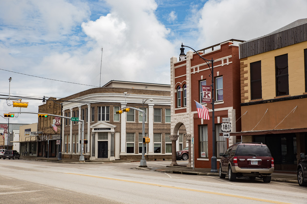


Why visit Kenedy
Townapedia lists 6 museums and landmarks, 3 parks and trails, 7 places to eat and 4 places to stay in and around town.
Highlights include Escondido Creek Parkway.
August is the warmest month, with average highs of 97°F; January lows average 43°F.
Weather in Kenedy
Forecast from the National Weather Service. Full forecast
About Kenedy
Kenedy is a city in Karnes County, Texas, United States, named for Mifflin Kenedy, who bought 400,000 acres (1,600 km2) and wanted to develop a new town that would carry his name. The population was 3,473 at the 2020 census, up from 3,296 at the 2010 census.
From the Wikipedia article Kenedy, Texas (this version), under CC BY-SA 4.0.
Museums and landmarks6

Parks, trails and playgrounds3

Restaurants and cafes7


Domino's
Fast food · Pizza · 1.8 mi
119 Business Park Boulevard, Kenedy
Mo-Th 10:00-24:00; Fr-Sa 10:00-01:00; Su 10:00-24:00
Sonic
Fast food · Burger · 0.6 mi
200 North Sunset Strip Drive, Kenedy
Mo-Th 08:00-22:00; Fr-Sa 08:00-23:00; Su 08:00-22:00
Where to stay4

Microtel Inn & Suites by Wyndham Kenedy
Motel and hotel · 1.1 mi
333 North Sunset Strip Drive, Kenedy
History
In the early 1900s many of Kenedy's gunfighter shootings caused the town to be nicknamed "Six Shooter Junction".
In 1901, Gregorio Cortez and his brother Romaldo were tenant farmers on the W. A. Thulmeyer Ranch, approximately ten miles west of Kenedy. While investigating a reported horse theft, Karnes County Sheriff W. T. "Brack" Morris and his deputies questioned several Kenedy residents before traveling to the ranch. A confrontation there, complicated by misunderstandings in translation, resulted in Morris wounding Romaldo and Cortez shooting and killing Morris. Cortez subsequently fled, beginning a widely publicized manhunt.
The incident became the subject of El Corrido de Gregorio Cortez, one of the best-known Mexican-American corridos of the period. The story was later examined by Américo Paredes in his 1958 book With His Pistol in His Hand and adapted into the 1982 film The Ballad of Gregorio Cortez, starring Edward James Olmos.
From the History section of Kenedy, Texas on Wikipedia, under CC BY-SA 4.0.
Churches and places of worship7
Our Lady Queen of Peace Catholic Church
Church · Roman Catholic · 0.7 mi
605 Karnes Street, Kenedy
Kenedy Church of Christ
Church · Church Of Christ · 0.5 mi
729 West Main Street, Kenedy
Shopping2
Gas and EV charging4
Schools, colleges and libraries12
Healthcare1
Map of Kenedy
46 places. The map loads OpenStreetMap tiles when you open it.
Climate by month
Monthly table
| Month | High | Low | Rain | Snow |
|---|---|---|---|---|
| Jan | 65°F | 43°F | 1.9 in | 0.0 in |
| Feb | 68°F | 46°F | 1.5 in | 0.0 in |
| Mar | 74°F | 52°F | 2.3 in | 0.0 in |
| Apr | 82°F | 59°F | 2.7 in | 0.0 in |
| May | 88°F | 66°F | 3.6 in | 0.0 in |
| Jun | 93°F | 72°F | 3.4 in | 0.0 in |
| Jul | 96°F | 74°F | 2.9 in | 0.0 in |
| Aug | 97°F | 73°F | 2.3 in | 0.0 in |
| Sep | 91°F | 69°F | 3.5 in | 0.0 in |
| Oct | 83°F | 60°F | 2.8 in | 0.0 in |
| Nov | 74°F | 51°F | 2.2 in | 0.0 in |
| Dec | 66°F | 44°F | 1.9 in | 0.4 in |
U.S. Climate Normals 1991-2020 for Karnes City 2N (7 mi away), rain and snow from Runge, NOAA NCEI.
People and cost of living
American Community Survey 5-year estimates, 2020-2024, U.S. Census Bureau. Estimates have margins of error, larger for small towns.
Disaster history
Karnes County has had 12 federal disaster declarations since 2000, most often for hurricanes.
- 2021-02-19: Severe Winter Storms (Severe Ice Storm)
- 2021-02-14: Severe Winter Storm (Severe Ice Storm)
- 2020-03-25: Covid-19 Pandemic (Biological)
- 2020-03-13: Covid-19 (Biological)
- 2017-08-25: Hurricane Harvey (Hurricane)
- 2008-03-14: Wildfires (Fire)
OpenFEMA disaster declarations summaries.
Getting there and nearby towns
Chase Field Industrial (NIR) is the nearest airport with scheduled flights listed in OpenStreetMap, 33 miles away.
- Karnes City 6 mi northwest, about 10 min by car
- Beeville 29 mi south, about 46 min by car
- Goliad 30 mi east, about 48 min by car
- George West 37 mi southwest, about 59 min by car
- Pleasanton 40 mi west, about 1 h by car
- Jourdanton 42 mi west, about 1 h 15 min by car
- China Grove 50 mi northwest, about 1 h 15 min by car
- Victoria 53 mi east, about 1 h 30 min by car
- Seguin 54 mi north, about 1 h 30 min by car
- Converse 56 mi northwest, about 1 h 30 min by car
Drive times are estimates from straight-line distance, not routes.
Local news
Headlines from INDB, the NEMICO news database.
Reviews, tips and questions
Loading what members have shared...
Sources and licences
- NCES EDGE (Public domain): public schools
- NOAA NCEI U.S. Climate Normals 1991-2020 (Public domain): climate by month
- OpenFEMA (Public domain): disaster declarations
- OpenStreetMap contributors (ODbL 1.0): places, airports, map data
- U.S. Census Bureau (Public domain): population, income, housing, education, commute
- Wikidata (CC0 1.0): elevation, founding date, time zone, website
- Wikimedia Commons (see each image): photos
- Wikipedia (CC BY-SA 4.0): overview and history text
Photo credits
- Kenedy Texas (1 of 1), Renelibrary, CC BY-SA 4.0
- Kenedy tx po window detail, Larry D. Moore, CC BY 4.0
- Kenedy tx post office 2014, Larry D. Moore, CC BY 4.0
Page built October 30, 2026. Spotted a mistake? Tell us or suggest a place.