


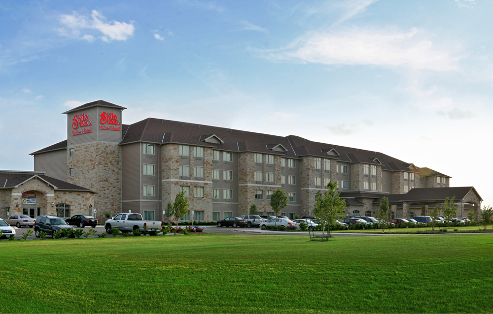


Killeen, Texas
Killeen is a city of 158,159 people in Bell County, Texas, founded in 1872.
Why visit Killeen
Townapedia lists 228 museums and landmarks, 39 parks and trails, 120 places to eat, 24 places to stay and 6 attractions in and around town.
Highlights include Texas A&M University–Central Texas, Regal Cinemas, Killeen High School and ReWax & UnWine Candle Making Experience.
August is the warmest month, with average highs of 97°F; January lows average 36°F.
Weather in Killeen
Forecast from the National Weather Service. Full forecast
About Killeen
Killeen is a city in the U.S. state of Texas, located in Bell County. According to the 2020 census, its population was 153,095, making it the 19th-most populous city in Texas and the largest of the three principal cities of Bell County. It is the principal city of the Killeen–Temple–Fort Hood Metropolitan Statistical Area. Killeen is 68 miles (109 km) north of Austin, 125 miles (201 km) southwest of Dallas, and 125 miles (201 km) northeast of San Antonio.
From the Wikipedia article Killeen, Texas (this version), under CC BY-SA 4.0.
Things to do6

Texas A&M University–Central Texas
School · 2.9 mi
Public university in Killeen, Texas, United States

Regal Cinemas
Cinema and theater · 1.6 mi
2501 East Central Texas Expressway, Killeen

Museums and landmarks228

Killeen High School
Monument and historic site · National Register of Historic Places · 3.2 mi
Historic place in Killeen, Bell County, Texas

216 more on the map.
Parks, trails and playgrounds39


Urban Air Trampoline and Adventure Park
Sports field and stadium · 2.2 mi
2102 Jennifer Drive, Killeen
Leo Buckley Stadium
Sports field and stadium · 3.2 mi
3498 Atkinson Avenue, Killeen
27 more on the map.
Restaurants and cafes120

Heights Pizzeria And Drafthouse
Restaurant · American, Pizza · 3.9 mi
201 #1460 East Central Texas Expressway
Mo-Th 11:00-22:00; Fr-Sa 11:00-23:00; Su 11:00-21:00


Caffé Luna
Diner · American · 3.5 mi
110 Ste. B Farm-to-Market Road 2410
Mo-Fr 07:00-19:00; Sa 07:00-18:00
Galaxy Bar & Grill
Diner · American · 2.9 mi
104 West Veterans Memorial Boulevard
Mo-Th 08:00-21:00; Fr-Sa 08:00-22:00; Su 08:00-20:00
Hook & Reel Cajun Seafood & Bar
Restaurant · Seafood · 1.3 mi
1701 East Central Texas Expressway, Killeen
Mo-Th,Su 11:30-22:00; Fr-Sa 11:30-23:00
Jimmy's Egg
Restaurant · American, Breakfast, Burger, Chicken, Coffee Shop, Juice, Pancake, Salad, Sandwich, Sausage · 1.8 mi
1103 West Stan Schlueter Loop, Killeen
Mo-Su 06:00-14:00
KPOT Korean BBQ & Hot Pot
Restaurant · Asian, Korean, Noodle · 1.3 mi
1501 E Central Texas Expy, Killeen
Mo-Th,Su 12:00-22:30; Fr-Sa 12:00-23:30
Koko Cafe
Cafe · Hawaiian · 2.6 mi
223 East Hallmark Avenue, Killeen
Tu-Fr 10:00-20:00; Sa 10:00-17:00
Los Cabos Mexican Grill
Restaurant · Mexican · 2.4 mi
1215 South Fort Hood Street
Tu-Th 11:00-22:00; Fr-Sa 11:00-23:00; Su-Mo 11:00-22:00

Rock And Roll Ice Cream Parlor
Ice cream · 0.5 mi
4524 Ste. 105 South W.S. Young Drive
Mo-Th 11:00-21:30; Fr-Sa 11:00-22:00; Su 12:00-21:30
108 more on the map.
History
In 1881, the Gulf, Colorado and Santa Fe Railway extended its tracks through central Texas, buying 360 acres (1.5 km2) a few miles southwest of a small farming community known as Palo Alto, which had existed since about 1872. The railroad platted a 70-block town on its land and named it after Frank P. Killeen, the assistant general manager of the railroad. By the next year, the town included a railroad depot, a saloon, several stores, and a school. Many of the residents of the surrounding smaller communities in the area moved to Killeen. By 1884, the town had grown to include about 350 people, served by five general stores, two gristmills, two cotton gins, two saloons, a lumberyard, a blacksmith shop, and a hotel.
Killeen expanded as it became an important shipping point for cotton, wool, and grain in western Bell and eastern Coryell Counties. By 1900, its population was about 780.
Around 1905, local politicians and businessmen convinced the Texas legislature to build bridges over Cowhouse Creek and other streams, doubling Killeen's trade area. A public water system began operation in 1914 and its population had increased to 1,300 residents.
From the History section of Killeen, Texas on Wikipedia, under CC BY-SA 4.0.
Where to stay24
Churches and places of worship50
Saint Elizabeth Ann Seton Catholic Church
Church · Roman Catholic · 4.3 mi
East Tank Destroyer Boulevard, Fort Hood
Killeen Central Baptist Church
Church · Baptist · 2.5 mi
1318 Pershing Drive, Killeen
Kingdom Hall of Jehovah's Witnesses
Church · Jehovahs Witness · 2.0 mi
2204 Sunny Lane, Killeen
Korean Memorial Baptist Church
Church · Baptist · 2.9 mi
113 South 8th Street, Killeen
Marlboro Heights Missionary Basptist Church
Church · Baptist · 1.8 mi
1606 Iris Avenue, Killeen
Shopping33
Gas and EV charging28
Schools, colleges and libraries80
Healthcare10
Seton Medical Center Harker Heights
Hospital · 2.9 mi
850 West Central Texas Expressway, Harker Heights
Map of Killeen
250 places. The map loads OpenStreetMap tiles when you open it.
Climate by month
Monthly table
| Month | High | Low | Rain | Snow |
|---|---|---|---|---|
| Jan | 60°F | 36°F | 2.5 in | 0.0 in |
| Feb | 63°F | 40°F | 2.2 in | 0.0 in |
| Mar | 70°F | 47°F | 3.3 in | 0.0 in |
| Apr | 77°F | 54°F | 2.1 in | 0.0 in |
| May | 84°F | 63°F | 4.7 in | 0.0 in |
| Jun | 92°F | 70°F | 3.2 in | 0.0 in |
| Jul | 96°F | 72°F | 2.7 in | 0.0 in |
| Aug | 97°F | 73°F | 1.6 in | 0.0 in |
| Sep | 90°F | 67°F | 3.9 in | 0.0 in |
| Oct | 80°F | 56°F | 3.4 in | 0.0 in |
| Nov | 69°F | 46°F | 2.7 in | 0.0 in |
| Dec | 60°F | 38°F | 2.4 in | 0.0 in |
U.S. Climate Normals 1991-2020 for Killeen (2 mi away), NOAA NCEI.
People and cost of living
American Community Survey 5-year estimates, 2020-2024, U.S. Census Bureau. Estimates have margins of error, larger for small towns.
Disaster history
Bell County has had 15 federal disaster declarations since 2000, most often for hurricanes.
- 2024-05-17: Severe Storms, Straight-Line Winds, Tornadoes, And Flooding (Flood)
- 2021-02-19: Severe Winter Storms (Severe Ice Storm)
- 2021-02-14: Severe Winter Storm (Severe Ice Storm)
- 2020-03-25: Covid-19 Pandemic (Biological)
- 2020-03-13: Covid-19 (Biological)
- 2008-09-10: Hurricane Ike (Hurricane)
OpenFEMA disaster declarations summaries.
Getting there and nearby towns
Skylark Field (ILE) is the nearest airport with scheduled flights listed in OpenStreetMap, 3 miles away.
- Harker Heights 5 mi east, about 9 min by car
- Nolanville 7 mi east, about 12 min by car
- Copperas Cove 11 mi west, about 18 min by car
- Kempner 14 mi west, about 23 min by car
- Belton 15 mi east, about 24 min by car
- Salado 15 mi southeast, about 24 min by car
- Morgan's Point Resort 17 mi east, about 27 min by car
- Round Rock 38 mi south, about 1 h by car
- Waco 46 mi northeast, about 1 h 15 min by car
- Austin 54 mi south, about 1 h 30 min by car
Drive times are estimates from straight-line distance, not routes.
Local news
Headlines from INDB, the NEMICO news database.
Reviews, tips and questions
Loading what members have shared...
Sources and licences
- NCES EDGE (Public domain): public schools
- NOAA NCEI U.S. Climate Normals 1991-2020 (Public domain): climate by month
- OpenFEMA (Public domain): disaster declarations
- OpenStreetMap contributors (ODbL 1.0): places, airports, map data
- U.S. Census Bureau (Public domain): population, income, housing, education, commute
- Wikidata (CC0 1.0): elevation, founding date, time zone, website, landmarks and historic places
- Wikimedia Commons (see each image): photos
- Wikipedia (CC BY-SA 4.0): overview and history text
Photo credits
- D Avenue, Victorenriqueagosto, CC BY-SA 3.0
- Shilo Inn Suites Hotel - Killeen - panoramio, shiloinnshotels, CC BY-SA 3.0
- Shilo Inn Suites - Killeen - panoramio, dklimke, CC BY-SA 3.0
- French Dip - Tilted Kilt - Killeen, TX, shelnew19, CC BY 2.0
- Killeen Herald Historical Marker, Larry D. Moore, CC BY 4.0
- Killeen Daily Herald Building 2018, Larry D. Moore, CC BY 4.0
- Lubys memorial killeen, Larry D. Moore, CC BY 4.0
- Avenue D School Killeen Texas, Larry D. Moore, CC BY 4.0
- Avenue D School Killeen Texas Entrance, Larry D. Moore, CC BY 4.0
- Killeen High School 12, Summerdeleon, CC BY-SA 4.0
- Killeen High School 09, Summerdeleon, CC BY-SA 4.0
- Killeen High School 02, Summerdeleon, CC BY-SA 4.0
- Killeen High School 15, Summerdeleon, CC BY-SA 4.0
- Killeen High School 13, Summerdeleon, CC BY-SA 4.0
- Killeen High School 10, Summerdeleon, CC BY-SA 4.0
- 18-34-094-memorial, Dsdugan, CC0
- 16 10 301 memorial, Dsdugan, CC0
- 17 20 021 memorial, Dsdugan, CC0
- 17 20 028 memorial, Dsdugan, CC0
- 17 20 035 memorial, Dsdugan, CC0
- 17 20 049 memorial, Dsdugan, CC0
- Miss Texas USA Logan Lester at 3-16th FA's Battalion Ball, Carson Petry, Public domain
- ISS030-E-170456 - View of Earth, Earth Science and Remote Sensing Unit , Lyndon B. Johnson Space Center, Public domain
- ISS067-E-62623 - View of Earth, Earth Science and Remote Sensing Unit , Lyndon B. Johnson Space Center, Public domain
- ISS030-E-170455 - View of Earth, Earth Science and Remote Sensing Unit , Lyndon B. Johnson Space Center, Public domain
- John Blackburn Log House 02, CalicoSilk, CC BY-SA 3.0
- John Blackburn Log House 01, CalicoSilk, CC BY-SA 3.0
- Christmas wreaths placed for fallen warriors (Image 15 of 15) (11176386656), DVIDSHUB, Public domain
- Christmas love from a child to a fallen hero (Image 1 of 15) (11176339005), DVIDSHUB, Public domain
- Flickr - DVIDSHUB - 1st Air Cav, kids celebrate freedom, DVIDSHUB, Public domain
- Family of fallen hero places Christmas wreath at his grave (Image 13 of 15) (11176341475), DVIDSHUB, Public domain


Page built October 30, 2026. Spotted a mistake? Tell us or suggest a place.