
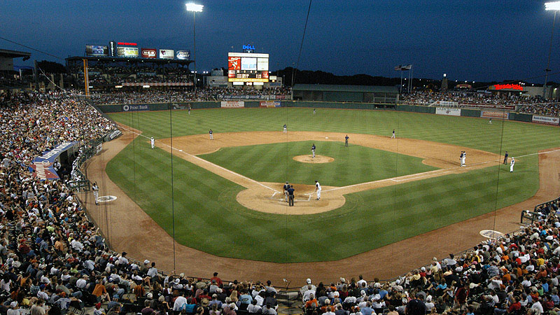

Round Rock, Texas
Round Rock is a city of 127,786 people in Travis County, Texas, founded in 1851.
Why visit Round Rock
Townapedia lists 35 museums and landmarks, 55 parks and trails, 258 places to eat, 38 places to stay and 6 attractions in and around town.
Highlights include Flix Brewhouse Round Rock, Immortal Ten Bridge, Hutto Commercial Historic District and Texas Museum of Science and Technology.
Weather in Round Rock
Forecast from the National Weather Service. Full forecast
About Round Rock
Round Rock is a city in Williamson and Travis counties in the U.S. state of Texas. The population was 119,468 at the 2020 census. It is part of the Greater Austin metropolitan area.
From the Wikipedia article Round Rock, Texas (this version), under CC BY-SA 4.0.
Things to do6

Flix Brewhouse Round Rock
Cinema and theater · 2.9 mi
2000 Interstate Highway 35 Service Road, Round Rock
Mo-Fr 10:00-23:00; Sa-Su 09:00-02:00


Inner Space Cavern
Monument and historic site · 5.8 mi
Cave in United States of America
Museums and landmarks35
Hutto Commercial Historic District
Monument and historic site · National Register of Historic Places · 6.8 mi
Historic district in Hutto, Williamson County, Texas

Texas Museum of Science and Technology
Museum · 7.0 mi
Science museum in Cedar Park, Texas
Old Round Rock Stagecoach Inn
Monument and historic site · 2.0 mi
On the date of January 2, 2019, the Round Rock Stagecoach Inn of Round Rock was successfully relocated to 750 Chisholm Trail.
750 Chisholm Trail Road, Round Rock
23 more on the map.
Parks, trails and playgrounds55


Kalarahi Resorts Indoor Water Park
Sports field and stadium · 1.8 mi
3001 Kalahari Boulevard, Round Rock
Mo-Su 10:00-21:00
Chisholm Trail Crossing Park
Park · 2.0 mi
Park in Round Rock, Texas, U.S
Rock'N River Water Park
Sports field and stadium · 1.8 mi
3300 East Palm Valley Boulevard, Round Rock

43 more on the map.
Restaurants and cafes258

Fogueira Gaúcha Brazilian Steakhouse
Restaurant · Steak House · 2.9 mi
Last seating is one hour before closing every night.
2000 South Interstate 35, Round Rock
Tu-Th 17:00-22:00; Fr 17:00-22:30; Sa 15:00-22:30; Su 13:00-21:00

BJ's
Diner · American · 3.0 mi
14201 N Interstate Hwy 35, Round Rock
Su-Th 11:00-22:00; Fr-Sa 11:00-23:00

Besos Cocina & Cantina
Restaurant · Mexican · 3.5 mi
3107 South Interstate 35, Round Rock
Su-Th 11:00-22:00; Fr-Sa 11:00-23:00
Bo Asian Bistro
Restaurant · Asian, Chinese, Thai, Malaysian · 3.5 mi
2711 La Frontera Boulevard, Round Rock
Mo-Th 11:00-21:30; Fr-Sa 11:00-22:00; Su 11:30-21:30
Casa Garcia's
Restaurant · Mexican · 1.7 mi
1901 North Interstate 35, Round Rock
Mo-Th 07:30-21:00; Fr 07:30-22:00; Sa 07:30-21:30; Su 07:30-20:00
Casa More - Round Rock
Restaurant · Mexican · 1.7 mi
301 West Palm Valley Boulevard, Round Rock
Mo-Su 08:00-22:00
China Wall Restaurant
Restaurant · Chinese · 2.8 mi
2000 South Interstate 35, Round Rock
Mo-Th 11:00-21:30; Fr 11:00-22:00; Sa 11:30-22:00; Su 11:30-21:00
Chuck E. Cheese's
Restaurant · Pizza · 3.5 mi
401 West Louis Henna Boulevard, Austin
Su-Sa 11:00-21:00

246 more on the map.
History
As the area developed into a rural Anglo community, some of the modern paved roads followed the original Native-American pathways. One famous immigration route passed through Round Rock and is called the "Double File Trail" because the path was wide enough for two horsemen to ride side-by-side. It is part of a longer trail from North Texas that crossed the San Gabriel River in Georgetown, Brushy Creek in Round Rock, and the Colorado River in Austin.
From the History section of Round Rock, Texas on Wikipedia, under CC BY-SA 4.0.
Where to stay38
Quality Inn & Suites Round Rock - Austin North
Motel and hotel · 2.5 mi
1802 South Interstate 35, Round Rock
Sleep Inn & Suites Round Rock - Austin North
Motel and hotel · 2.7 mi
1980 South Interstate 35, Round Rock
Comfort Suites Round Rock - Austin North I-35
Motel and hotel · 2.0 mi
609 Chisholm Trail, Round Rock
Churches and places of worship29
The Holy Cross Coptic Orthodox Church
Church · Coptic Orthodox · 2.2 mi
700 Interstate Highway 35 Service Road, Round Rock
Shopping36
Manpasand Indian Pakistani Halal Groceries Supermarket
Grocery · 3.2 mi
130 Sundance Parkway, Round Rock
Gas and EV charging50
Schools, colleges and libraries73
Claude Berkman Elementary School and Arts Integration Academy
School · 1.8 mi
400 West Anderson Avenue, Round Rock
Healthcare46
Baylor Scott & White Clinic – Round Rock 425 University
Clinic and pharmacy · 2.5 mi
425 University Boulevard, Round Rock
Baylor Scott & White Medical Center – Round Rock
Hospital · 2.9 mi
300 University Boulevard, Round Rock
Family Medical Center at Round Rock
Clinic and pharmacy · 2.4 mi
1925 South A W Grimes Boulevard, Round Rock
Map of Round Rock
250 places. The map loads OpenStreetMap tiles when you open it.
People and cost of living
American Community Survey 5-year estimates, 2020-2024, U.S. Census Bureau. Estimates have margins of error, larger for small towns.
Disaster history
Travis County has had 30 federal disaster declarations since 2000, most often for fires.
- 2025-07-06: Severe Storms, Straight-Line Winds, And Flooding (Flood)
- 2023-04-21: Severe Winter Storm (Winter Storm)
- 2021-02-19: Severe Winter Storms (Severe Ice Storm)
- 2021-02-14: Severe Winter Storm (Severe Ice Storm)
- 2020-08-24: Tropical Storms Marco And Laura (Hurricane)
- 2020-03-25: Covid-19 Pandemic (Biological)
OpenFEMA disaster declarations summaries.
Getting there and nearby towns
Austin-Bergstrom International Airport (AUS) is the nearest airport with scheduled flights listed in OpenStreetMap, 23 miles away.
- Brushy Creek 5 mi west, about 8 min by car
- Wells Branch 6 mi south, about 9 min by car
- Pflugerville 7 mi southeast, about 11 min by car
- Hutto 7 mi east, about 11 min by car
- Cedar Park 10 mi west, about 15 min by car
- Georgetown 10 mi north, about 16 min by car
- Leander 12 mi west, about 20 min by car
- Manor 13 mi southeast, about 22 min by car
- Austin 17 mi south, about 27 min by car
- Killeen 38 mi north, about 1 h by car
Drive times are estimates from straight-line distance, not routes.
Local news
Headlines from INDB, the NEMICO news database.
Reviews, tips and questions
Loading what members have shared...
Sources and licences
- NCES EDGE (Public domain): public schools
- OpenFEMA (Public domain): disaster declarations
- OpenStreetMap contributors (ODbL 1.0): places, airports, map data
- U.S. Census Bureau (Public domain): population, income, housing, education, commute
- Wikidata (CC0 1.0): elevation, founding date, time zone, website, landmarks and historic places
- Wikimedia Commons (see each image): photos
- Wikipedia (CC BY-SA 4.0): overview and history text
Photo credits
- Dell diamond 4DM, Donald G. Martin, CC BY-SA 3.0
Page built October 30, 2026. Spotted a mistake? Tell us or suggest a place.