


Lebanon, New Hampshire
Lebanon is a city of 14,999 people in Grafton County, New Hampshire, founded in 1761.
Why visit Lebanon
Townapedia lists 50 museums and landmarks, 86 parks and trails, 110 places to eat, 19 places to stay and 47 attractions in and around town.
Highlights include Northern Stage, Nugget Theater, Hood Museum of Art and Montshire Museum of Science.
July is the warmest month, with average highs of 83°F; January lows average 9°F.
Weather in Lebanon
Forecast from the National Weather Service. Full forecast
About Lebanon
Lebanon is the only city in Grafton County, New Hampshire, United States. The population was 14,282 at the 2020 census, up from 13,151 at the 2010 census. Lebanon is in western New Hampshire, south of Hanover, near the Connecticut River. It is the home to Dartmouth–Hitchcock Medical Center and Dartmouth College's Geisel School of Medicine, together comprising the largest medical facility between Boston, Massachusetts, and Burlington, Vermont.
From the Wikipedia article Lebanon, New Hampshire (this version), under CC BY-SA 4.0.
Things to do47


Meriden Bridge
Bridge · National Register of Historic Places · 5.7 mi
Stone Arch Underpass
Bridge · National Register of Historic Places · 2.6 mi

Thayer School of Engineering
School · 5.2 mi
Engineering school of Dartmouth College
Dartmouth College
School · 5.0 mi
Private university in Hanover, New Hampshire, US
Lyman Bridge
Bridge · 3.2 mi
Bridge in and White River Junction, Vermont


Stern's Quality Produce
Farm and orchard · 3.4 mi
83 Pine Street, White River Junction
Mo-Fr 10:00-18:00; Sa 10:00-17:00
35 more on the map.
Museums and landmarks50

Hood Museum of Art
Museum · 4.9 mi
Art museum in Hanover, New Hampshire
6 East Wheelock Street, Hanover
We 11:00-17:00; Th,Fr 11:00-20:00; Sa 13:00-17:00

Montshire Museum of Science
Museum · 5.2 mi
Science museum in Norwich, Vermont
35 Montshire Road, Norwich
Mo-Su 10:00-17:00

White River Junction Historic District
Monument and historic site · National Register of Historic Places · 3.4 mi
Historic district in Vermont, United States

Advent Camp Meeting Grounds Historic District
Monument and historic site · National Register of Historic Places · 3.4 mi
United States historic place

Christian Street Rural Historic District
Monument and historic site · National Register of Historic Places · 5.1 mi
Historic district in Vermont, United States

Colburn Park Historic District
Monument and historic site · National Register of Historic Places · 0.5 mi
Historic district in New Hampshire, United States

Enfield Shaker Museum
Museum · National Register of Historic Places · 5.4 mi
Outdoor history museum and historic district in Enfield, New Hampshire

Enfield Village Historic District
Monument and historic site · National Register of Historic Places · 5.6 mi
Historic district in New Hampshire, United States

Great Hollow Road Stone Arch Bridge
Bridge · National Register of Historic Places · 3.7 mi
Bridge in United States of America

Hanover Town Library
Monument and historic site · National Register of Historic Places · 4.5 mi
Library in Hanover, New Hampshire, United States
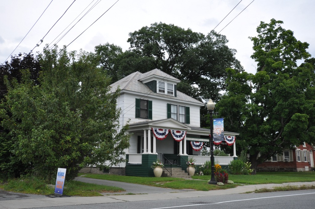
Hartford
Monument and historic site · National Register of Historic Places · 4.7 mi
Village in the town of Hartford, Windsor County, Vermont


Hewitt House
Monument and historic site · National Register of Historic Places · 5.5 mi
Historic house in New Hampshire, United States
38 more on the map.
Parks, trails and playgrounds86

The Green
Park · 5.0 mi
Grass-covered field and common space at the center of Dartmouth College


Whaleback Mountain
Sports field and stadium · 4.4 mi
160 Whaleback Mountain Road, Enfield

Hurricane Forest Wildlife Refuge
Hiking and trails · 5.2 mi
Wright Reservoir Road
sunrise-21:00
Nathan's Garden
Park · 5.0 mi
Nathan's Garden is a beautiful forest enclave to read, meditate, or observe wildlife. The garden was created to honor Nathan Hall, who...
sunrise-sunset
74 more on the map.
Restaurants and cafes110

Phnom Penh Sandwich Station
Restaurant · Cambodian, Sandwich · 0.4 mi
1 High St, Lebanon
Mo-Sa 11:00-20:00

110 Grill
Diner · American · 3.4 mi
250 Plainfield Road, West Lebanon
Mo-Sa 11:30-21:00; Su 11:30-20:00

Applebee's
Diner · American · 3.7 mi
280 Plainfield Road, West Lebanon
Su-Th 11:00-24:00; Fr,Sa 11:00-25:00
Cantore's Pizza
Restaurant · Pizza · 3.1 mi
1 Glen Road, West Lebanon
Tu-Th 11:00-20:00; Fr 11:00-21:00; Sa 13:00-20:00
China Moon Buffet
Restaurant · Chinese · 4.1 mi
96 Sykes Mountain Avenue, White River Junction
Mo-Th 11:00-21:30; Fr,Sa 11:00-22:30; Su 11:00-21:00
Jesse's Steaks, Seafood & Tavern
Restaurant · Steak House · 3.4 mi
7 Blue Sky Drive, Hanover
Mo-Sa 11:30-21:30; Su 10:00-21:30
98 more on the map.
History
Lebanon was chartered as a town by colonial governor Benning Wentworth on July 4, 1761, one of 16 along the Connecticut River. It was named for Lebanon, Connecticut, from where many early settlers had come or would come, including the Reverend Eleazar Wheelock, who arrived in 1770 and founded Dartmouth College. Lebanon, Connecticut, was the original home of Moor's Charity School, the antecedent of Dartmouth College.
Early settlement concentrated along the Connecticut River in what is now West Lebanon, and in the Mascoma Lake region near Enfield. In the mid-19th century, a mill district developed at falls on the Mascoma River. Industries included, at various times, furniture mills, a tannery, several machine shops, a woolen textile mill, and a clothing factory. In the mid-19th century, this district attracted many French workers from Canada's Quebec province. This became the center of town, although West Lebanon grew into a railroad hub with a separate identity after lines entered from Boston. This rail center would become known as "Westboro" after two trains collided when West Lebanon was mistaken for Lebanon.
From the History section of Lebanon, New Hampshire on Wikipedia, under CC BY-SA 4.0.
Where to stay19
Hampton Inn White River Junction
Motel and hotel · 4.3 mi
104 Ballardvale Drive, White River Junction
Holiday Inn Express & Suites White River Junction
Motel and hotel · 4.4 mi
121 Ballardvale Drive, White River Junction
Churches and places of worship33
The Church of Christ at Dartmouth College
Church · United Church Of Christ · 5.2 mi
40 College Street, Hanover
Shopping46
Gas and EV charging26
Schools, colleges and libraries43
Hartford Library
Library · National Register of Historic Places · 4.8 mi
1587 Maple Street, White River Junction
Community College of Vermont – Upper Valley
School · 4.7 mi
145 Billings Farm Road, White River Junction
Healthcare17
Map of Lebanon
250 places. The map loads OpenStreetMap tiles when you open it.
Climate by month
Monthly table
| Month | High | Low | Rain |
|---|---|---|---|
| Jan | 30°F | 9°F | 2.3 in |
| Feb | 34°F | 11°F | 2.1 in |
| Mar | 43°F | 21°F | 2.7 in |
| Apr | 57°F | 32°F | 3.0 in |
| May | 70°F | 44°F | 3.3 in |
| Jun | 78°F | 52°F | 3.8 in |
| Jul | 83°F | 58°F | 4.0 in |
| Aug | 81°F | 56°F | 3.6 in |
| Sep | 73°F | 49°F | 3.4 in |
| Oct | 60°F | 37°F | 4.0 in |
| Nov | 47°F | 28°F | 3.0 in |
| Dec | 36°F | 18°F | 2.8 in |
U.S. Climate Normals 1991-2020 for Lebanon Muni Ap (3 mi away), NOAA NCEI.
People and cost of living
American Community Survey 5-year estimates, 2020-2024, U.S. Census Bureau. Estimates have margins of error, larger for small towns.
Disaster history
Grafton County has had 30 federal disaster declarations since 2000, most often for severe storms.
- 2024-08-20: Severe Storm And Flooding (Severe Storm)
- 2024-07-10: Severe Winter Storm And Flooding (Winter Storm)
- 2024-04-19: Severe Storms And Flooding (Severe Storm)
- 2024-02-27: Severe Storm And Flooding (Severe Storm)
- 2023-09-14: Severe Storms And Flooding (Flood)
- 2023-03-15: Severe Storm And Flooding (Severe Storm)
OpenFEMA disaster declarations summaries.
Getting there and nearby towns
Lebanon Municipal Airport (LEB) is the nearest airport with scheduled flights listed in OpenStreetMap, 2 miles away.
- White River Junction 4 mi west, about 6 min by car
- Wilder 4 mi northwest, about 7 min by car
- Hanover 5 mi north, about 9 min by car
- Hartford Village 5 mi northwest, about 8 min by car
- Enfield 5 mi east, about 9 min by car
- Norwich 6 mi northwest, about 10 min by car
- North Hartland 6 mi southwest, about 10 min by car
- Claremont 18 mi south, about 28 min by car
- Concord 45 mi southeast, about 1 h 15 min by car
- Keene 47 mi south, about 1 h 15 min by car
Drive times are estimates from straight-line distance, not routes.
Local news
Headlines from INDB, the NEMICO news database.
Reviews, tips and questions
Loading what members have shared...
Sources and licences
- NCES EDGE (Public domain): public schools
- NOAA NCEI U.S. Climate Normals 1991-2020 (Public domain): climate by month
- OpenFEMA (Public domain): disaster declarations
- OpenStreetMap contributors (ODbL 1.0): places, airports, map data
- U.S. Census Bureau (Public domain): population, income, housing, education, commute
- Wikidata (CC0 1.0): elevation, founding date, time zone, website, landmarks and historic places
- Wikimedia Commons (see each image): photos
- Wikipedia (CC BY-SA 4.0): overview and history text
Photo credits
- Downtown Lebanon 5, Jon Platek, CC BY-SA 3.0
- Lebanon Fire Department 12 South Park Street downtown Lebanon NH, Artaxerxes, CC BY-SA 4.0
- Fountain downtown Lebanon NH June 2016, Artaxerxes, CC BY-SA 4.0
- Colburn Park fountain downtown Lebanon NH June 2016, Artaxerxes, CC BY-SA 4.0
- Colburn Park downtown Lebanon NH June 2016, Artaxerxes, CC BY-SA 4.0
- Stage Colburn Park Lebanon NH June 2016, Artaxerxes, CC BY-SA 4.0
- Outdoor stage rearview Colburn Park downtown Lebanon NH June 2016, Artaxerxes, CC BY-SA 4.0
- Salt Hill Pub West Park Street downtown Lebanon NH June 2016, Artaxerxes, CC BY-SA 4.0
- War Memorial Colburn Park Lebanon NH June 2016, Artaxerxes, CC BY-SA 4.0
- War memorial Colburn Park downtown Lebanon NH June 2016, Artaxerxes, CC BY-SA 4.0
- Historical plaque Colburn Park 51 North Park Street downtown Lebanon NH June 2016, Artaxerxes, CC BY-SA 4.0
- Lebanon, New Hampshire 050507 156, Dougtone, CC BY-SA 2.0
- Lebanon Public Library East Park Street downtown Lebanon NH June 2016, Artaxerxes, CC BY-SA 3.0
- Lebanon Public Library downtown Lebanon NH June 2016, Artaxerxes, CC BY-SA 3.0
- Lebanon, New Hampshire 050507 149, Dougtone, CC BY-SA 2.0
- Lebanon, New Hampshire 050507 157, Dougtone, CC BY-SA 2.0
- Lebanon NH Rest Area on Interstate 89 South, Kenneth C. Zirkel, CC BY 4.0
- Hood Museum of Art - Dartmouth College - DSC04673, Daderot, CC0
- Montshire Museum of Science in Norwich, Vermont, Jared and Corin, CC BY-SA 2.0
- White River Junction Former Post office, Doug Kerr, CC BY-SA 2.0
- GtHollowHanover, Ken Gallager at English Wikipedia, CC BY 3.0
- Shaker Historic District, Neil.m.young, CC BY-SA 3.0
- Colburn park, Scoppettone from en.wikipedia, CC0
- Orozco - Dartmouth c, Daderot ( original image ), CC BY-SA 3.0
- Hewitt House 3, Neil.m.young, CC BY-SA 3.0
- HartfordVT HistoricalSociety, Magicpiano, CC BY-SA 3.0
- NorwichVT CongregationalChurch, Magicpiano, CC BY-SA 3.0
- Enfield Village, Neil.m.young, CC BY-SA 3.0
- HanoverTownLibraryEtna, Ken Gallager at English Wikipedia, CC BY 3.0
- Wilder Station, Wilder, Vt (83548), Tichnor Brothers, Publisher, Public domain
- Meriden Town Hall, Bill Marrs, CC BY-SA 3.0
- Hartland-Vermont-Ottauquechee-River-Bridge, Henry S. Magnuski, CC BY-SA 3.0
- NorwichVT MidCenturyModernHD 2, Magicpiano, CC BY-SA 4.0
- HartfordVT ChristianStreetHD 1, Magicpiano, CC BY-SA 3.0
- WhiteRiverJunctionVT ProgressiveMarket, Magicpiano, CC BY-SA 3.0
- HartfordVT AdventCampMeeting, Magicpiano, CC BY-SA 4.0
- WhiteRiverJunctionVT FairviewTerrace 2, Magicpiano, CC BY-SA 3.0
- Rail Trail - panoramio, Sam Kovaka, CC BY-SA 3.0
- Clearing - panoramio (2), Sam Kovaka, CC BY-SA 3.0
- Woods - panoramio (3), Sam Kovaka, CC BY-SA 3.0


Page built October 30, 2026. Spotted a mistake? Tell us or suggest a place.