



Leesylvania, Virginia
Leesylvania is a community of 21,632 people in Prince William County, Virginia.
Why visit Leesylvania
Townapedia lists 13 museums and landmarks, 16 parks and trails, 62 places to eat, 5 places to stay and 3 attractions in and around town.
Highlights include Alamo Drafthouse Cinema, Rippon Lodge, Chopawamsic Recreational Demonstration Area Cabin Camp 1 and Leesylvania State Park.
July is the warmest month, with average highs of 88°F; January lows average 28°F.
Weather in Leesylvania
Forecast from the National Weather Service. Full forecast
About Leesylvania
Leesylvania, formerly known as Neabsco, is a census-designated place in Prince William County in the U.S. state of Virginia.
From the Wikipedia article Leesylvania, Virginia (this version), under CC BY-SA 4.0.
Things to do3


Museums and landmarks13

Rippon Lodge
Monument and historic site · National Register of Historic Places · 0.5 mi
Human settlement in Virginia, United States of America
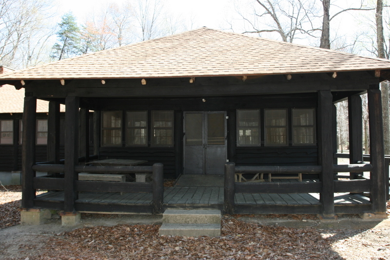
Chopawamsic Recreational Demonstration Area Cabin Camp 1
Monument and historic site · National Register of Historic Places · 4.0 mi
Civilian Conservation Corps campsite

Old Hotel
Monument and historic site · National Register of Historic Places · 3.5 mi
Hotel in Dumfries, Virginia
Pleasant Historic District, Chopawamsic RDA Camp 4
Monument and historic site · National Register of Historic Places · 4.0 mi
Historic district in Virginia, United States

Weems–Botts Museum
Museum · National Register of Historic Places · 3.8 mi
Building in Virginia, United States

Freestone Point Confederate Battery
Monument and historic site · National Register of Historic Places · 2.1 mi


Old Town Hall and School
Monument and historic site · National Register of Historic Places · 3.5 mi

1 more on the map.
Parks, trails and playgrounds16


Julie J. Metz Neabsco Creek Wetlands Preserve
Hiking and trails · 0.4 mi
15875 Neabsco Road, Woodbridge
King's Highway Historic Site
Hiking and trails · 0.7 mi
2201 Vantage Drive, Woodbridge
Neabsco Regional Park
Hiking and trails · 0.4 mi
15125 Blackburn Road, Woodbridge
Rippon Lodge Historic Site
Hiking and trails · 0.5 mi
15520 Blackburn Road, Woodbridge

4 more on the map.
Restaurants and cafes62

Dok Khao
Restaurant · Thai · 1.3 mi
15200 Potomac Town Place, Woodbridge
Su-Th 11:00-22:00; Fr,Sa 11:00-23:00
Hot Chickn Kitchn
Restaurant · Chicken · 2.0 mi
14313 Potomac Mills Road, Woodbridge
Mo-Th, Su 11:00-21:00; Fr-Sa 11:00-22:00


CAVA
Restaurant · Mediterranean · 1.6 mi
14901 Potomac Town Place, Woodbridge
Mo-Su 10:45-22:00
Viet Fortune
Restaurant · Vietnamese · 1.2 mi
2701 Neabsco Common Place, Woodbridge
Mo-Su 10:30-21:00
Aroma Latin Fusion
Restaurant · Latin American · 1.3 mi
15200 Potomac Town Place, Woodbridge

Average Not Your Joe's
Diner · American · 1.4 mi
15101 Potomac Town Place, Woodbridge
Betaneya Ehtiopian Restaurant
Restaurant · Ethiopian · 1.7 mi
14804 Buildamerica Drive, Woodbridge

Cold Stone Creamery
Ice cream · Ice Cream · 1.0 mi
16430 Navigation Drive, Woodbridge
50 more on the map.
History
Leesylvania plantation is located nearby in Leesylvania State Park. During the 18th century, Henry Lee II, grandfather of Robert E. Lee, lived in the plantation house with his family and enslaved Africans, growing tobacco on the property. Due to road construction in the 1950s, little of the house's foundation remains.
The CDP was formed as Neabsco (named for Neabsco Creek) in 2000 in an area which was formerly the southern area of Woodbridge. In 2020, the CDP was renamed Leesylvania, after the nearby state park and plantation.
From the History section of Leesylvania, Virginia on Wikipedia, under CC BY-SA 4.0.
Where to stay5
Churches and places of worship19
Cokesbury United Methodist Church
Church · Methodist · 1.8 mi
14806 Blackburn Road, Woodbridge
Evangelical Baptist Church
Church · Baptist · 1.9 mi
14836 Ashdale Avenue, Woodbridge
Good Shepheard United Methodist Church
Church · United Methodist · 2.1 mi
14999 Dale Boulevard, Dale City
Holiness Tabernacle Church of God in Christ
Church · Pentecostal · 2.1 mi
1505 Walnut Street, Woodbridge
Neabsco Baptist Church
Church · Baptist · 1.9 mi
15557 Cardinal Drive, Woodbridge
Open Arms PFWB Church
Church · Baptist · 2.1 mi
14549 Town Center Road, Woodbridge
The Church of Jesus Christ of Latter-day Saints
Church · Latter-Day Saints · 1.8 mi
3000 Dale Boulevard, Woodbridge
Shopping16
Todos Neighborhood Market
Grocery · 1.7 mi
16593 River Ridge Boulevard, Woodbridge
Gas and EV charging13
Schools, colleges and libraries51
Northern Virginia Community College - Woodbridge Campus
School · 1.0 mi
2645 College Drive, Woodbridge
Healthcare9
Go Well Urgent Care
Clinic and pharmacy · 1.5 mi
14900 Potomac Town Place, Woodbridge
Map of Leesylvania
207 places. The map loads OpenStreetMap tiles when you open it.
Climate by month
Monthly table
| Month | High | Low | Rain | Snow |
|---|---|---|---|---|
| Jan | 45°F | 28°F | 2.7 in | 3.5 in |
| Feb | 48°F | 30°F | 2.4 in | 5.8 in |
| Mar | 56°F | 37°F | 3.6 in | 1.4 in |
| Apr | 68°F | 47°F | 3.2 in | 0.0 in |
| May | 76°F | 57°F | 3.6 in | 0.0 in |
| Jun | 84°F | 66°F | 3.5 in | 0.0 in |
| Jul | 88°F | 71°F | 4.6 in | 0.0 in |
| Aug | 86°F | 69°F | 4.2 in | 0.0 in |
| Sep | 80°F | 62°F | 3.4 in | 0.0 in |
| Oct | 69°F | 50°F | 3.3 in | 0.0 in |
| Nov | 58°F | 39°F | 3.1 in | 0.0 in |
| Dec | 49°F | 32°F | 3.3 in | 1.7 in |
U.S. Climate Normals 1991-2020 for Quantico Mcas (8 mi away), NOAA NCEI.
People and cost of living
American Community Survey 5-year estimates, 2020-2024, U.S. Census Bureau. Estimates have margins of error, larger for small towns.
Disaster history
Prince William County has had 14 federal disaster declarations since 2000, most often for hurricanes.
- 2026-01-23: Severe Winter Storm (Winter Storm)
- 2020-04-02: Covid-19 Pandemic (Biological)
- 2020-03-13: Covid-19 (Biological)
- 2018-09-11: Hurricane Florence (Hurricane)
- 2016-03-07: Severe Winter Storm And Snowstorm (Snowstorm)
- 2012-11-26: Hurricane Sandy (Hurricane)
OpenFEMA disaster declarations summaries.
Getting there and nearby towns
Quantico Marine Corps Airfield/Turner Field (NYG) is the nearest airport with scheduled flights listed in OpenStreetMap, 7 miles away.
- Cherry Hill 3 mi south, about 4 min by car
- Dale City 4 mi northwest, about 7 min by car
- Lake Ridge 6 mi north, about 9 min by car
- Independent Hill 8 mi west, about 13 min by car
- Burke 12 mi north, about 19 min by car
- Buckhall 12 mi northwest, about 19 min by car
- Burke Centre 13 mi north, about 20 min by car
- Franconia 13 mi northeast, about 21 min by car
- Kingstowne 13 mi northeast, about 21 min by car
- Fairfax Station 13 mi north, about 21 min by car
Drive times are estimates from straight-line distance, not routes.
Local news
Headlines from INDB, the NEMICO news database.
Reviews, tips and questions
Loading what members have shared...
Sources and licences
- NCES EDGE (Public domain): public schools
- NOAA NCEI U.S. Climate Normals 1991-2020 (Public domain): climate by month
- OpenFEMA (Public domain): disaster declarations
- OpenStreetMap contributors (ODbL 1.0): places, airports, map data
- U.S. Census Bureau (Public domain): population, income, housing, education, commute
- Wikidata (CC0 1.0): landmarks and historic places
- Wikimedia Commons (see each image): photos
- Wikipedia (CC BY-SA 4.0): overview and history text
Photo credits
- Rippon Lodge Today, WhiteKMJK, Public domain
- Chopawamsic Camp 1 VA NPS, National Park Service, Public domain
- Weems-Botts House (Dumfries, Virginia) 001, Leonard J. DeFrancisci, CC BY-SA 3.0
- OLD HOTEL; PRINCE WILLIAM COUNTY, Jerrye & Roy Klotz, MD, CC BY-SA 3.0
- Chopawamsic Camp 4 dining VA NPS, National Park Service, Public domain
- OLD TOWN HALL AND SCHOOL, PRINCE WILLIAM COUNTY, VA, Jerrye & Roy Klotz, MD, CC BY-SA 3.0
- FREESTONE POINT CONFEDERATE BATTERY, PRINCE WILLIAM CO. VA, Jerrye & Roy Klotz, MD, CC BY-SA 3.0
- Calycopis cecrops 163998653, Ken Larsen, CC BY 4.0
- Eupareophora parca 37650431, Judy Gallagher, CC BY 4.0
- Hyla cinerea 157967896, mefisher, CC0
- Hyla cinerea 158051026, Ken Larsen, CC BY 4.0
- Diplazon laetatorius 236197018, Judy Gallagher, CC BY-SA 4.0
- Anthrax analis - iNaturalist 146271022, Judy Gallagher, CC BY-SA 4.0
- 2016-10-11 09 30 30 View south along U.S. Route 1 (Jefferson Davis Highway) at Neabsco Creek in Neabsco, Prince William County, Virginia, Famartin, CC BY-SA 4.0
- Regulus calendula 105894874, Gary House, CC BY 4.0
- Theodore Eisfeld survival letter from Dwight's Music Journal 13 Nov 1859, Theodore Eisfeld, Public domain
- Condylostylus brimleyi 81106427, Judy Gallagher, CC BY-SA 4.0
- Boisea trivittata 353478650, Judy Gallagher, CC BY-SA 4.0
- Orthonevra nitida pair 2, Judy Gallagher, CC BY-SA 4.0
- Boisea trivittata 346921943, Judy Gallagher, CC BY-SA 4.0
- Eristalis transversa 338312929, Judy Gallagher, CC BY-SA 4.0
- 2016-10-11 09 23 49 View north at the south end of Virginia State Route 394 (College Drive) at Neabsco Mills Road (Virginia State Secondary Route 642), at the Northern Virginia Community College..., Famartin, CC BY-SA 4.0
- JOW, Jessetangoh, CC BY-SA 4.0
- 2016-10-11 09 22 08 View south at the north end of Virginia State Route 394 (College Drive) at Neabsco Mills Road (Virginia State Secondary Route 642), at the Northern Virginia Community College..., Famartin, CC BY-SA 4.0
- ISS060-E-3573 - View of Earth, Earth Science and Remote Sensing Unit, NASA Johnson Space Center, Public domain
- ISS063-E-26587 - View of Earth, Earth Science and Remote Sensing Unit, NASA Johnson Space Center, Public domain
- ISS060-E-3570 - View of Earth, Earth Science and Remote Sensing Unit, NASA Johnson Space Center, Public domain
- ISS063-E-26591 - View of Earth, Earth Science and Remote Sensing Unit, NASA Johnson Space Center, Public domain
- ISS060-E-3571 - View of New Jersey, Earth Science and Remote Sensing Unit, NASA Johnson Space Center, Public domain
- ISS006-E-35936 - View of Virginia, Earth Science and Remote Sensing Unit , Lyndon B. Johnson Space Center, Public domain
- ISS026-E-16342 - View of Earth, Earth Science and Remote Sensing Unit , Lyndon B. Johnson Space Center, Public domain
- ISS067-E-140117 - View of Earth, Earth Science and Remote Sensing Unit , Lyndon B. Johnson Space Center, Public domain
- ISS063-E-26590 - View of Earth, Earth Science and Remote Sensing Unit, NASA Johnson Space Center, Public domain
- ISS060-E-3567 - View of Earth, Earth Science and Remote Sensing Unit, NASA Johnson Space Center, Public domain
- ISS063-E-26594 - View of Earth, Earth Science and Remote Sensing Unit, NASA Johnson Space Center, Public domain
- ISS060-E-3568 - View of Earth, Earth Science and Remote Sensing Unit, NASA Johnson Space Center, Public domain
- ISS063-E-26592 - View of Earth, Earth Science and Remote Sensing Unit, NASA Johnson Space Center, Public domain
- ISS047-E-3684 - View of Earth, Earth Science and Remote Sensing Unit , Lyndon B. Johnson Space Center, Public domain
- ISS063-E-26589 - View of Earth, Earth Science and Remote Sensing Unit, NASA Johnson Space Center, Public domain
- ISS060-E-3572 - View of Earth, Earth Science and Remote Sensing Unit, NASA Johnson Space Center, Public domain


Page built October 30, 2026. Spotted a mistake? Tell us or suggest a place.