


Longmeadow, Massachusetts
Longmeadow is a community of 15,696 people in Hampden County, Massachusetts.
Why visit Longmeadow
Townapedia lists 87 museums and landmarks, 54 parks and trails, 29 places to eat, 1 place to stay and 3 attractions in and around town.
Highlights include The Zoo in Forest Park & Education Center, Adams Apartment Building, Agawam Center Historic District and Connecticut River Greenway State Park.
July is the warmest month, with average highs of 85°F; January lows average 19°F, and about 52 inches of snow fall in a normal year.
Weather in Longmeadow
Forecast from the National Weather Service. Full forecast
Things to do3

The Zoo in Forest Park & Education Center
Zoo and aquarium · 2.0 mi
293 Sumner Ave, Springfield
Mo-Su 10:00-16:00

Museums and landmarks87

Adams Apartment Building
Monument and historic site · National Register of Historic Places · 3.5 mi
United States historic place

Agawam Center Historic District
Monument and historic site · National Register of Historic Places · 2.9 mi
Historic district in Agawam, Massachusetts
Ames Hill/Crescent Hill District
Monument and historic site · National Register of Historic Places · 3.0 mi
Historic district in Springfield, Massachusetts

Apremont Triangle Historic District
Monument and historic site · National Register of Historic Places · 4.1 mi
Human settlement in Springfield, Massachusetts, United States of America

Baystate Corset Block
Monument and historic site · National Register of Historic Places · 4.2 mi
Commercial building in Springfield, Massachusetts, United States
Belle and Franklin Streets Historic District
Monument and historic site · National Register of Historic Places · 4.6 mi
Historic district in Massachusetts, United States
Bicycle Club Building
Monument and historic site · National Register of Historic Places · 4.1 mi
Building in Massachusetts, United States

Bigelow-Hartford Carpet Mills
Monument and historic site · National Register of Historic Places · 3.7 mi
Building in the United States of America
Bigelow-Hartford Carpet Mills Historic District
Monument and historic site · National Register of Historic Places · 3.7 mi
Historic district in Enfield, Connecticut
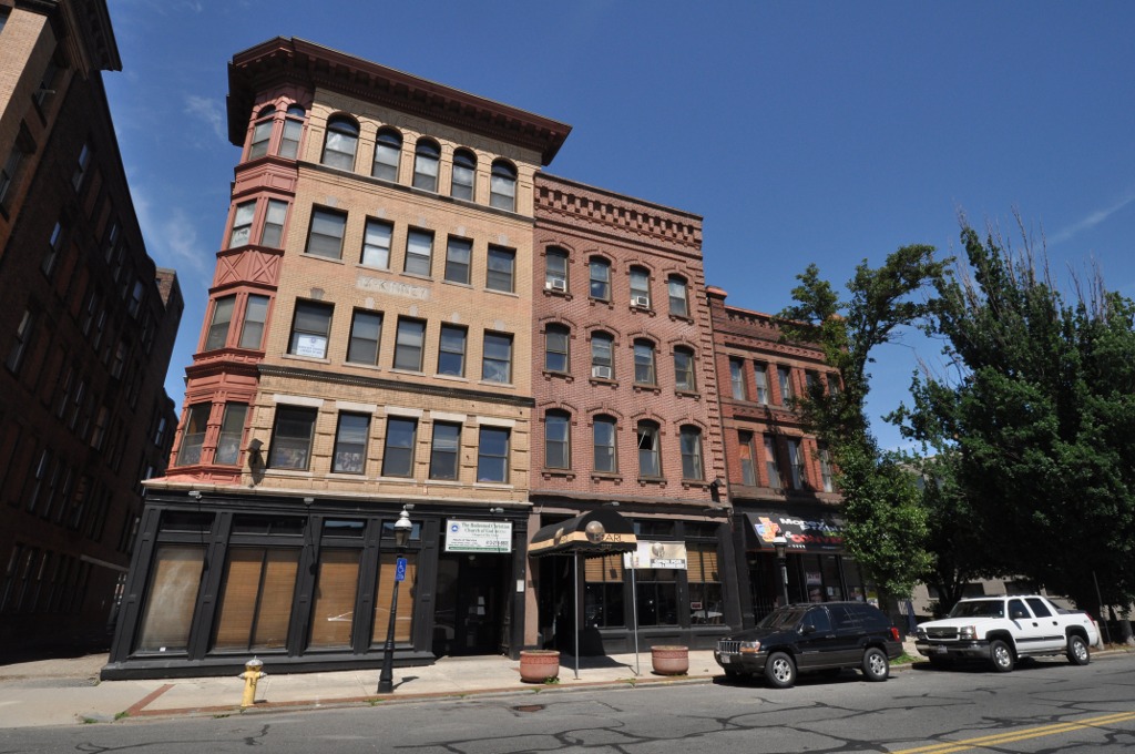


Burbach Block
Monument and historic site · National Register of Historic Places · 3.7 mi
Historic commercial and retail block in Springfield, Massachusetts, United States
Capt. Charles Leonard House
Monument and historic site · National Register of Historic Places · 2.8 mi
Historic house in Agawam, Massachusetts, USA
Carlton House Block
Monument and historic site · National Register of Historic Places · 4.1 mi
Springfield, Massachusetts, NRHP-listed
75 more on the map.
Parks, trails and playgrounds54





42 more on the map.
Restaurants and cafes29

Frankie's Pizza
Restaurant · American, Italian, Pizza · 1.3 mi
809 Maple Road
We-Th 10:30-19:45; Fr-Sa 10:30-20:30; Su 11:00-19:30
Posto
Restaurant · Italian · 0.9 mi
674 Bliss Road
Tu 15:00-20:00; Su-Mo, We 11:30-20:00; Fr-Sa 11:30-22:00; Th 11:30-21:00

Fletcher's BBQ Shop & Steakhouse
Restaurant · Barbecue · 1.0 mi
408 Longmeadow Street, Longmeadow
Mo-Th 11:30-21:00; Fr,Sa 11:30-22:00; Su 11:30-20:00
Grapevine
Restaurant · Pizza, American, Greek · 1.3 mi
753 Maple Road, Longmeadow
Mo-We 11:00-21:00; Th-Sa 11:00-21:30
Grapevine Pizzeria & Restaurant
Restaurant · Greek, Italian, Pasta, Pizza · 1.3 mi
753 Maple Road
Mo-We 11:00-21:00; Th-Sa 11:00-21:30
Iron Chef
Restaurant · Asian · 1.3 mi
927 Shaker Road, Longmeadow
Mo-Th 11:00-21:00; Tu off; Fr-Sa 11:00-21:30; Su 11:30-21:00
Li's Brothers
Restaurant · Chinese, Japanese · 1.3 mi
795 Maple Road, Longmeadow
Tu-Th 11:30-21:30; Fr-Sa 11:30-22:00; Su 12:00-21:00
Lola's
Restaurant · Mexican · 1.0 mi
732 Bliss Road, Longmeadow
Mo 15:00-21:00; Tu-Th 11:30-21:00; Fr-Sa 11:30-22:00; Su 11:30-20:00
Max Burger
Restaurant · Burger · 0.9 mi
684 Bliss Road, Longmeadow
Su-Th 11:30-21:00; Fr-Sa 11:30-22:00
New China
Restaurant · Chinese · 2.3 mi
284 North Maple Street
Mo-Th 10:30-21:00; Su 11:30-21:00; Fr-Sa 10:30-22:30
Pizza Works
Restaurant · Pizza, Sandwich · 2.7 mi
459 Dickinson Street, Springfield
Su-Th 10:00-00:00, Fr-Sa 10:00-02:00
17 more on the map.
Where to stay1
Churches and places of worship28
Saint Nicholas Russian Orthodox Church
Church · Russian Orthodox · 1.8 mi
343 North Maple Street, Enfield
St Paul The Apostle Catholic Church
Church · Roman Catholic · 2.5 mi
225 Dwight Road
The Unitarian Universalist Society of Greater Springfield (UUSGS)
Place of worship · 1.7 mi
245 Porter Lake Drive, Springfield
Enfield United Methodist Church
Church · Methodist · 2.4 mi
41 Brainard Road, Enfield
First Baptist Church of Enfield
Church · Baptist · 1.7 mi
253 Brainard Road, Enfield
Shopping9
Gas and EV charging7
Schools, colleges and libraries67
Healthcare6
Urgent Care of Longmeadow
Clinic and pharmacy · 0.9 mi
688 Bliss Road, Longmeadow
Map of Longmeadow
250 places. The map loads OpenStreetMap tiles when you open it.
Climate by month
Monthly table
| Month | High | Low | Rain | Snow |
|---|---|---|---|---|
| Jan | 35°F | 19°F | 3.3 in | 14.2 in |
| Feb | 38°F | 21°F | 3.1 in | 14.8 in |
| Mar | 47°F | 28°F | 3.8 in | 9.4 in |
| Apr | 60°F | 38°F | 3.9 in | 1.1 in |
| May | 72°F | 48°F | 3.8 in | 0.0 in |
| Jun | 80°F | 58°F | 4.3 in | 0.0 in |
| Jul | 85°F | 63°F | 4.2 in | 0.0 in |
| Aug | 83°F | 62°F | 4.2 in | 0.0 in |
| Sep | 76°F | 54°F | 4.4 in | 0.0 in |
| Oct | 64°F | 42°F | 4.5 in | 0.7 in |
| Nov | 52°F | 33°F | 3.5 in | 1.4 in |
| Dec | 41°F | 25°F | 4.1 in | 10.1 in |
U.S. Climate Normals 1991-2020 for Hartford Bradley Intl Ap 72508 (10 mi away), NOAA NCEI.
People and cost of living
American Community Survey 5-year estimates, 2020-2024, U.S. Census Bureau. Estimates have margins of error, larger for small towns.
Disaster history
Hampden County has had 19 federal disaster declarations since 2000, most often for severe storms.
- 2023-09-15: Hurricane Lee (Hurricane)
- 2020-03-27: Covid-19 Pandemic (Biological)
- 2020-03-13: Covid-19 (Biological)
- 2013-04-19: Severe Winter Storm, Snowstorm, And Flooding (Severe Storm)
- 2012-10-28: Hurricane Sandy (Hurricane)
- 2012-01-06: Severe Storm And Snowstorm (Severe Storm)
OpenFEMA disaster declarations summaries.
Getting there and nearby towns
Bradley International Airport (BDL) is the nearest airport with scheduled flights listed in OpenStreetMap, 9 miles away.
- Springfield 5 mi north, about 8 min by car
- Agawam Town 5 mi west, about 7 min by car
- Chicopee 9 mi north, about 14 min by car
- Windsor Locks 9 mi southwest, about 15 min by car
- Holyoke 12 mi north, about 19 min by car
- Easthampton 16 mi north, about 26 min by car
- Manchester 19 mi south, about 30 min by car
- Hartford 20 mi south, about 33 min by car
- East Hartford 20 mi south, about 32 min by car
- West Hartford 22 mi southwest, about 35 min by car
Drive times are estimates from straight-line distance, not routes.
Local news
Headlines from INDB, the NEMICO news database.
Reviews, tips and questions
Loading what members have shared...
Sources and licences
- NCES EDGE (Public domain): public schools
- NOAA NCEI U.S. Climate Normals 1991-2020 (Public domain): climate by month
- OpenFEMA (Public domain): disaster declarations
- OpenStreetMap contributors (ODbL 1.0): places, airports, map data
- U.S. Census Bureau (Public domain): population, income, housing, education, commute
- Wikidata (CC0 1.0): landmarks and historic places
- Wikimedia Commons (see each image): photos
Photo credits
- Storrs House Museum, Longmeadow MA, John Phelan, CC BY 4.0
- Richard Salter Storrs Library, Longmeadow MA, John Phelan, CC BY 4.0
- Leary Hall, Bay Path University, Longmeadow MA, John Phelan, CC BY 4.0
- Ashael Colton House, Longmeadow, August 2026, Pi.1415926535, CC BY-SA 4.0
- Former Longmeadow station building, August 2026, Pi.1415926535, CC BY-SA 4.0
- Wetland in Longmeadow, Massachusetts, August 2026, Pi.1415926535, CC BY-SA 4.0
- CT Rail Hartford Line train 6403 in Longmeadow, MA October 2026, 4300streetcar, CC BY 4.0
- Springfield Line north of Birnie Road, Longmeadow, August 2026, Pi.1415926535, CC BY-SA 4.0
- Springfield Line signals south of Birnie Road, Longmeadow, August 2026, Pi.1415926535, CC BY-SA 4.0
- Amtrak Hartford Line shuttle train 460 in Longmeadow, MA October 2026, 4300streetcar, CC BY 4.0
- Springfield District Court, TM01001, CC BY-SA 3.0
- SpringfieldMA KenwynApartments, User:Magicpiano, CC BY-SA 4.0
- 70 Patton Street, Springfield MA, John Phelan, CC BY-SA 3.0
- City View Commons, Springfield MA, John Phelan, CC BY-SA 3.0
- Baystate Corset Block, Springfield MA, John Phelan, CC BY-SA 3.0
- SpringfieldMA FederalSquare2, Magicpiano, CC BY-SA 4.0
- State Armory - Springfield, MA, TM01001, CC BY-SA 3.0
- Amtrak Station, Springfield MA, John Phelan, CC BY-SA 3.0
- SpringfieldMA AdamsApartments, Magicpiano, CC BY-SA 3.0
- AgawamMA SchoolStreetBarn, User:Magicpiano, CC BY-SA 4.0
- Whitcomb Building, Springfield MA, John Phelan, CC BY-SA 3.0
- SpringfieldMA StJamesApartments, Magicpiano, CC BY-SA 4.0
- HenkingCafe, Unknown author Unknown author, Public domain
- South Congregational Church, Springfield MA, John Phelan, CC BY-SA 3.0
- YMCA, Chestnut Street, Springfield MA, John Phelan, CC BY-SA 3.0
- Colonial Block, Springfield MA, John Phelan, CC BY 3.0
- SuffieldCT GothicCottage, Magicpiano, CC BY-SA 4.0
- Wason-Springfield Steam Power Blocks, Springfield MA, John Phelan, CC BY-SA 3.0
- Exterior - Museum of Fine Arts, Springfield, MA - DSC03877, Daderot, CC0
- Court Square 2013 06 02, Dms1788, CC BY-SA 3.0
- SpringfieldMA BurbachAndBangsBlocks, User:Magicpiano, CC BY-SA 4.0
- SpringfieldMA McKnightDistrict AmherstStreet, User:Magicpiano, CC BY-SA 4.0
- Mills-Stebbins House sp, Morton Hauler, Public domain
- ILLEBIGELOWHARTFORDCARPETMILLS-vi, Jerry Dougherty, CC BY 2.5
- SpringfieldMA HibernianBlock, Unknown author Unknown author, Public domain
- EastLongmeadowMA ElijahBurtHouse, User:Magicpiano, CC BY-SA 4.0
- Driscolls Block, Springfield MA, John Phelan, CC BY-SA 3.0
- Springfield Safe Deposit and Trust, Springfield MA, John Phelan, CC BY 3.0
- Republican Block, Springfield MA, John Phelan, CC BY-SA 3.0
- Hampden County Courthouse MA, Takomabibelot, CC BY 2.0


Page built October 30, 2026. Spotted a mistake? Tell us or suggest a place.