
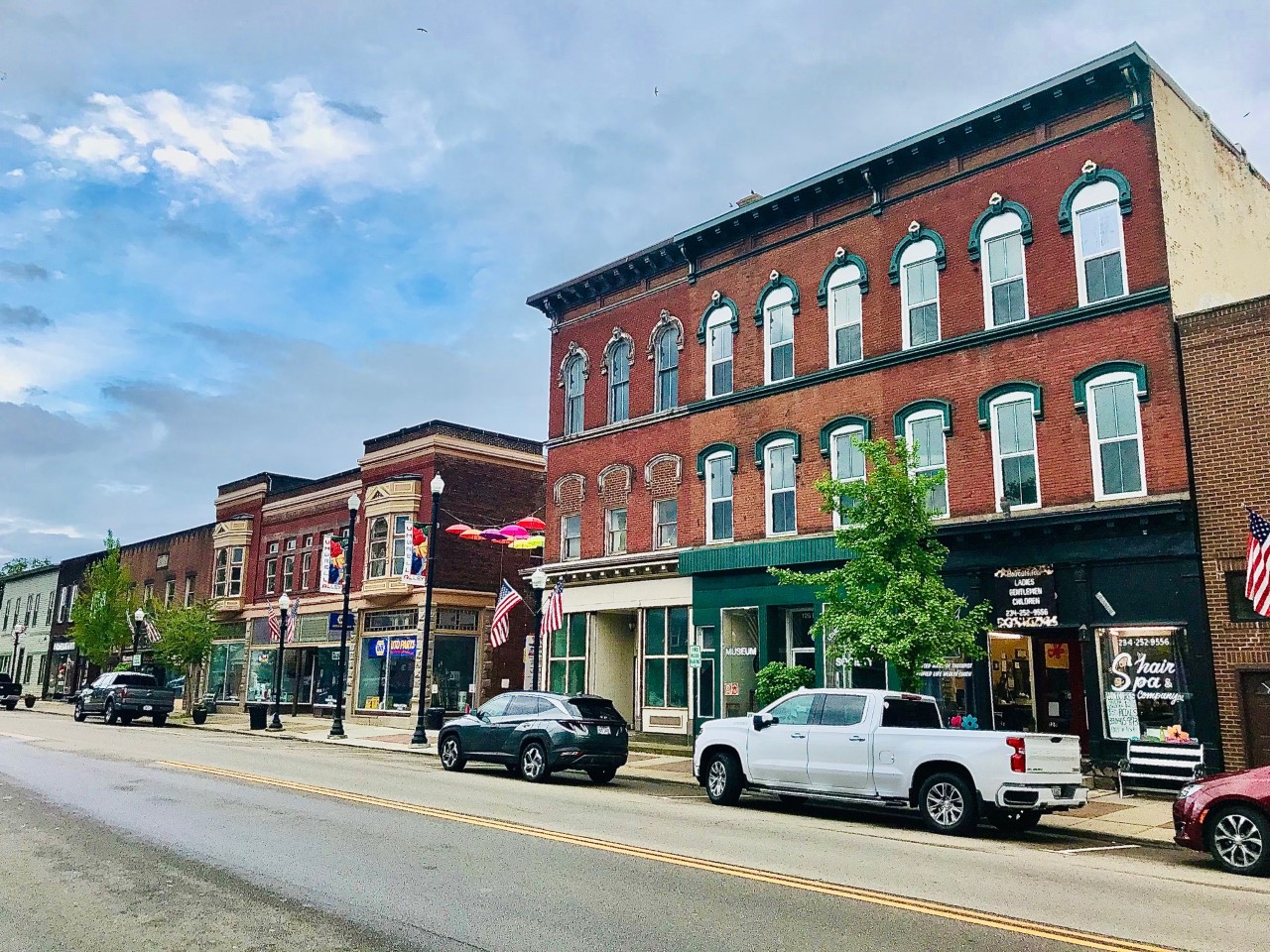


Louisville, Ohio
Louisville is a city of 9,602 people in Stark County, Ohio, founded in 1834.
Why visit Louisville
Townapedia lists 1 museum or landmark, 11 parks and trails, 13 places to eat and 2 attractions in and around town.
July is the warmest month, with average highs of 84°F; January lows average 20°F, and about 47 inches of snow fall in a normal year.
Weather in Louisville
Forecast from the National Weather Service. Full forecast
About Louisville
Louisville is a city in Stark County, Ohio, United States. The population was 9,521 at the time of the 2020 census. Located 7 miles (11 km) northeast of Canton, it is a suburb in the Canton–Massillon metropolitan area.
From the Wikipedia article Louisville, Ohio (this version), under CC BY-SA 4.0.
Things to do2

Mary C. Metzger Amphitheater
Cinema and theater · 1.1 mi
This area is a small amphitheater with a concrete platform that has stairs leading up to it.
Museums and landmarks1

Bluestar Memorial
Monument and historic site · 1.1 mi
A tribute to the Armed Forces that have defended the United States of America. Sponsored by Town and Country Garden Club of Louisville...
Parks, trails and playgrounds11

Nickleplate Trail (Creston Park)
Park · 1.3 mi
Sign saying "Please respect property boundaries" at the south end of the terminus. Please do not cross the fences at the edge of the...


Restaurants and cafes13

Tomi Hibachi Japanese Grill & Sushi
Restaurant · Japanese · 0.9 mi
1338 North Chapel Street, Louisville
Tu-Su 11:00-17:30, Mo closed


Domino's
Fast food · Pizza
520 West Main Street, Louisville
Mo-Th 10:30-24:00; Fr-Sa 10:30-01:00; Su 10:30-24:00
1 more on the map.
History
On October 8, 1834, Louisville was formally settled by Henry Lautzenheiser, from Germany, and Frederick Fainot, a French Huguenot. The city was named after Lautzenheiser's son, Lewis, and called Lewisville, Ohio. The name of the town was also considered appropriate because it was initially surveyed by the similar-sounding name of Lewis Vail. When the post office was established in 1837, with Sam Petree as its first postmaster, it was discovered Ohio already had a Lewisville, so the spelling was changed to Louisville.
Within Louisville's early days, the town competed with the fellow Nimishillen Township community of Harrisburg (also known as Barryville) for growth. Harrisburg initially flourished due to its accessibility as a stagecoach stop between Canton, Alliance, Cleveland, and Pittsburgh. Meanwhile, Louisville also grew, due to its location upon the east branch of the Nimishillen Creek, which flows toward Canton. However, when the Pittsburgh, Fort Wayne and Chicago Railway was laid through Louisville in 1852, Louisville began to grow more quickly than Harrisburg, which struggled with the difficulty of hauling its main product, wheat, by barge. Today, Harrisburg is now an unincorporated community, marked only by a handful of businesses and a Roman Catholic parish.
From the History section of Louisville, Ohio on Wikipedia, under CC BY-SA 4.0.
Churches and places of worship15
Shopping2
Gas and EV charging4
Schools, colleges and libraries23
Charles L Warstler Elementary School
School · 4.3 mi
2500 Schneider St Ne, Canton
East Branch Preparatory Academydbawright Preparatory Academy
School · 4.4 mi
1500 Superior Ave Ne, Canton
Healthcare1
Map of Louisville
72 places. The map loads OpenStreetMap tiles when you open it.
Climate by month
Monthly table
| Month | High | Low | Rain | Snow |
|---|---|---|---|---|
| Jan | 36°F | 20°F | 2.9 in | 13.4 in |
| Feb | 39°F | 22°F | 2.4 in | 12.0 in |
| Mar | 48°F | 29°F | 3.2 in | 7.6 in |
| Apr | 62°F | 40°F | 3.9 in | 1.7 in |
| May | 72°F | 50°F | 4.1 in | 0.0 in |
| Jun | 80°F | 59°F | 4.4 in | 0.0 in |
| Jul | 84°F | 63°F | 4.1 in | 0.0 in |
| Aug | 83°F | 62°F | 3.6 in | 0.0 in |
| Sep | 76°F | 55°F | 3.5 in | 0.0 in |
| Oct | 63°F | 44°F | 3.3 in | 0.3 in |
| Nov | 51°F | 34°F | 3.1 in | 3.3 in |
| Dec | 40°F | 26°F | 2.9 in | 8.9 in |
U.S. Climate Normals 1991-2020 for Akron Canton Rgnl Ap 72521 (10 mi away), NOAA NCEI.
People and cost of living
American Community Survey 5-year estimates, 2020-2024, U.S. Census Bureau. Estimates have margins of error, larger for small towns.
Disaster history
Stark County has had 9 federal disaster declarations since 2000, most often for severe storms.
- 2020-03-31: Covid-19 Pandemic (Biological)
- 2020-03-13: Covid-19 (Biological)
- 2012-06-30: Severe Storms (Severe Storm)
- 2006-07-02: Severe Storms, Tornadoes, Straight Line Winds, And Flooding (Severe Storm)
- 2005-09-13: Hurricane Katrina Evacuation (Hurricane)
- 2005-02-15: Severe Winter Storms, Flooding, And Mudslides (Severe Storm)
OpenFEMA disaster declarations summaries.
Getting there and nearby towns
Akron-Canton Airport (CAK) is the nearest airport with scheduled flights listed in OpenStreetMap, 11 miles away.
- East Canton 3 mi south, about 6 min by car
- Middlebranch 5 mi northwest, about 9 min by car
- Canton 6 mi west, about 9 min by car
- North Canton 7 mi west, about 12 min by car
- Alliance 9 mi northeast, about 15 min by car
- Reedurban 9 mi west, about 15 min by car
- Hartville 9 mi northwest, about 15 min by car
- North Industry 9 mi southwest, about 14 min by car
- Greentown 9 mi northwest, about 15 min by car
- Minerva 11 mi southeast, about 18 min by car
Drive times are estimates from straight-line distance, not routes.
Local news
Headlines from INDB, the NEMICO news database.
Reviews, tips and questions
Loading what members have shared...
Sources and licences
- NCES EDGE (Public domain): public schools
- NOAA NCEI U.S. Climate Normals 1991-2020 (Public domain): climate by month
- OpenFEMA (Public domain): disaster declarations
- OpenStreetMap contributors (ODbL 1.0): places, airports, map data
- U.S. Census Bureau (Public domain): population, income, housing, education, commute
- Wikidata (CC0 1.0): elevation, founding date, time zone, website, landmarks and historic places
- Wikimedia Commons (see each image): photos
- Wikipedia (CC BY-SA 4.0): overview and history text
Photo credits
- 5-26-22 thumbnail Image 0026, SilentMatt Psychedelic, CC BY-SA 4.0
- Louisville Ohio, 2013, MarvinThomas, CC BY-SA 3.0
- Louisville Ohio 2013,,021, MarvinThomas, CC BY-SA 3.0
- Louisville Ohio 2013 019, MarvinThomas, CC BY-SA 3.0
- Louisville Ohio 2013 023, MarvinThomas, CC BY-SA 3.0
- Louisville, Ohio - St. Louis 2011-02-04 (cropped), Roseohioresident, Public domain
- Louisville, Ohio - St. Louis 2011-02-04, Roseohioresident, Public domain
- Louisville - Former J&L lagoon (COAF) - 6022513292, Ohio Redevelopment Projects - ODSA, CC BY 2.0
- Louisville - Former J&L lagoon (COAF) - 6021956199, Ohio Redevelopment Projects - ODSA, CC BY 2.0
- Louisville - Former J&L lagoon (COAF) - 6022513490, Ohio Redevelopment Projects - ODSA, CC BY 2.0
- Louisville - Former J&L lagoon (COAF) - 6021955699, Ohio Redevelopment Projects - ODSA, CC BY 2.0
- Louisville - Former J&L lagoon (COAF) - 6022514160, Ohio Redevelopment Projects - ODSA, CC BY 2.0
- Louisville - Former J&L lagoon (COAF) - 6021955955, Ohio Redevelopment Projects - ODSA, CC BY 2.0
- Louisville - Former J&L lagoon (COAF), Ohio Redevelopment Projects - ODSA, CC BY 2.0
- Louisville - Former J&L lagoon (COAF) - 6022513180, Ohio Redevelopment Projects - ODSA, CC BY 2.0
- Louisville - Former J&L lagoon (COAF) - 6022512994, Ohio Redevelopment Projects - ODSA, CC BY 2.0
- Louisville - Former J&L lagoon (COAF) - 6021956315, Ohio Redevelopment Projects - ODSA, CC BY 2.0
- Louisville - Former J&L lagoon (COAF) - 6022513776, Ohio Redevelopment Projects - ODSA, CC BY 2.0
- Louisville-Beck Industrial Commerce Park (JRS) - 8443990755, Ohio Redevelopment Projects - ODSA, CC BY 2.0
- Louisville-Beck Industrial Commerce Park (JRS), Ohio Redevelopment Projects - ODSA, CC BY 2.0
- Louisville-Beck Industrial Commerce Park (JRS) - 8445079460, Ohio Redevelopment Projects - ODSA, CC BY 2.0
- Louisville-Beck Industrial Commerce Park (JRS) - 8443990217, Ohio Redevelopment Projects - ODSA, CC BY 2.0
- Louisville-Beck Industrial Commerce Park (JRS) - 8443990573, Ohio Redevelopment Projects - ODSA, CC BY 2.0
- Louisville-Beck Industrial Commerce Park (JRS) - 8445078646, Ohio Redevelopment Projects - ODSA, CC BY 2.0
- Louisville-Beck Industrial Commerce Park (JRS) - 8443990375, Ohio Redevelopment Projects - ODSA, CC BY 2.0
- Louisville-Beck Industrial Commerce Park (JRS) - 8445079404, Ohio Redevelopment Projects - ODSA, CC BY 2.0
- Louisville-Beck Industrial Commerce Park (JRS) - 8445079244, Ohio Redevelopment Projects - ODSA, CC BY 2.0
- Louisville-Beck Industrial Commerce Park (JRS) - 8443990273, Ohio Redevelopment Projects - ODSA, CC BY 2.0
- Louisville-Beck Industrial Commerce Park (JRS) - 8443990721, Ohio Redevelopment Projects - ODSA, CC BY 2.0
- Louisville-Beck Industrial Commerce Park (JRS) - 8445079420, Ohio Redevelopment Projects - ODSA, CC BY 2.0
- 024 Downtown looking west7, MarvinThomas, CC BY-SA 3.0
- 015 Downtown looking west2, MarvinThomas, CC BY-SA 3.0
- 022 Downtown looking west6, MarvinThomas, CC BY-SA 3.0
- 017 Downtown looking west3, MarvinThomas, CC BY-SA 3.0
- 014 Downtown looking west, MarvinThomas, CC BY-SA 3.0
- 018 Downtown looking west4, MarvinThomas, CC BY-SA 3.0
- 020 Downtown looking west5, MarvinThomas, CC BY-SA 3.0


Page built October 30, 2026. Spotted a mistake? Tell us or suggest a place.