


Ludlow, Kentucky
Ludlow is a city of 4,378 people in Kenton County, Kentucky, founded in 1864.
Why visit Ludlow
Townapedia lists 83 museums and landmarks, 18 parks and trails, 25 places to eat, 6 places to stay and 4 attractions in and around town.
Highlights include Gateway Community and Technical College, Elmwood Hall, Abraham J. Friedlander House and Devou Park.
July is the warmest month, with average highs of 85°F; January lows average 22°F.
Weather in Ludlow
Forecast from the National Weather Service. Full forecast
About Ludlow
Ludlow is a home rule-class city in Kenton County, Kentucky, United States, along the Ohio River. The population was 4,385 at the 2020 census. It is a suburb of the Cincinnati metropolitan area. It received its greatest period of early growth as a rail station.
From the Wikipedia article Ludlow, Kentucky (this version), under CC BY-SA 4.0.
Things to do4

Gateway Community and Technical College
School · 2.1 mi
Community college in Covington, Kentucky, U.S.


Warsaw Federal Incline Theater
Cinema and theater · 1.3 mi
801 Matson Place, Cincinnati
Museums and landmarks83

Elmwood Hall
Monument and historic site · National Register of Historic Places · 0.4 mi
House in Ludlow, Kentucky
244 Forest Avenue, Covington

Abraham J. Friedlander House
Monument and historic site · National Register of Historic Places · 2.1 mi
House in Cincinnati, Ohio

Alkemeyer Commercial Buildings
Monument and historic site · National Register of Historic Places · 2.2 mi
Building in Ohio, United States
Alms and Doepke Dry Goods Company
Monument and historic site · National Register of Historic Places · 2.4 mi
United States historic place
Apostolic Bethlehem Temple Church
Monument and historic site · National Register of Historic Places · 2.1 mi
Church building in Ohio, United States of America

Bartlett Building
Monument and historic site · National Register of Historic Places · 2.1 mi
Building in Cincinnati, Ohio

Bavarian Brewing Company
Monument and historic site · National Register of Historic Places · 1.8 mi
Former brewery and historic brewery building in Covington, Kentucky, USA
Bellevue
Monument and historic site · National Register of Historic Places · 3.0 mi
House in Newport, Kentucky
Betts-Longworth Historic District
Monument and historic site · National Register of Historic Places · 1.9 mi
Historic district in Cincinnati, Ohio, United States
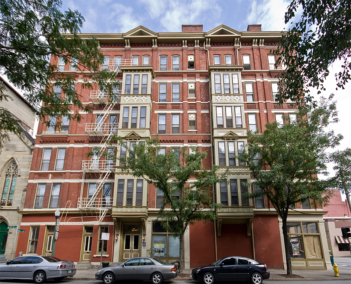


Brittany Apartments
Monument and historic site · National Register of Historic Places · 2.1 mi
Historic apartment building in Cincinnati, Ohio
Carew Tower
Monument and historic site · National Register of Historic Places · 2.1 mi
Skyscraper in Cincinnati, Ohio, United States
Cathedral Basilica of St. Peter in Chains
Monument and historic site · National Register of Historic Places · 1.9 mi
Cathedral of the Roman Catholic Archdiocese of Cincinnati in downtown Cincinnati, Ohio, United States, with the title of minor basilica
71 more on the map.
Parks, trails and playgrounds18


6 more on the map.
Restaurants and cafes25

Incline Public House
Diner · American · 1.2 mi
2601 West 8th Street, Cincinnati
Mo-Th 11:00-23:00, Fr-Sa 11:00-02:00, Su 11:00-22:00

Primavista
Restaurant · Italian · 1.3 mi
810 Matson Place, Cincinnati
Tu-Th 17:00-21:00; Fr-Sa 17:00-22:00; Su 16:30-20:00



13 more on the map.
Where to stay6
Holiday Inn Express & Suites Cincinnati Riverfront
Motel and hotel · 1.3 mi
200 Crescent Avenue, Covington
Churches and places of worship24
Cathedral Basilica of the Assumption
Church · National Register of Historic Places · 2.3 mi
Mother of God Roman Catholic Church
Church · National Register of Historic Places · 1.9 mi
Salem Methodist Episcopal Church and Parsonage
Church · National Register of Historic Places · 3.0 mi
St. Augustine Church Complex
Church · National Register of Historic Places · 2.5 mi
Trinity Episcopal Church
Church · National Register of Historic Places · 2.0 mi
Epworth Methodist Church
Church · Methodist · 0.9 mi
1229 Highway Avenue, Covington
Saint John’s Congregational Church
Church · Congregational · 0.8 mi
1235 Highway Avenue, Covington
Shopping2
Gas and EV charging6
Schools, colleges and libraries46
Chapman Vocational Education Center
School · 3.1 mi
25Th And Madison Streets, Covington
Map of Ludlow
214 places. The map loads OpenStreetMap tiles when you open it.
Climate by month
Monthly table
| Month | High | Low | Rain | Snow |
|---|---|---|---|---|
| Jan | 37°F | 22°F | 3.6 in | 6.0 in |
| Feb | 42°F | 25°F | 3.2 in | 4.3 in |
| Mar | 52°F | 33°F | 4.5 in | 2.4 in |
| Apr | 65°F | 43°F | 4.9 in | 0.2 in |
| May | 74°F | 53°F | 5.2 in | 0.0 in |
| Jun | 82°F | 62°F | 4.8 in | 0.0 in |
| Jul | 85°F | 65°F | 4.3 in | 0.0 in |
| Aug | 85°F | 64°F | 3.5 in | 0.0 in |
| Sep | 78°F | 57°F | 3.3 in | 0.0 in |
| Oct | 66°F | 45°F | 3.5 in | 0.3 in |
| Nov | 52°F | 35°F | 3.4 in | 0.2 in |
| Dec | 42°F | 27°F | 4.0 in | 2.6 in |
U.S. Climate Normals 1991-2020 for Cheviot (6 mi away), NOAA NCEI.
People and cost of living
American Community Survey 5-year estimates, 2020-2024, U.S. Census Bureau. Estimates have margins of error, larger for small towns.
Disaster history
Kenton County has had 13 federal disaster declarations since 2000, most often for severe storms.
- 2026-01-24: Severe Winter Storm (Winter Storm)
- 2025-04-24: Severe Storms, Straight-Line Winds, Tornadoes, Flooding, Landslides, And Mudslides (Severe Storm)
- 2025-04-03: Severe Storms, Straight-Line Winds, Tornadoes, And Flooding (Severe Storm)
- 2025-02-16: Severe Storms, Straight-Line Winds, Flooding, And Landslides (Severe Storm)
- 2020-03-28: Covid-19 Pandemic (Biological)
- 2020-03-13: Covid-19 (Biological)
OpenFEMA disaster declarations summaries.
Getting there and nearby towns
Lunken Airport (LUK) is the nearest airport with scheduled flights listed in OpenStreetMap, 7 miles away.
- Park Hills 2 mi southeast, about 3 min by car
- Delshire 3 mi west, about 4 min by car
- Crescent Springs 3 mi southwest, about 5 min by car
- Fort Mitchell 3 mi south, about 5 min by car
- Fort Wright 3 mi south, about 5 min by car
- Villa Hills 3 mi southwest, about 5 min by car
- Newport 3 mi east, about 5 min by car
- Cincinnati 4 mi northeast, about 7 min by car
- Covington 4 mi south, about 6 min by car
- Delhi Hills 4 mi west, about 6 min by car
Drive times are estimates from straight-line distance, not routes.
Local news
Headlines from INDB, the NEMICO news database.
Reviews, tips and questions
Loading what members have shared...
Sources and licences
- NCES EDGE (Public domain): public schools
- NOAA NCEI U.S. Climate Normals 1991-2020 (Public domain): climate by month
- OpenFEMA (Public domain): disaster declarations
- OpenStreetMap contributors (ODbL 1.0): places, airports, map data
- U.S. Census Bureau (Public domain): population, income, housing, education, commute
- Wikidata (CC0 1.0): elevation, founding date, time zone, website, landmarks and historic places
- Wikimedia Commons (see each image): photos
- Wikipedia (CC BY-SA 4.0): overview and history text
Photo credits
- Elm Street shotguns in Ludlow, Nyttend, Public domain
- Old Ludlow Theatre, Elm Street, Ludlow, KY (50325197646), Warren LeMay from Covington, KY, United States, CC0
- Ludlow Theater from southwest, Nyttend, Public domain
- Ludlow Lagoon Clubhouse, Nyttend, Public domain
- 855-859 Oak Street, Ludlow, Nyttend, Public domain
- StPaulDistrict, Photo by Greg Hume ( Greg5030 ), CC BY 3.0
- BrittanyApartments, Photo by Greg Hume ( Greg5030 ), CC BY 3.0
- StAugustineComplex, Photo by Greg Hume ( Greg5030 ), CC BY-SA 3.0
- PhoenixClub, Photo by Greg Hume ( Greg5030 ), CC BY 3.0
- MutterGottesHistoricDistrict, Photo by Greg Hume ( Greg5030 ), CC BY 3.0
- Gwynne, Photo by Greg Hume ( Greg5030 ), CC BY 3.0
- CovenantPresbyterian, Photo by Greg Hume ( Greg5030 ), CC BY 3.0
- Alkmeyer, Photo by Greg Hume ( Greg5030 ), CC BY 3.0
- Race Street Historic District building, Nyttend, Public domain
- WadsworthElectric, Photo by Greg Hume ( Greg5030 ), CC BY 3.0
- Friedlander, Photo by Greg Hume ( Greg5030 ), CC BY 3.0
- LaSalette Academy in Covington, Nyttend, Public domain
- Cincinnati-800-broadway, Unknown author, Public domain
- CincinnatiBell, Photo by Greg Hume ( Greg5030 ), CC BY 3.0
- FireMuseum, Photo by Greg Hume ( Greg5030 ), CC BY 3.0
- Terrace Plaza Hotel, Cincinnati, Ohio (78788), Pub. by Bell Block News & Novelty Co., Cincinnati, Ohio. "Tichnor Quality Views," Reg. U. S. Pat. Off. Made Only by Tichnor Bros., Inc., Boston, Mass., Public domain
- TrinityCovington, Photo by Greg Hume ( Greg5030 ), CC BY 3.0
- St Paul's Episcopal Church Newport, KY 03, Paul Barnes, CC BY-SA 4.0
- PhoenixBuilding, Greg5030, CC BY 3.0
- Third and Garrard in Covington, Nyttend, Public domain
- BavarianBrewing, Photo by Greg Hume ( Greg5030 ), CC BY 3.0
- AthleticClub2e, Greg Hume, CC BY-SA 3.0
- Main and Third Street Cluster, Nyttend, Public domain
- JohnChurchCompanyBuilding, Photo by Greg Hume ( Greg5030 ), CC BY 3.0
- 123E4LR, Greg Hume, CC BY 3.0
- MotherOfGod, Photo by Greg Hume ( Greg5030 ), CC BY 3.0
- RopesBuilding, Unknown author, CC BY 3.0
- St. Mary's Cathedral Basilica of the Assumption in Covington, KY, Poghia ( talk ), Public domain
- Daniel Beard Home, C. Bedford Crenshaw, aka Bedford at en.wikipedia, Attribution
- StFrancisXavierChurch frontview, MamaGeek at en.wikipedia, CC BY-SA 3.0
- GoodallBuilding, Photo by Greg Hume ( Greg5030 ), CC BY 3.0
- HooperBuilding, Photo by Greg Hume ( Greg5030 ), CC BY 3.0
- YWCABuildingCincinnati, dave menninger, CC BY-SA 2.0
- Union Trust Building in Cincinnati, Nyttend, Public domain
- Fourth and Walnut Centre, Cincinnati, OH (47221101471), Warren LeMay from Cincinnati, OH, United States, CC0


Page built October 30, 2026. Spotted a mistake? Tell us or suggest a place.