


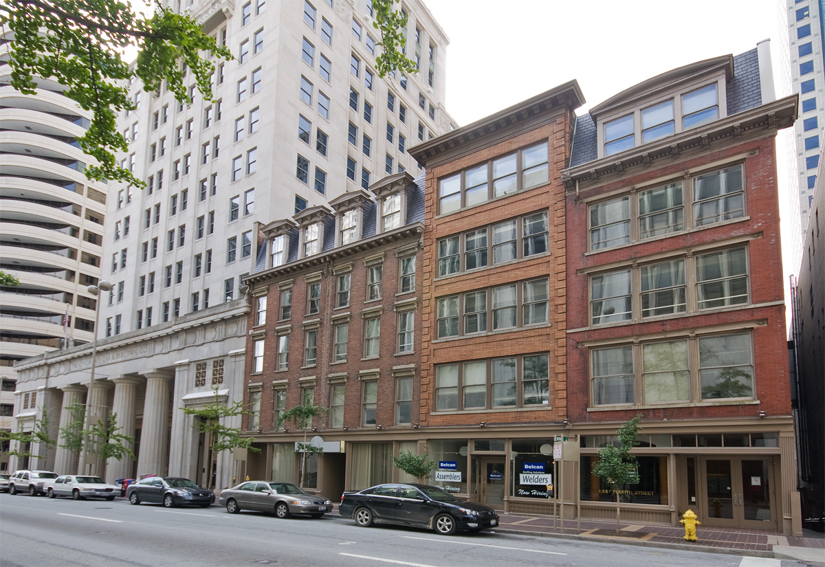

Newport, Kentucky
Newport is a city of 13,967 people in Campbell County, Kentucky, founded in 1795.
Why visit Newport
Townapedia lists 118 museums and landmarks, 51 parks and trails, 302 places to eat, 24 places to stay and 16 attractions in and around town.
Highlights include Aronoff Center for the Arts, Newport Aquarium, Contemporary Arts Center and East Fourth Street Historic District.
July is the warmest month, with average highs of 87°F; January lows average 24°F.
Weather in Newport
Forecast from the National Weather Service. Full forecast
About Newport
Newport is a home rule-class city in Campbell County, Kentucky, United States. It is at the confluence of the Ohio and Licking rivers across from Cincinnati. The population was 14,150 at the 2020 census. Historically, it was one of four county seats of Campbell County.
From the Wikipedia article Newport, Kentucky (this version), under CC BY-SA 4.0.
Things to do16

Aronoff Center for the Arts
Cinema and theater · 1.8 mi
Three theatres, an art gallery and a cafe
650 Walnut Street, Cincinnati


Gateway Community and Technical College
School · 1.2 mi
Community college in Covington, Kentucky, U.S.


The Andrew J Brady Music Center
Cinema and theater · 1.6 mi
25 Race Street, Cincinnati
The Southgate House Revival
Cinema and theater · 0.5 mi
111 East 6th Street, Newport
4 more on the map.
Museums and landmarks118

Contemporary Arts Center
Museum · 1.8 mi
44 East 6th Street, Cincinnati
We-Fr 10:00-19:00, Sa-Su 10:00-16:00
East Fourth Street Historic District
Monument and historic site · National Register of Historic Places · 1.7 mi
Historic district in Ohio, United States

LaSalette Academy
Monument and historic site · National Register of Historic Places · 1.1 mi
Parochial school

Lytle Park Historic District
Monument and historic site · National Register of Historic Places · 1.4 mi
Historic district in Cincinnati, Ohio, United States

Mother of God Roman Catholic Church
Monument and historic site · Roman Catholic · National Register of Historic Places · 1.4 mi
Historic church in Kentucky, United States
119 West 6th Street, Covington
Purple Paisley, Local Artisan Shop
Museum · 1.2 mi
Located in the historic Renaissance District of Covington Kentucky, PURPLE PAISLEY LOCAL ARTISAN SHOP is a curated handcrafted art...
715 Scott Street, Covington
Tu-Th 10:00-17:00, Fr,Sa 10:00-18:00; Mo,Su closed

Riverside Drive Historic District
Monument and historic site · National Register of Historic Places · 1.1 mi
Historic dristrict in Covington, Kentucky

Taft Museum of Art
Museum · National Register of Historic Places · 1.4 mi
Historic house museum holding a fine art collection in Cincinnati
316 Pike Street, Cincinnati

Trinity Episcopal Church
Monument and historic site · National Register of Historic Places · 1.3 mi
Church building in Kentucky, United States of America


Veteran's Monument
Monument and historic site · National Register of Historic Places · 1.8 mi
Historic monument in Covington, KY, USA

Abraham J. Friedlander House
Monument and historic site · National Register of Historic Places · 2.0 mi
House in Cincinnati, Ohio
Alkemeyer Commercial Buildings
Monument and historic site · National Register of Historic Places · 2.0 mi
Building in Ohio, United States
106 more on the map.
Parks, trails and playgrounds51


Paycor Stadium
Sports field and stadium · 1.7 mi
1 Paycor Stadium, Cincinnati
39 more on the map.
Restaurants and cafes302

Arnold’s Bar and Grill
Bar and pub · Pub, Burger, American · 1.8 mi
210 East 8th Street, Cincinnati
Tu-We 11:00-01:00; Th-Sa 11:00-02:30

Skyline Chili
Restaurant · Chili · 1.5 mi
254 East 4th Street, Cincinnati
Mo-Fr 10:30-19:00; Sa 10:30-16:00
Governors House Wine Bar & Italian Kitchen
Restaurant · Italian, Wine · 1.1 mi
Wine bar and Italian restaurant housed in a restored mansion, with a full bar and patio
314 Greenup Street, Covington
Tu-Th 16:00-22:00; Fr-Sa 16:00-23:00
Smoke Justis
Restaurant · American, Barbecue, Wings · 1.2 mi
302 Court Street, Covington
Mo 16:00-01:00; Tu-Th 11:00-01:00; Fr 11:00-02:00; Sa 10:00-02:00;...
Bellevue Bistro
Restaurant · Sandwich · 1.4 mi
313 Fairfield Avenue, Bellevue
Mo-Tu 09:00-14:00; We closed; Th-Su 08:00-14:00
Boca
Restaurant · French · 1.7 mi
114 East 6th Street, Cincinnati
Tu-Th 17:00-21:00, Fr-Sa 17:00-22:00
Bourbon House Pizza
Restaurant · Pizza · 0.7 mi
100 Aqua Way, Newport
Mo off; Tu-Th 16:00-21:00; Fr-Sa 11:00-22:00; Su 12:00-21:00
Bru Burger Bar
Restaurant · Burger, American · 1.8 mi
41 East 6th Street, Cincinnati
Mo-Th 11:00-22:00; Fr-Sa 11:00-23:00; Su 11:00-21:00
290 more on the map.
History
Newport was settled c. 1791 by James Taylor Jr. on land purchased by his father James Sr. from George Muse, who received it as a grant. Taylor's brother, Hubbard Taylor, had been mapping the land twenty years prior. It was not named for its position on the river but for Christopher Newport, the commander of the first ship to reach Jamestown, Virginia, in 1607. Newport was established as a town on December 14, 1795, and incorporated as a city on February 24, 1834. In 1803, the Ft. Washington military post was moved from Cincinnati to become the Newport Barracks. A bridge first connected Newport to Covington in 1853, and the first bridge spanning the Ohio River to Cincinnati, the John A. Roebling Suspension Bridge, opened in 1866. Newport experienced large German immigration in the 1880-90s.
By 1900, Newport was the third largest city in Kentucky, after Covington and Louisville, although Newport and Covington were rightly considered satellites of Cincinnati.
Prohibition under the Volstead Act of 1919 resulted in a widespread illegal sale of alcohol. Many gangsters began to smuggle alcohol into the city to supply citizens and businesses. Speakeasies, bribery, and corruption became a norm in Newport. A well known Newport crime boss was gambler and National Crime Syndicate member Ed Levinson.
From the History section of Newport, Kentucky on Wikipedia, under CC BY-SA 4.0.
Where to stay24
AC Hotel by Marriott Cincinnati at The Banks
Motel and hotel · 1.4 mi
135 Joe Nuxhall Way, Cincinnati
Cincinnati Marriott at RiverCenter
Motel and hotel · 1.4 mi
10 West River Center Boulevard, Covington
Renaissance Cincinnati Downtown Hotel
Motel and hotel · 1.6 mi
36 East 4th Street, Cincinnati
Residence Inn by Marriott Cincinnati Downtown/The Phelps
Motel and hotel · 1.4 mi
506 East 4th Street, Cincinnati
Churches and places of worship50
Cathedral Basilica of the Assumption
Church · Roman Catholic · National Register of Historic Places · 1.3 mi
1130 Madison Avenue, Covington
Sacred Heart Church
Church · Roman Catholic · National Register of Historic Places · 1.2 mi
341 Taylor Avenue, Bellevue
Shopping31
Gas and EV charging11
Schools, colleges and libraries60
Healthcare9
Map of Newport
250 places. The map loads OpenStreetMap tiles when you open it.
Climate by month
Monthly table
| Month | High | Low | Rain |
|---|---|---|---|
| Jan | 41°F | 24°F | 2.9 in |
| Feb | 45°F | 26°F | 2.8 in |
| Mar | 55°F | 33°F | 3.9 in |
| Apr | 67°F | 42°F | 4.4 in |
| May | 75°F | 53°F | 4.7 in |
| Jun | 83°F | 61°F | 4.6 in |
| Jul | 87°F | 65°F | 4.4 in |
| Aug | 86°F | 64°F | 3.4 in |
| Sep | 80°F | 56°F | 3.1 in |
| Oct | 68°F | 44°F | 3.0 in |
| Nov | 55°F | 34°F | 2.9 in |
| Dec | 45°F | 28°F | 3.3 in |
U.S. Climate Normals 1991-2020 for Cincinnati Lunken Ap (4 mi away), NOAA NCEI.
People and cost of living
American Community Survey 5-year estimates, 2020-2024, U.S. Census Bureau. Estimates have margins of error, larger for small towns.
Disaster history
Campbell County has had 14 federal disaster declarations since 2000, most often for severe storms.
- 2026-01-24: Severe Winter Storm (Winter Storm)
- 2025-04-24: Severe Storms, Straight-Line Winds, Tornadoes, Flooding, Landslides, And Mudslides (Severe Storm)
- 2025-04-03: Severe Storms, Straight-Line Winds, Tornadoes, And Flooding (Severe Storm)
- 2025-02-16: Severe Storms, Straight-Line Winds, Flooding, And Landslides (Severe Storm)
- 2020-03-28: Covid-19 Pandemic (Biological)
- 2020-03-13: Covid-19 (Biological)
OpenFEMA disaster declarations summaries.
Getting there and nearby towns
Lunken Airport (LUK) is the nearest airport with scheduled flights listed in OpenStreetMap, 4 miles away.
- Bellevue 1 mi northeast, about 2 min by car
- Fort Thomas 2 mi east, about 3 min by car
- Southgate 2 mi southeast, about 3 min by car
- Dayton 2 mi northeast, about 4 min by car
- Park Hills 3 mi southwest, about 4 min by car
- Wilder 3 mi south, about 5 min by car
- Ludlow 3 mi west, about 5 min by car
- Cincinnati 4 mi north, about 6 min by car
- Covington 4 mi southwest, about 6 min by car
- Highland Heights 4 mi southeast, about 6 min by car
Drive times are estimates from straight-line distance, not routes.
Local news
Headlines from INDB, the NEMICO news database.
Reviews, tips and questions
Loading what members have shared...
Sources and licences
- NCES EDGE (Public domain): public schools
- NOAA NCEI U.S. Climate Normals 1991-2020 (Public domain): climate by month
- OpenFEMA (Public domain): disaster declarations
- OpenStreetMap contributors (ODbL 1.0): places, airports, map data
- U.S. Census Bureau (Public domain): population, income, housing, education, commute
- Wikidata (CC0 1.0): elevation, founding date, time zone, website, landmarks and historic places
- Wikimedia Commons (see each image): photos
- Wikipedia (CC BY-SA 4.0): overview and history text
Photo credits
- DSCF7941 (47895781251), Paul Sableman from St. Louis, MO, CC BY 2.0
- Sacred-Heart-Church-Bellevue-KY, Wholtone, Public domain
- St. Mary's Cathedral Basilica of the Assumption in Covington, KY, Poghia ( talk ), Public domain
- Third and Garrard in Covington, Nyttend, Public domain
- 123E4LR, Greg Hume, CC BY 3.0
- MotherOfGod, Photo by Greg Hume ( Greg5030 ), CC BY 3.0
- TrinityCovington, Photo by Greg Hume ( Greg5030 ), CC BY 3.0
- Veteran's Monument in Covington north, The original uploader was Bedford at English Wikipedia ., Public domain
- LaSalette Academy in Covington, Nyttend, Public domain
- TaftMuseum, Greg Hume ( User:Greg5030 ), CC BY-SA 2.5
- Literary Club of Cincinnati, Nyttend, Public domain
- St Paul's Episcopal Church Newport, KY 03, Paul Barnes, CC BY-SA 4.0
- PhoenixBuilding, Greg5030, CC BY 3.0
- ImmaculateConceptionChurch, Photo by Greg Hume ( Greg5030 ), CC BY 3.0
- BavarianBrewing, Photo by Greg Hume ( Greg5030 ), CC BY 3.0
- Main and Third Street Cluster, Nyttend, Public domain
- RopesBuilding, Unknown author, CC BY 3.0
- StFrancisXavierChurch frontview, MamaGeek at en.wikipedia, CC BY-SA 3.0
- Findlay Market Cincinnati, Lanskeith17, Public domain
- YWCABuildingCincinnati, dave menninger, CC BY-SA 2.0
- Fourth and Walnut Centre, Cincinnati, OH (47221101471), Warren LeMay from Cincinnati, OH, United States, CC0
- KrumburgBuilding, Unknown author, CC BY 3.0
- Renovated Cincinnati Music Hall 2, Larsonj3, CC BY-SA 4.0
- Doctors' Building, Cincinnati, Nyttend, Public domain
- ThePowerBuildingCincinnati, dave menninger, CC BY-SA 2.0
- Linden Grove Cemetery gate, Bedford at en.wikipedia, Public domain
- Purplepeoplebridge, Sunkorg at en.wikipedia, CC BY-SA 3.0
- Underwriters Salvage Corps in Cincinnati, Nyttend, Public domain
- Fenwick Club Annex site, Nyttend, Public domain
- Krippendorf, Photo by Greg Hume ( Greg5030 ), CC BY 3.0
- FifthDistrictSchool, Photo by Greg Hume ( Greg5030 ), CC BY 3.0
- Sycamore in the Manufacturing and Warehouse District, Nyttend, Public domain
- Metropole Building, DaveMenninger, CC BY-SA 3.0
- OH-Cincinnati 1938 1 Ref, National Archives, Public domain
- OddFellowsHallCovington, Photo by Greg Hume ( Greg5030 ), CC BY-SA 3.0
- CincinnatiGasLight, Photo by Greg Hume ( Greg5030 ), CC BY 3.0
- CourtlandFlats, Greg5030, CC BY 3.0
- Nast Trinity Methodist front, Nyttend, Public domain
- Lewisburg HD in Covington, Nyttend, Public domain
- CuvierPressClub, Photo by Greg Hume ( Greg5030 ), CC BY 3.0


Page built October 30, 2026. Spotted a mistake? Tell us or suggest a place.