


Mamaroneck, New York
Mamaroneck is a village of 19,826 people in Westchester County, New York.
Why visit Mamaroneck
Townapedia lists 26 museums and landmarks, 39 parks and trails, 123 places to eat, 1 place to stay and 7 attractions in and around town.
Highlights include Playland, Emelin Theatre, Albert E. and Emily Wilson House and Bird Homestead.
July is the warmest month, with average highs of 86°F; January lows average 23°F, and about 33 inches of snow fall in a normal year.
Weather in Mamaroneck
Forecast from the National Weather Service. Full forecast
About Mamaroneck
Mamaroneck (, mə-MAIR-ə-nek) is a village in Westchester County, New York, United States. The population was 18,929 at the 2010 census. As of 2019, its population was an estimated 19,131. It is located partially within the town of Mamaroneck and partially within the town of Rye.
From the Wikipedia article Mamaroneck (village), New York (this version), under CC BY-SA 4.0.
Things to do7
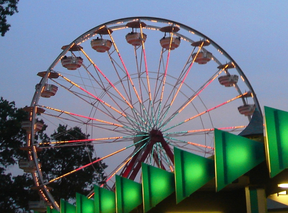
Playland
Monument and historic site · National Register of Historic Places · 3.5 mi
Amusement park in Rye, New York

Emelin Theatre
Cinema and theater · 1.0 mi
151 Library Lane, Mamaroneck

RKO Quad
Cinema and theater · 3.6 mi
Former movie theater in New Rochelle, New York, United States
Artistree Performing Arts
Cinema and theater · 0.9 mi
114 West Boston Post Road, Mamaroneck

Museums and landmarks26

Albert E. and Emily Wilson House
Monument and historic site · National Register of Historic Places · 1.3 mi
Historic house in Mamaroneck, New York

Bird Homestead
Monument and historic site · National Register of Historic Places · 2.7 mi
Historic house in New York, United States

Boston Post Road Historic District
Monument and historic site · National Register of Historic Places · 2.1 mi
Historic district in Rye, New York

Davenport House
Monument and historic site · National Register of Historic Places · 3.3 mi
An NRHP gothic-revival estate in New Rochelle, New York, United States

Hadden-Margolis House
Monument and historic site · National Register of Historic Places · 2.5 mi
Historic house in New York, United States

Lispenard-Rodman-Davenport House
Monument and historic site · National Register of Historic Places · 3.3 mi
Historic house in New York, United States

New Rochelle station
Monument and historic site · National Register of Historic Places · 3.4 mi
Railway station in New Rochelle, New York

Pioneer Building
Monument and historic site · National Register of Historic Places · 3.4 mi
Listed on the NRHP in Westchester County, New York

Quaker Ridge Golf Club
Monument and historic site · National Register of Historic Places · 2.9 mi
Private golf club in Scarsdale, New York

Rochelle Park-Rochelle Heights Historic District
Monument and historic site · National Register of Historic Places · 2.9 mi
Human settlement in New Rochelle, New York, United States of America

Rye African-American Cemetery
Monument and historic site · National Register of Historic Places · 3.1 mi
Historic cemetery in Westchester County, New York


Rye Meeting House
Monument and historic site · National Register of Historic Places · 2.3 mi
Historic church in New York, United States
14 more on the map.
Parks, trails and playgrounds39

Jay Estate
Park · 1.8 mi
23-acre park and historic site with 3 owners: the nonprofit Jay Heritage Center(JHC) (1.5 acres), NY State Parks and Westchester County...
210 Boston Post Road, City of Rye

Otter Creek Preserve
Park · 0.8 mi
Nature reserve in Westchester County, New York, United States of America
Jay Heritage Center
Park · 1.9 mi
National Historic Landmark home of John Jay. Historic Site and Park. Member Site of New York State's Path Through History, Hudson River...
210 Boston Post Road, Rye

Nichols Yacht Yard
Marina and boat launch · 0.5 mi
500 Rushmore Avenue, Mamaroneck
27 more on the map.
Restaurants and cafes123

Decadent Ales
Brewery and winery · 1.3 mi
139 Hoyt Avenue, Mamaroneck
We-Th 16:00-22:00; Fr-Sa 12:00-00:00; Su 11:00-19:00



Brooklyn Bagel & Coffee Company
Restaurant · Bagel, Coffee Shop · 1.5 mi
690 Mamaroneck Avenue, Mamaroneck

Penny Lick Ice Cream
Ice cream · 0.9 mi
1212 West Boston Post Road, Mamaroneck
Tu-Th 12:00-20:00; Fr,Sa 12:00-21:00; Su 12:00-19:00

Coriander Modern Indian
Restaurant · Indian · 1.4 mi
154 Larchmont Avenue, Larchmont
111 more on the map.
History
Originally, the farming community of Mamaroneck was located on two sides of the Mamaroneck River. In the 1890s, the two areas surrounding the river were joined into one commercial village, Mamaroneck, which was incorporated in 1895. The eastern side of the village lies in the town of Rye and is known as Rye Neck. Some controversy surrounded the incorporation of the village, but the State Appellate Court approved the village's election status. The population of Mamaroneck village in 1895 was 1,500.
Along with the other shore communities of Westchester, Mamaroneck was at one time the location of summer residences for wealthy families from New York City. Summer residence neighborhoods included Greenhaven, Orienta and Shore Acres. The local railroad from New York City (now Metro-North) began to serve the village in 1848. Currently, the village of Mamaroneck is a commuter town for individuals working in Manhattan. A harbor on the Long Island Sound supports facilities for pleasure boating and is the location of Harbor Island Park, a large public park with beach and sporting facilities.
The main commercial streets in Mamaroneck are the Boston Post Road (U.S. Route 1) and Mamaroneck Avenue, the site of several annual parades. Local industry is centered on Fenimore Road.
From the History section of Mamaroneck (village), New York on Wikipedia, under CC BY-SA 4.0.
Where to stay1
Churches and places of worship32
Saint Vito - Most Holy Trinity Catholic Church
Church · Roman Catholic · 1.6 mi
816 Underhill Avenue, Mamaroneck
First Presbyterian Church and Lewis Pintard House
Church · National Register of Historic Places · 3.7 mi
Mamaroneck Methodist Church
Church · National Register of Historic Places · 1.1 mi
St. Thomas' Episcopal Church Complex
Church · National Register of Historic Places · 0.9 mi
Trinity-St. Paul's Episcopal Church
Church · National Register of Historic Places · 3.5 mi
Saint Augustine Catholic Church
Church · Roman Catholic · 1.3 mi
18 Cherry Avenue, Larchmont
Shopping38
AAA Sneller / Alexander Antique Restoration
Shop · 1.7 mi
901 Mamaroneck Avenue, Mamaroneck
Gas and EV charging7
Schools, colleges and libraries49
Chatsworth Avenue School
School · 1.4 mi
34 Chatsworth Avenue, Larchmont
Mamaroneck High School
School · 1.0 mi
1000 West Boston Post Road, Mamaroneck
Healthcare2
PhysicianOne Urgent Care
Clinic and pharmacy · 0.9 mi
1030 West Boston Post Road, Mamaroneck
Map of Mamaroneck
250 places. The map loads OpenStreetMap tiles when you open it.
Climate by month
Monthly table
| Month | High | Low | Rain | Snow |
|---|---|---|---|---|
| Jan | 40°F | 23°F | 3.9 in | 9.4 in |
| Feb | 43°F | 24°F | 3.3 in | 10.9 in |
| Mar | 51°F | 31°F | 4.4 in | 5.8 in |
| Apr | 63°F | 40°F | 4.3 in | 0.7 in |
| May | 73°F | 50°F | 4.3 in | 0.0 in |
| Jun | 81°F | 59°F | 4.6 in | 0.0 in |
| Jul | 86°F | 64°F | 4.5 in | 0.0 in |
| Aug | 84°F | 63°F | 4.4 in | 0.0 in |
| Sep | 77°F | 56°F | 4.6 in | 0.0 in |
| Oct | 65°F | 45°F | 4.4 in | 0.0 in |
| Nov | 54°F | 36°F | 3.9 in | 0.3 in |
| Dec | 44°F | 29°F | 4.7 in | 5.6 in |
U.S. Climate Normals 1991-2020 for Dobbs Ferry-Ardsley Hcn (7 mi away), NOAA NCEI.
People and cost of living
American Community Survey 5-year estimates, 2020-2024, U.S. Census Bureau. Estimates have margins of error, larger for small towns.
Disaster history
Westchester County has had 21 federal disaster declarations since 2000, most often for hurricanes.
- 2024-01-30: Severe Storm And Flooding (Flood)
- 2021-09-05: Remnants Of Hurricane Ida (Hurricane)
- 2021-09-02: Remnants Of Hurricane Ida (Hurricane)
- 2021-08-22: Hurricane Henri (Hurricane)
- 2020-10-02: Tropical Storm Isaias (Hurricane)
- 2020-03-20: Covid-19 Pandemic (Biological)
OpenFEMA disaster declarations summaries.
Getting there and nearby towns
Westchester County Airport (HPN) is the nearest airport with scheduled flights listed in OpenStreetMap, 9 miles away.
- Eastchester 4 mi west, about 7 min by car
- Glen Cove 6 mi southeast, about 9 min by car
- Harrison 6 mi north, about 10 min by car
- Yonkers 7 mi west, about 12 min by car
- Greenwich 8 mi northeast, about 13 min by car
- Dobbs Ferry 9 mi northwest, about 14 min by car
- Great Neck 9 mi south, about 15 min by car
- Tenafly 12 mi west, about 19 min by car
- Englewood 13 mi west, about 21 min by car
- Stamford 14 mi northeast, about 22 min by car
Drive times are estimates from straight-line distance, not routes.
Local news
Headlines from INDB, the NEMICO news database.
Reviews, tips and questions
Loading what members have shared...
Sources and licences
- NCES EDGE (Public domain): public schools
- NOAA NCEI U.S. Climate Normals 1991-2020 (Public domain): climate by month
- OpenFEMA (Public domain): disaster declarations
- OpenStreetMap contributors (ODbL 1.0): places, airports, map data
- U.S. Census Bureau (Public domain): population, income, housing, education, commute
- Wikidata (CC0 1.0): elevation, founding date, time zone, website, landmarks and historic places
- Wikimedia Commons (see each image): photos
- Wikipedia (CC BY-SA 4.0): overview and history text
Photo credits
- Mamaroneck High School Boston Post Road Bldg DSCN1998, N0TABENE, CC BY-SA 4.0
- Mamaroneck Church in New York, Doug Kerr, CC BY-SA 2.0
- Mamaroneck Wikivoyage Banner, June Marie from Suburban New York City, USA, CC BY-SA 2.0
- Mamaroneck Village Court, June Marie from Suburban New York City, USA, CC BY-SA 2.0
- First Church of Christ, Mamaroneck NY, June Marie from Suburban New York City, USA, CC BY-SA 2.0
- Pristine harbor view in Mamaroneck, NY (2308654978), 'Nino" Eugene La Pia from the city of gracious living, in New York, USA, CC BY 2.0
- Osborn Residence, Mamaroneck, New York (3678923736), Cornell University Library, No restrictions
- Osborn Residence, Mamaroneck, New York (3678931552), Cornell University Library, No restrictions
- Gatehouse, Osborn Residence, Mamaroneck, New York (3678928138), Cornell University Library, No restrictions
- Mamaroneck High School 2008 jeh, Jim.henderson, Public domain
- Lee Stringer Mamaroneck Author, Frenchpress, CC BY-SA 4.0
- Long catenary bridge in Mamaroneck, September 2018, Pi.1415926535, CC BY-SA 3.0
- M8 arriving to Mamaroneck-20110417, 209harrison, CC0
- Whitby-castle-rye, Dmadeo, CC BY-SA 4.0
- Bird Homestead Rye NY DSCN2013, Barry Eagel, CC BY-SA 4.0
- HarrisonNY HaddenMargolisHouse, Magicpiano, CC BY-SA 4.0
- Two M8s at New Rochelle Metro-North Station, DanTD, CC BY-SA 4.0
- Mamaroneck Methodist Church Mar 10, Doug Kerr from Upstate New York, CC BY-SA 2.0
- Playland Gondola Wheel, ChangChienFu at English Wikipedia, Public domain
- NewRochelleNY DavenportHouse, Magicpiano, CC BY-SA 4.0
- Lispenard-Rodman-Davenport House, 180 Davenport Ave. New Rochelle, (Main building), ALT55-VictorM, CC BY-SA 3.0
- First Presbyterian Church and Lewis Pintard House, Pintard Ave. New Rochelle ,(French church), ALT55-VictorM, CC BY-SA 3.0
- Rye Meeting House Library on left DSCN1922, Barry Eagel, CC BY-SA 4.0
- ScarsdaleNY QuakerRidgeGolfClub1, Magicpiano, CC BY-SA 4.0
- Rochelle Park-Rochelle Heights Historic District, David alexander david, CC BY-SA 4.0
- New Rochelle Pioneer; Full-front View, DanTD, CC BY-SA 4.0
- Albert E- and Emily Wilson House 2012-09 jeh, jim.henderson, CC BY-SA 3.0
- Knapp House Rye NY DSCN2033, Barry Eagel, CC BY-SA 4.0
- RyeNY AfricanCemetery BellFamilyPlot, Magicpiano, CC BY-SA 4.0
- Trinity Saint Paul's Episcopal Church of New Rochelle-5, DanTD, CC BY-SA 4.0
- 01 2015 Paine Cottage, Ɱ, CC BY-SA 4.0
- Winged Foot Golf Club main entrance, Unknown author, CC BY-SA 3.0
- Seely Skinny House Mamaroneck vert close DSCN1847 01, N0TABENE, CC BY-SA 4.0
- USPO New Rochelle jeh, Jim.henderson, Public domain
- Wildcliff, 42 ,Wildcliff Rd., New Rochelle, Westchester County, New York, ALT55-VictorM, CC BY-SA 3.0
- U.S. Post Office Larchmont NY Jul 10, Doug Kerr from Upstate New York, CC BY-SA 2.0
- U.S. Post Office Harrison NY Jul 10, Doug Kerr from Upstate New York, CC BY-SA 2.0
- Rye Beach house jeh, Jim.henderson, CC0
- Thomas Paine Monument 2015, Ɱ, CC BY-SA 4.0
- St. Vito's Church - Mamaroneck, New York, Crusadinggoonie, Public domain


Page built October 30, 2026. Spotted a mistake? Tell us or suggest a place.