
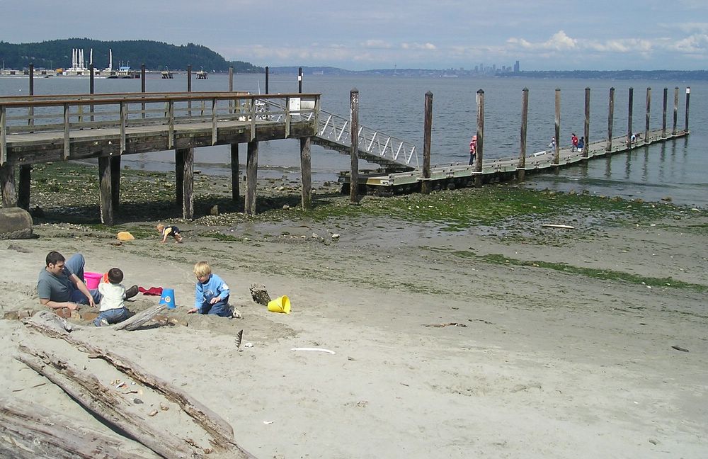


Manchester, Washington
Manchester is a community of 5,956 people in Kitsap County, Washington.
Why visit Manchester
Townapedia lists 1 museum or landmark, 3 parks and trails, 3 places to eat and 1 place to stay in and around town.
Highlights include Fort Ward and Fort Ward Park.
August is the warmest month, with average highs of 77°F; December lows average 35°F.
Weather in Manchester
Forecast from the National Weather Service. Full forecast
About Manchester
Manchester is an unincorporated community and census-designated place (CDP) in Kitsap County, Washington, United States. The population was 5,714 at the 2020 census. Manchester is located on the Puget Sound approximately 10 miles from downtown Seattle, and is adjacent to county seat Port Orchard to its east. Today, Manchester labels itself as a village.
From the Wikipedia article Manchester, Washington (this version), under CC BY-SA 4.0.
Museums and landmarks1

Fort Ward
Monument and historic site · National Register of Historic Places · 2.4 mi
Historic fort in Washington State, USA
Parks, trails and playgrounds3




Restaurants and cafes3

Manchester Pub
Bar and pub · 0.6 mi
Mo-Th 11:00-23:00; Fr,Sa 11:00-24:00; Su 11:00-22:00


Where to stay1

Cascadia Marine Trail Campsite - Blake Island
Campground · 1.7 mi
Primitive camping available for those arriving via human powered boat. Water available in Summer, from nearby spigots.
History
Manchester was established in the 1860s and was originally known as "Brooklyn", after the borough in New York City. The name was changed to "Manchester" in 1892 in honor of the city of Manchester, England. Manchester was accessible by land via Shelton/Allyn/Belfair, but the main population center in the region, Seattle, had only boat access. After a permanent dock was built in 1908, regular steamboat service connected Manchester to nearby communities like Colby, Southworth, and Harper, and to Seattle across the water.
From 1925 to 1936, a ferry route across Puget Sound connected Manchester with Alki Point in West Seattle. When the Alki Point dock washed away in 1936, the Seattle terminus was shifted to Colman Dock on the Seattle central waterfront. Ferry service was discontinued in 1936 and never resumed.
From the History section of Manchester, Washington on Wikipedia, under CC BY-SA 4.0.
Churches and places of worship1
United Methodist Church of Colby
Church · Methodist · 1.7 mi
2881 Harvey Street Southeast, Port Orchard
Schools, colleges and libraries24
Capt Johnston Blakely Elem Sch
School · 4.1 mi
4704 Blakely Ave Ne, Bainbridge Island
Hidden Creek Elementary School
School · 4.9 mi
5455 Converse Road Se, Port Orchard
Map of Manchester
33 places. The map loads OpenStreetMap tiles when you open it.
Climate by month
Monthly table
| Month | High | Low | Rain | Snow |
|---|---|---|---|---|
| Jan | 47°F | 36°F | 9.3 in | 0.6 in |
| Feb | 49°F | 35°F | 5.8 in | 0.7 in |
| Mar | 54°F | 38°F | 6.4 in | 0.1 in |
| Apr | 59°F | 41°F | 3.9 in | 0.0 in |
| May | 66°F | 46°F | 2.4 in | 0.0 in |
| Jun | 70°F | 51°F | 1.6 in | 0.0 in |
| Jul | 76°F | 55°F | 0.8 in | 0.0 in |
| Aug | 77°F | 55°F | 1.1 in | 0.0 in |
| Sep | 72°F | 51°F | 1.8 in | 0.0 in |
| Oct | 61°F | 45°F | 5.1 in | 0.0 in |
| Nov | 51°F | 39°F | 8.8 in | 0.3 in |
| Dec | 46°F | 35°F | 9.9 in | 1.3 in |
U.S. Climate Normals 1991-2020 for Bremerton (7 mi away), NOAA NCEI.
People and cost of living
American Community Survey 5-year estimates, 2020-2024, U.S. Census Bureau. Estimates have margins of error, larger for small towns.
Disaster history
Kitsap County has had 7 federal disaster declarations since 2000, most often for severe storms.
- 2020-03-22: Covid-19 Pandemic (Biological)
- 2020-03-13: Covid-19 (Biological)
- 2007-12-08: Severe Storms, Flooding, Landslides, And Mudslides (Severe Storm)
- 2006-05-17: Severe Storms, Flooding, Tidal Surge, Landslides, And Mudslides (Severe Storm)
- 2005-09-07: Hurricane Katrina Evacuation (Coastal Storm)
- 2003-11-07: Severe Storms And Flooding (Severe Storm)
OpenFEMA disaster declarations summaries.
Getting there and nearby towns
Boeing Field (BFI) is the nearest airport with scheduled flights listed in OpenStreetMap, 11 miles away.
- Southworth 2 mi south, about 4 min by car
- Port Orchard 4 mi west, about 7 min by car
- East Port Orchard 4 mi southwest, about 7 min by car
- Enetai 4 mi northwest, about 6 min by car
- Bethel 5 mi southwest, about 9 min by car
- Navy Yard City 6 mi west, about 9 min by car
- Bainbridge Island 7 mi north, about 11 min by car
- Rocky Point 7 mi northwest, about 11 min by car
- Bremerton 8 mi west, about 13 min by car
- Seattle 10 mi northeast, about 16 min by car
Drive times are estimates from straight-line distance, not routes.
Local news
Headlines from INDB, the NEMICO news database.
Reviews, tips and questions
Loading what members have shared...
Sources and licences
- NCES EDGE (Public domain): public schools
- NOAA NCEI U.S. Climate Normals 1991-2020 (Public domain): climate by month
- OpenFEMA (Public domain): disaster declarations
- OpenStreetMap contributors (ODbL 1.0): places, airports, map data
- U.S. Census Bureau (Public domain): population, income, housing, education, commute
- Wikidata (CC0 1.0): elevation, founding date, time zone, website, landmarks and historic places
- Wikimedia Commons (see each image): photos
- Wikipedia (CC BY-SA 4.0): overview and history text
Photo credits
- ManchesterWashingtonWaterfront, Mlouns at English Wikipedia, CC BY-SA 3.0
- Bainbridge Island - Fort Ward Park - Battery Vinton 03, Joe Mabel, CC BY-SA 3.0
- Bainbridge Island - Fort Ward Park 03, Joe Mabel, CC BY-SA 3.0
- Cloudy Day Somewhere In The Pacific Northwest, Dana Hutchinson, CC BY 3.0
- Mulberry 140317-A-WJ570-007, Capt. Christopher Larsen, Public domain
- Army tug Mulberry (ST-914) -a, Karl S. Linderman, Public domain
- USS Kitty Hawk (CV-63) is towed from Bremerton, Washington (USA), to the scrapyard on 15 January 2022 (220115-N-DS883-1002), U.S. Navy photo by Mass Communication Specialist 1st Class Heather C. Wamsley, Public domain
- WSF Kitsap (16755260442), Jonathan Miske from United States, CC BY-SA 2.0
- Seattle - panoramio (8), runt35, CC BY 3.0


Page built October 30, 2026. Spotted a mistake? Tell us or suggest a place.