

Why visit Manila
Townapedia lists 3 museums and landmarks, 3 parks and trails and 3 places to eat in and around town.
Highlights include Herman Davis State Park and Jonesboro, Lake City & Eastern Railroad Depot.
July is the warmest month, with average highs of 91°F; January lows average 31°F.
Weather in Manila
Forecast from the National Weather Service. Full forecast
About Manila
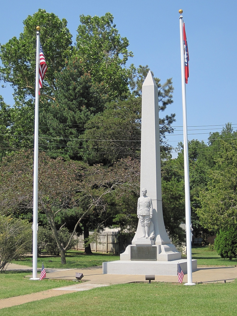
Manila is a city in Mississippi County, Arkansas, United States. The population was 3,682 at the 2020 census, up from 3,342 in 2010. It was the hometown of World War I sniper Herman Davis.
From the Wikipedia article Manila, Arkansas (this version), under CC BY-SA 4.0.
Museums and landmarks3

Herman Davis State Park
Monument and historic site · National Register of Historic Places · 0.8 mi
State park in Arkansas, United States
Baltimore Avenue, Manila


Jonesboro, Lake City & Eastern Railroad Depot
Monument and historic site · National Register of Historic Places · 0.4 mi
Railway station in Manila, Arkansas

Parks, trails and playgrounds3



Restaurants and cafes3


Sonic
Fast food · Burger · 1.0 mi
747 Fleeman, Manila
Mo-Th 07:00-22:00; Fr-Sa 07:00-23:00; Su 09:00-22:00
Churches and places of worship8

History
Manila has its origins in a herdsman's camp established by John Needham in the late 1860s. By the late 1890s, a community known as "Cinda" (named after an early postmaster's sister) had developed in the area. In 1901, this community incorporated as a city, and chose the name "Manila" to honor Commodore George Dewey's 1898 victory in the Battle of Manila Bay during the Spanish–American War.
In the early 1900s, the Jonesboro, Lake City and Eastern Railroad (later part of the St. Louis-San Francisco Railway system) extended a rail line to Manila. In 1910, the Manila Depot was constructed by the railroad. This train station now serves as a museum, and is listed on the National Register of Historic Places.
In 1925, a memorial was established in the city for Herman Davis. The memorial was designated a state park in 1953, and the Arkansas Department of Parks and Tourism is responsible for its maintenance.
From the History section of Manila, Arkansas on Wikipedia, under CC BY-SA 4.0.
Shopping1
Gas and EV charging3
Schools, colleges and libraries5
Buffalo Island Central Elementary School
School · 5.8 mi
1100 Nelson St, Leachville
Healthcare1
Map of Manila
27 places. The map loads OpenStreetMap tiles when you open it.
Climate by month
Monthly table
| Month | High | Low | Rain | Snow |
|---|---|---|---|---|
| Jan | 47°F | 31°F | 4.1 in | 0.6 in |
| Feb | 52°F | 34°F | 4.5 in | 0.9 in |
| Mar | 61°F | 42°F | 5.0 in | 0.3 in |
| Apr | 72°F | 52°F | 5.5 in | 0.0 in |
| May | 81°F | 62°F | 5.5 in | 0.0 in |
| Jun | 89°F | 70°F | 4.0 in | 0.0 in |
| Jul | 91°F | 73°F | 3.9 in | 0.0 in |
| Aug | 90°F | 71°F | 3.0 in | 0.0 in |
| Sep | 85°F | 63°F | 3.3 in | 0.0 in |
| Oct | 74°F | 51°F | 4.0 in | 0.0 in |
| Nov | 61°F | 41°F | 4.3 in | 0.0 in |
| Dec | 51°F | 34°F | 4.9 in | 0.0 in |
U.S. Climate Normals 1991-2020 for Keiser (14 mi away), NOAA NCEI.
People and cost of living
American Community Survey 5-year estimates, 2020-2024, U.S. Census Bureau. Estimates have margins of error, larger for small towns.
Disaster history
Mississippi County has had 17 federal disaster declarations since 2000, most often for severe storms.
- 2026-01-24: Severe Winter Storm (Winter Storm)
- 2025-05-21: Severe Storms, Tornadoes, And Flooding (Flood)
- 2025-04-05: Severe Storms, Tornadoes, And Flooding (Severe Storm)
- 2021-12-23: Severe Storms And Tornadoes (Tornado)
- 2020-08-27: Hurricane Laura (Hurricane)
- 2020-04-03: Covid-19 Pandemic (Biological)
OpenFEMA disaster declarations summaries.
Getting there and nearby towns
Manila Municipal Airport (MXA) is the nearest airport with scheduled flights listed in OpenStreetMap, 1 miles away.
- Leachville 5 mi west, about 9 min by car
- Gosnell 12 mi northeast, about 20 min by car
- Blytheville 15 mi east, about 24 min by car
- Lepanto 21 mi southwest, about 34 min by car
- Paragould 23 mi northwest, about 36 min by car
- Brookland 23 mi west, about 37 min by car
- Bay 24 mi southwest, about 38 min by car
- Kennett 25 mi north, about 41 min by car
- Jonesboro 29 mi west, about 47 min by car
- Atoka 38 mi southeast, about 1 h by car
Drive times are estimates from straight-line distance, not routes.
Local news
Headlines from INDB, the NEMICO news database.
Reviews, tips and questions
Loading what members have shared...
Sources and licences
- NCES EDGE (Public domain): public schools
- NOAA NCEI U.S. Climate Normals 1991-2020 (Public domain): climate by month
- OpenFEMA (Public domain): disaster declarations
- OpenStreetMap contributors (ODbL 1.0): places, airports, map data
- U.S. Census Bureau (Public domain): population, income, housing, education, commute
- Wikidata (CC0 1.0): elevation, founding date, time zone, website, landmarks and historic places
- Wikimedia Commons (see each image): photos
- Wikipedia (CC BY-SA 4.0): overview and history text
Photo credits
- Herman Davis Memorial Manila AR 001, Thomas R Machnitzki ([email protected]), CC BY 3.0
- Manila-Depot-Museum-ar, Brian Stansberry, CC BY 4.0
Page built October 30, 2026. Spotted a mistake? Tell us or suggest a place.