



Manistee, Michigan
Manistee is a city of 6,275 people in Manistee County, Michigan, founded in 1841.
Why visit Manistee
Townapedia lists 10 museums and landmarks, 18 parks and trails, 27 places to eat, 7 places to stay and 7 attractions in and around town.
Highlights include North Pierhead Light, Manistee Pierhead lights, SS City of Milwaukee and Manistee Central Business District.
July is the warmest month, with average highs of 80°F; January lows average 19°F.
Weather in Manistee
Forecast from the National Weather Service. Full forecast
About Manistee
Manistee is a city in the U.S. state of Michigan. Located in southwestern Manistee County, it is part of the northwestern Lower Peninsula. Manistee is the county seat of Manistee County, and its population was 6,259 at the 2020 census. This makes Manistee the fifth-largest city in Northern Michigan.
From the Wikipedia article Manistee, Michigan (this version), under CC BY-SA 4.0.
Things to do7

North Pierhead Light
Lighthouse · 1.1 mi
May 25-Sep 09: Mo 13:00-17:00; May 25-Sep 09: Tu-Su 10:00-17:00;...

Manistee Pierhead lights
Lighthouse · National Register of Historic Places · 1.0 mi
Lighthouse in Michigan, United States

Ramsdell Theatre
Cinema and theater · National Register of Historic Places
Theater in Manistee, Michigan, United States

Museums and landmarks10

SS City of Milwaukee
Monument and historic site · National Register of Historic Places · 1.2 mi
Great Lakes railroad car ferry

Manistee Central Business District
Monument and historic site · National Register of Historic Places
Historic district in Michigan, USA
Orchard Beach State Park
Monument and historic site · National Register of Historic Places · 2.4 mi
State park in Manistee County, Michigan, USA

Simeon Babcock House
Monument and historic site · National Register of Historic Places
Historic house in Manistee, Michigan, USA

Manistee Harbor, South Breakwater
Monument and historic site · National Register of Historic Places · 1.2 mi


Manistee Iron Works
Monument and historic site · National Register of Historic Places · 0.8 mi
United States Coast Guard Cutter Acacia
Monument and historic site · 1.2 mi
U.S. Coast Guard - Station Manistee
Monument and historic site · 0.8 mi
Primarily a Search and Rescue station, but also conducts security patrols, law enforcement missions, and ice rescue during the winter...
523 5th Avenue, Manistee

Parks, trails and playgrounds18


North Riverwalk and Veterans Memorial Park
Park · 0.4 mi
177 Memorial Drive, Manistee


6 more on the map.
Restaurants and cafes27

The Outsider
Restaurant · American, Snack, Pub
457 River Street
Tu-Th 11:30-21:00; Fr,Sa 11:30-22:00; Su 12:00-21:00
Wander In
Restaurant · American, Sandwich, Regional, Breakfast, Grill, Diner, Fries, Burger · 1.1 mi
91 Arthur Street

Goody's Juice & Java
Cafe · Coffee, Smoothie, Sandwich, Wrap, Pastry, Espresso, Salad, Soup, Cookie, Scone, Italian Soda · 0.4 mi
343 River Street, Manistee
Mo-Sa 09:00-17:00; Su 08:00-15:00
The Outpost of Manistee
Cafe · Coffee, Tea · 0.4 mi
359 River Street, Manistee
Mo-Sa 09:00-18:00


15 more on the map.
History
In 1751, a Jesuit mission was established in Manistee. Missionaries visited Manistee in the early 19th century, and a Jesuit mission house is known to have been located on the northwest shore of Manistee Lake in 1826. In 1832, a group of traders from Massachusetts built a log house up the Manistee River. However, they were soon driven off by the Odawa nation. The first white settlement and sawmill was built there in 1841.
In 1830, the village of Manistee was one of about 15 Odawa (Ottawa) villages along the shore of Lake Michigan. Much of the Manistee River Valley, including Manistee itself, was designated as an Odawa Reservation from 1836 to 1848.
The first permanent Euro-American settlement was made on April 16, 1841, when John Stronach and his son, Adam Stronach, arrived at the mouth of the Manistee River in a schooner loaded with fifteen men and equipment, and established a sawmill.
From the History section of Manistee, Michigan on Wikipedia, under CC BY-SA 4.0.
Where to stay7
Hampton Inn & Suites Manistee Waterfront
Motel and hotel · 0.8 mi
101 South Lakeshore Drive, Manistee
Churches and places of worship16
First Congregational Church
Church · Congregational · National Register of Historic Places · 0.4 mi
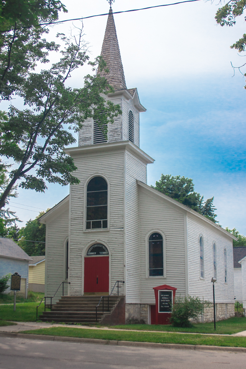
Our Saviour's Evangelical Lutheran Church
Church · National Register of Historic Places · 0.4 mi
Shopping6
Gas and EV charging3
Schools, colleges and libraries14
Manistee Catholic Central School
School · Roman Catholic · 0.9 mi
1200 US-31, Manistee
Healthcare1
Map of Manistee
109 places. The map loads OpenStreetMap tiles when you open it.
Climate by month
Monthly table
| Month | High | Low | Rain |
|---|---|---|---|
| Jan | 30°F | 19°F | 2.2 in |
| Feb | 32°F | 19°F | 1.6 in |
| Mar | 42°F | 25°F | 2.2 in |
| Apr | 55°F | 35°F | 3.4 in |
| May | 67°F | 45°F | 3.3 in |
| Jun | 76°F | 54°F | 3.8 in |
| Jul | 80°F | 59°F | 3.3 in |
| Aug | 78°F | 59°F | 3.3 in |
| Sep | 72°F | 52°F | 3.3 in |
| Oct | 59°F | 42°F | 4.1 in |
| Nov | 46°F | 33°F | 3.2 in |
| Dec | 35°F | 24°F | 2.7 in |
U.S. Climate Normals 1991-2020 for Manistee 3Se (3 mi away), NOAA NCEI.
People and cost of living
American Community Survey 5-year estimates, 2020-2024, U.S. Census Bureau. Estimates have margins of error, larger for small towns.
Disaster history
Manistee County has had 5 federal disaster declarations since 2000, most often for biologicals.
- 2026-06-30: Severe Storms, Tornadoes, And Flooding (Flood)
- 2020-03-27: Covid-19 Pandemic (Biological)
- 2020-03-13: Covid-19 (Biological)
- 2008-07-14: Severe Storms, Tornadoes, And Flooding (Severe Storm)
- 2005-09-07: Hurricane Katrina Evacuation (Hurricane)
OpenFEMA disaster declarations summaries.
Getting there and nearby towns
Manistee County-Blacker Airport (MBL) is the nearest airport with scheduled flights listed in OpenStreetMap, 4 miles away.
- Scottville 20 mi south, about 33 min by car
- Ludington 21 mi south, about 33 min by car
- Frankfort 27 mi north, about 44 min by car
- Baldwin 34 mi southeast, about 54 min by car
- Hart 38 mi south, about 1 h by car
- Cadillac 44 mi east, about 1 h 15 min by car
- Shelby 44 mi south, about 1 h 15 min by car
- Chums Corner 44 mi northeast, about 1 h 15 min by car
- Kingsley 46 mi northeast, about 1 h 15 min by car
- Traverse City 50 mi northeast, about 1 h 15 min by car
Drive times are estimates from straight-line distance, not routes.
Local news
Headlines from INDB, the NEMICO news database.
Reviews, tips and questions
Loading what members have shared...
Sources and licences
- NCES EDGE (Public domain): public schools
- NOAA NCEI U.S. Climate Normals 1991-2020 (Public domain): climate by month
- OpenFEMA (Public domain): disaster declarations
- OpenStreetMap contributors (ODbL 1.0): places, airports, map data
- U.S. Census Bureau (Public domain): population, income, housing, education, commute
- Wikidata (CC0 1.0): elevation, founding date, time zone, website, landmarks and historic places
- Wikimedia Commons (see each image): photos
- Wikipedia (CC BY-SA 4.0): overview and history text
Photo credits
- Manistee Harbor, US Army Corps of Engineers, Public domain
- SS City of Milwaukee, Bill Herd, Public domain
- First Congregational Church of Manistee, Michigan, Cbl62, CC BY-SA 3.0
- Manistee North Pierhead Lighthouse, Cbl62, CC BY-SA 3.0
- Danish Lutheran Church, rossograph, CC BY-SA 4.0
- Orchard Beach State Park, rossograph, CC BY-SA 3.0
- Maryland Building, Manistee, Michigan, Cbl62, CC BY-SA 3.0
- Simeon Babcock House, Cbl62, CC BY-SA 3.0
- Manistee Iron Works Div., Cbl62, CC BY-SA 3.0
- Guardian Angel-Manistee, rossograph, CC BY-SA 4.0

Page built October 30, 2026. Spotted a mistake? Tell us or suggest a place.