
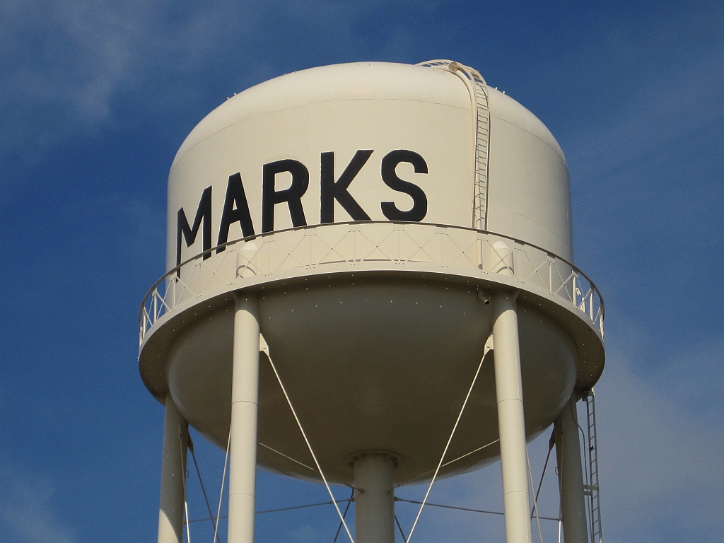

Marks, Mississippi
Marks is a city of 1,377 people in Quitman County, Mississippi, founded in 1907.
Why visit Marks
Townapedia lists 1 place to eat in and around town.
July is the warmest month, with average highs of 92°F; January lows average 32°F.
Weather in Marks
Forecast from the National Weather Service. Full forecast
About Marks
Marks is a city in and the county seat of Quitman County, Mississippi. As of the 2020 census, the city population was 1,444.
From the Wikipedia article Marks, Mississippi (this version), under CC BY-SA 4.0.
Restaurants and cafes1

Churches and places of worship7

Marks Presbyterian Church
Church · Presbyterian Church In America
511 Locust Street
Gas and EV charging1

Schools, colleges and libraries6

History
The town of Marks was named after Leopold Marks (1851–1910) who left Germany to avoid conscription by the German army. He arrived in New York in 1868. Marks, a Jew, became Quitman County's first representative to the state legislature and served for eight years. He encouraged the Yazoo and Mississippi Valley Railroad to come to the area by giving the railroad company, without cost, the right-of-way through his plantation plus 10 acres (40,000 m2) of land. Leopold Marks' son Henry donated land to the town to be used as a cemetery.
The official "founding" of the town is considered to be May 12, 1907; on May 12, 2007, the town celebrated its centennial.
On September 26, 1913, a black man named Walter Brownloe, accused of attacking a white farmer's wife, was taken from the town prison by a mob and hanged.
Marks was the starting point of Dr. Martin Luther King Jr's Poor People's Campaign in 1968.
Amtrak's City of New Orleans began stopping at Marks on April 4, 2018. A new station was built for passengers to get on or get off.
From the History section of Marks, Mississippi on Wikipedia, under CC BY-SA 4.0.
Healthcare1
Quitman County Health Center
Clinic and pharmacy · 0.4 mi
235 Chestnut Street, Marks
Map of Marks
16 places. The map loads OpenStreetMap tiles when you open it.
Climate by month
Monthly table
| Month | High | Low | Rain | Snow |
|---|---|---|---|---|
| Jan | 50°F | 32°F | 5.1 in | 0.1 in |
| Feb | 55°F | 35°F | 5.7 in | 0.0 in |
| Mar | 64°F | 43°F | 5.5 in | 0.2 in |
| Apr | 74°F | 51°F | 6.1 in | 0.0 in |
| May | 82°F | 61°F | 5.9 in | 0.0 in |
| Jun | 90°F | 69°F | 4.2 in | 0.0 in |
| Jul | 92°F | 71°F | 3.0 in | 0.0 in |
| Aug | 92°F | 70°F | 3.3 in | 0.0 in |
| Sep | 87°F | 64°F | 3.1 in | 0.0 in |
| Oct | 76°F | 50°F | 4.2 in | 0.0 in |
| Nov | 64°F | 41°F | 4.5 in | 0.0 in |
| Dec | 53°F | 35°F | 6.1 in | 0.1 in |
U.S. Climate Normals 1991-2020 for Lambert 1W (4 mi away), NOAA NCEI.
People and cost of living
American Community Survey 5-year estimates, 2020-2024, U.S. Census Bureau. Estimates have margins of error, larger for small towns.
Disaster history
Quitman County has had 17 federal disaster declarations since 2000, most often for severe storms.
- 2026-02-06: Severe Winter Storm (Winter Storm)
- 2026-01-24: Severe Winter Storm (Winter Storm)
- 2021-10-22: Hurricane Ida (Hurricane)
- 2021-08-28: Hurricane Ida (Hurricane)
- 2021-05-04: Severe Winter Storms (Severe Ice Storm)
- 2020-04-16: Severe Storms, Tornadoes, Straight-Line Winds, And Flooding (Severe Storm)
OpenFEMA disaster declarations summaries.
Getting there and nearby towns
Selfs Airport (MMS) is the nearest airport with scheduled flights listed in OpenStreetMap, 2 miles away.
- Clarksdale 17 mi west, about 28 min by car
- Courtland 19 mi east, about 30 min by car
- Batesville 20 mi east, about 33 min by car
- Charleston 21 mi southeast, about 34 min by car
- Como 26 mi northeast, about 42 min by car
- Helena-West Helena 28 mi northwest, about 44 min by car
- Coldwater 35 mi northeast, about 56 min by car
- Grenada 42 mi southeast, about 1 h 15 min by car
- Oxford 43 mi east, about 1 h 15 min by car
- Hernando 44 mi north, about 1 h 15 min by car
Drive times are estimates from straight-line distance, not routes.
Local news
Headlines from INDB, the NEMICO news database.
Reviews, tips and questions
Loading what members have shared...
Sources and licences
- NCES EDGE (Public domain): public schools
- NOAA NCEI U.S. Climate Normals 1991-2020 (Public domain): climate by month
- OpenFEMA (Public domain): disaster declarations
- OpenStreetMap contributors (ODbL 1.0): places, airports, map data
- U.S. Census Bureau (Public domain): population, income, housing, education, commute
- Wikidata (CC0 1.0): elevation, founding date, time zone, website
- Wikimedia Commons (see each image): photos
- Wikipedia (CC BY-SA 4.0): overview and history text
Photo credits
- Marks MS 051, Thomas R Machnitzki ([email protected]), CC BY 3.0
Page built October 30, 2026. Spotted a mistake? Tell us or suggest a place.