


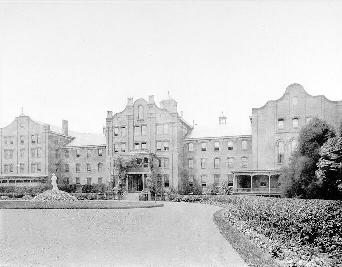

Martins Ferry, Ohio
Martins Ferry is a city of 6,140 people in Belmont County, Ohio, founded in 1779.
Why visit Martins Ferry
Townapedia lists 39 museums and landmarks, 7 parks and trails, 7 places to eat and 6 attractions in and around town.
Highlights include Aetnaville Bridge, Bridgeport Bridge, Cathedral Parish School and Central School.
July is the warmest month, with average highs of 85°F; January lows average 22°F.
Weather in Martins Ferry
Forecast from the National Weather Service. Full forecast
About Martins Ferry
Martins Ferry is the most populous city in Belmont County, Ohio, United States. The population was 6,260 as of the 2020 census. Located along the Ohio River across from Wheeling, West Virginia, it is part of the Wheeling metropolitan area.
From the Wikipedia article Martins Ferry, Ohio (this version), under CC BY-SA 4.0.
Things to do6

Aetnaville Bridge
Bridge · 1.7 mi
Bridge in Ohio, United States of America

Capitol Theatre
Cinema and theater · 2.4 mi
Theater, movie theater and music venue in Wheeling, West Virginia
Military Order of the Purple Heart Bridge
Bridge · 2.3 mi
Bridge in United States of America
Victoria Theater
Cinema and theater · 2.6 mi
Theater in Wheeling, West Virginia, United States

Museums and landmarks39

Cathedral Parish School
Monument and historic site · National Register of Historic Places · 2.7 mi
Primary school in West Virginia, United States of America

Central School
Monument and historic site · National Register of Historic Places · 0.7 mi
Historic school building in Martins Ferry, Ohio, USA

Centre Market Square Historic District
Monument and historic site · National Register of Historic Places · 3.2 mi
Wheeling, West Virginia, listed on the NRHP in Ohio County, West Virginia

Chapline Street Row Historic District
Monument and historic site · National Register of Historic Places · 3.1 mi
Historic district in West Virginia, United States

Charles W. Russell House
Monument and historic site · National Register of Historic Places · 2.6 mi
Wheeling, West Virginia, listed on the NRHP in Ohio County

East Wheeling Historic District
Monument and historic site · National Register of Historic Places · 2.7 mi
Historic district in West Virginia, United States

Edemar
Monument and historic site · National Register of Historic Places · 3.5 mi
Building in West Virginia, United States

Elm Hill
Monument and historic site · National Register of Historic Places · 2.8 mi
Building in West Virginia, United States

Fischer-Lasch Farmhouse
Monument and historic site · National Register of Historic Places · 2.9 mi
Wheeling, West Virginia, listed on the NRHP in Ohio County, West Virginia

H. C. Ogden House
Monument and historic site · National Register of Historic Places · 2.1 mi
Wheeling, West Virginia, listed on the NRHP in Ohio County, West Virginia

Harry C. and Jessie F. Franzheim House
Monument and historic site · National Register of Historic Places · 2.6 mi
Historic house in West Virginia, United States

Henry K. List House
Monument and historic site · National Register of Historic Places · 2.2 mi
Historic house in West Virginia, United States
27 more on the map.
Parks, trails and playgrounds7


Oglebay Park
Park · National Register of Historic Places · 3.2 mi
Park in Wheeling, West Virginia



Restaurants and cafes7



History
Martins Ferry is the oldest European settlement in the state of Ohio, having been settled at least as early as 1779, almost a decade before Marietta. The settlement got its start as a consequence of a land grant to George Mercer of the Ohio Company in 1748 from the British Crown for 200,000 acres in the Ohio Country, a colloquial term for what is now much of Ohio, and western West Virginia and Pennsylvania. The grant called for among other things, establishment of a fort. The grant was for land south of the Ohio River in West Virginia (then Virginia). Settlement was hampered by the outbreak of the French and Indian War. The settlement was named Zanesburg (renamed Wheeling in 1795). The Ohio Company was dissolved in 1779, and claims issued by the Crown became moot after the Revolutionary War. The community across the river was a westward extension of Zanesburg, but at that time, settlement on the west bank of the Ohio River was prohibited by the Treaty of Fort Stanwix, 1768. Through the years, it has been known as Hoglinstown, Mercertown, Norristown (1785), Jefferson (1795), Martinsville (1835), and Martin's Ferry (1865).
From the History section of Martins Ferry, Ohio on Wikipedia, under CC BY-SA 4.0.
Churches and places of worship15
Shopping3
Gas and EV charging3
Schools, colleges and libraries23
Anna Marie Ayers Elementary School
School · 0.6 mi
5002 Ayers Lime Stone Rd, Martins
Martins Ferry Middle School
School · 0.4 mi
5000 Ayers Limestone Rd, Martins Ferry
The Bridgeport School District - Elementary
School · 3.5 mi
55707 Industrial Dr, Bridgeport
The Bridgeport School District - High School
School · 3.5 mi
55707 Industrial Dr, Bridgeport
The Bridgeport School District - Middle School
School · 3.5 mi
55707 Industrial Dr, Bridgeport
Healthcare1
Map of Martins Ferry
104 places. The map loads OpenStreetMap tiles when you open it.
Climate by month
Monthly table
| Month | High | Low | Rain |
|---|---|---|---|
| Jan | 39°F | 22°F | 3.4 in |
| Feb | 42°F | 23°F | 2.7 in |
| Mar | 51°F | 30°F | 3.8 in |
| Apr | 64°F | 40°F | 3.5 in |
| May | 74°F | 50°F | 4.2 in |
| Jun | 81°F | 59°F | 4.3 in |
| Jul | 85°F | 64°F | 4.1 in |
| Aug | 85°F | 63°F | 3.2 in |
| Sep | 79°F | 56°F | 3.5 in |
| Oct | 66°F | 44°F | 2.9 in |
| Nov | 54°F | 34°F | 2.9 in |
| Dec | 43°F | 27°F | 3.4 in |
U.S. Climate Normals 1991-2020 for Wheeling (3 mi away), NOAA NCEI.
People and cost of living
American Community Survey 5-year estimates, 2020-2024, U.S. Census Bureau. Estimates have margins of error, larger for small towns.
Disaster history
Belmont County has had 12 federal disaster declarations since 2000, most often for severe storms.
- 2020-03-31: Covid-19 Pandemic (Biological)
- 2020-03-13: Covid-19 (Biological)
- 2019-04-08: Severe Storms, Flooding, And Landslides (Flood)
- 2018-04-17: Severe Storms, Landslides, And Mudslides (Flood)
- 2012-08-20: Severe Storms And Straight-Line Winds (Severe Storm)
- 2012-06-30: Severe Storms (Severe Storm)
OpenFEMA disaster declarations summaries.
Getting there and nearby towns
Wheeling-Ohio County Airport (HLG) is the nearest airport with scheduled flights listed in OpenStreetMap, 6 miles away.
- Wheeling 3 mi southeast, about 4 min by car
- Bridgeport 3 mi south, about 5 min by car
- Wolfhurst 4 mi southwest, about 6 min by car
- Tiltonsville 5 mi north, about 8 min by car
- Bellaire 6 mi south, about 10 min by car
- Brilliant 12 mi northeast, about 20 min by car
- Cadiz 17 mi northwest, about 28 min by car
- Steubenville 18 mi north, about 30 min by car
- Bethesda 19 mi west, about 31 min by car
- Weirton 23 mi northeast, about 37 min by car
Drive times are estimates from straight-line distance, not routes.
Local news
Headlines from INDB, the NEMICO news database.
Reviews, tips and questions
Loading what members have shared...
Sources and licences
- NCES EDGE (Public domain): public schools
- NOAA NCEI U.S. Climate Normals 1991-2020 (Public domain): climate by month
- OpenFEMA (Public domain): disaster declarations
- OpenStreetMap contributors (ODbL 1.0): places, airports, map data
- U.S. Census Bureau (Public domain): population, income, housing, education, commute
- Wikidata (CC0 1.0): elevation, founding date, time zone, website, landmarks and historic places
- Wikimedia Commons (see each image): photos
- Wikipedia (CC BY-SA 4.0): overview and history text
Photo credits
- Fourth from Hanover, Martins Ferry, Nyttend, Public domain
- Martins Ferry October 2016, Dustinsheets9, CC BY-SA 4.0
- Grace UPCNA, Martins Ferry, Nyttend, Public domain
- Joseph kirkwood house, Bwsmith84 at en.wikipedia, CC BY 3.0
- Mountdechantal, H. R. Page, Public domain
- John McLure House, Nyttend, Public domain
- Henry K. List House in Wheeling, Nyttend, Public domain
- West Virginia Independence Hall from southwest, Nyttend, Public domain
- Elm Hill through the trees, Nyttend, Public domain
- Wheeling Warehouse HD, Main and 22nd, Nyttend, Public domain
- Cathedral Parish School in Wheeling, Nyttend, Public domain
- Harry C and Jesse F Franzheim House, Bwsmith84 ( talk ), CC BY 3.0
- 14th east of Byron, East Wheeling, Nyttend, Public domain
- WheelingSuspBridge, Jack Boucher, Public domain
- Woodridge, Bwsmith84 ( talk ), CC BY 3.0
- Central School Site, Bwsmith84 ( talk ), CC BY 3.0
- Center Market Square Historic District, Bwsmith84 ( talk ), CC BY 3.0
- Buildings DowntownWheelingWV, Unknown author, Public domain
- Wheeling Island, Tim Kiser ( w:User:Malepheasant ), CC BY-SA 2.5
- Lang-Hess House in Wheeling, Nyttend, Public domain
- Edemar, Bwsmith84 ( talk ), CC BY 3.0
- Oglebaymansion2 (cropped), Morganismysheltie ( talk ), CC BY-SA 3.0
- Fischer-Lasch Farmhouse 1, Ammodramus, CC0
- Birch from Edgington in Wheeling, Nyttend, Public domain
- Charles W. Russell House in Wheeling, Nyttend, Public domain
- Church of God and Saints of Christ, Wheeling, Nyttend, Public domain
- Robert W Hazlett House Wheeling WV, Bwsmith84 ( talk ), CC BY 3.0
- Frasier Houses in Bridgeport Ohio, Bwsmith84 ( talk ), CC BY 3.0
- HC Ogden House, Bwsmith84 ( talk ), CC BY 3.0
- LS Good House Wheeling WV, Bwsmith84 ( talk ), CC BY 3.0
- Warwood Fire Station, Nyttend, Public domain
- Robert C Woods House Wheeling WV, Bwsmith84 ( talk ), CC BY 3.0
- Johnson Camden McKinley House, Bwsmith84 ( talk ), CC BY 3.0
- B&OBuilding, WVnativeson at en.wikipedia, Public domain
- William Miles Tiernan House, Bwsmith84 at en.wikipedia, CC BY 3.0
- Chapline Street Row HD in Wheeling, Nyttend, Public domain
- Stratford Springs, WVnativeson at en.wikipedia, Public domain
- Riverside Iron Works Office Building, Nyttend, Public domain
- Center Market Wheeling WV, Bwsmith84 ( talk ), CC BY 3.0
- St. Joseph Cathedral Wheeling WV 2, Farragutful, Public domain


Page built October 30, 2026. Spotted a mistake? Tell us or suggest a place.