


Merrillville, Indiana
Merrillville is a town of 36,476 people in Lake County, Indiana, founded in 1971.
Why visit Merrillville
Townapedia lists 21 museums and landmarks, 40 parks and trails, 107 places to eat, 24 places to stay and 4 attractions in and around town.
Highlights include AMC CLASSIC Hobart 12, Crown Point Bridge, Indiana, Barney Sablotney House and Albert Maack House.
Weather in Merrillville
Forecast from the National Weather Service. Full forecast
About Merrillville
Merrillville is a town in Ross Township, Lake County, Indiana, United States. The population was 36,444 at the 2020 census. Merrillville is in east-central Lake County, in the Chicago metropolitan area. On January 1, 2015, Merrillville became the most populated town in Indiana, as Fishers in Hamilton County was converted from a town to a city.
From the Wikipedia article Merrillville, Indiana (this version), under CC BY-SA 4.0.
Things to do4


Crown Point Bridge, Indiana
Bridge · 5.5 mi
Covered bridge in Lake County, Indiana, USA

Indiana University Northwest
School · 5.9 mi
Public university in Gary, Indiana
Star Plaza Theatre
Cinema and theater · 0.6 mi
Music venue in Merrillville, Indiana, USA
Museums and landmarks21

Barney Sablotney House
Monument and historic site · National Register of Historic Places · 4.4 mi
Historic house in Indiana, United States
501 West 47th Avenuew, Gary

Albert Maack House
Monument and historic site · National Register of Historic Places · 5.0 mi
Historic house in Indiana, United States

Crawford-Winslow House
Monument and historic site · National Register of Historic Places · 4.8 mi
Historic home located at Crown Point, Lake County, Indiana

Crown Point Courthouse Square Historic District
Monument and historic site · National Register of Historic Places · 4.6 mi
Historic district in Indiana, United States

E.J. and E. Griffith Interlocking Tower
Monument and historic site · National Register of Historic Places · 6.6 mi
Signalling control in Griffith, United States of America
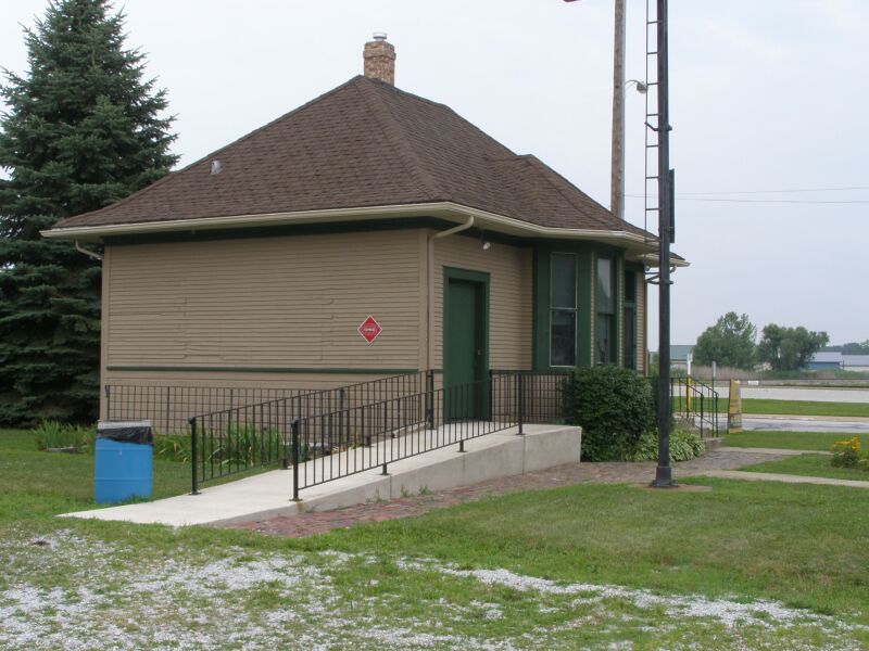
Griffith Grand Trunk Depot
Monument and historic site · National Register of Historic Places · 6.6 mi
Railway station in Griffith, the United States of America
Hobart Carnegie Library
Monument and historic site · National Register of Historic Places · 5.0 mi
Carnegie library in Hobart, Indiana
Hobart Commercial District
Monument and historic site · National Register of Historic Places · 5.2 mi
Historic district in Indiana, United States
Hobart station
Monument and historic site · National Register of Historic Places · 5.6 mi
Disused train station in Hobart, Indiana

Jefferson Street Historic District
Monument and historic site · National Register of Historic Places · 5.6 mi
Historic district in Indiana, United States
Lake County Courthouse
Monument and historic site · National Register of Historic Places · 4.6 mi
Courthouse in Crown Point, Indiana


Lake County Sheriff's House and Jail
Monument and historic site · National Register of Historic Places · 4.6 mi
Historic government buildings in Indiana, United States
9 more on the map.
Parks, trails and playgrounds40




28 more on the map.
Restaurants and cafes107

Breath'g Vegan
Restaurant · Regional, American · 2.6 mi
Southern-inspired vegan restaurant.
7187 Taft Street
Tu 12:00-19:00; We-Fr 11:00-19:00; Sa 15:00-19:00
#1 Chop Suey
Restaurant · Chinese · 1.2 mi
409 West 81st Avenue, Merrillville
Mo 11:00-21:00, Fr-Sa 11:00-22:00, Su closed
BC Osaka
Restaurant · Chinese, Japanese, Sushi · 1.0 mi
2999 East Lincoln Highway, Merrillville
Mo-Th, Su 11:00-20:30; Fr, Sa 11:00-21:00

Beggars Pizza
Restaurant · Pizza · 3.2 mi
1640 East Summit Street, Crown Point
Mo-Fr 11:00-20:00; Sa, Su 12:00-20:00
Provecho Latin Provisions
Restaurant · Latin American, Spanish · 4.5 mi
110 South Main Street, Crown Point
Su 11:00-20:00; Tu-Th 16:00-21:00; Fr 16:00-22:00; Sa 11:00-22:00
Ramen District
Restaurant · Japanese · 4.5 mi
1 Court House Square Old Lake Court House, North Entrance, Crown Point
Su-Mo 12:00-20:00; We-Sa 12:00-20:00

Smalltown Coffee Company
Cafe · Coffee Shop, Pastry, Tea · 4.1 mi
306 East Goldsborough Street, Crown Point
Su , Sa 08:00-15:00; Tu-Fr 07:00-15:00
Yummy Bowl
Restaurant · Asian, Chinese, Sushi
1605 Southlake Mall
Mo-Th 10:30-21:30; Fr-Sa 10:30-22:00; Su 11:00-21:00
Golden Apple
Restaurant · American, Breakfast · 3.5 mi
101 107th Avenue, Crown Point
Mo-Sa 06:00-21:00; Su 06:00-20:00
95 more on the map.
History
Merrillville occupies what used to be woodland belonging to the Potawatomi Indians. In 1834, a clearing was created for ceremonial purposes and called McGwinn Village. A year later, a white man, Jeremiah Wiggins, settled in the place; McGwinn Village became Wiggins Point.
Wiggins Point became a well-known stop for wagon trains heading to Joliet, Illinois along the Sauk Trail (also called the Sac Trail), an old Indian trail. At one time, 16 trails radiated outward from Wiggins Point. In 1838, Wiggins died. Sometime afterward, local settlers renamed the place Centerville. Later still, it was renamed Merrillville after the brothers Dudley and William Merrill. Dudley Merrill operated a hotel and store in Centerville, and his son John P. Merrill was a Township Trustee.
Nearby, in the same former Potawatomi hunting grounds, other settlements had sprung up. Near Deep River creek was a settlement named Deep River; near Turkey Creek was another settlement with that creek's name. Others included Ainsworth, Lottaville, and Rexville. At one time, the post office for the area was named Lottaville.
In 1848, all of these settlements, including Merrillville (that is, the old McGwinn Village) were collected into one and called Ross Township. As time went by, bits and pieces of Ross Township were taken by Hobart and Crown Point when those towns incorporated.
From the History section of Merrillville, Indiana on Wikipedia, under CC BY-SA 4.0.
Where to stay24
Holiday Inn Express & Suites Merrillville
Motel and hotel · 0.5 mi
8460 Mississippi Street, Merrillville
Churches and places of worship56
First Unitarian Church of Hobart
Church · National Register of Historic Places · 5.2 mi
Saint Sava Serbian Orthodox Church
Church · Orthodox · 1.4 mi
9191 Mississippi Street, Merrillville
Protection of the Virgin Mary Orthodox Church
Church · Orthodox · 3.1 mi
8600 Grand Boulevard, Merrillville
Saints Constantine & Helen Greek Orthodox Cathedral
Church · Greek Orthodox · 1.2 mi
8000 Madison Street, Merrillville
First Presbyterian Church of Merrillville
Church · Presbyterian · 2.5 mi
7898 W Taft Street, Merrillville
First United Methodist Church
Church · Methodist · 4.7 mi
352 South Main Street, Crown Point
Shopping35
Gas and EV charging32
Schools, colleges and libraries44
Ivy Tech Community College Lake County Campus at Crown Point
School · 2.6 mi
9900 Connecticut Drive, Crown Point
Andrean High School
School · Roman Catholic · 2.7 mi
5959 Broadway, Merrillville
Healthcare18
Carepointe Ear . Nose . Throat . Sinus, Hearing Center
Clinic and pharmacy · 1.1 mi
99 East 86th Avenue, Merrillville
Map of Merrillville
250 places. The map loads OpenStreetMap tiles when you open it.
People and cost of living
American Community Survey 5-year estimates, 2020-2024, U.S. Census Bureau. Estimates have margins of error, larger for small towns.
Disaster history
Lake County has had 19 federal disaster declarations since 2000, most often for severe storms.
- 2026-08-25: Severe Storms, Straight-Line Winds, Tornadoes, And Flooding (Flood)
- 2026-08-15: Severe Storms, Straight-Line Winds, Tornadoes, And Flooding (Flood)
- 2026-01-24: Severe Winter Storm (Winter Storm)
- 2023-04-15: Severe Storms, Straight-Line Winds, And Tornadoes (Severe Storm)
- 2020-04-03: Covid-19 Pandemic (Biological)
- 2020-03-13: Covid-19 (Biological)
OpenFEMA disaster declarations summaries.
Getting there and nearby towns
Gary/Chicago International Airport (GYY) is the nearest airport with scheduled flights listed in OpenStreetMap, 11 miles away.
- Hobart 4 mi northeast, about 6 min by car
- Crown Point 5 mi south, about 7 min by car
- Griffith 7 mi northwest, about 11 min by car
- Gary 8 mi north, about 13 min by car
- Lake Station 8 mi northeast, about 13 min by car
- Highland 9 mi northwest, about 14 min by car
- Cedar Lake 9 mi southwest, about 15 min by car
- Dyer 10 mi west, about 16 min by car
- Lansing 13 mi northwest, about 22 min by car
- Hammond 14 mi northwest, about 22 min by car
Drive times are estimates from straight-line distance, not routes.
Local news
Headlines from INDB, the NEMICO news database.
Reviews, tips and questions
Loading what members have shared...
Sources and licences
- NCES EDGE (Public domain): public schools
- OpenFEMA (Public domain): disaster declarations
- OpenStreetMap contributors (ODbL 1.0): places, airports, map data
- U.S. Census Bureau (Public domain): population, income, housing, education, commute
- Wikidata (CC0 1.0): elevation, founding date, time zone, website, landmarks and historic places
- Wikimedia Commons (see each image): photos
- Wikipedia (CC BY-SA 4.0): overview and history text
Photo credits
- Merrillville Skyline with US 30, Dennisyerger84, CC BY-SA 3.0
- SS Constantine and Helen Cathedral in Merrillville, Nyttend, Public domain
- Our Lady of Consolation Church - Merrillville, Indiana 02, Farragutful, CC BY-SA 4.0
- Our Lady of Consolation Church - Merrillville, Indiana 01, Farragutful, CC BY-SA 4.0
- Our Lady of Consolation Church - Merrillville, Indiana 03, Farragutful, CC BY-SA 4.0
- Our Lady of Consolation Church - Merrillville, Indiana 04, Farragutful, CC BY-SA 4.0
- St. Elijah Cathedral - Merrillville, Indiana 05, Farragutful, CC BY-SA 4.0
- St. Elijah Cathedral - Merrillville, Indiana 01, Farragutful, CC BY-SA 4.0
- St. Elijah Cathedral - Merrillville, Indiana 02, Farragutful, CC BY-SA 4.0
- St. Elijah Cathedral - Merrillville, Indiana 07, Farragutful, CC BY-SA 4.0
- St. Elijah Cathedral - Merrillville, Indiana 06, Farragutful, CC BY-SA 4.0
- St. Elijah Cathedral - Merrillville, Indiana 01 (cropped), Farragutful, CC BY-SA 4.0
- St. Elijah Cathedral - Merrillville, Indiana 03, Farragutful, CC BY-SA 4.0
- St. Elijah Cathedral - Merrillville, Indiana 04, Farragutful, CC BY-SA 4.0
- St. Elijah Cathedral - Merrillville, Indiana 08, Farragutful, CC BY-SA 4.0
- St. Elijah Cathedral - Merrillville, Indiana 09, Farragutful, CC BY-SA 4.0
- Serbian American Hall - Merrillville, Indiana, Farragutful, CC BY-SA 4.0
- Barney Sablotney House, Nyttend, Public domain
- EJ&E Interlocking Tower Griffith, IN P7150029 Tower, Chris Light ( talk ), CC BY-SA 3.0
- Lake County Sheriff's House and Jail in Crown Point, Nyttend, Public domain
- Wellington A. Clark House, Nyttend, Public domain
- Walter Allman House, Nyttend, Public domain
- First Unitarian Church, Hobart Indiana P7220039, Chris Light ( talk ), CC BY-SA 3.0
- William Whitaker House, Nyttend, Public domain
- Crawford-Winslow House, Nyttend, Public domain
- Houses on 46th in Morningside, Nyttend, Public domain
- Albert Maack House, Nyttend, Public domain
- Grand Trunk Depot Griffith 7150025 Train Station, Chris Light ( talk ), CC BY-SA 3.0
- Adams from 36th in Gary, Nyttend, Public domain
- Morgan-Skinner-Boyd Homestead, Nyttend, Public domain
- 4960884402 - Flickr - Nicole Yeary, Nicole Yeary, CC BY 2.0
- Hidden Lake Park, AtlasArchives, CC BY-SA 4.0
- Carpophilus humeralis, Tyler Bishop, CC BY 4.0
- ISS046-E-31743 - View of Earth, Earth Science and Remote Sensing Unit , Lyndon B. Johnson Space Center, Public domain
- ISS006-E-12569 - View of Illinois, Earth Science and Remote Sensing Unit , Lyndon B. Johnson Space Center, Public domain
- ISS009-E-13526 - View of Indiana, Earth Science and Remote Sensing Unit , Lyndon B. Johnson Space Center, Public domain
- ISS056-E-13992 - View of Earth, Earth Science and Remote Sensing Unit, NASA Johnson Space Center, Public domain
- ISS046-E-31744 - View of Earth, Earth Science and Remote Sensing Unit , Lyndon B. Johnson Space Center, Public domain
- ISS046-E-31742 - View of Earth, Earth Science and Remote Sensing Unit , Lyndon B. Johnson Space Center, Public domain
- Sede di Mobili Fiver d Stati Uniti, Francesky, CC BY-SA 4.0


Page built October 30, 2026. Spotted a mistake? Tell us or suggest a place.