
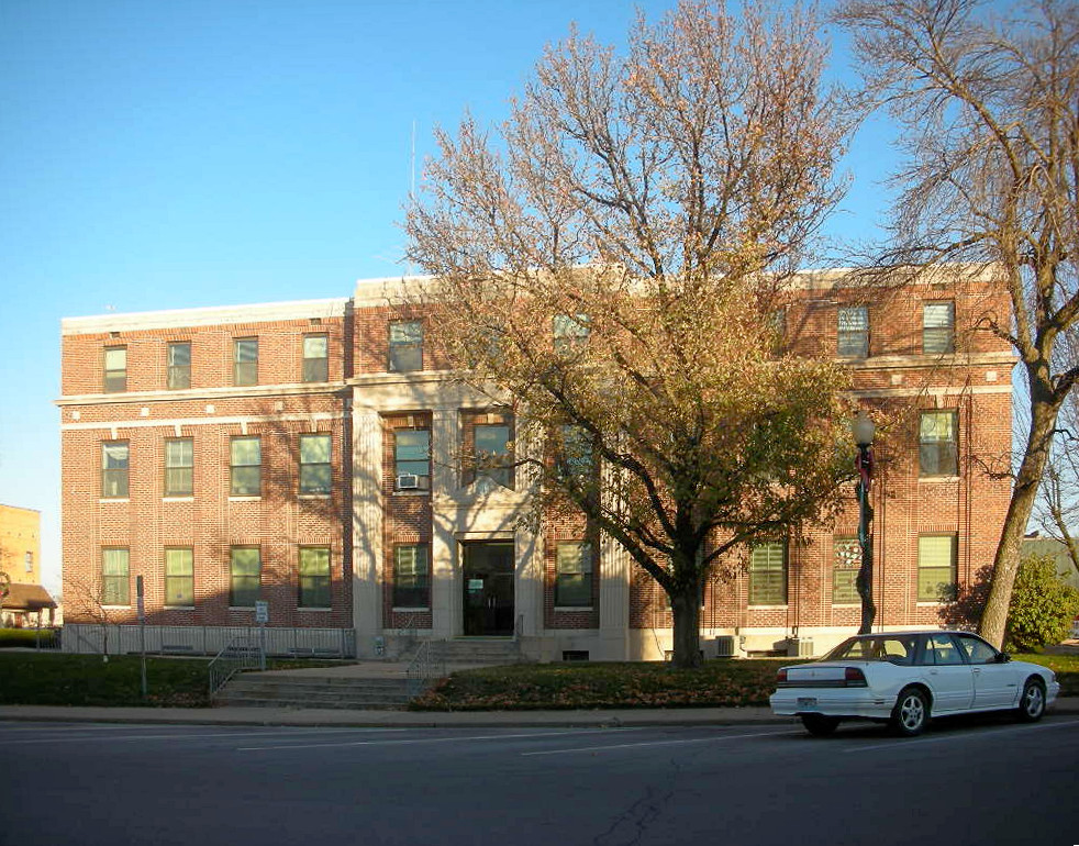

Mexico, Missouri
Mexico is a city of 11,477 people in Audrain County, Missouri, founded in 1836.
Why visit Mexico
Townapedia lists 17 museums and landmarks, 17 parks and trails, 18 places to eat, 5 places to stay and 4 attractions in and around town.
Highlights include Mexico Cinema III, Arthur Simmons Stables Historic District, Audrain County Courthouse and Jefferson Street Mini-Park.
July is the warmest month, with average highs of 88°F; January lows average 19°F.
Weather in Mexico
Forecast from the National Weather Service. Full forecast
About Mexico
Mexico, formerly known as New Mexico, is a city in and the county seat of Audrain County, Missouri, United States. It is home to the Missouri Military Academy and annually hosts the Miss Missouri Pageant. The city's population was 11,469 at the 2020 census. The micropolitan statistical area consists of Audrain County.
From the Wikipedia article Mexico, Missouri (this version), under CC BY-SA 4.0.
Things to do4


Hickory Ridge Orchard
Farm and orchard · 2.9 mi
24688 Audrain Rd 820, Mexico
Presser Arts Center
Cinema and theater · 0.5 mi
900 South Jefferson Street, Mexico
Museums and landmarks17

Arthur Simmons Stables Historic District
Monument and historic site · National Register of Historic Places · 0.9 mi
Building in Missouri, United States
Audrain County Courthouse
Monument and historic site · National Register of Historic Places · 0.9 mi
Building in Missouri, United States


Ross House
Monument and historic site · National Register of Historic Places · 1.0 mi
Building in Missouri, United States

Brian C. K. MacFarlane, Purple Leaf Plum Tree
Monument and historic site · 0.9 mi
5 more on the map.
Parks, trails and playgrounds17


Garfield Park
Park
Public Use park - Baseball, Basketball, Playground, Shelter, Restrooms
5 more on the map.
Restaurants and cafes18


DQ Grill & Chill
Fast food · Ice Cream, Burger · 1.5 mi
3076 South Clark Street, Mexico
Mo-Fr 10:30-22:00; Sa,Su 10:30-23:00
6 more on the map.
History
Mexico was laid out as "New Mexico" in 1836 and was a major stop for settlers heading to the Republic of Texas (thus the name "New Mexico"), and it became the county seat under its present name in 1837. The word "New" was dropped after the Mexican War that saw Texas become a part of the United States.
There is an apocryphal story about the name. When a University of Missouri student, who was questioned on radio, was unable to give an account of her hometown's name, the question was put to L. Mitchell White, then editor and publisher of the Mexico Ledger: "'The first settlers found a wooden sign along the trail. It pointed southwest, and on it had been painted Mexico.'" To avoid unnecessary labor, the sign was left in place. "It was easier to call their town 'Mexico' than to take down the old sign."
From the History section of Mexico, Missouri on Wikipedia, under CC BY-SA 4.0.
Where to stay5
Days Inn by Wyndham Mexico
Motel and hotel · 1.4 mi
2902 South Clark Street, Mexico
Churches and places of worship9
Shopping9
Gas and EV charging8
Schools, colleges and libraries17
Healthcare6
Map of Mexico
110 places. The map loads OpenStreetMap tiles when you open it.
Climate by month
Monthly table
| Month | High | Low | Rain |
|---|---|---|---|
| Jan | 38°F | 19°F | 2.0 in |
| Feb | 43°F | 23°F | 2.3 in |
| Mar | 54°F | 32°F | 3.2 in |
| Apr | 66°F | 43°F | 4.7 in |
| May | 75°F | 54°F | 5.1 in |
| Jun | 84°F | 63°F | 5.2 in |
| Jul | 88°F | 67°F | 4.4 in |
| Aug | 87°F | 65°F | 3.9 in |
| Sep | 79°F | 56°F | 4.9 in |
| Oct | 68°F | 44°F | 2.8 in |
| Nov | 54°F | 34°F | 2.8 in |
| Dec | 42°F | 24°F | 2.3 in |
U.S. Climate Normals 1991-2020 for Mexico Hcn (1 mi away), NOAA NCEI.
People and cost of living
American Community Survey 5-year estimates, 2020-2024, U.S. Census Bureau. Estimates have margins of error, larger for small towns.
Disaster history
Audrain County has had 16 federal disaster declarations since 2000, most often for severe storms.
- 2021-09-01: Severe Storms, Straight-Line Winds, Tornadoes, And Flooding (Severe Storm)
- 2020-03-26: Covid-19 Pandemic (Biological)
- 2020-03-13: Covid-19 (Biological)
- 2016-01-02: Severe Storms, Tornadoes, Straight-Line Winds, And Flooding (Flood)
- 2015-08-07: Severe Storms, Tornadoes, Straight-Line Winds, And Flooding (Severe Storm)
- 2011-03-23: Severe Winter Storm And Snowstorm (Severe Storm)
OpenFEMA disaster declarations summaries.
Getting there and nearby towns
Columbia Regional Airport (COU) is the nearest airport with scheduled flights listed in OpenStreetMap, 30 miles away.
- Auxvasse 10 mi south, about 16 min by car
- Martinsburg 13 mi east, about 21 min by car
- Centralia 14 mi west, about 23 min by car
- Laddonia 14 mi northeast, about 22 min by car
- Wellsville 17 mi east, about 28 min by car
- Hallsville 19 mi west, about 31 min by car
- Fulton 22 mi south, about 35 min by car
- Columbia 29 mi southwest, about 46 min by car
- Jefferson City 44 mi south, about 1 h 15 min by car
- Hannibal 45 mi northeast, about 1 h 15 min by car
Drive times are estimates from straight-line distance, not routes.
Local news
Headlines from INDB, the NEMICO news database.
Reviews, tips and questions
Loading what members have shared...
Sources and licences
- NCES EDGE (Public domain): public schools
- NOAA NCEI U.S. Climate Normals 1991-2020 (Public domain): climate by month
- OpenFEMA (Public domain): disaster declarations
- OpenStreetMap contributors (ODbL 1.0): places, airports, map data
- U.S. Census Bureau (Public domain): population, income, housing, education, commute
- Wikidata (CC0 1.0): elevation, founding date, time zone, website, landmarks and historic places
- Wikimedia Commons (see each image): photos
- Wikipedia (CC BY-SA 4.0): overview and history text
Photo credits
- Audrain County Missouri Courthouse, Onegentlemanofverona, CC BY-SA 3.0
- ROSS HOUSE, JERRYE & ROY KLOTZ MD, CC BY-SA 3.0
Page built October 30, 2026. Spotted a mistake? Tell us or suggest a place.