
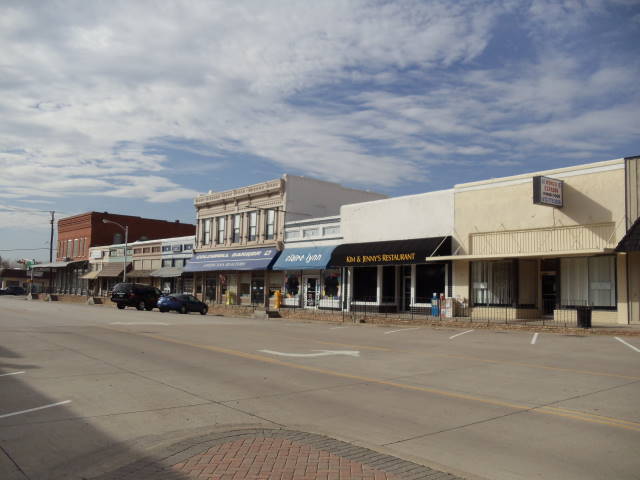


Why visit Midlothian
Townapedia lists 12 museums and landmarks, 16 parks and trails, 27 places to eat and 2 places to stay in and around town.
Highlights include Midlothian ISD Multi-Purpose Stadium and Kimmel Park.
August is the warmest month, with average highs of 95°F; January lows average 34°F.
Weather in Midlothian
Forecast from the National Weather Service. Full forecast
About Midlothian
Midlothian is a city in northwest Ellis County, Texas, United States. The city is 25 miles (40 km) southwest of Dallas. It is the hub for the cement industry in North Texas, as it is the home to three separate cement production facilities, as well as a steel mill. As of the 2020 census, Midlothian had a population of 35,125.
From the Wikipedia article Midlothian, Texas (this version), under CC BY-SA 4.0.
Museums and landmarks12

Parks, trails and playgrounds16

Midlothian ISD Multi-Purpose Stadium
Sports field and stadium · 0.4 mi
1800 South 14th Street, Midlothian

4 more on the map.
Restaurants and cafes27



Domino's
Fast food · Pizza · 0.7 mi
1111 George Hopper Road, Midlothian
Mo-Th 10:30-24:00; Fr-Sa 10:30-01:00; Su 10:30-24:00
McDonald's
Fast food · Burger · 0.8 mi
1310 U.S. 287 Business, Midlothian
Mo-Sa 06:00-22:00; Su 07:00-22:00
Sonic
Fast food · Burger · 2.9 mi
2220 Plainview Road, Midlothian
Mo-Th 06:00-22:00; Fr-Sa 06:00-23:00; Su 06:00-22:00
15 more on the map.
Where to stay2

Americas Best Value Inn
Motel and hotel · 1.5 mi
220 North US Highway 67;North Highway 67, Midlothian
History
In the early 1800s, settlements began to take place in the area that became Ellis County, but full colonization of this area was slow until 1846, when the US finalized peace treaties initiated by Sam Houston between several of the indigenous inhabitants of the region and the Republic of Texas. The earliest inhabitants of this area were the Tonkawa people, but other tribes also hunted in this area, including the Anadarko, Bidai, Kickapoo, and Waco peoples.
The future Ellis County area of the young Republic of Texas was known as the Peters Colony, named for a Louisville, Kentucky-based land grant company consisting of English and American investors. The Mexican empresario grant program encouraged settlements in the province of Texas. The few settlers who lived in this region trapped animals and sold their pelts, and traded goods with the natives. The majority of Ellis County's original settlers came from the southern half of the United States. They arrived with their cultural and educational traditions, their methods of farming and care for farm animals, and for a few, the people they had enslaved.
From the History section of Midlothian, Texas on Wikipedia, under CC BY-SA 4.0.
Churches and places of worship15
FBC Midlothian
Church · Baptist · 0.7 mi
1651 South Midlothian Parkway, Midlothian
FBC Student Center
Church · Baptist · 0.8 mi
1680 South Midlothian Parkway, Midlothian
Oak Crest Baptist Church
Church · Baptist · 0.5 mi
1701 South 5th Street, Midlothian
Renovation Church
Place of worship · 2.8 mi
5010 Farm-to-Market Road 663, Midlothian
Shopping8
Gas and EV charging9
Schools, colleges and libraries22
Healthcare2
Methodist Midlothian Medical Center
Hospital · 0.5 mi
1201 East Us Highway 287 Service Road, Midlothian
Brookshire's Pharmacy
Clinic and pharmacy · 0.8 mi
1400 East Main Street, Midlothian
Map of Midlothian
113 places. The map loads OpenStreetMap tiles when you open it.
Climate by month
Monthly table
| Month | High | Low | Rain | Snow |
|---|---|---|---|---|
| Jan | 56°F | 34°F | 2.6 in | 0.0 in |
| Feb | 60°F | 38°F | 2.7 in | 0.0 in |
| Mar | 67°F | 45°F | 4.0 in | 0.0 in |
| Apr | 75°F | 53°F | 3.5 in | 0.0 in |
| May | 82°F | 63°F | 4.3 in | 0.0 in |
| Jun | 90°F | 71°F | 4.2 in | 0.0 in |
| Jul | 95°F | 74°F | 2.5 in | 0.0 in |
| Aug | 95°F | 74°F | 2.9 in | 0.0 in |
| Sep | 88°F | 67°F | 3.3 in | 0.0 in |
| Oct | 78°F | 55°F | 4.7 in | 0.0 in |
| Nov | 66°F | 44°F | 2.9 in | 0.0 in |
| Dec | 58°F | 36°F | 3.1 in | 0.0 in |
U.S. Climate Normals 1991-2020 for Waxahachie (9 mi away), NOAA NCEI.
People and cost of living
American Community Survey 5-year estimates, 2020-2024, U.S. Census Bureau. Estimates have margins of error, larger for small towns.
Disaster history
Ellis County has had 18 federal disaster declarations since 2000, most often for hurricanes.
- 2024-05-17: Severe Storms, Straight-Line Winds, Tornadoes, And Flooding (Flood)
- 2021-02-19: Severe Winter Storms (Severe Ice Storm)
- 2021-02-14: Severe Winter Storm (Severe Ice Storm)
- 2020-08-24: Tropical Storms Marco And Laura (Hurricane)
- 2020-03-25: Covid-19 Pandemic (Biological)
- 2020-03-13: Covid-19 (Biological)
OpenFEMA disaster declarations summaries.
Getting there and nearby towns
Dallas Executive Airport (RBD) is the nearest airport with scheduled flights listed in OpenStreetMap, 16 miles away.
- Cedar Hill 8 mi north, about 13 min by car
- Mansfield 10 mi northwest, about 17 min by car
- Glenn Heights 10 mi northeast, about 16 min by car
- DeSoto 12 mi northeast, about 19 min by car
- Duncanville 13 mi north, about 21 min by car
- Grand Prairie 14 mi north, about 23 min by car
- Lancaster 15 mi northeast, about 25 min by car
- Arlington 18 mi northwest, about 29 min by car
- Burleson 20 mi west, about 32 min by car
- Dallas 26 mi northeast, about 42 min by car
Drive times are estimates from straight-line distance, not routes.
Local news
Headlines from INDB, the NEMICO news database.
Reviews, tips and questions
Loading what members have shared...
Sources and licences
- NCES EDGE (Public domain): public schools
- NOAA NCEI U.S. Climate Normals 1991-2020 (Public domain): climate by month
- OpenFEMA (Public domain): disaster declarations
- OpenStreetMap contributors (ODbL 1.0): places, airports, map data
- U.S. Census Bureau (Public domain): population, income, housing, education, commute
- Wikidata (CC0 1.0): elevation, founding date, time zone, website
- Wikimedia Commons (see each image): photos
- Wikipedia (CC BY-SA 4.0): overview and history text
Photo credits
- Midlothian, Renelibrary, CC BY-SA 3.0
- ISS064-E-15772 - View of Earth, Earth Science and Remote Sensing Unit, NASA Johnson Space Center, Public domain
- ISS016-E-28734 - View of Earth, Earth Science and Remote Sensing Unit , Lyndon B. Johnson Space Center, Public domain
- ISS020-E-33234 - View of Earth, Earth Science and Remote Sensing Unit , Lyndon B. Johnson Space Center, Public domain
- ISS019-E-6594 - View of Earth, Earth Science and Remote Sensing Unit , Lyndon B. Johnson Space Center, Public domain
- ISS040-E-46683 - View of Earth, Earth Science and Remote Sensing Unit , Lyndon B. Johnson Space Center, Public domain
- Linum berlandieri, Annika Lindqvist, CC BY 4.0
- Pyrota insulata 7291099, Sam Kieschnick, CC BY 4.0
- Hamatophylus guttulosus - iNaturalist 372376053, Nathan May, CC BY 4.0
- Green Lynx Spider imported from iNaturalist photo 94837451 on 22 September 2022, (c) Sam Kieschnick, some rights reserved (CC BY), CC BY 4.0
- Chorioactis geaster 2835172, Annika Lindqvist, CC BY 4.0
- Chorioactis geaster 2835170, Annika Lindqvist, CC BY 4.0
- Chorioactis geaster 2835173, Annika Lindqvist, CC BY 4.0
- Chorioactis geaster 2835168, Annika Lindqvist, CC BY 4.0
- Euchaetes bolteri, Annika Lindqvist, CC BY 4.0
- Midway regional airport tower, Larry D. Moore, CC BY 4.0
- A-4L at Sunset, LegionnaireIntl, CC BY-SA 4.0
- JWY MID-WAY REGIONAL AIRPORT FROM FLIGHT CDG-IAH 777 F-GSQM (10243952066), Eric Salard, CC BY-SA 2.0
- ISS040-E-104861 - View of Earth, Earth Science and Remote Sensing Unit , Lyndon B. Johnson Space Center, Public domain
- ISS040-E-104860 - View of Earth, Earth Science and Remote Sensing Unit , Lyndon B. Johnson Space Center, Public domain
- ISS019-E-6595 - View of Earth, Earth Science and Remote Sensing Unit , Lyndon B. Johnson Space Center, Public domain
- Sardis United Methodist Church, MarciaDianeOT, CC BY-SA 4.0
- ISS040-E-104863 - View of Earth, Earth Science and Remote Sensing Unit , Lyndon B. Johnson Space Center, Public domain
- ISS040-E-104862 - View of Earth, Earth Science and Remote Sensing Unit , Lyndon B. Johnson Space Center, Public domain
- ISS029-E-30719 - View of Earth, Earth Science and Remote Sensing Unit , Lyndon B. Johnson Space Center, Public domain


Page built October 30, 2026. Spotted a mistake? Tell us or suggest a place.