
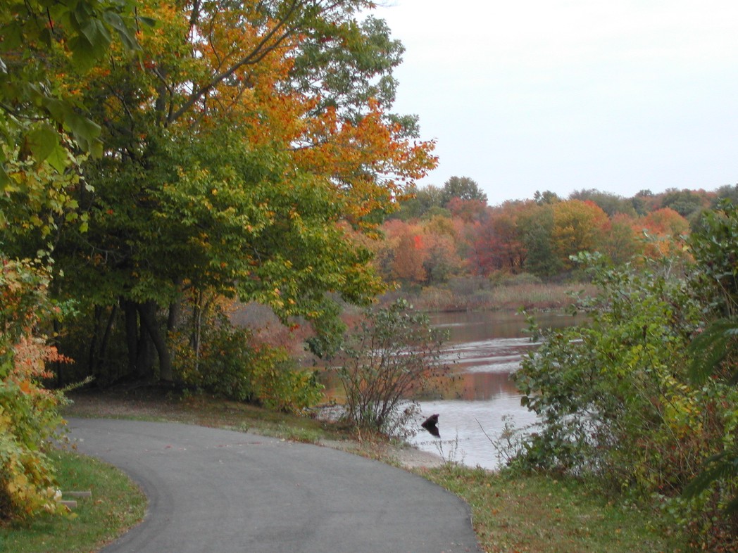


Milltown, New Jersey
Milltown is a borough of 7,059 people in Middlesex County, New Jersey, founded in 1889.
Why visit Milltown
Townapedia lists 18 museums and landmarks, 9 parks and trails, 27 places to eat, 2 places to stay and 5 attractions in and around town.
Highlights include Albany Street Bridge, Basilone Memorial Bridge, Alexander Johnston Hall and Edward S. Kearney House.
July is the warmest month, with average highs of 86°F; January lows average 23°F, and about 29 inches of snow fall in a normal year.
Weather in Milltown
Forecast from the National Weather Service. Full forecast
About Milltown
Milltown is a borough in Middlesex County, in the U.S. state of New Jersey. The borough is nestled within the heart of the Raritan Valley region, with Lawrence Brook (a Raritan river tributary) flowing through the center of the community. As of the 2020 United States census, the borough's population was 7,037, an increase of 144 (+2.1%) from the 2010 census count of 6,893, which in turn reflected a decrease of 107 (−1.5%) from the 7,000 counted in the 2000 census.
From the Wikipedia article Milltown, New Jersey (this version), under CC BY-SA 4.0.
Things to do5

Albany Street Bridge
Bridge · 3.3 mi
Bridge in United States of America
Basilone Memorial Bridge
Bridge · 3.3 mi
Bridge in Middlesex County, New Jersey

Crossroads Theatre
Cinema and theater · 3.0 mi
Theater company based in New Brunswick, New Jersey, United States
George Street Playhouse
Cinema and theater · 3.0 mi
Theater in New Brunswick, New Jersey
State Theatre New Jersey
Cinema and theater · 3.0 mi
Theater and former movie theater in New Brunswick, New Jersey, United States
Museums and landmarks18

Alexander Johnston Hall
Monument and historic site · National Register of Historic Places · 3.4 mi
Historic building in New Brunswick, New Jersey

Edward S. Kearney House
Monument and historic site · National Register of Historic Places · 2.4 mi
Historic house in Middlesex County, New Jersey

Henry Guest House
Monument and historic site · National Register of Historic Places · 2.9 mi
Historic house in New Brunswick, New Jersey

King Block
Monument and historic site · National Register of Historic Places · 3.2 mi
Listed on the National Register of Historic Places in Middlesex County, New Jersey

Levi D. Jarrard House
Monument and historic site · National Register of Historic Places · 2.5 mi
Historic house in New Brunswick, New Jersey

Livingston Avenue Historic District
Monument and historic site · National Register of Historic Places · 2.8 mi
Historic district in New Brunswick, New Jersey

Main Post Office
Monument and historic site · National Register of Historic Places · 3.0 mi
Post office in New Brunswick, New Jersey

Milltown India Rubber Company
Monument and historic site · National Register of Historic Places
Historic building in Milltown, New Jersey

National Musical String Company
Monument and historic site · National Register of Historic Places · 1.9 mi
Historic building in New Brunswick, New Jersey

New Brunswick station
Monument and historic site · National Register of Historic Places · 3.3 mi
NJ Transit and Amtrak train station

Old Queens
Monument and historic site · National Register of Historic Places · 3.4 mi
Oldest extant building in Rutgers University


Poile Zedek Synagogue
Monument and historic site · National Register of Historic Places · 3.1 mi
Historic synagogue at 145 Neilson Street in New Brunswick, New Jersey
6 more on the map.
Parks, trails and playgrounds9


Restaurants and cafes27

Applebee's
Diner · American · 0.8 mi
324 Ryders Lane, Milltown
Mo-Th,Su 11:00-24:00, Fr-Sa 11:00-01:00

Chili's
Restaurant · Tex-Mex · 1.5 mi
667 US 1 South, North Brunswick
Mo-Th 11:00-23:00; Fr-Sa 11:00-24:00; Su 11:00-23:00
Fresco Steak & Seafood Grill
Restaurant · Fish · 0.5 mi
210 Ryders Lane, Milltown
Mo off; Tu-Th,Su 12:00-21:00; Fr-Sa 12:00-22:00

Häagen-Dazs
Ice cream · Ice Cream · 1.4 mi
651 Shoppes Boulevard, North Brunswick
Mo-Th,Su 12:00-21:00; Fr-Sa 12:00-22:00




15 more on the map.
History
Long before the arrival of the first Europeans, the Lenape Native Americans had established settlements along the Lawrence Brook. The discovery of many artifacts in the area above today's municipal building (now a small county park) suggests the presence of a Native American settlement. In 1678, Thomas Lawrence, a New York baker, acquired a large area around the Lawrence Brook, which likely included today's Milltown. The Lawrence Brook was then called Piscopeek (and on later maps, Lawrence's Brook). The names and marks of several Native Americans (Quemareck, Quesiacs, Isarick, Metapis, Peckawan and Turantaca) appear on the bill of sale. In 1769, Fulcard Van Nordstrand advertised the sale of a large gristmill on the bank of Lawrence Brook. It would soon be called Lawrence Brook Mill. The 1903 classic western film The Great Train Robbery was shot in Milltown.
After the end of World War I, the Michelin Illustrated Guides to the Battlefields (1914-1918) of the Western Front were published in Milltown.
Milltown was home to a large French community, about 3,000 of whom worked at the Michelin tire factory. Many hailed from Gourin, and spoke Breton.
From the History section of Milltown, New Jersey on Wikipedia, under CC BY-SA 4.0.
Where to stay2
Churches and places of worship18
Christ Church
Church · National Register of Historic Places · 3.2 mi
First Reformed Church
Church · National Register of Historic Places · 3.1 mi
Old School Baptist Church and Cemetery
Church · National Register of Historic Places · 2.8 mi
Saint Mary of Mount Virgin Roman Catholic Church
Church · National Register of Historic Places · 2.5 mi
Saint Peter the Apostle Church
Church · National Register of Historic Places · 3.3 mi
St. Mary's Church
Church · National Register of Historic Places · 3.0 mi
East Brunswick Baptist Church
Church · Baptist · 1.3 mi
456 Ryders Lane, East Brunswick
Shopping7
Gas and EV charging5
Schools, colleges and libraries49
Benjamin Franklin Elementary School
School · 4.8 mi
2485 Woodbridge Avenue, Edison
Healthcare1
Map of Milltown
141 places. The map loads OpenStreetMap tiles when you open it.
Climate by month
Monthly table
| Month | High | Low | Rain | Snow |
|---|---|---|---|---|
| Jan | 40°F | 23°F | 3.7 in | 8.3 in |
| Feb | 43°F | 24°F | 3.0 in | 9.3 in |
| Mar | 51°F | 31°F | 4.4 in | 5.2 in |
| Apr | 62°F | 41°F | 3.9 in | 0.6 in |
| May | 72°F | 51°F | 4.0 in | 0.0 in |
| Jun | 81°F | 60°F | 4.8 in | 0.0 in |
| Jul | 86°F | 66°F | 4.8 in | 0.0 in |
| Aug | 85°F | 64°F | 4.7 in | 0.0 in |
| Sep | 78°F | 56°F | 4.2 in | 0.0 in |
| Oct | 66°F | 44°F | 4.1 in | 0.2 in |
| Nov | 56°F | 35°F | 3.4 in | 0.5 in |
| Dec | 45°F | 28°F | 4.5 in | 4.9 in |
U.S. Climate Normals 1991-2020 for New Brunswick 3 Se Hcn (2 mi away), NOAA NCEI.
People and cost of living
American Community Survey 5-year estimates, 2020-2024, U.S. Census Bureau. Estimates have margins of error, larger for small towns.
Disaster history
Middlesex County has had 17 federal disaster declarations since 2000, most often for hurricanes.
- 2021-09-05: Remnants Of Hurricane Ida (Hurricane)
- 2021-09-02: Remnants Of Hurricane Ida (Hurricane)
- 2020-03-25: Covid-19 Pandemic (Biological)
- 2020-03-13: Covid-19 (Biological)
- 2016-03-14: Severe Winter Storm And Snowstorm (Severe Storm)
- 2012-10-30: Hurricane Sandy (Hurricane)
OpenFEMA disaster declarations summaries.
Getting there and nearby towns
Central Jersey Regional Airport (JVI) is the nearest airport with scheduled flights listed in OpenStreetMap, 10 miles away.
- New Brunswick 3 mi north, about 4 min by car
- South River 3 mi east, about 5 min by car
- Highland Park 4 mi north, about 6 min by car
- East Franklin 4 mi northwest, about 6 min by car
- Somerset 5 mi northwest, about 9 min by car
- Helmetta 5 mi south, about 8 min by car
- Deans 5 mi southwest, about 9 min by car
- Sayreville 6 mi east, about 9 min by car
- Franklin Park 6 mi west, about 9 min by car
- Old Bridge 7 mi southeast, about 11 min by car
Drive times are estimates from straight-line distance, not routes.
Local news
Headlines from INDB, the NEMICO news database.
Reviews, tips and questions
Loading what members have shared...
Sources and licences
- NCES EDGE (Public domain): public schools
- NOAA NCEI U.S. Climate Normals 1991-2020 (Public domain): climate by month
- OpenFEMA (Public domain): disaster declarations
- OpenStreetMap contributors (ODbL 1.0): places, airports, map data
- U.S. Census Bureau (Public domain): population, income, housing, education, commute
- Wikidata (CC0 1.0): elevation, founding date, time zone, website, landmarks and historic places
- Wikimedia Commons (see each image): photos
- Wikipedia (CC BY-SA 4.0): overview and history text
Photo credits
- Milltown NJ 5, Jhouston1956 at English Wikipedia, Public domain
- Milltown, NJ post office, Jan. 2025, Mr. Matté (if there is an issue with this image, contact me using this image's Commons talk page , my Commons user talk page , or my English Wikipedia user talk page ; I'll know about it a lot faster), CC BY-SA 4.0
- Middlesex CR 606 nb, Milltown, NJ (1), July 2026, Mr. Matté (if there is an issue with this image, contact me using this image's Commons talk page , my Commons user talk page , or my English Wikipedia user talk page ; I'll know about it a lot faster), CC BY-SA 4.0
- Milltown, NJ municipal building, Jan. 2025, Mr. Matté (if there is an issue with this image, contact me using this image's Commons talk page , my Commons user talk page , or my English Wikipedia user talk page ; I'll know about it a lot faster), CC BY-SA 4.0
- Ford Avenue wb, Milltown, NJ, July 2026, Mr. Matté (if there is an issue with this image, contact me using this image's Commons talk page , my Commons user talk page , or my English Wikipedia user talk page ; I'll know about it a lot faster), CC BY-SA 4.0
- Level Grade Crossing, Milltown, NJ, Curlyrnd, CC BY-SA 4.0
- Middlesex CR 606 nb, Milltown, NJ (2), July 2026, Mr. Matté (if there is an issue with this image, contact me using this image's Commons talk page , my Commons user talk page , or my English Wikipedia user talk page ; I'll know about it a lot faster), CC BY-SA 4.0
- 2018-05-21 15 40 41 View south along Interstate 95 (New Jersey Turnpike) between Exit 9 and Exit 8A in Milltown, Middlesex County, New Jersey, Famartin, CC BY-SA 4.0
- 2021-05-25 14 28 05 View south along Interstate 95 (New Jersey Turnpike) from the overpass for Middlesex County Route 617 (Ryders Lane) in Milltown, Middlesex County, New Jersey, Famartin, CC BY-SA 4.0
- 2021-05-25 14 24 36 View north along Interstate 95 (New Jersey Turnpike) from the overpass for the rail line just south of Middlesex County Route 617 (Ryders Lane) in Milltown, Middlesex County, New..., Famartin, CC BY-SA 4.0
- 2021-05-25 14 23 44 View south along Interstate 95 (New Jersey Turnpike) from the overpass for the rail line just south of Middlesex County Route 617 (Ryders Lane) in Milltown, Middlesex County, New..., Famartin, CC BY-SA 4.0
- Haig Avenue at Foch Avenue, Milltown, NJ, Aug. 2026, Mr. Matté (if there is an issue with this image, contact me using this image's Commons talk page , my Commons user talk page , or my English Wikipedia user talk page ; I'll know about it a lot faster), CC BY-SA 4.0
- Washington Avenue wb entering Milltown, NJ, July 2026, Mr. Matté (if there is an issue with this image, contact me using this image's Commons talk page , my Commons user talk page , or my English Wikipedia user talk page ; I'll know about it a lot faster), CC BY-SA 4.0
- 2021-05-25 14 12 44 View south along Interstate 95 (New Jersey Turnpike) from the overpass for Middlesex County Route 606 (South Main Street) in Milltown, Middlesex County, New Jersey, Famartin, CC BY-SA 4.0
- 2021-05-25 14 14 44 View north along Interstate 95 (New Jersey Turnpike) from the overpass for Middlesex County Route 606 (South Main Street) in Milltown, Middlesex County, New Jersey, Famartin, CC BY-SA 4.0
- 2018-05-21 08 36 05 View north along Interstate 95 (New Jersey Turnpike) between Exit 8A and Exit 9 in Milltown, Middlesex County, New Jersey, Famartin, CC BY-SA 4.0
- Old CR 3-R-9 shield, Middlesex CR 606, Milltown, NJ, July 2026, Mr. Matté (if there is an issue with this image, contact me using this image's Commons talk page , my Commons user talk page , or my English Wikipedia user talk page ; I'll know about it a lot faster), CC BY-SA 4.0
- Middlesex CR 606 sb at Garver Street, Milltown, NJ, March 2026, Mr. Matté (if there is an issue with this image, contact me using this image's Commons talk page , my Commons user talk page , or my English Wikipedia user talk page ; I'll know about it a lot faster), CC BY-SA 4.0
- 2020-07-24 10 19 50 View south along U.S. Route 1 at the exit for Milltown Road NORTH in North Brunswick Township, Middlesex County, New Jersey, Famartin, CC BY-SA 4.0
- 2021-07-16 18 03 58 View north along U.S. Route 1 from the overpass for Middlesex County Route 606 (Milltown Road) in North Brunswick Township, Middlesex County, New Jersey, Famartin, CC BY-SA 4.0
- 2020-07-24 10 21 20 View south along U.S. Route 1 at the exit for Milltown Road SOUTH in North Brunswick Township, Middlesex County, New Jersey, Famartin, CC BY-SA 4.0
- 2021-07-16 17 59 53 View south along U.S. Route 1 from the overpass for Middlesex County Route 606 (Milltown Road) in North Brunswick Township, Middlesex County, New Jersey, Famartin, CC BY-SA 4.0
- College Hall, Rutgers, New Brunswick, NJ - south view, Zeete, CC BY-SA 3.0
- Henry Guest House, New Brunswick, NJ - front view, Zeete, CC BY-SA 4.0
- LivingstonAveHistoricDistrict, KForce, CC BY-SA 3.0
- OldSchoolBaptistChurchSouthRiver, KForce, CC BY-SA 3.0
- KingBlockNewBrunswick, Janet W. Foster, Public domain
- Saint Mary of Mount Virgin Roman Catholic Church front, Ben McLaughlin, CC BY-SA 3.0
- PoileZedek, KForce at en.wikipedia, CC BY-SA 3.0
- Old Queens, New Brunswick, NJ - looking north, 2014, Zeete, CC BY-SA 4.0
- First Reformed Church, New Brunswick, NJ - south view, Zeete, CC BY-SA 4.0
- ChristEpiscopalChurchNewBrunswick, KForce ( talk ) ( Uploads ), CC BY-SA 3.0
- Saint Peter the Apostle Church, New Brunswick, NJ, Zeete, CC BY-SA 3.0
- MilltownIndiaRubberCo, KForce, CC BY-SA 3.0
- New Brunswick Station, street view, Zeete, CC BY-SA 3.0
- NationalMusicalStringCo, KForce at en.wikipedia, CC BY-SA 3.0
- Queens Campus, New Brunswick, NJ - Class of 1902 Memorial Gateway, Zeete, CC BY-SA 4.0
- Thomas I. Agnew House, New Brunswick, NJ, Zeete, CC BY-SA 3.0
- Edward S. Kearney House front view, Gould363, CC BY-SA 3.0
- Alexander Johnston Hall, New Brunswick, NJ - looking west, Zeete, CC BY-SA 4.0


Page built October 30, 2026. Spotted a mistake? Tell us or suggest a place.