


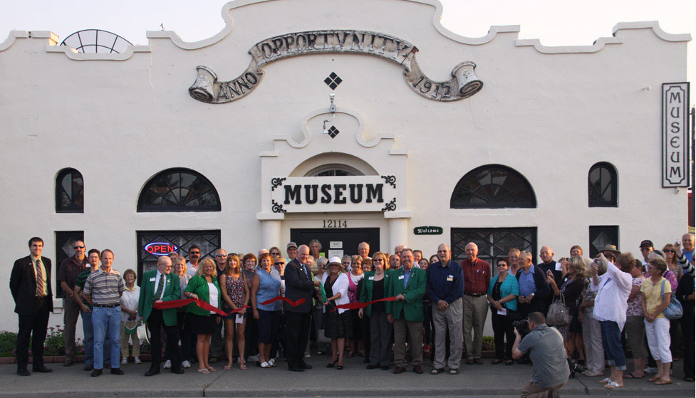


Millwood, Washington
Millwood is a city of 1,890 people in Spokane County, Washington, founded in 1927.
Why visit Millwood
Townapedia lists 4 museums and landmarks, 7 parks and trails, 38 places to eat and 5 places to stay in and around town.
Highlights include Hutton Settlement District, Millwood Historic District, Minnehaha Park and Pumpkin Patch Community Garden.
July is the warmest month, with average highs of 87°F; December lows average 26°F.
Weather in Millwood
Forecast from the National Weather Service. Full forecast
About Millwood
Millwood is a city in Spokane County, Washington, United States. As of the 2020 census, the city had a population of 1,881. Millwood is a suburb of Spokane, and is surrounded on three sides by the city of Spokane Valley. The Spokane River flows along the northern edge of the city.
From the Wikipedia article Millwood, Washington (this version), under CC BY-SA 4.0.
Museums and landmarks4

Hutton Settlement District
Monument and historic site · National Register of Historic Places · 1.2 mi
Historic district in Washington, United States
Millwood Historic District
Monument and historic site · National Register of Historic Places · 0.4 mi
Historic district in Washington, United States
Rosebush House
Monument and historic site · National Register of Historic Places · 0.4 mi
Historic house in Washington, United States
Parks, trails and playgrounds7


Minnehaha Park
Park · 3.4 mi
City park in Spokane, Washington, United States


Splash Down Waterpark
Sports field and stadium · 1.3 mi
11127 East Mission Avenue, Spokane Valley

Restaurants and cafes38

Longhorn Barbecue
Restaurant · Barbecue · 0.5 mi
2315 North Argonne Road, Spokane Valley
Mo 11:00-20:00; Tu-Sa 11:00-21:00; Su 10:00-22:00
Pizza Hut
Restaurant · Pizza · 0.4 mi
9211 East Montgomery Avenue, Spokane
Mo-Th,Su 10:00-22:00; Fr,Sa 10:00-24:00
The Sushi House
Restaurant · Sushi · 1.1 mi
7905 East Trent Avenue, Spokane Valley
Su-Th 11:00-21:00; Fr-Sa 11:00-21:30


Whistle Punk Brewing
Bar and pub
9013 East Frederick Avenue, Spokane
Mo-Th 15:00-21:00; Fr-Sa 13:00-22:00; Su 13:00-19:00
Badass Backyard Brewing
Bar and pub · 1.1 mi
1415 North Argonne Road, Spokane Valley
Tu-Sa 14:00-20:00
YaYa Brewing Company
Bar and pub · 1.5 mi
11712 East Montgomery Avenue, Spokane Valley
Mo,We-Th 14:00-20:00; Fr 14:00-21:00; Sa 12:00-21:00; Su 12:00-20:00
Casa de Oro
Restaurant · Mexican · 0.9 mi
1611 North Mullan Road, Spokane Valley
Pint House Burgers & Brews
Restaurant · Burger · 1.0 mi
Mo-Th 11:00-22:00; Fr-Sa 11:00-22:30; Su 11:00-21:00

26 more on the map.
Where to stay5

History
Millwood was officially incorporated as a town on October 26, 1927. It was named for the local sawmill.
According to the Tacoma Public Library's Washington Place Names database: "In 1900, it was chosen as a station by the Spokane-Coeur d'Alene Electric Railway, and was named Woodard's for the family who owned the land along the railway route. When Inland Empire Paper Company built a paper mill they requested a name change to Milltown. Railway officials refused the change unless the Woodard family agreed. A compromise resulted, using the word mill combined with the first four letters of Woodard. It was incorporated October 27, 1927."
The Rosebush House, located in the center of Millwood, "is one of Millwood's best preserved homes" and is listed on the U.S. National Register of Historic Places.
From the History section of Millwood, Washington on Wikipedia, under CC BY-SA 4.0.
Churches and places of worship7
New Hope Christian Center
Church · 1.2 mi
1108 North Argonne Road, Spokane Valley
Shopping6
Gas and EV charging3
Schools, colleges and libraries49
Central Valley Early Learning Center
School · 4.0 mi
15111 E Sprague Ave, Spokane Valley
Central Valley Virtual Learning
School · 5.8 mi
1512 N. Barker Rd., Spokane Valley
Healthcare3
Map of Millwood
122 places. The map loads OpenStreetMap tiles when you open it.
Climate by month
Monthly table
| Month | High | Low | Rain |
|---|---|---|---|
| Jan | 38°F | 26°F | 2.0 in |
| Feb | 42°F | 27°F | 1.3 in |
| Mar | 51°F | 32°F | 1.8 in |
| Apr | 60°F | 37°F | 1.5 in |
| May | 70°F | 44°F | 1.7 in |
| Jun | 76°F | 50°F | 1.5 in |
| Jul | 87°F | 56°F | 0.7 in |
| Aug | 86°F | 54°F | 0.5 in |
| Sep | 76°F | 47°F | 0.7 in |
| Oct | 60°F | 38°F | 1.5 in |
| Nov | 45°F | 31°F | 2.0 in |
| Dec | 37°F | 26°F | 2.2 in |
U.S. Climate Normals 1991-2020 for Spokane Felts Fld (2 mi away), NOAA NCEI.
People and cost of living
American Community Survey 5-year estimates, 2020-2024, U.S. Census Bureau. Estimates have margins of error, larger for small towns.
Disaster history
Spokane County has had 23 federal disaster declarations since 2000, most often for fires.
- 2026-08-03: Wildfires (Fire)
- 2026-08-02: Autumn Lane Fire (Fire)
- 2026-08-02: Fairview Fire (Fire)
- 2026-08-01: Old Trails Fire (Fire)
- 2026-06-16: Upriver Fire (Fire)
- 2024-02-15: Wildfires (Fire)
OpenFEMA disaster declarations summaries.
Getting there and nearby towns
Felts Field Airport (SFF) is the nearest airport with scheduled flights listed in OpenStreetMap, 2 miles away.
- Spokane Valley 3 mi southeast, about 4 min by car
- Spokane 7 mi west, about 12 min by car
- Liberty Lake 8 mi east, about 13 min by car
- Fairwood 9 mi northwest, about 14 min by car
- Airway Heights 14 mi west, about 23 min by car
- Post Falls 16 mi east, about 25 min by car
- Fairchild AFB 18 mi west, about 29 min by car
- Rathdrum 19 mi northeast, about 31 min by car
- Cheney 20 mi southwest, about 31 min by car
- Coeur d'Alene 22 mi east, about 36 min by car
Drive times are estimates from straight-line distance, not routes.
Local news
Headlines from INDB, the NEMICO news database.
Reviews, tips and questions
Loading what members have shared...
Sources and licences
- NCES EDGE (Public domain): public schools
- NOAA NCEI U.S. Climate Normals 1991-2020 (Public domain): climate by month
- OpenFEMA (Public domain): disaster declarations
- OpenStreetMap contributors (ODbL 1.0): places, airports, map data
- U.S. Census Bureau (Public domain): population, income, housing, education, commute
- Wikidata (CC0 1.0): elevation, founding date, time zone, website, landmarks and historic places
- Wikimedia Commons (see each image): photos
- Wikipedia (CC BY-SA 4.0): overview and history text
Photo credits
- Millwood Presbyterian, Will Maupin, CC BY-SA 4.0
- Millwood HD NRHP 01000064 Spokane County, WA, Jon Roanhaus, CC BY-SA 3.0
- Spokane Valley Museum, Spokanevalleymuseum, CC BY-SA 4.0
- Lawn and trees at Minnehaha Park, Spokane, Washington, Dannooll at English Wikipedia, CC BY-SA 3.0
- Rosebush House2 NRHP 0001446 Spokane County, WA, Jon Roanhaus, CC BY-SA 4.0
- Rosebush House NRHP 00001446 Spokane County, WA, Jon Roanhaus, CC BY-SA 4.0
- West Valley High School (site) NRHP 91001736 Spokane County, WA, Jon Roanhaus, CC BY-SA 4.0
- Argonne Bridge Architectural Drawing, Ben J. Garnett, Public domain
- Argonne, SpokaneWilly, CC BY-SA 4.0
- Hutton Settlement NRHP 76001919 Spokane County, WA, Jon Roanhaus, CC BY-SA 4.0
- ISS053-E-298779 - View of Earth, Earth Science and Remote Sensing Unit , Lyndon B. Johnson Space Center, Public domain
- ISS060-E-44671 - View of Earth, Earth Science and Remote Sensing Unit, NASA Johnson Space Center, Public domain
- The valley (484540098), Argyleist, CC BY 2.0


Page built October 30, 2026. Spotted a mistake? Tell us or suggest a place.