


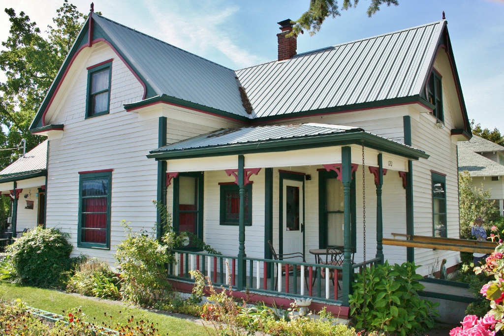

Post Falls, Idaho
Post Falls is a city of 43,391 people in Kootenai County, Idaho, founded in 1871.
Why visit Post Falls
Townapedia lists 5 museums and landmarks, 34 parks and trails, 90 places to eat, 7 places to stay and 4 attractions in and around town.
Highlights include Ford Rock, Samuel and Ann Young House and Kiwanis Park.
August is the warmest month, with average highs of 83°F; January lows average 26°F.
Weather in Post Falls
Forecast from the National Weather Service. Full forecast
About Post Falls
Post Falls is a city in Kootenai County, Idaho, United States. It is the gateway city to Northern Idaho off Interstate 90, just west of Coeur d'Alene, and east of Spokane, Washington. The population is an estimated 44,194 in 2022 according to the U.S. Census Bureau estimate, making it Idaho's ninth-largest city and the second largest city in North Idaho behind Coeur d’Alene.
From the Wikipedia article Post Falls, Idaho (this version), under CC BY-SA 4.0.
Things to do4



Museums and landmarks5
Samuel and Ann Young House
Monument and historic site · National Register of Historic Places · 1.0 mi
Historic house in Idaho, United States


Parks, trails and playgrounds34

22 more on the map.
Restaurants and cafes90

Capone's
Diner · American · 2.6 mi
315 Ross Point Road, Post Falls
Su-Th 11:00-21:00; Fr,Sa 11:00-22:00

Houston TX Hot Chicken
Restaurant · Chicken, American · 2.4 mi
870 North Highway 41, Post Falls
Mo-Th 10:00-22:00, Fr-Sa 10:00-23:00, Su 10:00-22:00

Jitterz Espresso
Cafe · Coffee Shop · 2.2 mi
3798 East Horsehaven Avenue, Post Falls
Mo-Fr 04:30-19:00; Sa 06:00-19:00; Su 08:00-17:00
New York Pizza Dept
Restaurant · Pizza · 3.3 mi
4380 West Riverbend Avenue, Post Falls
Tu-Sa 10:00-20:00; Su 11:00-20:00

Post Falls Brewing Company
Bar and pub · 1.3 mi
112 North Spokane Street, Post Falls
Mo-Sa 12:00-22:00; Su 10:00-22:00
Roasted Coffee Company
Cafe · Coffee Shop · 3.0 mi
4000 West Riverbend Avenue, Post Falls
Mo-Fr 05:30-18:00, Sa-Su 07:00-17:00
78 more on the map.
History
Post Falls is named after Frederick Post, a German immigrant who constructed a lumber mill along the Spokane River in 1871 on land he purchased from Andrew Seltice, Chief of the Coeur d'Alene Tribe. The purchase of the land is preserved in a pictograph on a granite cliff in Treaty Rock Park.
From the History section of Post Falls, Idaho on Wikipedia, under CC BY-SA 4.0.
Where to stay7
Churches and places of worship25
Post Falls Community United Presbyterian Church
Church · National Register of Historic Places · 1.0 mi
St. Joan of Arc Roman Catholic Church
Church · Catholic · 2.8 mi
4772 East Poleline Avenue, Post Falls
St. John the Baptist Orthodox Church
Church · Orthodox · 2.8 mi
4718 East Horsehaven Avenue, Post Falls
The Church of Jesus Christ of Latter-day Saints
Church · Mormon · 1.6 mi
1670 North McGuire Road, Post Falls
North Country Chapel
Church · Nondenominational · 1.7 mi
2281 West Seltice Way, Post Falls
Shopping15
Gas and EV charging18
Schools, colleges and libraries28
Betty Kiefer Elementary School
School · 5.4 mi
13898 North Schooner Street, Rathdrum
Healthcare16
Northwest Family Medicine
Clinic and pharmacy · 1.0 mi
1551 East Mullan Avenue, Post Falls
Northwest Imaging Center
Clinic and pharmacy · 1.1 mi
750 North Syringa Street, Post Falls
Map of Post Falls
242 places. The map loads OpenStreetMap tiles when you open it.
Climate by month
Monthly table
| Month | High | Low | Rain |
|---|---|---|---|
| Jan | 36°F | 26°F | 3.2 in |
| Feb | 41°F | 26°F | 2.1 in |
| Mar | 48°F | 31°F | 2.7 in |
| Apr | 56°F | 37°F | 1.9 in |
| May | 66°F | 44°F | 2.1 in |
| Jun | 72°F | 51°F | 2.2 in |
| Jul | 83°F | 57°F | 0.7 in |
| Aug | 83°F | 56°F | 0.8 in |
| Sep | 74°F | 48°F | 0.8 in |
| Oct | 58°F | 39°F | 2.0 in |
| Nov | 44°F | 32°F | 3.3 in |
| Dec | 36°F | 26°F | 3.5 in |
U.S. Climate Normals 1991-2020 for Coeur D'Alene Hcn (7 mi away), NOAA NCEI.
People and cost of living
American Community Survey 5-year estimates, 2020-2024, U.S. Census Bureau. Estimates have margins of error, larger for small towns.
Disaster history
Kootenai County has had 11 federal disaster declarations since 2000, most often for severe storms.
- 2026-06-30: Severe Storms, Straight-Line Winds, Flooding, Landslides, And Mudslides (Severe Storm)
- 2026-04-07: Straight-Line Winds (Straight-Line Winds)
- 2021-03-04: Straight-Line Winds (Severe Storm)
- 2020-04-09: Covid-19 Pandemic (Biological)
- 2020-03-13: Covid-19 (Biological)
- 2017-05-18: Severe Storms, Flooding, Landslides, And Mudslides (Flood)
OpenFEMA disaster declarations summaries.
Getting there and nearby towns
Coeur d'Alene Airport (COE) is the nearest airport with scheduled flights listed in OpenStreetMap, 6 miles away.
- Hauser 4 mi northwest, about 7 min by car
- Rathdrum 5 mi northeast, about 9 min by car
- Coeur d'Alene 7 mi east, about 11 min by car
- Hayden 7 mi northeast, about 12 min by car
- Otis Orchards-East Farms 7 mi west, about 11 min by car
- Liberty Lake 8 mi southwest, about 14 min by car
- Dalton Gardens 8 mi east, about 13 min by car
- Hayden Lake 9 mi east, about 15 min by car
- Spokane Valley 14 mi west, about 23 min by car
- Spokane 23 mi west, about 37 min by car
Drive times are estimates from straight-line distance, not routes.
Local news
Headlines from INDB, the NEMICO news database.
Reviews, tips and questions
Loading what members have shared...
Sources and licences
- NCES EDGE (Public domain): public schools
- NOAA NCEI U.S. Climate Normals 1991-2020 (Public domain): climate by month
- OpenFEMA (Public domain): disaster declarations
- OpenStreetMap contributors (ODbL 1.0): places, airports, map data
- U.S. Census Bureau (Public domain): population, income, housing, education, commute
- Wikidata (CC0 1.0): elevation, founding date, time zone, website, landmarks and historic places
- Wikimedia Commons (see each image): photos
- Wikipedia (CC BY-SA 4.0): overview and history text
Photo credits
- Treaty Rock 1 - Post Falls Idaho, Ian Poellet, CC BY-SA 4.0
- Treaty Rock 3 - Post Falls Idaho, Ian Poellet, CC BY-SA 4.0
- Treaty Rock 2 - Post Falls Idaho, Ian Poellet, CC BY-SA 4.0
- (IDAHO-A-0226) Post Falls Dam (North Channel), WaterArchives.org, CC BY-SA 2.0
- PF Com United Presbyterian-Post Falls-ID, Nancy Reilly Young, CC BY-SA 3.0
- Samuel and Ann Young House-Post Falls-ID, Nancy Reilly Young, CC BY-SA 3.0
- Bernard E. Pedersen, Ajrenuzit, CC BY-SA 4.0
- Spokane Valley Land & Water Co. Canal NRHP 03000124 Kootenai County, ID, Jon Roanhaus, CC BY-SA 4.0
- Spokane Valley Land & Water Co. Canal2 NRHP 03000124 Kootenai County, ID, Jon Roanhaus, CC BY-SA 4.0
- Washington Water Power Bridge, Harvey S. "Pete" Rice, Public domain
- ISS059-E-106392 - View of Earth, Earth Science and Remote Sensing Unit, NASA Johnson Space Center, Public domain
- ISS059-E-106393 - View of Earth, Earth Science and Remote Sensing Unit, NASA Johnson Space Center, Public domain
- Montaphe elrodi 38428753, Diane Leeper, CC BY-SA 4.0
- Peltigera malacea 26348016, Diane Leeper, CC BY-SA 4.0
- ISS007-E-13990 - View of Washington, Earth Science and Remote Sensing Unit , Lyndon B. Johnson Space Center, Public domain
- ISS042-E-210299 - View of Earth, Earth Science and Remote Sensing Unit , Lyndon B. Johnson Space Center, Public domain
- ISS042-E-210300 - View of Earth, Earth Science and Remote Sensing Unit , Lyndon B. Johnson Space Center, Public domain
- ISS059-E-106390 - View of Earth, Earth Science and Remote Sensing Unit, NASA Johnson Space Center, Public domain
- ISS007-E-13991 - View of Washington, Earth Science and Remote Sensing Unit , Lyndon B. Johnson Space Center, Public domain
- ISS059-E-106391 - View of Earth, Earth Science and Remote Sensing Unit, NASA Johnson Space Center, Public domain
- ISS042-E-195187 - View of Earth, Earth Science and Remote Sensing Unit , Lyndon B. Johnson Space Center, Public domain
- ISS042-E-195188 - View of Earth, Earth Science and Remote Sensing Unit , Lyndon B. Johnson Space Center, Public domain
- ISS034-E-8375 - View of Earth, Earth Science and Remote Sensing Unit , Lyndon B. Johnson Space Center, Public domain


Page built October 30, 2026. Spotted a mistake? Tell us or suggest a place.