
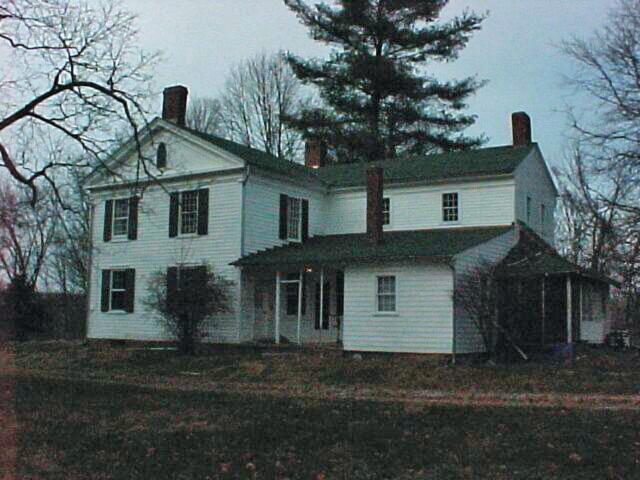


Montrose-Ghent, Ohio
Montrose-Ghent is a community of 5,903 people in Summit County, Ohio.
Why visit Montrose-Ghent
Townapedia lists 7 museums and landmarks, 9 parks and trails, 98 places to eat, 14 places to stay and 1 attraction in and around town.
Highlights include Regal Cinemas, Botzum Farm, Hale Farm and Village and Bath Nature Preserve.
July is the warmest month, with average highs of 82°F; January lows average 18°F.
Weather in Montrose-Ghent
Forecast from the National Weather Service. Full forecast
About Montrose-Ghent
Montrose-Ghent is a census-designated place (CDP) in Summit County, Ohio, United States, composed of the unincorporated communities of Montrose and Ghent. The population was 5,254 at the 2020 census. It is part of the Akron Metropolitan Statistical Area.
From the Wikipedia article Montrose-Ghent, Ohio (this version), under CC BY-SA 4.0.
Things to do1

Museums and landmarks7
Botzum Farm
Monument and historic site · National Register of Historic Places · 3.5 mi
Farm in Summit County, United States of America


Hale Farm and Village
Monument and historic site · National Register of Historic Places · 3.7 mi
Building in Ohio, United States
Jim Brown House
Monument and historic site · National Register of Historic Places · 3.8 mi
Peninsula, Ohio, listed on the NRHP in Summit County, Ohio

Paleo Crossing Site
Monument and historic site · 4.7 mi
Archaeological site in Ohio, United States

Parks, trails and playgrounds9

Bath Nature Preserve
Hiking and trails · 1.8 mi
411 acre parcel of land consists of wetlands, woodlands, riparian, and old fields. Parking for twenty cars and six vehicles with horse...
4160 Ira Road, Akron

Restaurants and cafes98

The Original Philly Cheesesteak
Restaurant · Sandwich · 1.6 mi
3750 West Market Street, Fairlawn
Mo-Th 10:30-21:00; Fr-Sa 10:30-22:00; Su 10:30-20:00
Gasoline Alley
Restaurant · Burger, American · 0.4 mi
870 North Cleveland Massillon Road, Bath
Su 10:00-15:00; Mo-Sa 11:00-22:00



Tito's Mexican Grill
Restaurant · 2.4 mi
25 Ghent Road
Mo-Th 11:00-22:00; Su 11:00-21:00; Fr-Sa 11:00-22:30
86 more on the map.
Where to stay14
Churches and places of worship10
Shopping23
Gas and EV charging8
Schools, colleges and libraries21
Copley-Fairlawn Middle School
School · 4.2 mi
1531 S Cleveland Massillon Rd, Copley
Judith A Resnik Community Learning Center
School · 4.2 mi
65 N Meadowcroft Dr, Akron
Healthcare12
Akron Children's Hospital - Urgent Care - Montrose/Medina
Clinic and pharmacy · 1.6 mi
4125 Medina Road, Akron
Cleveland Clinic - Akron General Health & Wellness - Bath
Clinic and pharmacy · 1.6 mi
4125 Medina Road, Akron
Colonial Pharmacy
Clinic and pharmacy · 2.2 mi
1915 North Cleveland Massillon Road
Passport Health Fairlawn Travel Clinic
Clinic and pharmacy · 2.7 mi
66 South Miller Road, Fairlawn
Map of Montrose-Ghent
203 places. The map loads OpenStreetMap tiles when you open it.
Climate by month
Monthly table
| Month | High | Low | Rain |
|---|---|---|---|
| Jan | 33°F | 18°F | 3.1 in |
| Feb | 36°F | 19°F | 2.5 in |
| Mar | 46°F | 25°F | 3.2 in |
| Apr | 60°F | 37°F | 3.7 in |
| May | 70°F | 47°F | 4.1 in |
| Jun | 78°F | 56°F | 4.1 in |
| Jul | 82°F | 60°F | 4.2 in |
| Aug | 81°F | 59°F | 3.5 in |
| Sep | 74°F | 52°F | 3.8 in |
| Oct | 61°F | 41°F | 3.3 in |
| Nov | 49°F | 32°F | 3.0 in |
| Dec | 38°F | 24°F | 3.1 in |
U.S. Climate Normals 1991-2020 for Stow 4 Se (10 mi away), NOAA NCEI.
People and cost of living
American Community Survey 5-year estimates, 2020-2024, U.S. Census Bureau. Estimates have margins of error, larger for small towns.
Disaster history
Summit County has had 10 federal disaster declarations since 2000, most often for severe storms.
- 2020-03-31: Covid-19 Pandemic (Biological)
- 2020-03-13: Covid-19 (Biological)
- 2012-06-30: Severe Storms (Severe Storm)
- 2008-10-24: Severe Wind Storm Associated With Tropical Depression Ike (Severe Storm)
- 2005-09-13: Hurricane Katrina Evacuation (Hurricane)
- 2004-09-19: Severe Storms And Flooding (Severe Storm)
OpenFEMA disaster declarations summaries.
Getting there and nearby towns
Akron Fulton International Airport (AKC) is the nearest airport with scheduled flights listed in OpenStreetMap, 12 miles away.
- Cuyahoga Falls 5 mi east, about 8 min by car
- Sharon Center 7 mi southwest, about 10 min by car
- Akron 8 mi southeast, about 13 min by car
- Norton 9 mi south, about 14 min by car
- Wadsworth 10 mi southwest, about 16 min by car
- Brecksville 10 mi north, about 17 min by car
- Silver Lake 10 mi east, about 16 min by car
- Barberton 11 mi south, about 17 min by car
- Stow 11 mi east, about 17 min by car
- Brunswick 11 mi northwest, about 18 min by car
Drive times are estimates from straight-line distance, not routes.
Local news
Headlines from INDB, the NEMICO news database.
Reviews, tips and questions
Loading what members have shared...
Sources and licences
- NCES EDGE (Public domain): public schools
- NOAA NCEI U.S. Climate Normals 1991-2020 (Public domain): climate by month
- OpenFEMA (Public domain): disaster declarations
- OpenStreetMap contributors (ODbL 1.0): places, airports, map data
- U.S. Census Bureau (Public domain): population, income, housing, education, commute
- Wikidata (CC0 1.0): landmarks and historic places
- Wikimedia Commons (see each image): photos
- Wikipedia (CC BY-SA 4.0): overview and history text
Photo credits
- Jim Brown House NPS, National Park Service, Public domain
- Botzum Forebay Barn NPS, National Park Service, Public domain
- AERIAL VIEW OF THE HALE FARM AND WESTERN RESERVE VILLAGE NEAR BATH AND AKRON, OHIO. OPERATED BY THE WESTERN RESERVE HISTORICAL SOCIETY, THE COMPLEX IS OPERATED AS A LIVING EXAMPLE OF 19TH CENTURY..., Frank John Aleksandrowicz, Public domain
- Cleveland-Massillon Road at Tee Drive, Nyttend, Public domain
- Dinner in the Dark 32 - Amuse Bouche, Edsel Little, CC BY-SA 2.0
- Energizer Bunny® Hot “Hare” Balloon (5820020310), Mark Turnauckas from Akron, Ohio, USA, CC BY 2.0
- Mechanisms inside a coffee vending machine, Mark Turnauckas from Akron, Ohio, USA, CC BY 2.0
- Halloween ghost cake, Mark Turnauckas from Akron, Ohio, USA, CC BY 2.0
- 81-87 Springside Dr. - panoramio, Mark Turnauckas, CC BY-SA 3.0
- Barnes & Noble Bookstore - panoramio, Mark Turnauckas, CC BY-SA 3.0
- Montrose Shopping Strip - panoramio, Mark Turnauckas, CC BY-SA 3.0
- Acme15Montrose, Chimatronx, CC BY-SA 4.0
- Bath Ohio Police Ford Police Interceptor Utility (50447635941), Raymond Wambsgans from Akron Ohio, USA, CC BY 2.0
- Bath Ohio Police Ford Police Interceptor Utility (50447814092), Raymond Wambsgans from Akron Ohio, USA, CC BY 2.0
- Copley Ohio Police Ford Police Interceptor Utility (50446940488), Raymond Wambsgans from Akron Ohio, USA, CC BY 2.0
- Bath Ohio Police Ford Police Interceptor Utility (50446940373), Raymond Wambsgans from Akron Ohio, USA, CC BY 2.0
- Copley Ohio Fire Department Engine 1523 (50446940423), Raymond Wambsgans from Akron Ohio, USA, CC BY 2.0
- Copley Ohio Police Ford Police Interceptor Utility (50447635841), Raymond Wambsgans from Akron Ohio, USA, CC BY 2.0
- Copley Township, OH, USA - panoramio, Eric Friedebach, CC BY 3.0
- Kaiser Permanente - Fairlawn, Ohio Medical Offices - panoramio, Mark Turnauckas, CC BY-SA 3.0
- Chick-fil-A in Fairlawn, Ohio - panoramio, Mark Turnauckas, CC BY-SA 3.0
- Haruka Kennady in 2022, HKSB4l, CC BY-SA 4.0
- Copley Township - panoramio, EAydinceren, CC BY 3.0
- Elijah Hale House site near Ghent, Nyttend, Public domain


Page built October 30, 2026. Spotted a mistake? Tell us or suggest a place.