


Morganville, New Jersey
Morganville is a community of 5,902 people in Monmouth County, New Jersey.
Why visit Morganville
Townapedia lists 12 museums and landmarks, 13 parks and trails, 21 places to eat and 2 attractions in and around town.
Highlights include PNC Bank Arts Center, Beacon Hill, Aberdeen-Matawan and Bell Labs Holmdel Complex.
July is the warmest month, with average highs of 86°F; January lows average 23°F.
Weather in Morganville
Forecast from the National Weather Service. Full forecast
About Morganville
Morganville is an unincorporated community and census-designated place (CDP) within Marlboro Township, in Monmouth County, New Jersey, United States. As of the 2020 census, the CDP's population was 6,203, up from 5,040 in 2010.
From the Wikipedia article Morganville, New Jersey (this version), under CC BY-SA 4.0.
Things to do2

PNC Bank Arts Center
Cinema and theater · 3.2 mi
Outdoor theater in Holmdel Township, New Jersey, United States

Museums and landmarks12

Aberdeen-Matawan
Monument and historic site · National Register of Historic Places · 3.1 mi
NJ Transit rail station

Bell Labs Holmdel Complex
Monument and historic site · National Register of Historic Places · 3.5 mi
Mixed-use commercial complex in Holmdel, New Jersey

Cedar Grove School
Monument and historic site · National Register of Historic Places · 3.0 mi
Historic building in Old Bridge Township, New Jersey
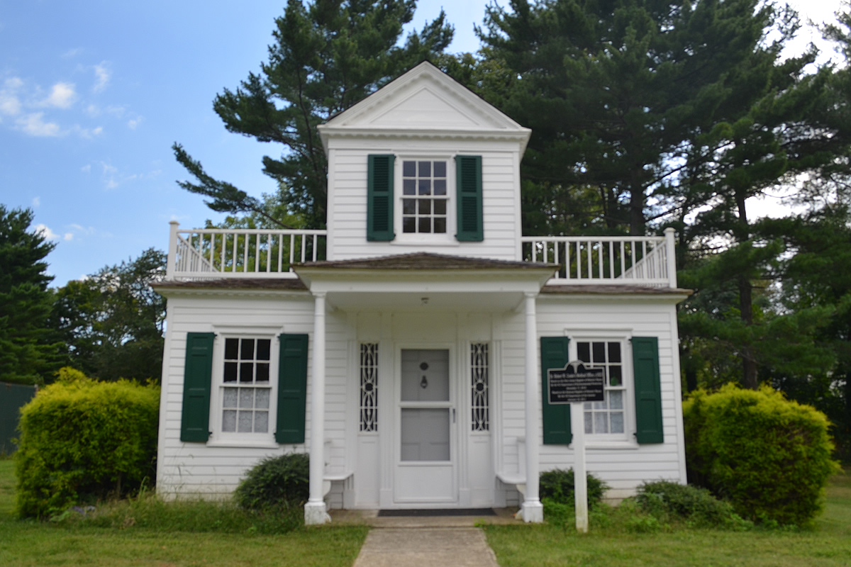
Dr. Robert W. Cooke Medical Office
Monument and historic site · National Register of Historic Places · 3.8 mi
Historic building in Monmouth County, New Jersey

Holmdel Horn Antenna
Monument and historic site · National Register of Historic Places · 2.7 mi
Microwave horn antenna in New Jersey, US
Holmes-Hendrickson House
Monument and historic site · National Register of Historic Places · 2.7 mi
Historic house in New Jersey, United States

Kovenhoven
Monument and historic site · National Register of Historic Places · 2.1 mi
Building in New Jersey, United States

Longstreet Farm
Monument and historic site · National Register of Historic Places · 2.6 mi
Living history farm in Holmdel, New Jersey

Maj. John Burrowes Mansion
Monument and historic site · National Register of Historic Places · 2.8 mi
Building in New Jersey, United States
Old Kentuck
Monument and historic site · National Register of Historic Places · 1.0 mi
Historic house in Monmouth County, New Jersey

Old Scots Burying Ground
Monument and historic site · National Register of Historic Places · 2.9 mi
Historic cemetery in Monmouth County, New Jersey

Parks, trails and playgrounds13

Freneau Woods Park
Park · 2.0 mi
Park in Monmouth County, New Jersey, United States of America



1 more on the map.
Restaurants and cafes21

Shanghai Bun - Matawan
Restaurant · 2.1 mi
952 State Route 34 Ste 6, Matawan
Mo,We,Th,Fr,Sa,Su 11:00-22:00; Tu off
Park Place Diner
Restaurant · Diner · 1.8 mi
1040 Route 34, Matawan
Su-Th 06:00-01:00; Fr-Sa 06:00-03:00


West Lake Plum House
Restaurant · 1.9 mi
1016 State Route 34 Ste 2, Matawan
Mo,Tu,We,Th,Su 11:30-21:30; Fr,Sa 11:30-22:00
Sri Krishna Vegan Bhojanashala (Temple Cafeteria)
Restaurant · Indian, Hindu, Asian · 1.5 mi
Mo-Th off; Fr 06:00-20:30; Sa-Su 11:30-20:30


9 more on the map.
Churches and places of worship15
Holmdel Dutch Reformed Church
Church · National Register of Historic Places · 3.3 mi
Upper Meeting House of the Baptist Church of Middletown
Church · National Register of Historic Places · 3.3 mi
Matawan United Methodist Church
Church · Methodist · 2.2 mi
Atlantic Avenue, Aberdeen
Sri Guruvayurappan Temple
Place of worship · Hindu · 1.6 mi
31 Wooleytown Road, Morganville
Shopping5
Gas and EV charging4
Schools, colleges and libraries51
Healthcare2
CORE Medical & Wellness
Clinic and pharmacy · 1.1 mi
1320 Suite A NJ-34, Aberdeen Township
Map of Morganville
125 places. The map loads OpenStreetMap tiles when you open it.
Climate by month
Monthly table
| Month | High | Low | Rain |
|---|---|---|---|
| Jan | 42°F | 23°F | 3.9 in |
| Feb | 44°F | 25°F | 3.1 in |
| Mar | 51°F | 31°F | 4.2 in |
| Apr | 63°F | 41°F | 3.8 in |
| May | 72°F | 51°F | 3.8 in |
| Jun | 81°F | 60°F | 4.4 in |
| Jul | 86°F | 66°F | 4.7 in |
| Aug | 85°F | 63°F | 4.1 in |
| Sep | 78°F | 56°F | 4.2 in |
| Oct | 67°F | 44°F | 4.1 in |
| Nov | 56°F | 36°F | 3.5 in |
| Dec | 47°F | 28°F | 4.7 in |
U.S. Climate Normals 1991-2020 for Freehold-Marlboro (4 mi away), NOAA NCEI.
People and cost of living
American Community Survey 5-year estimates, 2020-2024, U.S. Census Bureau. Estimates have margins of error, larger for small towns.
Disaster history
Monmouth County has had 16 federal disaster declarations since 2000, most often for hurricanes.
- 2021-09-05: Remnants Of Hurricane Ida (Hurricane)
- 2021-09-02: Remnants Of Hurricane Ida (Hurricane)
- 2020-12-11: Tropical Storm Isaias (Hurricane)
- 2020-03-25: Covid-19 Pandemic (Biological)
- 2020-03-13: Covid-19 (Biological)
- 2016-03-14: Severe Winter Storm And Snowstorm (Severe Storm)
OpenFEMA disaster declarations summaries.
Getting there and nearby towns
Monmouth Executive Airport (BLM) is the nearest airport with scheduled flights listed in OpenStreetMap, 14 miles away.
- Matawan 2 mi north, about 4 min by car
- Brownville 4 mi northwest, about 6 min by car
- Robertsville 4 mi southwest, about 7 min by car
- Keyport 4 mi northeast, about 7 min by car
- Old Bridge 5 mi west, about 9 min by car
- Cliffwood Beach 5 mi north, about 8 min by car
- Laurence Harbor 5 mi north, about 8 min by car
- Madison Park 6 mi northwest, about 9 min by car
- Lincroft 6 mi southeast, about 10 min by car
- Keansburg 7 mi northeast, about 11 min by car
Drive times are estimates from straight-line distance, not routes.
Local news
Headlines from INDB, the NEMICO news database.
Reviews, tips and questions
Loading what members have shared...
Sources and licences
- NCES EDGE (Public domain): public schools
- NOAA NCEI U.S. Climate Normals 1991-2020 (Public domain): climate by month
- OpenFEMA (Public domain): disaster declarations
- OpenStreetMap contributors (ODbL 1.0): places, airports, map data
- U.S. Census Bureau (Public domain): population, income, housing, education, commute
- Wikidata (CC0 1.0): elevation, founding date, time zone, website, landmarks and historic places
- Wikimedia Commons (see each image): photos
- Wikipedia (CC BY-SA 4.0): overview and history text
Photo credits
- Morganville, NJ, Mr. Matté (if there is an issue with this image, contact me using this image's Commons talk page , my Commons user talk page , or my English Wikipedia user talk page ; I'll know about it a lot faster), CC BY 3.0
- Aberdeen Matawan station, KOknockout920 at English Wikipedia, CC BY-SA 3.0
- Old Kentuck, Marlboro Township, NJ, T.K. Kellers, Public domain
- Bell Works Primary Building (110125), Szeremeta, CC BY-SA 4.0
- Holmes-Hendrickson House front, Ben McLaughlin, CC BY-SA 3.0
- Holmdel Dutch Reformed Church, Ben McLaughlin, CC BY-SA 3.0
- Dr. Robert W. Cooke Medical Office front, Ben McLaughlin, CC BY-SA 3.0
- Kovenhoven, Ben McLaughlin, CC BY-SA 3.0
- Upper Meeting House of the Baptist Church of Middletown, Ben McLaughlin, CC BY-SA 3.0
- Major John Burrowes Mansion (EXTERIOR - EAST AND NORTH ELEVATIONS), Samuel E. Tilton, Public domain
- Cedar Grove School, Ben McLaughlin, CC BY-SA 3.0
- Horn Antenna-in Holmdel, New Jersey, NASA, Public domain
- Old Scots Burying Ground (16), Apc106, CC BY-SA 3.0
- Holmdel Park-Steeplechase Trail, Lithium6ion, Public domain
- PNC Bank Arts Center, Holmdel, New Jersey, US, Clyde Charles Brown, CC BY-SA 4.0

Page built October 30, 2026. Spotted a mistake? Tell us or suggest a place.