


Laurence Harbor, New Jersey
Laurence Harbor is a community of 6,191 people in Middlesex County, New Jersey.
Why visit Laurence Harbor
Townapedia lists 6 museums and landmarks, 14 parks and trails, 10 places to eat, 2 places to stay and 3 attractions in and around town.
Highlights include Morgan Draw, Raritan Bay Drawbridge, Aberdeen-Matawan and Cedar Grove School.
July is the warmest month, with average highs of 86°F; January lows average 23°F, and about 29 inches of snow fall in a normal year.
Weather in Laurence Harbor
Forecast from the National Weather Service. Full forecast
About Laurence Harbor
Laurence Harbor is an unincorporated community and census-designated place (CDP) located along Raritan Bay within Old Bridge Township, Middlesex County, New Jersey, United States. As of the 2020 United States census, the CDP's population was 6,635, an increase of 99 (+1.5%) from the 6,536 recorded at the 2010 census, which in turn reflected an increase of 309 (+5.0%) from the 6,227 counted in the 2000 census.
From the Wikipedia article Laurence Harbor, New Jersey (this version), under CC BY-SA 4.0.
Things to do3

Morgan Draw
Bridge · 1.0 mi
Bridge in Morgan and Laurence Harbor, New Jersey

Raritan Bay Drawbridge
Bridge · 3.6 mi
Bridge in United States of America

Museums and landmarks6

Aberdeen-Matawan
Monument and historic site · National Register of Historic Places · 2.7 mi
NJ Transit rail station

Cedar Grove School
Monument and historic site · National Register of Historic Places · 2.7 mi
Historic building in Old Bridge Township, New Jersey

Great Beds Light
Lighthouse · National Register of Historic Places · 2.8 mi
Lighthouse in New Jersey, United States

Maj. John Burrowes Mansion
Monument and historic site · National Register of Historic Places · 2.6 mi
Building in New Jersey, United States

Ward's Point
Monument and historic site · National Register of Historic Places · 3.6 mi
Southernmost point in the State of New York

Parks, trails and playgrounds14

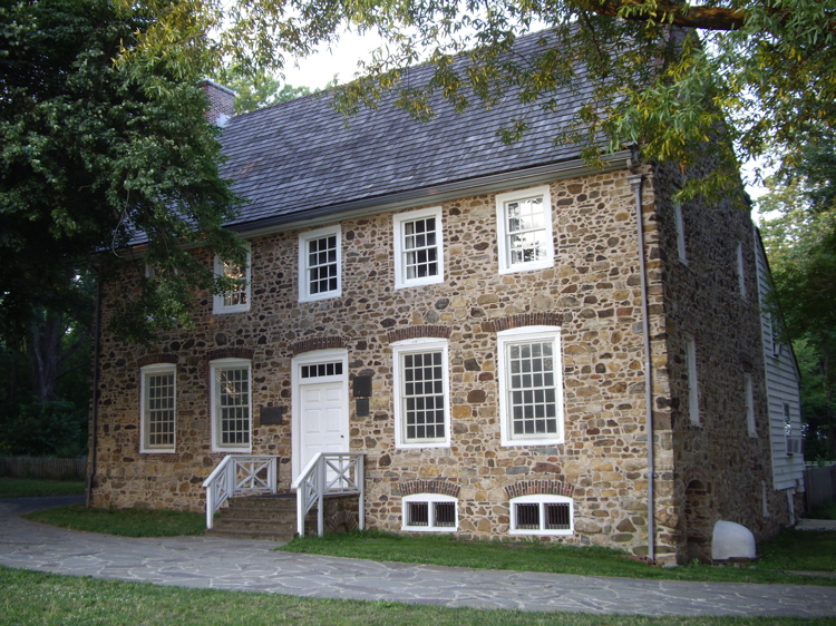


Conference House Park
Park · 3.5 mi
Park in the United States of America

Freneau Woods Park
Park · 3.2 mi
Park in Monmouth County, New Jersey, United States of America


2 more on the map.
Restaurants and cafes10

Lisa Italian Restaurant & Pizzeria
Restaurant · Italian, Pasta, Soup, Seafood, Salad, Dessert, Pizza, Sandwich · 1.0 mi
NJ 35 & Laurence Parkway, Laurence Harbor
Mo-Sa 10:00-22:30; Su 11:00-22:00

Dunkin'
Fast food · Donut, Coffee Shop · 1.8 mi
189 NJ 35, Cliffwood
Mo 05:00-20:30; Tu-Su 05:00-21:00
History
The lands known today as Laurence Harbor were part of the southernmost region inhabited by the Lenni Lenape tribe (also known as the Delaware) in the 17th century. In 1664, they became part of greater East Jersey, and in 1684 became part of South Amboy, which was much larger than it is today. In 1869, Madison Township split off from South Amboy; it was renamed Old Bridge Township in 1975.
European settlement of the area was linked to commerce passing through the Amboys along the Raritan River. From a military perspective, the area was useful for its high bayside cliffs, which allowed strategic observation of ships traveling between New York Harbor and the Atlantic Ocean.
From the History section of Laurence Harbor, New Jersey on Wikipedia, under CC BY-SA 4.0.
Where to stay2
Churches and places of worship6
Saint Mark African Methodist Episcopal Zion Church
Church · African Methodist Episcopal Zion · 1.2 mi
Shopping2
Gas and EV charging2
Schools, colleges and libraries45
Old Bridge Public Library - Laurence Harbor Branch
Library · 1.0 mi
302 Laurence Parkway, Laurence Harbor
Academy For Urban Leadership Charter School
School · 5.2 mi
612 Amboy Ave, Perth Amboy
Map of Laurence Harbor
90 places. The map loads OpenStreetMap tiles when you open it.
Climate by month
Monthly table
| Month | High | Low | Rain | Snow |
|---|---|---|---|---|
| Jan | 40°F | 23°F | 3.7 in | 8.3 in |
| Feb | 43°F | 24°F | 3.0 in | 9.3 in |
| Mar | 51°F | 31°F | 4.4 in | 5.2 in |
| Apr | 62°F | 41°F | 3.9 in | 0.6 in |
| May | 72°F | 51°F | 4.0 in | 0.0 in |
| Jun | 81°F | 60°F | 4.8 in | 0.0 in |
| Jul | 86°F | 66°F | 4.8 in | 0.0 in |
| Aug | 85°F | 64°F | 4.7 in | 0.0 in |
| Sep | 78°F | 56°F | 4.2 in | 0.0 in |
| Oct | 66°F | 44°F | 4.1 in | 0.2 in |
| Nov | 56°F | 35°F | 3.4 in | 0.5 in |
| Dec | 45°F | 28°F | 4.5 in | 4.9 in |
U.S. Climate Normals 1991-2020 for New Brunswick 3 Se Hcn (9 mi away), NOAA NCEI.
People and cost of living
American Community Survey 5-year estimates, 2020-2024, U.S. Census Bureau. Estimates have margins of error, larger for small towns.
Disaster history
Middlesex County has had 17 federal disaster declarations since 2000, most often for hurricanes.
- 2021-09-05: Remnants Of Hurricane Ida (Hurricane)
- 2021-09-02: Remnants Of Hurricane Ida (Hurricane)
- 2020-03-25: Covid-19 Pandemic (Biological)
- 2020-03-13: Covid-19 (Biological)
- 2016-03-14: Severe Winter Storm And Snowstorm (Severe Storm)
- 2012-10-30: Hurricane Sandy (Hurricane)
OpenFEMA disaster declarations summaries.
Getting there and nearby towns
Linden Airport (LDJ) is the nearest airport with scheduled flights listed in OpenStreetMap, 12 miles away.
- Cliffwood Beach 2 mi east, about 4 min by car
- Keyport 3 mi east, about 5 min by car
- Sayreville 4 mi west, about 6 min by car
- Brownville 4 mi southwest, about 6 min by car
- Perth Amboy 5 mi north, about 8 min by car
- Old Bridge 5 mi southwest, about 8 min by car
- Keansburg 5 mi east, about 9 min by car
- Keasbey 5 mi northwest, about 9 min by car
- South River 6 mi west, about 10 min by car
- Hopelawn 6 mi north, about 10 min by car
Drive times are estimates from straight-line distance, not routes.
Local news
Headlines from INDB, the NEMICO news database.
Reviews, tips and questions
Loading what members have shared...
Sources and licences
- NCES EDGE (Public domain): public schools
- NOAA NCEI U.S. Climate Normals 1991-2020 (Public domain): climate by month
- OpenFEMA (Public domain): disaster declarations
- OpenStreetMap contributors (ODbL 1.0): places, airports, map data
- U.S. Census Bureau (Public domain): population, income, housing, education, commute
- Wikidata (CC0 1.0): elevation, founding date, time zone, website, landmarks and historic places
- Wikimedia Commons (see each image): photos
- Wikipedia (CC BY-SA 4.0): overview and history text
Photo credits
- 2018-05-20 10 09 49 View south along New Jersey State Route 444 (Garden State Parkway) 1 mile north of Exit 120 (Laurence Harbor, Matawan) in Old Bridge Township, Middlesex County, New Jersey, Famartin, CC BY-SA 4.0
- 2020-07-16 11 19 52 View south along New Jersey State Route 444 (Garden State Parkway) at Exit 120 (Laurence Harbor, Matawan) in Old Bridge Township, Middlesex County, New Jersey, Famartin, CC BY-SA 4.0
- 2021-05-28 08 30 45 View north along the northbound lanes of New Jersey State Route 444 (Garden State Parkway) from the overpass for Middlesex County Route 626 (Laurence Harbor-Matawan Road) in Old..., Famartin, CC BY-SA 4.0
- 2021-05-28 08 28 09 View south along the northbound lanes of New Jersey State Route 444 (Garden State Parkway) from the overpass for Middlesex County Route 626 (Laurence Harbor-Matawan Road) in Old..., Famartin, CC BY-SA 4.0
- 2020-07-11 15 21 29 View north along New Jersey State Route 444 (Garden State Parkway) at Exit 120 (Laurence Harbor, Matawan) in Old Bridge Township, Middlesex County, New Jersey, Famartin, CC BY-SA 4.0
- 2021-05-28 08 37 40 View north along the southbound lanes of New Jersey State Route 444 (Garden State Parkway) from the overpass for Middlesex County Route 626 (Laurence Harbor-Matawan Road) in Old..., Famartin, CC BY-SA 4.0
- 2021-05-28 08 25 12 View south along the southbound lanes of New Jersey State Route 444 (Garden State Parkway) from the overpass for Middlesex County Route 626 (Laurence Harbor-Matawan Road) in Old..., Famartin, CC BY-SA 4.0
- 2018-05-26 08 21 43 View north along New Jersey State Route 444 (Garden State Parkway) south of Exit 120 (Laurence Harbor, Matawan) on the border of Aberdeen Township and Matawan in Monmouth County..., Famartin, CC BY-SA 4.0
- Aberdeen Matawan station, KOknockout920 at English Wikipedia, CC BY-SA 3.0
- South Pole SI jeh, Jim.henderson, Public domain
- Major John Burrowes Mansion (EXTERIOR - EAST AND NORTH ELEVATIONS), Samuel E. Tilton, Public domain
- Cedar Grove School, Ben McLaughlin, CC BY-SA 3.0
- Raritan Bay Bridge, Lithium6ion, Public domain
- Conference-house-staten-island, Dmadeo, CC BY-SA 3.0
- Tapinella atrotomentosa 156730376, Zachary L. Standig, CC0
- Pitch Pine cone, John B. from Highland Park, NJ, United States, CC BY 2.0
- Cheesequake State Park First Day Hike 2017 group descends hill, Jonathan Schilling, CC BY-SA 4.0
- Cheesequake State Park First Day Hike 2017 the two terrains, Jonathan Schilling, CC BY-SA 4.0
- Cheesequake Blue Trail indicator, Steven Reynolds, CC BY 2.0
- Cheesequake State Park First Day Hike 2017 guide checks on group, Jonathan Schilling, CC BY-SA 4.0
- GillespieExplosion, Unknown photographer, Public domain
- Governor Phil Murphy riding on NJ Transit train March 2019, Jonathan Schilling, CC BY-SA 4.0
- Amazing sunset with sun rays cutting across at the beach, Ramesh Sankaranarayanan, CC BY-SA 4.0
- Amazing sunset at the beach, Ramesh Sankaranarayanan, CC BY-SA 4.0
- Amazing sunset beach view, Ramesh Sankaranarayanan, CC BY-SA 4.0
- 2018-05-20 10 18 51 View north along New Jersey State Route 444 (Garden State Parkway) just south of Exit 120 in Old Bridge Township, Middlesex County, New Jersey, Famartin, CC BY-SA 4.0
- 2018-05-18 16 31 22 View north along New Jersey State Route 35 at Morgan Avenue in Sayreville, Middlesex County, New Jersey, Famartin, CC BY-SA 4.0
- 2018-05-18 16 26 55 View north along New Jersey State Route 35 at Furman Boulevard in Old Bridge Township, Middlesex County, New Jersey, Famartin, CC BY-SA 4.0
- 2018-05-26 08 28 27 View south along New Jersey State Route 444 (Garden State Parkway) just south of Exit 120 in Aberdeen Township, Monmouth County, New Jersey, Famartin, CC BY-SA 4.0
- 2018-05-18 16 20 10 View south along New Jersey State Route 35 at Rosewood Drive in Old Bridge Township, Middlesex County, New Jersey, Famartin, CC BY-SA 4.0
- Monmouth CR 6A sb from CR 6A, Matawan, NJ, Aug. 2026, Mr. Matté (if there is an issue with this image, contact me using this image's Commons talk page , my Commons user talk page , or my English Wikipedia user talk page ; I'll know about it a lot faster), CC BY-SA 4.0
- 2021-05-27 18 13 09 View north along the southbound lanes of New Jersey State Route 444 (Garden State Parkway) from the overpass for Monmouth County Route 6A (Cliffwood Avenue) in Aberdeen Township..., Famartin, CC BY-SA 4.0
- 2021-05-27 18 10 38 View south along the southbound lanes of New Jersey State Route 444 (Garden State Parkway) from the overpass for Monmouth County Route 6A (Cliffwood Avenue) in Aberdeen Township..., Famartin, CC BY-SA 4.0
- 2021-05-27 18 12 03 View north along the northbound lanes of New Jersey State Route 444 (Garden State Parkway) from the overpass for Monmouth County Route 6A (Cliffwood Avenue) in Aberdeen Township..., Famartin, CC BY-SA 4.0
- 2021-05-27 18 11 37 View south along the northbound lanes of New Jersey State Route 444 (Garden State Parkway) from the overpass for Monmouth County Route 6A (Cliffwood Avenue) in Aberdeen Township..., Famartin, CC BY-SA 4.0
- Cheesequake State Park entrance to Blue Trail, Jonathan Schilling, CC BY-SA 4.0
- 2020-07-11 15 25 26 View north along New Jersey State Route 444 (Garden State Parkway) at the Cheesequake Service Area in Sayreville, Middlesex County, New Jersey, Famartin, CC BY-SA 4.0
- 2018-05-26 08 23 25 View north along New Jersey State Route 444 (Garden State Parkway) just south of Exit 120 in Aberdeen Township, Monmouth County, New Jersey, Famartin, CC BY-SA 4.0
- Middlesex CR 689 wb approaching NJ Route 34, Aug. 2026, Mr. Matté (if there is an issue with this image, contact me using this image's Commons talk page , my Commons user talk page , or my English Wikipedia user talk page ; I'll know about it a lot faster), CC BY-SA 4.0
- 2018-05-26 15 17 23 View south along New Jersey State Route 35 at County Road in Aberdeen Township, Monmouth County, New Jersey, Famartin, CC BY-SA 4.0


Page built October 30, 2026. Spotted a mistake? Tell us or suggest a place.