


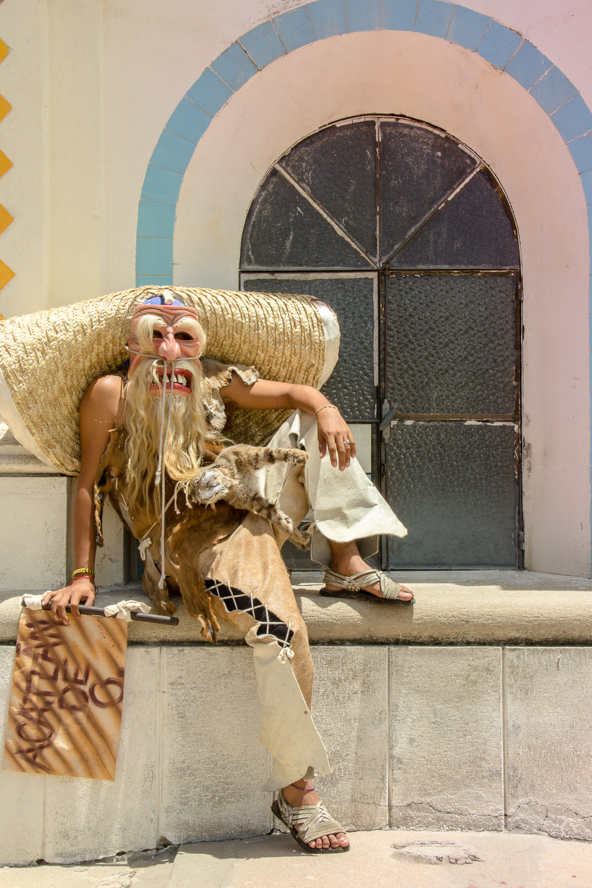


Acatlán de Osorio, Mexico
Acatlán de Osorio is a town of 19,341 people in Puebla, Mexico.
Why visit Acatlán de Osorio
Townapedia lists 1 park or trail, 1 place to eat and 2 places to stay in and around town.
Weather in Acatlán de Osorio
Forecast from MET Norway (CC BY 4.0). Full forecast
About Acatlán de Osorio
Acatlán de Osorio is a city in the Mexican state of Puebla. The shortened name Acatlán, is commonly used to refer to the municipality of which it is the seat, and to the city itself. It is at an elevation of 1,213 m (3,981 ft). In the 2020 census, the population of the city was 19,341.
From the Wikipedia article Acatlán de Osorio (this version), under CC BY-SA 4.0.
Parks, trails and playgrounds1

Restaurants and cafes1

Where to stay2

Churches and places of worship1


History
The Mixtecs who ruled this area prior to the Spanish incursion called it Yucuyuxi or Yuta Tisaha. Acatlán was the capital of a strategic province of the Aztec Empire after being conquered by Moctezuma I, and its rulers were related those of the Mexica. It sent gifts of mantas and rabbit skins to Tenochtitlan and received gifts in return, and every 80 days, two nobles were sent along with their wives to serve in the royal palace. Although mainly inhabited by Mixtecs, the town had a Nahua minority. Salt and cochineal dye were important local products. Acatlan fought wars with Itzocan (now Izúcar de Matamoros), Tepexic, Piaxtla and Petlalcingo. In New Spain, Acatlán was the seat of the alcaldía mayor Acatlán y Piastla.
The modern city of Acatlán was founded on January 6, 1712, and built on the ruins of a town destroyed by an earthquake in 1711. It attained city status on April 3, 1883.
From the History section of Acatlán de Osorio on Wikipedia, under CC BY-SA 4.0.
Shopping1
Gas and EV charging1
Schools, colleges and libraries6
Healthcare2
Map of Acatlán de Osorio
15 places. The map loads OpenStreetMap tiles when you open it.
Getting there and nearby towns
Aeropuerto Nacional de Tehuacán (TCN) is the nearest airport with scheduled flights listed in OpenStreetMap, 74 km away.
- Las Nieves 2 km south, about 2 min by car
- Amatitlán de Azueta 4 km southwest, about 4 min by car
- Tetelcingo 5 km northeast, about 5 min by car
- San Bernardo 6 km west, about 6 min by car
- San Francisco Rancho Nuevo 6 km north, about 6 min by car
- Tianguistengo 7 km northeast, about 7 min by car
- La Huerta 7 km northeast, about 7 min by car
- Ciudad de Huajuapan de León 52 km southeast, about 52 min by car
- Tehuacán 75 km northeast, about 1 h 15 min by car
- Atlixco 88 km northwest, about 1 h 30 min by car
Drive times are estimates from straight-line distance, not routes.
Local news
Headlines from INDB.
Reviews, tips and questions
Loading what members have shared...
Sources and licences
- GeoNames (CC BY 4.0): population, coordinates, regions and time zone
- OpenStreetMap contributors (ODbL 1.0): places, airports, map data
- Wikidata (CC0 1.0): elevation, founding date, time zone, website
- Wikimedia Commons (see each image): photos
- Wikipedia (CC BY-SA 4.0): overview and history text
Photo credits
- Camino Tradicional, Andrés Junco, CC BY 3.0
- Cúpula de las oficinas parroquiales de Acatlán, Yavidaxiu, CC BY-SA 3.0
- Cúpulas del templo de Acatlán, Yavidaxiu, CC BY-SA 3.0
- Tetechtlakautli, Andrés Junco, CC BY 3.0
- Acateco, Andrés Junco, CC BY 3.0
- Tachi, Andrés Junco, CC BY 3.0
- AcatlanPuebla039, AlejandroLinaresGarcia, CC BY-SA 4.0
- AcatlanPuebla001, AlejandroLinaresGarcia, CC BY-SA 4.0
- AcatlanPuebla010, AlejandroLinaresGarcia, CC BY-SA 4.0
- AcatlanPuebla002, AlejandroLinaresGarcia, CC BY-SA 4.0
- AcatlanPuebla008, AlejandroLinaresGarcia, CC BY-SA 4.0
- AcatlanPuebla003, AlejandroLinaresGarcia, CC BY-SA 4.0
- AcatlanPuebla011, AlejandroLinaresGarcia, CC BY-SA 4.0
- AcatlanPuebla004, AlejandroLinaresGarcia, CC BY-SA 4.0
- AcatlanPuebla025, AlejandroLinaresGarcia, CC BY-SA 4.0
- AcatlanPuebla026, AlejandroLinaresGarcia, CC BY-SA 4.0
- AcatlanPuebla012, AlejandroLinaresGarcia, CC BY-SA 4.0
- AcatlanPuebla013, AlejandroLinaresGarcia, CC BY-SA 4.0
- San Juan Bautista de Acatlán, Yavidaxiu, CC BY-SA 3.0


Page built November 4, 2026. Spotted a mistake? Tell us or suggest a place.