


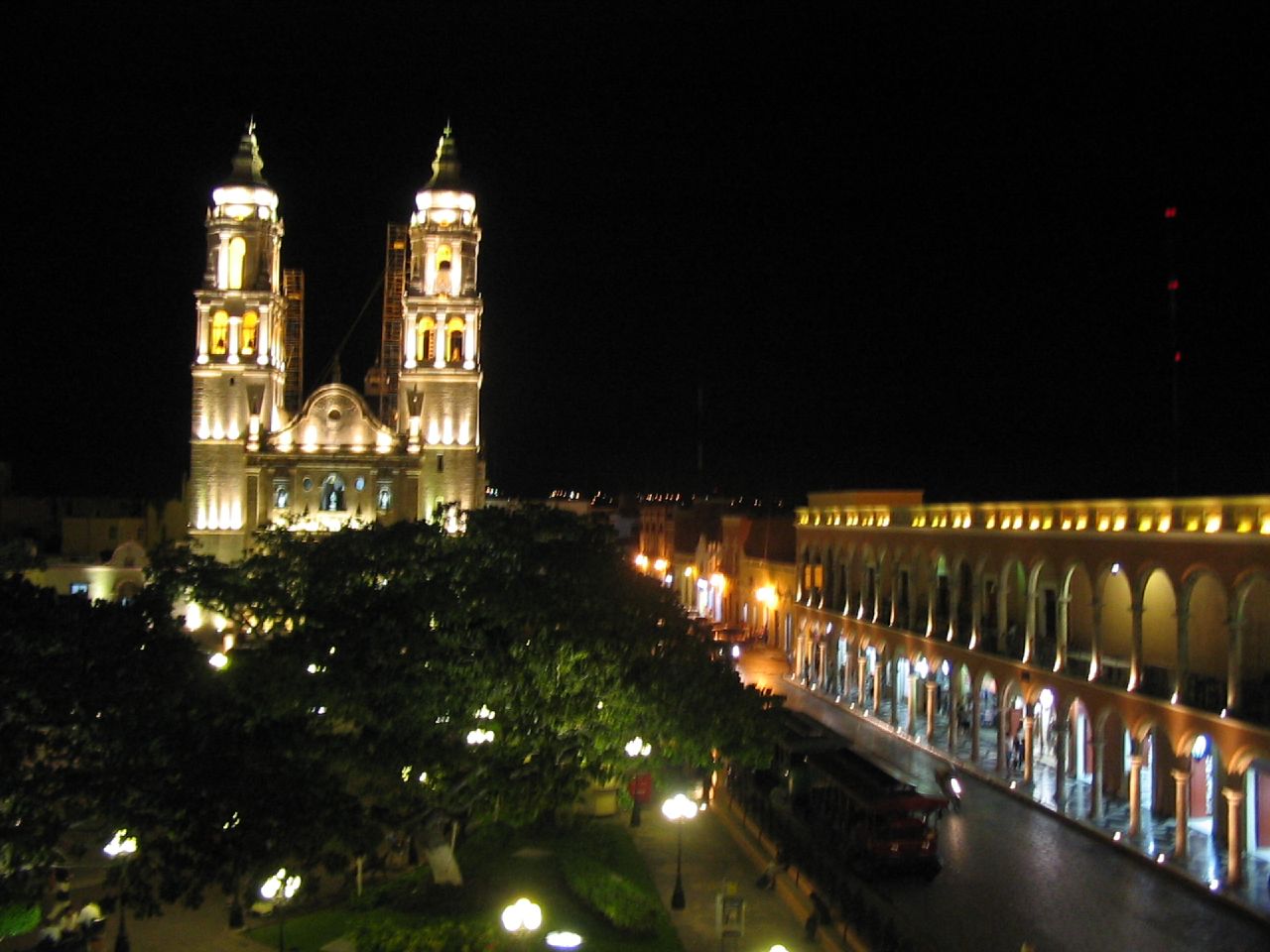


Campeche, Mexico
San Francisco de Campeche
Campeche is a regional capital of 220,389 people in Campeche, Mexico, founded in October 14, 1540.
Why visit Campeche
Townapedia lists 32 museums and landmarks, 102 parks and trails, 98 places to eat, 48 places to stay and 5 attractions in and around town.
Highlights include Autonomous University of Campeche, Bastion of Solitude, Maya Architecture Museum and Estadio Leandro Dominguez.
Weather in Campeche
Forecast from MET Norway (CC BY 4.0). Full forecast
About Campeche
San Francisco de Campeche (pronounced [saɱ fɾanˈsisko ðe kamˈpetʃe]; Yucatec Maya: Ahk'ìin Pech, pronounced [aχkʼiːn˥˧ pʰetʃ]), 19th c., also known simply as Campeche, is the capital and largest city of the Mexican state of Campeche, and the seat of Campeche Municipality. It is located on the shore of the Bay of Campeche in the Gulf of Mexico. The city had a population of 220,389 in the 2010 census, while the municipality had a population of 259,005.
From the Wikipedia article Campeche (city) (this version), under CC BY-SA 4.0.
Travel tips from other travellers: Campeche on Wikivoyage (CC BY-SA 4.0).
Things to do5

Autonomous University of Campeche
School · 4.3 km
Educational institution in Mexico

Teatro de la Ciudad" Francisco de Paula Toro"
Cinema and theater · 1.9 km
Calle 12 de Colón, Campeche
Museums and landmarks32

Bastion of Solitude
Museum · 2.3 km
Calle 8, Zona Centro, 24000 Campeche, Camp., Mexiko
Mo-Su 09:00-18:00



20 more on the map.
Parks, trails and playgrounds102


PARQUE LICENCIADO PABLO GARCIA
Park · 0.7 km
PARQUE INAUGURADO JUNTO CON EL FRACCIONAMIENTO MOTIVO POR EL CUAL RECIBE EL MISMO NOMBRE.
FOVISSSTE PABLO GARCIA BLOQUE 12 Calle 16, CAMPECHE
Parque de los Musicos
Park · 1.7 km
Parque de la Libertad de Expresión o del Músico
Parque de San Martín
Park · 1.9 km
Parque del IV Centenario, mejor conocido como San Martín
Parque del Fraccionamiento Pablo Garcia
Park · 0.8 km
Parque correspondiente al fraccionamiento
90 more on the map.
Restaurants and cafes98

Casa Tiramisú Niravo
Cafe · Italian · 1.2 km
20-A Calle 12-A, San Francisco de Campeche
13:30-20:00 || "by appointment"

Casa Vittoria
Restaurant · Italian · 2.0 km
Calle 59 Antes América, San Francisco de Campeche
Mo-Su 14:00-00:00

La Parroquia
Restaurant · Mexican · 2.1 km
Wi-Fi Name: Parroquia PW: 1234567890
8 Calle 55 Indepencia
24/7
Aduana
Restaurant · Mexican · 2.3 km
1 Calle 59
Mo-Th, Su 08:00-00:00; Fr, Sa 08:00-02:00

Capressito
Cafe · Breakfast, Mexican · 2.4 km
25 Calle 65 de Reforma
Mo-Sa 09:00-13:00, 17:00-22:00
Crush Fast Food
Restaurant · Burger · 2.1 km
16 Calle 57 de Hidalgo, San Francisco de Campeche
Tu-Su 14:00-22:00
La María Cocina Peninsular
Restaurant · Local, Mexican · 2.2 km
173 Calle 8 de la Muralla
Su-Mo, We-Th 13:00-21:00; Fr-Sa 13:00-22:00
Luz de Luna
Restaurant · Mexican · 2.2 km
6 Calle 59 Antes América
Su-Th 08:00-23:00; Fr-Sa 08:00-00:00
86 more on the map.
History
The modern city of San Francisco de Campeche was founded in 1540 by Francisco de Montejo upon the site of Can Pech, the former capital city of a Maya chiefdom. The city of Campeche was terrorized by pirates and marauders (such as the 1633 Sack of Campeche and the 1663 Sack of Campeche) until the city constructed major fortifications. The fortifications were started in 1686 and completed in 1704.
From the History section of Campeche (city) on Wikipedia, under CC BY-SA 4.0.
Where to stay48
Churches and places of worship22
Cathedral of Our Lady of the Immaculate Conception
Church · Catholic · 2.1 km
Our Lady of the Immaculate Conception Cathedral, Campeche
Church · 2.1 km
Monumento a la Virgen de Guadalupe
Church · Catholic · 0.7 km
FOVISSSTE PABLO GARCIA BLOQUE 10 Avenida Gobernadores, Campeche
Virgen de la Concepción
Church · Catholic · 0.7 km
ESTACIONAMIENTO ESC. PRIM PABLO GARCIA Avenida Gobernadores, CAMPECHE
Nicho de La Virgen de Guadalupe
Church · Catholic · 1.3 km
2 Privada de Arboleda, San Francisco de Campeche
Parroquia de San Rafael Arcángel
Church · Catholic · 2.3 km
S/N Calle Pedro Moreno, San Francisco de Campeche
Parroquia de Santa Cecilia
Church · Catholic · 2.3 km
S/N Avenida Casa de Justicia, CAmpeche
La Iglesia de Jesucristo de los Santos de los Últimos Días
Church · Mormon · 2.0 km
Shopping23
Gas and EV charging10
Schools, colleges and libraries21
ESC. PRIM. URB. VENUSTIANO CARRANZA
School · 1.4 km
Calle10, SanFranciscoCampeche
Healthcare11
Map of Campeche
250 places. The map loads OpenStreetMap tiles when you open it.
Getting there and nearby towns
Ing. Alberto Acuña Ongay International Airport (CPE) is the nearest airport with scheduled flights listed in OpenStreetMap, 3 km away.
- Chiná 8 km south, about 8 min by car
- Lerma 10 km southwest, about 10 min by car
- Castamay 9 km east, about 9 min by car
- San Francisco Kobén 13 km northeast, about 13 min by car
- Hampolol 16 km northeast, about 16 min by car
- Bethania 17 km northeast, about 17 min by car
- Chemblás 19 km northeast, about 19 min by car
- Pocyaxum 21 km southeast, about 21 min by car
- Nilchí 26 km east, about 26 min by car
- Seybaplaya 29 km southwest, about 29 min by car
Drive times are estimates from straight-line distance, not routes.
Local news
Headlines from INDB.
Reviews, tips and questions
Loading what members have shared...
Sources and licences
- GeoNames (CC BY 4.0): population, coordinates, regions and time zone
- OpenStreetMap contributors (ODbL 1.0): places, airports, map data
- Wikidata (CC0 1.0): elevation, founding date, time zone, website, landmarks and historic places
- Wikimedia Commons (see each image): photos
- Wikipedia (CC BY-SA 4.0): overview and history text
Photo credits
- Montaje de San Francisco de Campeche, self., CC BY-SA 4.0
- DIA DE MUERTOS EN CAMPECHE - panoramio, ERVIN ESCOBAR, CC BY-SA 3.0
- Guacamole with Tortilla Chips - Colonial Quarter, Campeche, Bernard DUPONT, CC BY-SA 2.0
- Parque at night, Campeche, CHeitz, CC BY 2.0
- Burrito in salsa verde - Colonial Quarter, Campeche, Bernard DUPONT, CC BY-SA 2.0
- Campeche Cd Mayo 2011 - Calle Ocho, Hermenegildo Santamaria, CC BY 2.0
- Campeche Cd Mayo 2011 - 01, Hermenegildo Santamaria, CC BY 2.0
- Campeche Cd Mayo 2011 - 04, Hermenegildo Santamaria, CC BY 2.0
- Campeche Cd Mayo 2011 - 02, Hermenegildo Santamaria, CC BY 2.0
- Centro histórico Campeche 21, WendyAvilesR, CC BY-SA 4.0
- Catedral de Campeche 08, Dge, CC BY-SA 4.0
- Catedral de Campeche 16, Dge, CC BY-SA 4.0
- Catedral de Campeche 14, Dge, CC BY-SA 4.0
- Campeche plaza centro, Nathanael Vinnue Avila Cruz, CC BY-SA 3.0
- Jardin Centro Campeche, Nathanael Vinnue Avila Cruz, CC BY-SA 3.0
- Catedral de Campeche 01, Dge, CC BY-SA 4.0
- Catedral de Campeche 03, Dge, CC BY-SA 4.0
- Catedral de Campeche 11, Dge, CC BY-SA 4.0
- CEntro Campeche, Nathanael Vinnue Avila Cruz, CC BY-SA 3.0
- San Juan de Dios, Campeche, FotoCaribe, CC BY-SA 4.0
- Rectoria13, UACAM, CC BY 3.0
- Campeche6, lapin.lapin, CC BY-SA 2.0
- DIA DE MUERTOS - panoramio, ERVIN ESCOBAR, CC BY-SA 3.0
- DIA DE MUERTOS - panoramio (1), ERVIN ESCOBAR, CC BY-SA 3.0
- Loro, Ashley Escamilla Carpizo, CC BY 3.0
- DIA DE MUERTOS - panoramio (3), ERVIN ESCOBAR, CC BY-SA 3.0
- Xcavil de Yaxché (3675947060), Cornell University Library, No restrictions
- San Francisquito, FotoCaribe, CC BY-SA 4.0
- VISTA PANORÁMICA DEL TERRAPLÉN, MARCO A. YAM CAMACHO, CC BY-SA 3.0
- PASO DE AGUA DEL RÍO VERDE, HAMPOLOL, MARCO ANTONIO YAM CAMACHO, CC BY-SA 3.0
- PANORÁMICA DE LOS MUROS DE SOPORTE DEL PUENTE DE HAMPOLOL, MARCO ANTONIO YAM CAMACHO, CC BY-SA 3.0
- PATIO CENTRAL. SAN JOSÉ EL ALTO, MARCO A. YAM CAMACHO, CC BY-SA 3.0
- De la sala a la recamara, Flor de María Vadillo Damas, CC BY-SA 3.0
- Chicanná1, Rose Vekony, CC BY-SA 3.0
- Puerta de Tierra 02, FotoCaribe, CC BY-SA 4.0
- Sobra agua, Flor de María Vadillo Damas, CC BY-SA 3.0
- Fuerte de San Muguel 2, Javiericardo, CC BY-SA 3.0
- Cocina típica Campechana, Flor de María Vadillo Damas, CC BY-SA 3.0
- GARITA, MARCO A. YAM CAMACHO, CC BY-SA 3.0
- Vista nocturna de la catedral desde el kiosko, Joeldesalvatierra, CC BY-SA 3.0
- Toma aérea del Baluarte de San Pedro 02, ProtoplasmaKid, CC BY-SA 4.0


Page built November 4, 2026. Spotted a mistake? Tell us or suggest a place.