
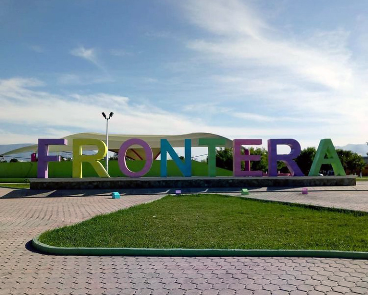


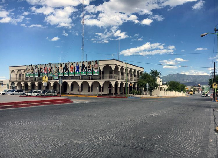


Frontera, Mexico
Frontera is a town of 69,462 people in Coahuila, Mexico, founded in 1884.
Why visit Frontera
Townapedia lists 4 museums and landmarks, 11 parks and trails, 14 places to eat, 2 places to stay and 1 attraction in and around town.
Highlights include Autonomous University of Coahuila, Parque Tecnológico and Plaza Tecnológico.
Weather in Frontera
Forecast from MET Norway (CC BY 4.0). Full forecast
About Frontera
Ciudad Frontera is a town in the northern Mexican state of Coahuila. It is in the east-central part of the state, just west of the city of Monclova. It is located in the state's central region (Región Centro).
From the Wikipedia article Ciudad Frontera (this version), under CC BY-SA 4.0.
Things to do1

Autonomous University of Coahuila
School · 4.1 km
Public research university in Mexico
Museums and landmarks4

Parks, trails and playgrounds11


Restaurants and cafes14



2 more on the map.
Where to stay2
Churches and places of worship16
Shopping4
Gas and EV charging10
Schools, colleges and libraries19
Healthcare3
Map of Frontera
84 places. The map loads OpenStreetMap tiles when you open it.
Getting there and nearby towns
Venustiano Carranza International Airport (LOV) is the nearest airport with scheduled flights listed in OpenStreetMap, 4 km away.
- Monclova 4 km southeast, about 4 min by car
- Colonia Diana Laura Riojas de Colosio 6 km northwest, about 6 min by car
- La Cruz 8 km northwest, about 8 min by car
- Ocho de Enero 9 km northwest, about 9 min by car
- Castaños 16 km south, about 16 min by car
- San Buenaventura 18 km northwest, about 18 min by car
- Nadadores 18 km northwest, about 18 min by car
- Sacramento 28 km west, about 28 min by car
- Abasolo 28 km north, about 28 min by car
- Lamadrid 37 km west, about 37 min by car
Drive times are estimates from straight-line distance, not routes.
Local news
Headlines from INDB.
Reviews, tips and questions
Loading what members have shared...
Sources and licences
- GeoNames (CC BY 4.0): population, coordinates, regions and time zone
- OpenStreetMap contributors (ODbL 1.0): places, airports, map data
- Wikidata (CC0 1.0): elevation, founding date, time zone, website, landmarks and historic places
- Wikimedia Commons (see each image): photos
- Wikipedia (CC BY-SA 4.0): overview and history text
Photo credits
- Stella nombre Frontera, Coahuila, MikSed, CC BY 4.0
- Locomotora en estación, Frontera, Coahuila, MikSed, CC BY 4.0
- Presidencia municipal de Frontera, Coahuila, MikSed, CC BY 4.0
- Recuerdos de la infancia, Danastern222, CC BY-SA 4.0
- Amanecer del Decierto, Danastern222, CC BY-SA 4.0
- Mis lelos, Danastern222, CC BY-SA 4.0
- Argemone de vida, Danastern222, CC BY-SA 4.0
- Bello es el manatial, Danastern222, CC BY-SA 4.0


Page built November 4, 2026. Spotted a mistake? Tell us or suggest a place.