




Why visit Ixtepec
Townapedia lists 2 museums and landmarks, 5 parks and trails, 3 places to eat and 3 places to stay in and around town.
Weather in Ixtepec
Forecast from MET Norway (CC BY 4.0). Full forecast
About Ixtepec
Ixtepec (formally: Ciudad Ixtepec; previously known as Villa de San Jerónimo Doctor) is a small city, and municipality of the same name, located in the state of Oaxaca, in southeastern Mexico.
From the Wikipedia article Ixtepec, Oaxaca (this version), under CC BY-SA 4.0.
Travel tips from other travellers: Ixtepec on Wikivoyage (CC BY-SA 4.0).
Museums and landmarks2


Parks, trails and playgrounds5



Restaurants and cafes3


Where to stay3

History
The name "Ixtepec" is derived from Nahuatl and roughly translates to either "view of the mountain" or "face of the mountain."Its name was Iztepeque until 1935, when it was officially changed to Ciudad Ixtepec. The founding of the city was most likely in the 16th century as a Zapotec settlement shortly before the Spanish Conquest. It remained an indigenous community until the 19th century, with its economy based on subsistence farming. In the early 20th century, the community grew in economic importance as its location made it attractive to foreign investment with the building of the Pan-American Highway, originally as a rail line.
From the History section of Ixtepec, Oaxaca on Wikipedia, under CC BY-SA 4.0.
Churches and places of worship3
La Iglesia de Jesucristo de los Santos de los Últimos Días
Church · Mormon
Carretera Guevea de Humboldt-Ciudad Ixtepec, CIUDAD IXTEPEC
Shopping4
FerreAcero López Lena S.A. de C.V.
Hardware store · 8.6 km
S/N Calle 13 de Septiembre, Asunción Ixtaltepec
Gas and EV charging1
Schools, colleges and libraries11
Bachillerato Asunción Ixtaltepec
School · Roman Catholic · 7.7 km
69 Avenida Morelos, Asunción Ixtaltepec
Healthcare4
Map of Ixtepec
36 places. The map loads OpenStreetMap tiles when you open it.
Getting there and nearby towns
Ixtepec Airport (IZT) is the nearest airport with scheduled flights listed in OpenStreetMap, 12 km away.
- Santo Domingo Chihuitán 7 km northwest, about 7 min by car
- Asunción Ixtaltepec 8 km southeast, about 8 min by car
- San Pedro Comitancillo 10 km southwest, about 10 min by car
- El Espinal 11 km southeast, about 11 min by car
- Santiago Laollaga 11 km west, about 11 min by car
- Magdalena Tlacotepec 12 km southwest, about 12 min by car
- Heroica Ciudad de Juchitán de Zaragoza 17 km southeast, about 17 min by car
- La Ventosa 17 km east, about 17 min by car
- Santo Domingo Tehuantepec 30 km southwest, about 30 min by car
- Salina Cruz 44 km south, about 44 min by car
Drive times are estimates from straight-line distance, not routes.
Local news
Headlines from INDB.
Reviews, tips and questions
Loading what members have shared...
Sources and licences
- GeoNames (CC BY 4.0): population, coordinates, regions and time zone
- OpenStreetMap contributors (ODbL 1.0): places, airports, map data
- Wikidata (CC0 1.0): elevation, founding date, time zone, website
- Wikimedia Commons (see each image): photos
- Wikipedia (CC BY-SA 4.0): overview and history text
Photo credits
- Morisonia incana, Alexis López Hernández, CC BY 4.0
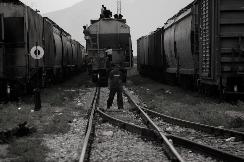
- Mexico train surfing migrants 2, Peter Haden, CC BY 2.0
- Mexico train surfing migrants 1, Peter Haden, CC BY 2.0
- Mexico train surfing migrants 4, Peter Haden, CC BY 2.0
- Mexico train surfing migrants 3, Peter Haden, CC BY 2.0
- ISS047-E-102409 - View of Earth, Earth Science and Remote Sensing Unit , Lyndon B. Johnson Space Center, Public domain
- ISS047-E-102411 - View of Earth, Earth Science and Remote Sensing Unit , Lyndon B. Johnson Space Center, Public domain
- ISS047-E-102412 - View of Earth, Earth Science and Remote Sensing Unit , Lyndon B. Johnson Space Center, Public domain
- ISS047-E-102413 - View of Earth, Earth Science and Remote Sensing Unit , Lyndon B. Johnson Space Center, Public domain
- ISS047-E-102410 - View of Earth, Earth Science and Remote Sensing Unit , Lyndon B. Johnson Space Center, Public domain
- ISS047-E-102414 - View of Earth, Earth Science and Remote Sensing Unit , Lyndon B. Johnson Space Center, Public domain
- ISS047-E-107104 - View of Earth, Earth Science and Remote Sensing Unit , Lyndon B. Johnson Space Center, Public domain
- ISS047-E-102417 - View of Earth, Earth Science and Remote Sensing Unit , Lyndon B. Johnson Space Center, Public domain
- ISS047-E-102415 - View of Earth, Earth Science and Remote Sensing Unit , Lyndon B. Johnson Space Center, Public domain
- ISS047-E-102416 - View of Earth, Earth Science and Remote Sensing Unit , Lyndon B. Johnson Space Center, Public domain
- Rhinoclemmys rubida, Juan Rafael Rodríguez Razgado, CC BY 4.0
- Phrynosoma asio 568475033, Juan Rafael Rodríguez Razgado, CC BY 4.0
- Phrynosoma asio 216808633, Juan Rafael Rodríguez Razgado, CC BY 4.0
- Phrynosoma asio 216809053, Juan Rafael Rodríguez Razgado, CC BY 4.0
- Staurotypus salvinii 336346833, Juan Rafael Rodríguez Razgado, CC BY 4.0
- Staurotypus salvinii 336346800, Juan Rafael Rodríguez Razgado, CC BY 4.0
- Staurotypus salvinii 336346817, Juan Rafael Rodríguez Razgado, CC BY 4.0


Page built November 4, 2026. Spotted a mistake? Tell us or suggest a place.