
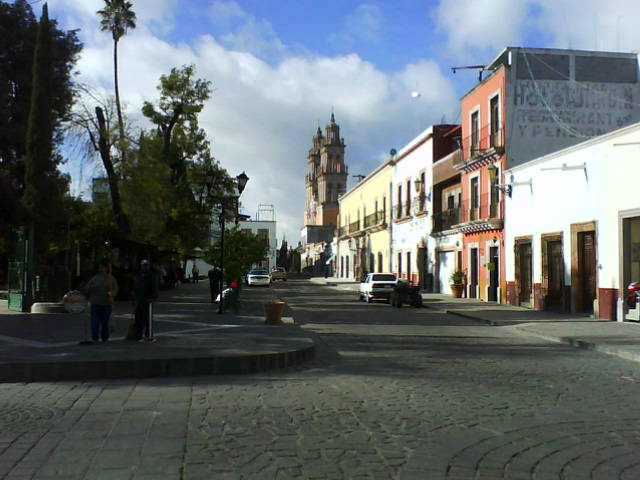


Jerez de García Salinas, Mexico
Jerez de García Salinas is a town of 43,064 people in Zacatecas, Mexico, founded in 1569.
Why visit Jerez de García Salinas
Townapedia lists 5 museums and landmarks, 11 parks and trails, 12 places to eat, 7 places to stay and 1 attraction in and around town.
Weather in Jerez de García Salinas
Forecast from MET Norway (CC BY 4.0). Full forecast
About Jerez de García Salinas
Jerez (Spanish: [xeˈɾes ðe ɣaɾˈsia saˈlinas] ) is a town, as well as a municipality, in the Mexican state of Zacatecas. To distinguish the two, the town is officially called Jerez de García Salinas, in honor of a 19th-century reformer. The town of Jerez governs 128 other communities, which comprise a rural area known for its production of fruit trees and dairy. Jerez was designated a Pueblo Mágico to promote tourism, as it is in close proximity to the state capital of Zacatecas and offers handcrafts, traditional food, and architecture.
From the Wikipedia article Jerez de García Salinas (this version), under CC BY-SA 4.0.
Travel tips from other travellers: Jerez de García Salinas on Wikivoyage (CC BY-SA 4.0).
Things to do1

Museums and landmarks5


Parks, trails and playgrounds11


Restaurants and cafes12




History
The area was named by the town's founders: Pedro Carrillo Dávila, Pedro Caldera, and Martín Morelos, who originally hailed from Jerez de la Frontera, Spain. The town in Zacatecas is named after its Spanish counterpart. 'Jerez' originates from the Arabic 'scherich,' which denotes an abundance of produce. The choice of this name was influenced by the fertility of the Zacatecas region and its resemblance to the founders' hometown. The addition of the town's name took place in 1952 and is a tribute to Francisco García Salinas, a local politician who played a key role in land redistribution, establishing textile mills, and opening schools. The municipality also boasts an official seal, featuring an image of Our Lady of Solitude."
Before the arrival of the Spanish, two indigenous groups dominated the region: the Guachichils and the Zacatecos. The Zacatecos spoke a language similar to Nahuatl and were engaged in agriculture.
From the History section of Jerez de García Salinas on Wikipedia, under CC BY-SA 4.0.
Where to stay7
Churches and places of worship7
Iglesia San Antonio De Padua
Church · Catholic · 2.3 km
5 Hidalgo, Jerez de García Salinas
Shopping2
Gas and EV charging4
Schools, colleges and libraries11
Healthcare5
Map of Jerez de García Salinas
65 places. The map loads OpenStreetMap tiles when you open it.
Getting there and nearby towns
General Leobardo C. Ruiz International Airport (ZCL) is the nearest airport with scheduled flights listed in OpenStreetMap, 41 km away.
- Ermita de Guadalupe 8 km southwest, about 8 min by car
- Santa Rita (Luis Moya) 10 km northeast, about 10 min by car
- Susticacán 12 km west, about 12 min by car
- Los Haros 13 km north, about 13 min by car
- Colonia Felipe Ángeles 23 km southeast, about 23 min by car
- Malpaso 24 km east, about 24 min by car
- El Tigre 24 km south, about 24 min by car
- Tepetongo 27 km southwest, about 27 min by car
- Zacatecas 44 km east, about 44 min by car
- Fresnillo 60 km north, about 1 h by car
Drive times are estimates from straight-line distance, not routes.
Local news
Headlines from INDB.
Reviews, tips and questions
Loading what members have shared...
Sources and licences
- GeoNames (CC BY 4.0): population, coordinates, regions and time zone
- OpenStreetMap contributors (ODbL 1.0): places, airports, map data
- Wikidata (CC0 1.0): elevation, founding date, time zone, website
- Wikimedia Commons (see each image): photos
- Wikipedia (CC BY-SA 4.0): overview and history text
Photo credits
- Jerez0010, César Landeros Soriano, Public domain
- PortalIguanazo, Thelmadatter, CC BY-SA 3.0
- JerezKiosk, Thelmadatter, CC BY-SA 3.0
- Tostadas de Jerez 01, WendyAvilesR, CC BY-SA 4.0
- Tostadas de Jerez 06, WendyAvilesR, CC BY-SA 4.0
- Tostadas de Jerez 03, WendyAvilesR, CC BY-SA 4.0
- Tostadas de Jerez 04, WendyAvilesR, CC BY-SA 4.0
- Arracadas jerezanas 02, WendyAvilesR, CC BY-SA 4.0
- Arracadas jerezanas 06, WendyAvilesR, CC BY-SA 4.0
- Tostadas de Jerez 02, WendyAvilesR, CC BY-SA 4.0
- Arracadas jerezanas 05, WendyAvilesR, CC BY-SA 4.0
- Arracadas jerezanas 07, WendyAvilesR, CC BY-SA 4.0
- Tostadas de Jerez 05, WendyAvilesR, CC BY-SA 4.0
- Arracadas jerezanas 08, WendyAvilesR, CC BY-SA 4.0
- Arracadas jerezanas 04, WendyAvilesR, CC BY-SA 4.0
- Arracadas jerezanas 03, WendyAvilesR, CC BY-SA 4.0
- Santuario de Nuestra Señora de la Soledad - panoramio (1), JavierDo, CC BY-SA 3.0
- Santuario de Nuestra Señora de la Soledad - panoramio (2), JavierDo, CC BY-SA 3.0
- DelaTorreJerez, Thelmadatter, CC BY-SA 3.0
- Portales de las PalomasJerez, Thelmadatter, CC BY-SA 3.0
- Portales de las Palomas Jerez de Garcia Mexico banner, Thelmadatter, CC BY-SA 3.0
- Santuario de Nuestra Señora de la Soledad, interior - panoramio, JavierDo, CC BY-SA 3.0
- SoledadJerez01, Thelmadatter, CC BY-SA 3.0
- SoledadJerez02, Thelmadatter, CC BY-SA 3.0
- Santuario de Nuestra Señora de la Soledad, altar - panoramio, JavierDo, CC BY-SA 3.0
- InmaculadaConcepcionParish02, Thelmadatter, CC BY-SA 3.0
- InmaculadaConcepcionParish03, Thelmadatter, CC BY-SA 3.0
- InmaculadaConcepcionParish01, Thelmadatter, CC BY-SA 3.0
- TeatroHinojosa01, Thelmadatter, CC BY-SA 3.0
- TeatroHinojosa02, Thelmadatter, CC BY-SA 3.0
- JardinHidalgoJerez02, Thelmadatter, CC BY-SA 3.0
- JardinHidalgoJerez01, Thelmadatter, CC BY-SA 3.0
- Jeréz, Centro - panoramio, JavierDo, CC BY-SA 3.0
- RiversideParkJerez2, Thelmadatter, CC BY-SA 3.0
- RiversideParkJerez1, Thelmadatter, CC BY-SA 3.0
- StreamJerez, Thelmadatter, CC BY-SA 3.0


Page built November 4, 2026. Spotted a mistake? Tell us or suggest a place.