
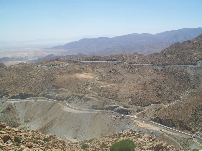

Why visit La Rumorosa
Townapedia lists 1 park or trail and 12 places to eat in and around town.
Weather in La Rumorosa
Forecast from MET Norway (CC BY 4.0). Full forecast
About La Rumorosa
La Rumorosa is a town in the municipality of Tecate, Baja California, Mexico. It has a population of 1,836 inhabitants. It lies on the road between Tecate and Mexicali, and it is directly across the international border from Jacumba Hot Springs, California. However, no official border crossing exists; the nearest official crossing is in Tecate.
From the Wikipedia article La Rumorosa (this version), under CC BY-SA 4.0.
Parks, trails and playgrounds1

Restaurants and cafes12

María Bonita - Taquería y Comida Mexicana
Restaurant · Mexican, Tacos, Antojitos, Mexicanos · 2.3 km
Fr-Mo 14:00-23:00
Steak Taco Las Chabelas
Restaurant · Steak House · 0.8 km
Carretera Tecate-Mexicali

Shopping3


Schools, colleges and libraries3

Benito Jui�Rez
School · 1.0 km
Nivel: Primaria; Subnivel: Primaria General; Tipo de servicio: Primaria General; Turno Matutino
Carretera Tecate-Mexicali Kilometro 66
Dr. Gustavo Aubanel Vallejo
School · 1.0 km
Nivel: Primaria; Subnivel: Primaria General; Tipo de servicio: Primaria General; Turno Matutino
Carretera Tecate-Mexicali Kilometro 69
Rafael RamiRez Castaneda
School · 1.0 km
Nivel: Secundaria; Subnivel: Secundaria Tecnica; Tipo de servicio: Secundaria Tecnica Agropecuaria; Turno Matutino
SN Calle Graciano Si�Nchez S/N
Map of La Rumorosa
19 places. The map loads OpenStreetMap tiles when you open it.
Getting there and nearby towns
Calexico International Airport (CXL) is the nearest airport with scheduled flights listed in OpenStreetMap, 53 km away.
- Seeley 45 km northeast, about 45 min by car
- Tecate 54 km west, about 54 min by car
- El Centro 55 km northeast, about 55 min by car
- Calexico 55 km east, about 55 min by car
- Heber 54 km northeast, about 54 min by car
- Pine Valley 55 km northwest, about 55 min by car
- Imperial 57 km northeast, about 57 min by car
- Mexicali 57 km east, about 57 min by car
- Brawley 70 km northeast, about 1 h 15 min by car
- Tijuana 89 km west, about 1 h 30 min by car
Drive times are estimates from straight-line distance, not routes.
Local news
Headlines from INDB.
Reviews, tips and questions
Loading what members have shared...
Sources and licences
- GeoNames (CC BY 4.0): population, coordinates, regions and time zone
- OpenStreetMap contributors (ODbL 1.0): places, airports, map data
- Wikidata (CC0 1.0): elevation, founding date, time zone, website
- Wikimedia Commons (see each image): photos
- Wikipedia (CC BY-SA 4.0): overview and history text
Photo credits
- Autopista la Rumorosa, Tony HG, CC BY 3.0
Page built November 4, 2026. Spotted a mistake? Tell us or suggest a place.