


Why visit Mazatlán
Townapedia lists 17 museums and landmarks, 25 parks and trails, 75 places to eat, 30 places to stay and 8 attractions in and around town.
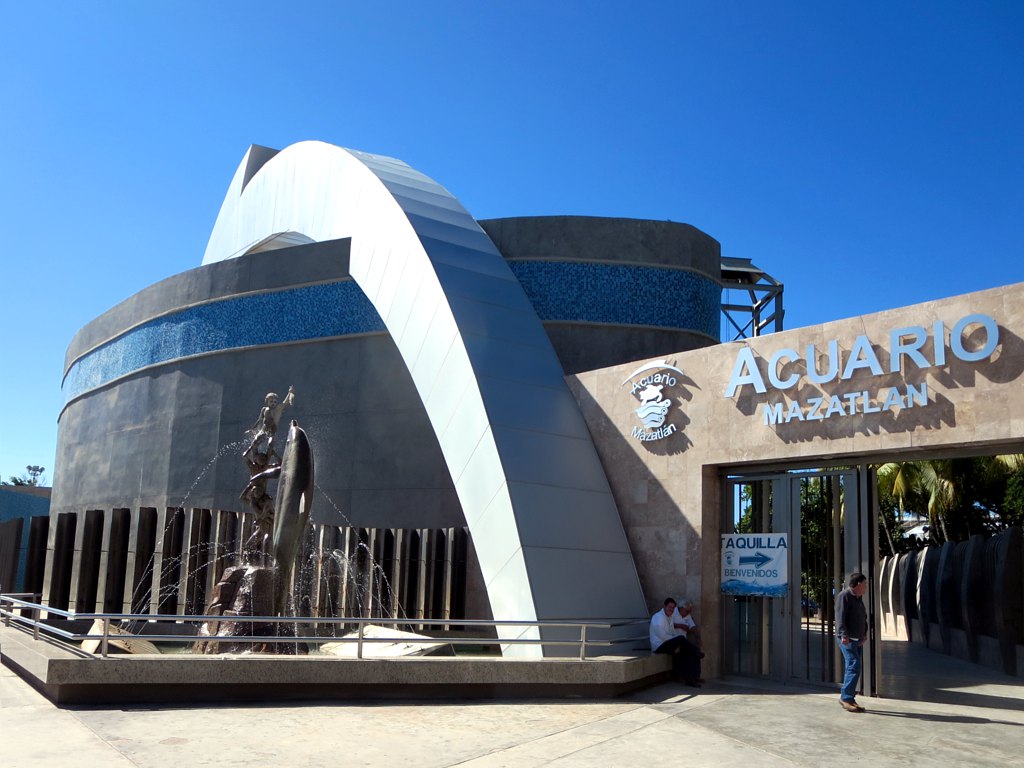
Highlights include Ángela Peralta Theatre, Mazatlán Lighthouse, Acuario Mazatlán and Observatorio 1873.
Weather in Mazatlán
Forecast from MET Norway (CC BY 4.0). Full forecast
About Mazatlán
Mazatlán (Spanish pronunciation: [masaˈtlan] ) is a city in the Mexican state of Sinaloa. The city serves as the municipal seat for the surrounding municipio, known as the Mazatlán Municipality. It is located on the Pacific coast across from the southernmost tip of the Baja California peninsula.
From the Wikipedia article Mazatlán (this version), under CC BY-SA 4.0.
Travel tips from other travellers: Mazatlán on Wikivoyage (CC BY-SA 4.0).
Things to do8

Ángela Peralta Theatre
Cinema and theater · 2.7 km
Theatre in Mazatlán, Sinaloa, Mexico




Museums and landmarks17

Observatorio 1873
Museum · 3.7 km
Tourism park in Mazatlán, Sinaloa, Mexico

Virgin of La Puntilla, Mazatlán
Monument and historic site · 3.7 km
Statue in Mazatlán

5 more on the map.
Parks, trails and playgrounds25




13 more on the map.
Restaurants and cafes75

Doña Lidia
Restaurant · Steak House · 2.4 km
Avenida Insurgentes
Mo-Su 18:00-23:00
Aguas El Oasis
Restaurant · Tacos, Mexican, Tortas, Aguas Frescas, Beverages · 1.7 km
2300 Aquiles Serdan, Mazatlán
Mo-Sa 08:00-17:00

63 more on the map.
Where to stay30
Churches and places of worship11
Cathedral Basilica of the Immaculate Conception, Mazatlán
Church · 2.3 km
Parroquia San Pablo Apostol
Church · Catholic · 2.2 km
Calle 13 de Abril, Mazatlan
Shopping20
Gas and EV charging4
Schools, colleges and libraries36
Healthcare21
Map of Mazatlán
247 places. The map loads OpenStreetMap tiles when you open it.
Getting there and nearby towns
General Rafael Buelna International Airport (MZT) is the nearest airport with scheduled flights listed in OpenStreetMap, 17 km away.
- El Castillo 9 km east, about 9 min by car
- Fraccionamiento los Ángeles 10 km east, about 10 min by car
- El Habal 14 km north, about 14 min by car
- El Vainillo 16 km east, about 16 min by car
- San Francisquito 17 km east, about 17 min by car
- Barrón 18 km southeast, about 18 min by car
- Lomas de Monterrey 17 km east, about 17 min by car
- Escamillas 18 km east, about 18 min by car
- El Walamo 20 km southeast, about 20 min by car
- Villa Unión 21 km east, about 21 min by car
Drive times are estimates from straight-line distance, not routes.
Local news
Headlines from INDB.
Reviews, tips and questions
Loading what members have shared...
Sources and licences
- GeoNames (CC BY 4.0): population, coordinates, regions and time zone
- OpenStreetMap contributors (ODbL 1.0): places, airports, map data
- Wikidata (CC0 1.0): elevation, founding date, time zone, website, landmarks and historic places
- Wikimedia Commons (see each image): photos
- Wikipedia (CC BY-SA 4.0): overview and history text
Photo credits
- Mazatlan El Faro 2, Stan Shebs, CC BY-SA 3.0
- Playa en Mazatlán 09, Alfredo Gayou, CC BY 2.0
- Playa en Mazatlán 08, Frank_am_Main, CC BY-SA 2.0
- Playa en Mazatlán 38, Frank_am_Main, CC BY-SA 2.0
- Mermaid monument in Mazatlán, Frank_am_Main, CC BY-SA 2.0
- Playa en Mazatlán 64, Dennis Sylvester Hurd, Public domain
- Mazatlán Bay, TravelingOtter, CC BY-SA 2.0
- Chachalaca en el Acuario Mazatlán, Jaime Robles, CC BY-SA 2.0
- Mazatlán, Sinaloa, Alejandro Hernández Osuna, Public domain
- Catedral Basílica de Mazatlán, Sinaloa, Alejandro Hernández Osuna, Public domain
- Mazatlán, Sinaloa. - Flickr - alej hernández, Alejandro Hernández Osuna from Guadalajara, Jalisco, México, Public domain
- Mazatlán, Sinaloa, MX, Alejandro Hernández Osuna, Public domain
- Mazatlán19, Alejandro Hernández Osuna, CC0
- Monumento al pescador, Mazatlán, Gabriel, CC BY 2.0
- Playa en Mazatlán 46, S. Alexis, CC BY-SA 2.0
- Playa en Mazatlán 62, Dennis Sylvester Hurd, Public domain
- El pescador, Mazatlán, S. Alexis, CC BY-SA 2.0
- Old Town Mazatlán and the Golden Zone - panoramio, Shane Smith, CC BY-SA 3.0
- Playa en Mazatlán 36, S. Alexis, CC BY-SA 2.0
- Ave en el Acuario Mazatlán, S. Alexis, CC BY-SA 2.0
- Pelícano en el Acuario Mazatlán, S. Alexis, CC BY-SA 2.0
- White fish in Mazatlán, Bryce Edwards, CC BY 2.0
- Monumento en el Acuario Mazatlán, Bryce Edwards, CC BY 2.0
- Peacock in Mazatlán, Bryce Edwards, CC BY 2.0
- Playa en Mazatlán 61, Dennis Sylvester Hurd, Public domain
- Playa en Mazatlán 15, S. Alexis, CC BY-SA 2.0
- Deer Monument Mazatlán, Frank_am_Main, CC BY-SA 2.0
- MazatlánPanorámica, Dennis Sylvester Hurd, CC0
- Monument to the fishermen in Mazatlán, Frank_am_Main, CC BY-SA 2.0
- Teatro Angela Peralta (26910810311), David Stanley from Nanaimo, Canada, CC BY 2.0
- Mazatlan El Faro lighthouse, Stan Shebs, CC BY-SA 3.0
- Funicular Observatorio 1873, Palomilla Apocatastásica, CC BY 4.0
- Estatua de la Virgen de Guadalupe, Mazatlán, 12 de diciembre de 2018, El Nuevo Doge, CC BY-SA 4.0
- Plazuela Hidalgo, Mazatlán, 5 de septiembre de 2022, El Nuevo Doge, CC0
- Plazuela Machado, Dennis Sylvester Hurd, Public domain
- Plazuela República, Mazatlán, 12 de diciembre de 2022, El Nuevo Doge, CC0
- Letrero de Sinaloa Digital, Plazuela Zaragoza, Mazatlán, 19 de abril de 2022, DogeGamer2015MZT2, CC0
- Catedral Basílica de la Inmaculada Concepción 2012-09-08 18-20-27, wittenbergman, CC BY-SA 3.0
- Parroquia Cristo Rey (Mazatlán) Estado de Sinaloa,México - 5620157885, Catedrales e Iglesias/Cathedrals and Churches, CC BY 2.0
- Iglesia de San José, Mazatlán, 19 de octubre de 2022 03, El Nuevo Doge, CC0
- Nuevo Teodoro Mariscal, Anarpi, CC BY-SA 4.0
- Acuario Mazatlán (26895659702), David Stanley from Nanaimo, Canada, CC BY 2.0


Page built November 4, 2026. Spotted a mistake? Tell us or suggest a place.