


Monterrey, Mexico
Monterrey is a regional capital of 1,135,512 people in Nuevo León, Mexico, founded in September 20, 1596.
Why visit Monterrey
Townapedia lists 42 museums and landmarks, 31 parks and trails, 169 places to eat, 60 places to stay and 24 attractions in and around town.
Highlights include Auditorio Banamex, Mirador del Obispado, El Obispado and Faro del Comercio.
Weather in Monterrey
Forecast from MET Norway (CC BY 4.0). Full forecast
About Monterrey
Monterrey ( MON-tə-RAY, Spanish: [monteˈrej] ) is the capital and largest city of the northeastern Mexican state of Nuevo León. The city anchors the Monterrey metropolitan area, Mexico's second largest metropolitan area with a population of 5,347,000 as of 2026, according to the 2020 census, and Monterrey proper has a population of 1,142,194, making it Mexico’s eighth-largest city. Located at the foothills of the Sierra Madre Oriental, Monterrey is a major business and industrial hub in Mexico and the Americas. It is also the biggest industrial city in Mexico.
From the Wikipedia article Monterrey (this version), under CC BY-SA 4.0.
Travel tips from other travellers: Monterrey on Wikivoyage (CC BY-SA 4.0).
Things to do24

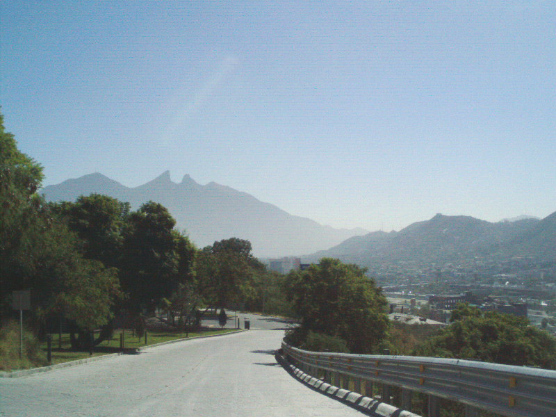
Mirador del Obispado
Monument and historic site · 3.0 km
Hill and lookout in Monterrey, Mexico

Monterrey Institute of Technology and Higher Education
School · 4.5 km
Private multi-campus university in Mexico

Monterrey Institute of Technology and Higher Education, Monterrey
School · 4.6 km
University campus


Universidad Autónoma Nuevo León
School · 4.8 km
Public university in the state Nuevo León in Mexico
Universidad de la vida, la casa de los famosos
School · 1.6 km
Institution of higher education in Monterrey, México
Universidad Metropolitana de Monterrey
School · 1.3 km
Mexican university

Teatro Municipal Jose Calderón
Cinema and theater · 0.6 km
135 Benito Juárez, Monterrey
12 more on the map.
Museums and landmarks42


Faro del Comercio
Monument and historic site · 2.1 km
Monument in Mexico


Museo Universitario de Ciencias UANL
Museum · 2.2 km
1060 Vicente Suárez
Tu-Fr 09:00-18:00; Sa-Su 10:00-17:00

Government Palace Museum
Museum · 1.5 km
State government building in Monterrey, Mexico
Museo de Arte Contemporáneo de Monterrey
Museum · 1.9 km
Museum of Contemporary Art in Monterrey, Mexico

Museum of Steel
Museum · 3.5 km
Museum in Monterrey, Nuevo León, Mexico
Palacio del Obispado
Museum · 2.8 km
History Museum in Nuevo Leon, MX
Cyrus Art Studio
Museum · 1.9 km
334 A Calle Jacaranda, monterrey
Mo-Su 10:00-22:00


Museo de Historia Mexicana
Museum · 1.8 km
Tu,Su 10:00-20:00; We-Sa 10:00-18:00; Mo off
30 more on the map.
Parks, trails and playgrounds31


Macroplaza
Park · 1.9 km
La Macroplaza o Gran Plaza es una plaza de la ciudad de Monterrey en México. Se denomina así a la parte central de Monterrey que ocupa...

Explanada Cultural
Park · 1.5 km
Explanada Cultural Perteneciente al LABNL Lab Cultural Ciudadano
19 more on the map.
Restaurants and cafes169

Al Restaurant
Restaurant · Breakfast, Deli, Diner, Tea · 0.8 km
520 Calzada Francisco I. Madero
Mo-Su 07:30-22:30
El Gran Pastor
Restaurant · Local · 2.8 km
3126 Calzada Francisco I. Madero
Mo-Th, Su 12:00-00:00; Fr, Sa 12:00-01:00

Botanero Moritas
Restaurant · 2.8 km
Puntacero Av Fundidora 200, Obrera, 64800 Monterrey, N.L.
Mo-Th 01:00-01:00; Fr, Sa 01:00-02:00; Su 01:00-05:00
tacos y gorditas del comal a su boca
Restaurant · Mexican · 1.1 km
1190 Calle Profesor José Silvestre Aramberri, Monterrey
Mo-Su 09:00-21:00
Comidas Caseras, La Tía Mary
Restaurant · Regional · 1.4 km
111 Nte. Calle América, Monterrey
Mo-Fr 08:00-17:00
El cabrito
Restaurant · Regional · 1.0 km
Es un restaurante de comida regional que venden especificamente cabrito pero tambien hay mas variedad de comida.
Calle José Silvestre Aramberri, Monterrey
24/7
Kød Rustic Deli
Restaurant · Sandwich, Meat · 2.9 km
108 Calle Matehuala, Monterrey
Tu-Su 13:00-22:00
157 more on the map.
Where to stay60
Fiesta Inn Express Monterrey Centro
Motel and hotel · 1.8 km
363 Calle Miguel Hidalgo y Costilla, Monterrey
Churches and places of worship27
Capilla de los Dulces Nombres de Jesús, María y José
Church · Catholic · 1.9 km
Mariano Matamoros, Monterrey, Nuevo León, México
Catedral Metropolitana
Church · Catholic · 2.2 km
Juan Zuazua, Monterrey, Nuevo León, México
Centro Misionero María Siempre Virgen, Monterrey
Church · Catholic · 0.8 km
316 Calle Democracia, Monterrey
Centro de las Obras de la Cruz
Church · Catholic · 2.2 km
309 Río Frío, Monterrey
Centro Pastoral Comunidad Apostólica de María Siempre Virgen
Church · Catholic · 2.7 km
436 Calle 5 de Febrero, Monterrey
Iglesia adventista Vallarta
Church · Seventh Day Adventist · 1.8 km
644 Calle Ignacio Luis Vallarta, Monterrey
Shopping52
Bricos Express (Mayoreo Electrico de Monterrey)
Hardware store · 1.9 km
2450 Calz Francisco I. Madero, Monterrey
Gas and EV charging51
Schools, colleges and libraries50
Escuela Industrial y Preparatoria Tecnica Pablo Livas - Unidad Centro
School · 1.1 km
Jose Mariano Jimenez, Monterrey
Insituto de tecnología avanzada
School · 1.1 km
1147 Calle Profesor José Silvestre Aramberri, Monterrey
Healthcare50
Clínica de atención integral al autismo
Clinic and pharmacy · 3.1 km
Calle San José
Centro de rehabilitación
Clinic and pharmacy · 1.6 km
1222 Calle 5 de Mayo, Monterrey
Map of Monterrey
250 places. The map loads OpenStreetMap tiles when you open it.
Getting there and nearby towns
Del Norte International Airport (NTR) is the nearest airport with scheduled flights listed in OpenStreetMap, 21 km away.
- Guadalupe 6 km east, about 6 min by car
- San Nicolás de los Garza 7 km north, about 7 min by car
- San Pedro Garza García 9 km west, about 9 min by car
- Ciudad General Escobedo 12 km north, about 12 min by car
- Santa Catarina 14 km west, about 14 min by car
- Jardines de la Silla 14 km southeast, about 14 min by car
- Mitras Poniente 15 km northwest, about 15 min by car
- Ciudad Apodaca 17 km northeast, about 17 min by car
- Parque Industrial Ciudad Mitras 17 km northwest, about 17 min by car
- Monte Kristal 17 km east, about 17 min by car
Drive times are estimates from straight-line distance, not routes.
Local news
Headlines from INDB.
Reviews, tips and questions
Loading what members have shared...
Sources and licences
- GeoNames (CC BY 4.0): population, coordinates, regions and time zone
- OpenStreetMap contributors (ODbL 1.0): places, airports, map data
- Wikidata (CC0 1.0): elevation, founding date, time zone, website, landmarks and historic places
- Wikimedia Commons (see each image): photos
- Wikipedia (CC BY-SA 4.0): overview and history text
Photo credits
- Cerro de la Silla, Nathaniel C. Sheetz, CC BY-SA 3.0
- Auditorio Banamex, Tavoman666, CC BY-SA 3.0
- ITESMMonterreyRectoria03, Thelmadatter, CC BY-SA 3.0
- Puente en Monterrey, Nuevo León, Rick González, CC BY 2.0
- Torre Rectoria UANL (2023), Davidmejoradas, CC BY-SA 4.0
- Farodelcomercio, Cvmontuy, CC BY-SA 3.0
- PALACIO DE GOB, LABNL Lab Cultural Ciudadano, CC BY-SA 2.0
- Parque Fundidora, Monterrey1, México en Fotos, CC BY-SA 2.0
- Montaña en el Parque la huasteca, Anaramirezz, CC BY-SA 4.0
- Basilica de Guadalupe Monterrey 17, Valdez Lopez, CC BY-SA 3.0
- Monterrey - Catedral de la Inmaculada Concepción - 4, This illustration was made by Peter Potrowl . Please credit this with : © Peter Potrowl in the immediate vicinity of the image. A link to my website sitemai.eu would be much appreciated but isn't..., CC BY-SA 4.0
- Monterrey - Antigua basilica de Guadalupe - 2, This illustration was made by Peter Potrowl . Please credit this with : © Peter Potrowl in the immediate vicinity of the image. A link to my website sitemai.eu would be much appreciated but isn't..., CC BY-SA 4.0
- Fachada MARCO, Limbo@MX C, CC BY 2.5
- Antiguo Obispado o Museo Regional de Nuevo León, Brendablue77, CC BY-SA 3.0
- Cerro de la Silla désde la Macroplaza - panoramio, José Javier Reyna Va…, CC BY-SA 3.0
- Bandera Monumental Ensenada, José R. Quintanilla, CC BY 2.5
- Lapurisima, Pacogq, Public domain
- Mirador Obispado 3, Unknown author, CC BY-SA 2.5
- Pabellón Sopladores del Museo del Acero en el Parque Fundidora, Rick González, CC BY 2.0
- Macroplaza de Monterrey y alrededores - 6, ProtoplasmaKid, CC BY-SA 4.0
- Museo Historia Mexicana Monterrey, Unknown author, CC BY-SA 2.5
- Izando la bandera monumental del zocalo, gib_l, CC BY-SA 2.0


Page built November 4, 2026. Spotted a mistake? Tell us or suggest a place.