


Morelia, Mexico
Morelia is a regional capital of 743,275 people in Michoacán, Mexico, founded in May 28, 1541.
Why visit Morelia
Townapedia lists 39 museums and landmarks, 38 parks and trails, 172 places to eat, 30 places to stay and 15 attractions in and around town.
Highlights include Monterrey Institute of Technology and Higher Education, Morelia, Parque Zoológico Benito Juárez, Antimonumenta and Monumento a los Constructores.
Weather in Morelia
Forecast from MET Norway (CC BY 4.0). Full forecast
About Morelia
Morelia (Spanish pronunciation: [moˈɾelja]; from 1545 to 1828 known as Valladolid; Otomi: Mänxuni) is the capital and most populous city of the Mexican state of Michoacán. Situated in the Guayangareo Valley in the north-central part of the state, it is the municipal seat of the municipality of Morelia. The main pre-Hispanic cultures here were the Purépecha and the Matlatzinca, but no major cities were founded in the valley during this time. The Spanish took control of the area in the 1520s.
From the Wikipedia article Morelia (this version), under CC BY-SA 4.0.
Travel tips from other travellers: Morelia on Wikivoyage (CC BY-SA 4.0).
Things to do15
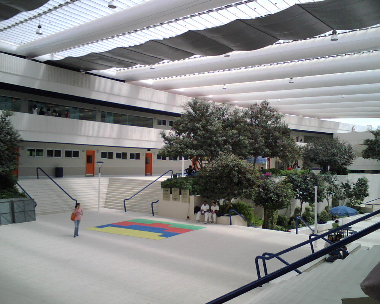
Monterrey Institute of Technology and Higher Education, Morelia
School · 5.4 km
University in Morelia, Mexico


Universidad Michoacana de San Nicolás de Hidalgo
School · 2.6 km
University in Mexico

3 more on the map.
Museums and landmarks39

Antimonumenta
Monument and historic site
Anti-monument in Morelia, Michoacán

Monumento a los Constructores
Monument and historic site · 1.7 km
Monument in Morelia, Michoacán, Mexico

Orquidario de Morelia Dr. y Gral. Alberto Oviedo Mota
Museum · 1.8 km
Mo-Fr 08:00-17:00; Sa,Su 10:30-14:00,15:00-17:00


Museo de Historia Natural "Manuel Martínez Solórzano"
Museum · 0.7 km
Mo-Fr 09:00-16:00; Sa,Su 11:00-16:00


27 more on the map.
Parks, trails and playgrounds38




Estadio Olímpico Venustiano Carranza
Sports field and stadium · 1.7 km
26 more on the map.
Restaurants and cafes172

Casa Madre Condesa
Restaurant · Mexican
87 Calle Isidro Huarte, Morelia
Mo-Fr 08:00-17:00; Sa 08:30-16:30; Su 09:00-14:00
Cocol Bistro
Restaurant · Coffee Shop, Sandwich · 1.8 km
12 Calle Guillermo Marconi, Morelia
Mo-Sa 08:30-22:00; Su 08:30-17:00

LIVERA CAFĒ
Cafe · Coffee Shop · 0.9 km
161 Calle Benito Juárez, Morelia
Mo-Sa 07:30-21:00; Su 11:30-18:30
¡OP! Poulet Salud
Restaurant · Salad, Chicken · 1.0 km
555 Calzada Ventura Puente, Morelia
Mo-Fr 09:00-20:00, Sa 10:00-19:00
Las reliquias café
Cafe · 1.3 km
494 Calle Ignacio Rayón, Morelia
Mo-Th 14:00-21:00; Fr-Sa 14:00-22:00

CUIXI Panificadora
Bakery · 1.3 km
171 Calle Andrés Quintana Roo, Morelia
Mo-Fr 08:00-21:00; Sa 10:30-18:00
Camila's
Restaurant · Mexican · 1.8 km
1661 Avenida Ventura Puente, Morelia
Mo-Su 08:00-18:00
160 more on the map.
History
Human settlements in the Guayangareo Valley in which Morelia is located have been dated back as far as the 7th century. Artifacts found here have shown Teotihuacán culture influence on early cultures in this area. In the 12th century, the Purépecha arrived in the valley. They dominated it politically for the rest of the pre-Hispanic period but did not build any major settlements here. Between the 12th and the 15th centuries, Matlatzincas moved into the area with permission of the Purépechas, who were based around nearby Pátzcuaro Lake. The main Matlatzinca settlement was where Júarez Plaza in the city is today.
The Spanish pushed into the Guayangareo Valley between 1525 and 1526, headed by Gonzalo Gómez. In the 1530s, the area was evangelized by Franciscans such as Juan de San Miguel and Antonio de Lisboa.
From the History section of Morelia on Wikipedia, under CC BY-SA 4.0.
Where to stay30
Best Western Plus Gran Hotel Morelia
Motel and hotel · 1.9 km
Av. Ventura Puente esq. con Camelinas, Morelia
City Express Hoteles
Motel and hotel · 1.0 km
245 Avenida Francisco I Madero, Morelia
Hotel Alameda
Motel and hotel · 1.1 km
313 Avenida Francisco I Madero Poniente, Morelia
Hotel Boutique Casa Madero
Motel and hotel
137 Avenida Francisco I Madero Oriente, Morelia
Churches and places of worship17
Templo de Nuestra Señora del Lourdes
Church · Catholic
240 Fray Antonio de San Miguel, Morelia
Templo El Corazón de María
Church · Catholic · 1.6 km
515 Batalla de la Angostura, Morelia
Shopping22
Gas and EV charging6
Schools, colleges and libraries47
Facultad de Derecho y Sciencias Sociales UMSNH
School · 0.7 km
200 Tata Vasco, Morelia
Healthcare29
IMSS Hospital General de Zona 83 Morelia
Clinic and pharmacy · 2.3 km
1935 Periférico Paseo de la República
Hospital Memorial de Morelia
Hospital · 2.4 km
2111 Periférico Paseo de la República
Centro Materno Infantil "San José" A.C.
Clinic and pharmacy
164 Calle Mariano Elizaga, Morelia
IMSS Unidad de Medicina Familiar 80
Clinic and pharmacy · 2.0 km
1200 Avenida Francisco I. Madero Poniente, Morelia
Farmacia Guadalajara
Clinic and pharmacy
617 Avenida Francisco I Madero Poniente, Morelia
Hospital Star Médica Morelia
Hospital · 2.1 km
C. Virrey de Mendoza 2000, Morelia
Map of Morelia
250 places. The map loads OpenStreetMap tiles when you open it.
Getting there and nearby towns
General Francisco J. Mujica International Airport (MLM) is the nearest airport with scheduled flights listed in OpenStreetMap, 23 km away.
- Montaña Monarca (Punta Altozano) 5 km southeast, about 5 min by car
- El Durazno 5 km south, about 5 min by car
- Fraccionamiento Villa Tzipekua (Fraccionamiento Erandeni 3) 5 km north, about 5 min by car
- Real Hacienda (Metrópolis) 6 km north, about 6 min by car
- Puerto de Buenavista (Lázaro Cárdenas) 6 km east, about 6 min by car
- Fraccionamiento Privadas del Sol 6 km north, about 6 min by car
- Fraccionamiento Metrópolis II 7 km north, about 7 min by car
- Jesús del Monte 6 km southeast, about 6 min by car
- Fraccionamiento Galaxia Tarímbaro 7 km north, about 7 min by car
- La Aldea 7 km northeast, about 7 min by car
Drive times are estimates from straight-line distance, not routes.
Local news
Headlines from INDB.
Reviews, tips and questions
Loading what members have shared...
Sources and licences
- GeoNames (CC BY 4.0): population, coordinates, regions and time zone
- OpenStreetMap contributors (ODbL 1.0): places, airports, map data
- Wikidata (CC0 1.0): elevation, founding date, time zone, website, landmarks and historic places
- Wikimedia Commons (see each image): photos
- Wikipedia (CC BY-SA 4.0): overview and history text
Photo credits
- Morelia panorama DSC 0400 ed AD, Adavyd, CC BY-SA 3.0
- Antimonumenta Morelia, Wotancito, CC BY-SA 4.0
- Capilla del Señor de la Columna Morelia 5, NS777, CC BY-SA 4.0
- Acueducto Morelia, Mexico, Jackson las, CC BY-SA 3.0
- Centro historico Morelia, Mexico, Acueducto, Jackson las, CC BY-SA 3.0
- MoreliaAqueduct02, AlejandroLinaresGarcia, CC BY-SA 3.0
- Mother with Child - Morelia - Michoacan - Mexico (19875725533), Adam Jones from Kelowna, BC, Canada, CC BY-SA 2.0
- Architectural Detail - Morelia - Michoacan - Mexico - 01 (20447167286), Adam Jones from Kelowna, BC, Canada, CC BY-SA 2.0
- Detail of Acueduct - Morelia - Michoacan - Mexico (20470904776), Adam Jones from Kelowna, BC, Canada, CC BY-SA 2.0
- MoreliaAqueduct04, AlejandroLinaresGarcia, CC BY-SA 3.0
- Acueducto Morelia 2, Jackson las, CC BY-SA 3.0
- MoreliaAqueduct03, AlejandroLinaresGarcia, CC BY-SA 3.0
- Plaza Scene with Fountain - Morelia - Michoacan - Mexico (20446746186), Adam Jones from Kelowna, BC, Canada, CC BY-SA 2.0
- MoreliaAqueduct01, AlejandroLinaresGarcia, CC BY-SA 3.0
- Acueducto de Morelia - panoramio, Alejandro Vega Rdz., CC BY-SA 3.0
- Amorelia Michoacan, Lunita28mx, CC BY-SA 4.0
- Bosque de Cuauhtemoc Scene with Acueduct - Morelia - Michoacan - Mexico (20497282015), Adam Jones from Kelowna, BC, Canada, CC BY-SA 2.0
- Callejon del Romance - Morelia - Michoacan - Mexico (20497239175), Adam Jones from Kelowna, BC, Canada, CC BY-SA 2.0
- Centro Historico Morelia, Jackson las, CC BY-SA 3.0
- Casa de las artesanías de Morelia 2° patio - panoramio, Alejandro Vega Rdz., CC BY-SA 3.0
- StreetMorelia, AlejandroLinaresGarcia, CC BY-SA 3.0
- SkaterMaderoMorelia, AlejandroLinaresGarcia, CC BY-SA 3.0
- Primera Iglesia Bautista, Morelia, Michoacán 06, Isaacvp, CC BY-SA 4.0
- Primera Iglesia Bautista, Morelia, Michoacán 07, Isaacvp, CC BY-SA 4.0
- Primera Iglesia Bautista, Morelia, Michoacán 05, Isaacvp, CC BY-SA 4.0
- Primera Iglesia Bautista, Morelia, Michoacán 04, Isaacvp, CC BY-SA 4.0
- Antiguo Convento de Santa Catalina de Sena-Templo de las Monjas Capuchinas Morelia 7, NS777, CC BY-SA 4.0
- Antiguo Convento de Santa Catalina de Sena-Templo de las Monjas Capuchinas Morelia 6, NS777, CC BY-SA 4.0
- Bosque Cuauhtemoc Morelia, Mexico, Jackson las, CC BY-SA 3.0
- Primera Iglesia Bautista, Morelia, Michoacán 03, Isaacvp, CC BY-SA 4.0
- ITESM Campus Morelia, Gildardo Sánchez, CC BY 2.0
- Monumento a los Constructores 4, mapeaton @ Mapillary, CC BY-SA 4.0
- Morelia Cathedral DSC 0524 AD, Adavyd, CC BY-SA 3.0
- EstadioVCarranza, Odiseo79, CC BY-SA 3.0
- Museo Regional Michoacano 040, VeoKenxiz, CC BY-SA 4.0
- GrevyZebra, Jeff Kubina from Columbia, Maryland, CC BY-SA 2.0
- Museo de Arte Contemporáneo "Alfredo Zalce" Morelia 4, NS777, CC BY-SA 4.0
- Fuente de las tarascas Michoacan, Lunita28mx, CC BY-SA 4.0
- 02315 - Capilla de la Virgen de Lourdes, Diego Espinosa Balderas, CC BY-SA 3.0
- Chicas trabajando en el Museo del dulce, Martha.Delgado23, CC BY-SA 4.0
- Palacio de Justicia, Morelia, Michoacan, Jonatan Malpica R., CC BY-SA 4.0


Page built November 4, 2026. Spotted a mistake? Tell us or suggest a place.