
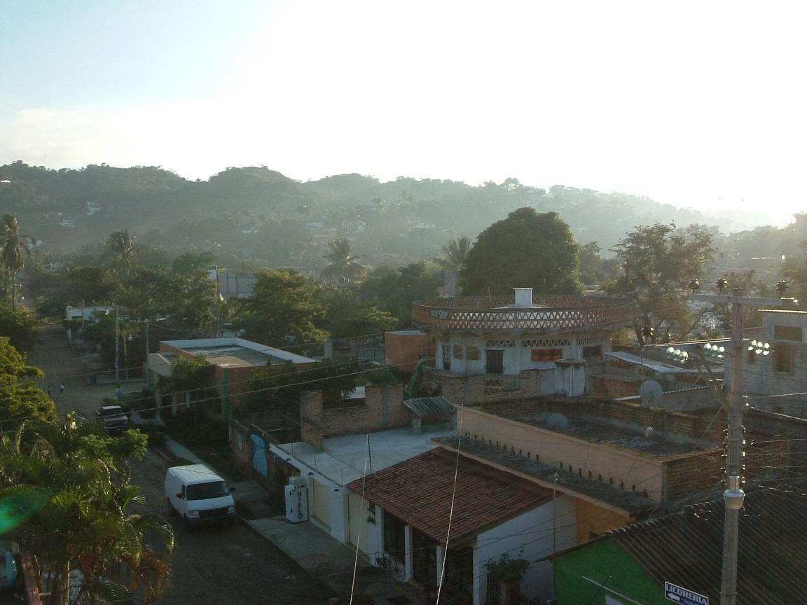


Why visit Sayulita
Townapedia lists 1 museum or landmark, 8 parks and trails, 47 places to eat, 16 places to stay and 1 attraction in and around town.
Weather in Sayulita
Forecast from MET Norway (CC BY 4.0). Full forecast
About Sayulita
Sayulita is a small town in Mexico along the Pacific Ocean at the southern end of the state of Nayarit and north of Banderas Bay. It has a population of approximately 5,000 inhabitants.
From the Wikipedia article Sayulita (this version), under CC BY-SA 4.0.
Travel tips from other travellers: Sayulita on Wikivoyage (CC BY-SA 4.0).
Things to do1

Museums and landmarks1

Parks, trails and playgrounds8




Restaurants and cafes47

El Conejo
Restaurant · Mexican Fusion
Surf inspired cuisine blending the flavors of Mexico, Asia and Hawaii. Delicious house Suerte Tequila from Atotonilco Jalisco. Come for...


Café El Fortín de San Sebastián - Sayulita
Cafe
18 Miramar, Sayulita
Mo - Su 07:00 - 14:00
Pieto's Tacos & Beer
Restaurant · Mexican
45 Avenida Revolución
35 more on the map.
History
Early inhabitants of Sayulita were drawn to the area to work on coconut palm ranches, where coconut oil was extracted from the palm species Attalea cohune. During the coconut oil boom, many people died of lung diseases caused by inhaling the dust that the coconuts gave off when split. The hacienda grew, and in addition to oil production, it soon became an important livestock emporium. In 1936, the livestock were sold and the land donated to the port workers with the intention to continue producing, leading to the formation of the Sayulita ejido.
In the 1940s, coconut production was reduced considerably, leading agriculture and fisheries to become the primary industries of the area. Though less abundant than the past, species fished commercially in the region include snapper, horse mackerel, sawfish, grouper, oyster, shrimp and lobster.
In 1965 the La Varas-Puerto Vallarta highway was built, which helped inaugurate tourism into the region. As a part of a tourism expansion and development project, Sayulita's streets were paved, and public works such as kiosks, public squares, markets, and sidewalks were built.
From the History section of Sayulita on Wikipedia, under CC BY-SA 4.0.
Where to stay16
Churches and places of worship1
Shopping3
Gas and EV charging1
Schools, colleges and libraries4
Healthcare1
Map of Sayulita
83 places. The map loads OpenStreetMap tiles when you open it.
Getting there and nearby towns
Licenciado Gustavo Díaz Ordaz International Airport (PVR) is the nearest airport with scheduled flights listed in OpenStreetMap, 28 km away.
- San Ignacio 3 km southeast, about 3 min by car
- San Francisco 5 km northeast, about 5 min by car
- Higuera Blanca 8 km south, about 8 min by car
- Corral del Risco (Punta de Mita) 13 km southwest, about 13 min by car
- Lo de Marcos 13 km northeast, about 13 min by car
- Cruz de Huanacaxtle 14 km southeast, about 14 min by car
- Ursulo Galván 14 km northeast, about 14 min by car
- Bucerías 16 km southeast, about 16 min by car
- Puerto Vallarta 35 km southeast, about 35 min by car
- San Blas 77 km north, about 1 h 15 min by car
Drive times are estimates from straight-line distance, not routes.
Local news
Headlines from INDB.
Reviews, tips and questions
Loading what members have shared...
Sources and licences
- GeoNames (CC BY 4.0): population, coordinates, regions and time zone
- OpenStreetMap contributors (ODbL 1.0): places, airports, map data
- Wikidata (CC0 1.0): elevation, founding date, time zone, website
- Wikimedia Commons (see each image): photos
- Wikipedia (CC BY-SA 4.0): overview and history text
Photo credits
- Sayulita Nayarit, Unknown author, CC BY-SA 2.0
- Stickers en el centro de Sayulita 01, Luisalvaz, CC BY-SA 4.0
- Iglesia de la Comunidad en Sayulita, Nayarit 02, Luisalvaz, CC BY-SA 4.0
- Stickers en el centro de Sayulita 04, Luisalvaz, CC BY-SA 4.0
- Stickers en el centro de Sayulita 02, Luisalvaz, CC BY-SA 4.0
- Stickers en el centro de Sayulita 03, Luisalvaz, CC BY-SA 4.0
- Iglesia de la Comunidad en Sayulita, Nayarit 01, Luisalvaz, CC BY-SA 4.0
- Centro de Sayulita a unas calles de la playa 02, Luisalvaz, CC BY-SA 4.0
- Centro de Sayulita a unas calles de la playa 03, Luisalvaz, CC BY-SA 4.0
- Town of Sayulita, Mexico, গীতাশ্ৰী গগৈ আপ্তে, CC BY-SA 4.0
- Calle de Sayulita 01, Luisalvaz, CC BY-SA 4.0
- Calle de Sayulita 03, Luisalvaz, CC BY-SA 4.0
- Calle de Sayulita 02, Luisalvaz, CC BY-SA 4.0
- Calle de Sayulita 04, Luisalvaz, CC BY-SA 4.0
- Sayulita (60845), গীতাশ্ৰী গগৈ আপ্তে, CC BY-SA 4.0
- Centro de Sayulita a unas calles de la playa 01, Luisalvaz, CC BY-SA 4.0
- Plaza de Sayulita (17273463592), David Stanley from Nanaimo, Canada, CC BY 2.0
- The downtown of Sayulita, গীতাশ্ৰী গগৈ আপ্তে, CC BY-SA 4.0
- Sayulita Nightday, Ismail Esen, CC BY 3.0
- Sayulita Mexico, Ismail Esen, CC BY 3.0
- Sayulita Restaurant, Ismail Esen, CC BY 3.0
- Playa Sayulita 01, Luisalvaz, CC BY-SA 4.0
- Grafiti y sticker en un cartel frente a la playa de Sayulita, Luisalvaz, CC BY-SA 4.0
- Playa Sayulita 03, Luisalvaz, CC BY-SA 4.0
- Beach at Sayulita (17268510126), David Stanley from Nanaimo, Canada, CC BY 2.0
- Playa Sayulita 04, Luisalvaz, CC BY-SA 4.0
- Sayulita, Mexico (Unsplash), Diana Feil diana_f, CC0
- Sayulita River (17112719168), David Stanley from Nanaimo, Canada, CC BY 2.0
- Iguana on asphalt (Unsplash), Eric Anderson aroc, CC0
- Piscina infinita 01, WendyAvilesR, CC BY 4.0
- Piscina infinita 02, WendyAvilesR, CC BY 4.0
- Piscina infinita 04, WendyAvilesR, CC BY 4.0
- Piscina infinita 03, WendyAvilesR, CC BY 4.0
- Ortalis wagleri 171170511, Christian Back, CC BY 4.0
- Calle Delfines (17283708815), David Stanley from Nanaimo, Canada, CC BY 2.0
- ESTO ES MEXICO (16657618914), David Stanley from Nanaimo, Canada, CC BY 2.0
- Eleutherodactylus pallidus, Don Loarie, CC BY 4.0
- Beach Life and Cafe Culture (17287660212), David Stanley from Nanaimo, Canada, CC BY 2.0
- Pacific Breakers (17108239530), David Stanley from Nanaimo, Canada, CC BY 2.0
- Calcinus californiensis, Don Loarie, CC BY 4.0
- Playa Sayulita 02, Luisalvaz, CC BY-SA 4.0
- Pelícano en la Playa de los Muertos, Sayulita, Luisalvaz, CC BY-SA 4.0


Page built November 4, 2026. Spotted a mistake? Tell us or suggest a place.