


Tampico, Mexico
Tampico is a town of 309,003 people in Tamaulipas, Mexico, founded in April 12, 1823.
Why visit Tampico
Townapedia lists 6 museums and landmarks, 85 parks and trails, 64 places to eat, 20 places to stay and 12 attractions in and around town.
Highlights include Universidad del Noreste, Monterrey Institute of Technology and Higher Education, Tampico, Monumental Flag and Parque Esfuerzo Obrero.
Weather in Tampico
Forecast from MET Norway (CC BY 4.0). Full forecast
About Tampico
Tampico is a city and port in the southeastern part of the Mexican state of Tamaulipas. It is located on the north bank of the Pánuco River, about 10 kilometers (6 mi) inland from the Gulf of Mexico, and directly north of the state of Veracruz. Tampico is the fifth-largest city in Tamaulipas, with a population of 314,418 in the city proper and 929,174 in the metropolitan area.
From the Wikipedia article Tampico (this version), under CC BY-SA 4.0.
Travel tips from other travellers: Tampico on Wikivoyage (CC BY-SA 4.0).
Things to do12

Universidad del Noreste
School · 0.6 km
Tampico, Tamaulipas, Mexico
Avenida Hidalgo
Monterrey Institute of Technology and Higher Education, Tampico
School · 11.0 km
University and high school campus



Museums and landmarks6



Parks, trails and playgrounds85

Vivero "El Trébol"
Park · 4.6 km
Calle Francisco Sarabia, Ciudad Madero
Mo-Su 09:00-21:00



Estadio Tamaulipas
Sports field and stadium · 2.8 km
Avenida Jalisco, Ciudad Madero
Parque Banderas
Park · 6.3 km
Parque publico con bancas y espacio para realizar actividades al aire libre, se permite estar con mascotas. El parque se encuentra...
Parque Vilas Nautico
Park · 6.4 km
Parque con palapas, juegos infantiles, pista para correr y caminar, pasear mascotas y realizar actividades al aire libre. Cuenta con...
73 more on the map.
Restaurants and cafes64

ROBLEORO Brewin Co Tap Room Restaurante
Restaurant · Cerveza Artesanal Y Comida Casual · 3.9 km
Av Cuauhtemoc esquina Matamoros, Madero
We-Sa 05:30-01:00
big quesadillas
Restaurant · Regional · 2.6 km
642 Calle Faja de Oro, Tampico
52 more on the map.
History
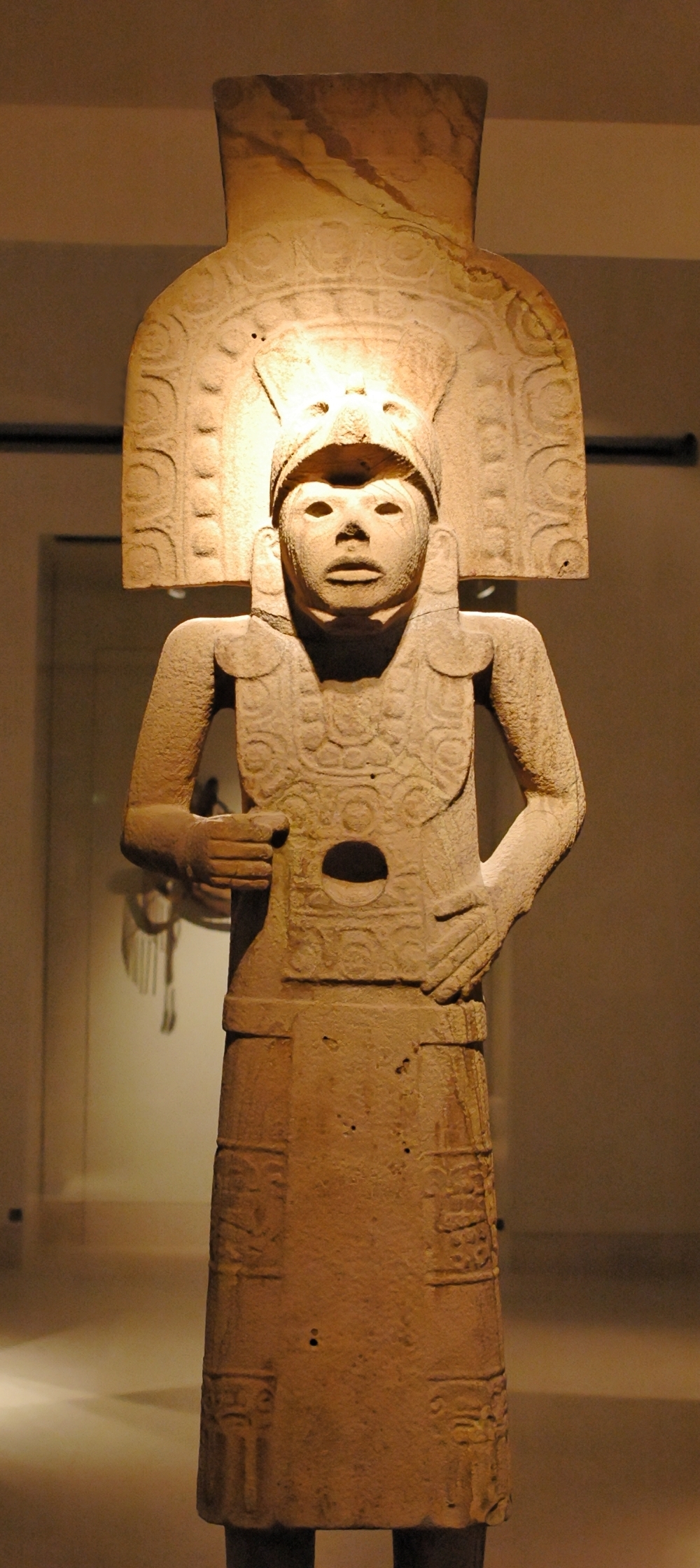
The name "Tampico" is of Huastec origin, tam-piko meaning "place of water dogs" (referring to otters which are endemic of the region). The city is surrounded by rivers and lagoons of the delta of the Pánuco River, which was the habitat of a large population of otters. There have been successive human settlements in the area for centuries. The region had several early Huastec settlements, among them the important site at Las Flores, which flourished between AD 1000 and 1250.
In 1532, during the Spanish colonial period, the Franciscan priest Andrés de Olmos established a mission and monastery in the area, building over a former Huastec village. At his request, Spanish officials founded a settlement named San Luis de Tampico in 1554. This site was abandoned in 1684, and the population relocated to the south of the Pánuco River because of frequent attacks by pirates. The area was abandoned for nearly 150 years.
From the History section of Tampico on Wikipedia, under CC BY-SA 4.0.
Where to stay20
Churches and places of worship29
Iglesia la Luz del mundo
Place of worship · 5.3 km
Humbolt esquina con Francisco Javier Mina
Shopping52
Gas and EV charging39
Schools, colleges and libraries56
Secundaria General Nº 7 "Francisco Medina Cedillo"
School · 0.9 km
Torres Miranda Sn, Tampico
The American School of Tampico, Mexico
School · 2.3 km
100 Calle Hidalgo - Colonia Tancol
Healthcare34
Map of Tampico
250 places. The map loads OpenStreetMap tiles when you open it.
Getting there and nearby towns
General Francisco Javier Mina International Airport (TAM) is the nearest airport with scheduled flights listed in OpenStreetMap, 1 km away.
- Ciudad Madero 6 km southeast, about 6 min by car
- Moralillo 8 km southwest, about 8 min by car
- Miramar 9 km north, about 9 min by car
- Primero de Mayo 9 km southeast, about 9 min by car
- Anahuac 9 km south, about 9 min by car
- Benito Juárez 10 km southeast, about 10 min by car
- Ciudad Cuauhtémoc 12 km south, about 12 min by car
- La Pedrera 12 km north, about 12 min by car
- Altamira 14 km northwest, about 14 min by car
- Tamos 14 km southwest, about 14 min by car
Drive times are estimates from straight-line distance, not routes.
Local news
Headlines from INDB.
Reviews, tips and questions
Loading what members have shared...
Sources and licences
- GeoNames (CC BY 4.0): population, coordinates, regions and time zone
- OpenStreetMap contributors (ODbL 1.0): places, airports, map data
- Wikidata (CC0 1.0): elevation, founding date, time zone, website, landmarks and historic places
- Wikimedia Commons (see each image): photos
- Wikipedia (CC BY-SA 4.0): overview and history text
Photo credits
- Tampico, Centro Historico (12059306706), Comisión Mexicana de Filmaciones from México D. F., México, CC BY-SA 2.0
- Cuervos facultad de comercio tampico - panoramio, bohemico1985, CC BY 3.0
- 1971 TAMPICO, MEXICO (4297435982), lindsaybridge from Sydney, Australia, CC BY 2.0
- 1971 TAMPICO, MEXICO (4297437320), lindsaybridge from Sydney, Australia, CC BY 2.0
- CCI campus Tam, Unknown author, Public domain
- Laguna de Carpintero - Tampico MX2, Gabriel Carranza Olguin ( GabboMatamoros ( talk )), CC BY-SA 3.0
- LDStemple83TampicoMexico, Eddie Willers, CC BY-SA 3.0
- Bandera Monumental Ensenada, José R. Quintanilla, CC BY 2.5
- Catedral de la Inmaculada Concepción desde Edificio, JuanGLoya, CC BY-SA 3.0
- Huastec statue Tampico Inv D94-20-600, Marie-Lan Nguyen, Public domain
- Izando la bandera monumental del zocalo, gib_l, CC BY-SA 2.0
- EstadioTamaulipasAGO2025, PersonAngel, CC BY 4.0
- MMTM001, Vmzp85, CC BY-SA 3.0
- TAM (3), Vmzp85, CC BY-SA 4.0
- TAM (2), Vmzp85, CC BY-SA 4.0
- TAM (4), Vmzp85, CC BY-SA 4.0
- MMTM003, Vmzp85, CC BY-SA 3.0
- General Francisco Javier Mina International Airport - 1, ProtoplasmaKid, CC BY 4.0
- TAM (7), Vmzp85, CC BY-SA 4.0
- TAM (6), Vmzp85, CC BY-SA 4.0
- MMTM002, Vmzp85, CC BY-SA 3.0
- Repostaje en avión de Aeroméxico, ProtoplasmaKid, CC BY 4.0
- Eriophora ravilla 254172518, Susan Aide, CC BY 4.0
- Miguel in his beggings, Miguel Ortiz05, CC BY-SA 4.0
- ISS042-E-137433 - View of Earth, Earth Science and Remote Sensing Unit , Lyndon B. Johnson Space Center, Public domain
- ISS030-E-184317 - View of Earth, Earth Science and Remote Sensing Unit , Lyndon B. Johnson Space Center, Public domain
- ISS042-E-137432 - View of Earth, Earth Science and Remote Sensing Unit , Lyndon B. Johnson Space Center, Public domain
- Estadio Tamaulipas - panoramio - Viktorazul, Viktorazul, CC BY-SA 3.0
- Estadio Tamaulipas - panoramio, Viktorazul, CC BY-SA 3.0
- Chelonia mydas 184199270, Susan Aide Morales Cruz, CC BY 4.0
- GYM - panoramio (1), YoPoio, CC BY 3.0
- GYM - panoramio, YoPoio, CC BY 3.0
- Antena XHFW, Ramiro254718, CC BY-SA 4.0
- Sam jr - panoramio, kikoconmor, CC BY-SA 3.0
- Tampiqueña, Gabriel Saldana, CC BY-SA 2.0
- Panulirus guttatus 223055244, Susan Aide, CC BY 4.0
- Isostichopus badionotus 225983164, Susan Aide, CC BY 4.0
- Nicholsina usta 223056050, Susan Aide, CC BY 4.0
- Nicholsina usta 223056050 (closeup), Susan Aide, CC BY 4.0
- Faro 045Cd. Madero, Jesús Eduardo Arteaga Flores, CC BY-SA 3.0


Page built November 4, 2026. Spotted a mistake? Tell us or suggest a place.