


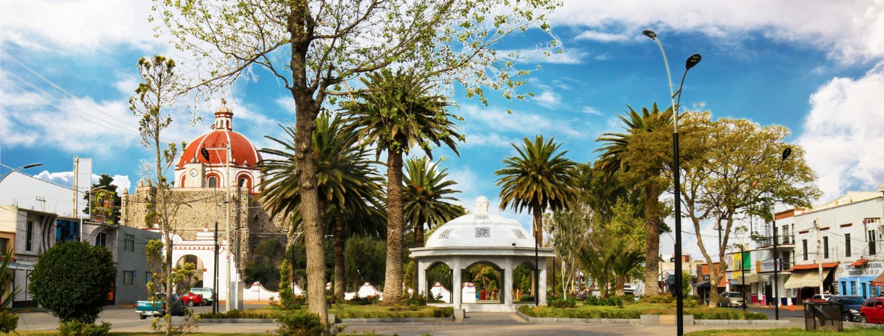

Why visit Temascalapa
Townapedia lists 5 museums and landmarks, 37 parks and trails, 6 places to eat, 1 place to stay and 20 attractions in and around town.
Highlights include Universidad Politecnica Metropolitana de Hidalgo, 1° jardin de Tizayuca and Jardin Central.
Weather in Temascalapa
Forecast from MET Norway (CC BY 4.0). Full forecast
About Temascalapa
Temascalapa is a city in the State of Mexico in Mexico. It serves as the municipal seat for the surrounding municipality of the same name. It is located to the north of Mexico City and in the west of the municipality, close to the border with the state of Hidalgo and connected with the city of Tizayuca by land. This locality was formerly known as San Francisco Temascalapa.
From the Wikipedia article Temascalapa (this version), under CC BY-SA 4.0.
Things to do20

Universidad Politecnica Metropolitana de Hidalgo
School · 13.2 km
University in Hidalgo, Mexico

8 more on the map.
Museums and landmarks5

Museo Comunitario Tetetzontlilco
Museum · 6.3 km
Morelos s/n Col. Olmos, Tizayuca

Parks, trails and playgrounds37


25 more on the map.
Restaurants and cafes6

Restaurante El retiro
Restaurant · Burger, Regional, Mexican, Barbecue
dr gustavo baz, Temascalapa
Fr,Sa 10:00-22:00
Roma Mia
Restaurant · 8.2 km
10 Avenida Juarez Norte, Tizayuca

Antojitos Mexicanos Ansu
Fast food · Barbecue, Diner, Mexican, Pancake, Savory Pancakes, Steak House · 8.5 km
Su-Mo,We-Sa 09:00-22:00
Where to stay1
Churches and places of worship7
Shopping10
Gas and EV charging6
Schools, colleges and libraries28
Colegio de Estudios Cientificos y Tecnologicos del Estado de Hidalgo Plantel Tizayuca
School · 8.1 km
Healthcare4
Consultorio Medico y Farmacia la Eder
Clinic and pharmacy · 9.6 km
Calle Michoacán
Map of Temascalapa
124 places. The map loads OpenStreetMap tiles when you open it.
Getting there and nearby towns
Felipe Ángeles International Airport (NLU) is the nearest airport with scheduled flights listed in OpenStreetMap, 15 km away.
- San Pablo de las Salinas 27 km southwest, about 27 min by car
- Tequixquiac 27 km west, about 27 min by car
- Ecatepec de Morelos 30 km southwest, about 30 min by car
- Tultepec 29 km southwest, about 29 min by car
- San Francisco Coacalco 31 km southwest, about 31 min by car
- San Salvador Atenco 31 km south, about 31 min by car
- Texcoco de Mora 35 km south, about 35 min by car
- Pachuca de Soto 37 km northeast, about 37 min by car
- Buenavista 37 km southwest, about 37 min by car
- Cuautitlán Izcalli 39 km southwest, about 39 min by car
Drive times are estimates from straight-line distance, not routes.
Local news
Headlines from INDB.
Reviews, tips and questions
Loading what members have shared...
Sources and licences
- GeoNames (CC BY 4.0): population, coordinates, regions and time zone
- OpenStreetMap contributors (ODbL 1.0): places, airports, map data
- Wikidata (CC0 1.0): elevation, founding date, time zone, website, landmarks and historic places
- Wikimedia Commons (see each image): photos
- Wikipedia (CC BY-SA 4.0): overview and history text
Photo credits
- Parroquia San Francisco de Asis (Temascalapa) Estado de México, Catedrales e Iglesias/Cathedrals and Churches, CC BY 2.0
- ISS053-E-142392 - View of Earth, Earth Science and Remote Sensing Unit , Lyndon B. Johnson Space Center, Public domain
- ISS016-E-31006 - View of Earth, Earth Science and Remote Sensing Unit , Lyndon B. Johnson Space Center, Public domain
- ISS053-E-142393 - View of Earth, Earth Science and Remote Sensing Unit , Lyndon B. Johnson Space Center, Public domain
- Amanecer en Huitzila, México, 2013-10-10, DD 01, Diego Delso, CC BY-SA 3.0
- Tizayuca, Diana Elizabeth Mendez Rosas, CC BY-SA 4.0
Page built November 4, 2026. Spotted a mistake? Tell us or suggest a place.