
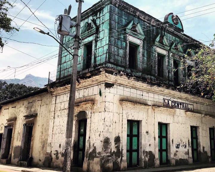


Urique, Mexico
Urique is a town of 1,102 people in Chihuahua, Mexico, founded in January 12, 1690.
Why visit Urique
Townapedia lists 1 museum or landmark, 7 places to stay and 2 attractions in and around town.
Weather in Urique
Forecast from MET Norway (CC BY 4.0). Full forecast
About Urique
Urique (Tarahumara: Urike) is a town and seat of the municipality of Urique, in the northern Mexican state of Chihuahua. As of 2010, the town of Urique had a population of 1,102, up from 984 as of 2005. Located in the southwest corner of the state in the region of the cliffs, the town is at the bottom of the valley Barranca de Urique, formed by the river of the same name, due to its relatively low elevation above sea level (about 550 meters) the climate of Urique is close to tropical. It's the principal village of the Municipality of Urique.
From the Wikipedia article Urique (this version), under CC BY-SA 4.0.
Things to do2

Museums and landmarks1

Where to stay7


Churches and places of worship1

Shopping3
Gas and EV charging1
Map of Urique
15 places. The map loads OpenStreetMap tiles when you open it.
Getting there and nearby towns
Aereopuerto de Alamos (XAL) is the nearest airport with scheduled flights listed in OpenStreetMap, 104 km away.
- Guapalayna 4 km southeast, about 4 min by car
- Cerocahui 17 km northwest, about 17 min by car
- Batopilas de Manuel Gómez Morín 27 km southeast, about 27 min by car
- San Rafael 31 km north, about 31 min by car
- Témoris 37 km west, about 37 min by car
- Samachique 38 km east, about 38 min by car
- Yoquivo 43 km southeast, about 43 min by car
- Polanco (Ranchería Mineral Polanco) 50 km southeast, about 50 min by car
- Creel 66 km northeast, about 1 h by car
- Choix 69 km southwest, about 1 h 15 min by car
Drive times are estimates from straight-line distance, not routes.
Local news
Headlines from INDB.
Reviews, tips and questions
Loading what members have shared...
Sources and licences
- GeoNames (CC BY 4.0): population, coordinates, regions and time zone
- OpenStreetMap contributors (ODbL 1.0): places, airports, map data
- Wikidata (CC0 1.0): elevation, founding date, time zone, website
- Wikimedia Commons (see each image): photos
- Wikipedia (CC BY-SA 4.0): overview and history text
Photo credits
- La Centrale en Urique, MikSed, CC BY 4.0
- Palacio municipal de Urique, MikSed, CC BY 4.0
- Cyanocitta stelleri diademata, Urique, Chihuahua, Mexico 2, gzepeda, CC BY-SA 4.0
- Guapalayna - panoramio, panza.rayada, CC BY-SA 3.0
- ISS043-E-175432 - View of Earth, Earth Science and Remote Sensing Unit , Lyndon B. Johnson Space Center, Public domain
- ISS013-E-30191 - View of Mexico, Earth Science and Remote Sensing Unit , Lyndon B. Johnson Space Center, Public domain
- ISS043-E-175431 - View of Earth, Earth Science and Remote Sensing Unit , Lyndon B. Johnson Space Center, Public domain

Page built November 4, 2026. Spotted a mistake? Tell us or suggest a place.