


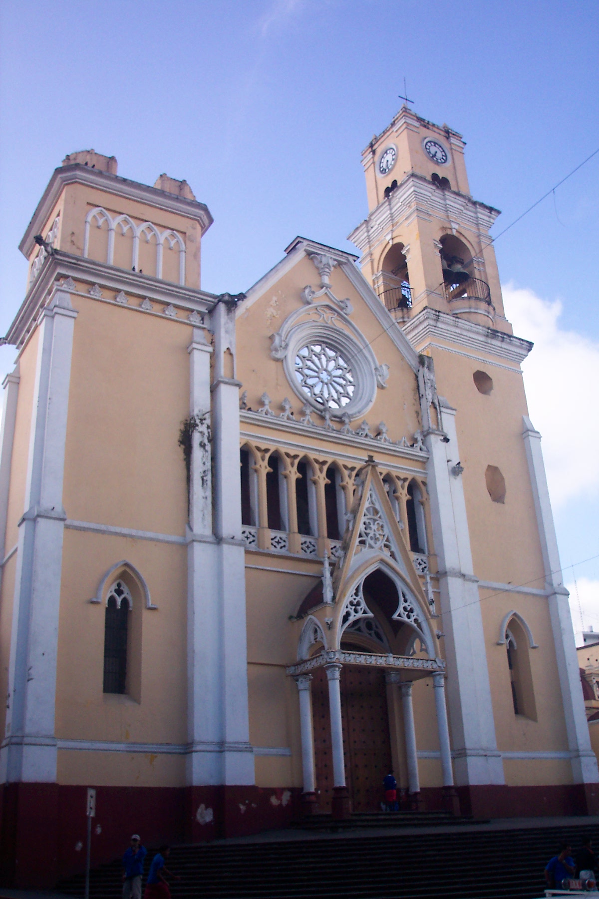
Xalapa de Enríquez, Mexico
Xalapa-Enríquez
Xalapa de Enríquez is a regional capital of 424,755 people in Veracruz, Mexico, founded in 1791.
Why visit Xalapa de Enríquez
Townapedia lists 25 museums and landmarks, 18 parks and trails, 222 places to eat, 56 places to stay and 17 attractions in and around town.
Highlights include Instituto Tecnológico Superior de Xalapa, Universidad de América Latina, Jardín de Esculturas and Museo de Antropología de Xalapa.
Weather in Xalapa de Enríquez
Forecast from MET Norway (CC BY 4.0). Full forecast
About Xalapa de Enríquez
Xalapa or Jalapa (English: , Spanish: [xaˈlapa] ), officially Xalapa-Enríquez (IPA: [xaˈlapa enˈrikes]), is the capital city of the Mexican state of Veracruz and the name of the surrounding municipality. In 2020 census the city reported a population of 443,063 and the municipality of which it serves as municipal seat reported a population of 488,531. The municipality has an area of 118.45 km2. Xalapa lies near the geographic center of the state and is the second-largest city in the state after the city of Veracruz to the southeast.
From the Wikipedia article Xalapa (this version), under CC BY-SA 4.0.
Travel tips from other travellers: Xalapa de Enríquez on Wikivoyage (CC BY-SA 4.0).
Things to do17

Instituto Tecnológico Superior de Xalapa
School · 4.9 km
University in Xalapa, Veracruz, Mexico
Universidad de América Latina
School · 4.7 km
University in Xalapa, Mexico

Cinema Nahual
Cinema and theater · 1.0 km
Cinema Nahual es una sala independiente de cine que es construida por un grupo de cinéfilos con el afán de conformar una comunidad y...
14 Calle José Azueta, Xalapa
Teatro J. J. Herrera
Cinema and theater · 1.1 km
12 Miguel Palacios, Xalapa
El Rincón de los Títeres de Merequetengue
Cinema and theater · 0.7 km
28 Diego Leño, Xalapa
5 more on the map.
Museums and landmarks25


Museo de Antropología de Xalapa
Museum · 2.7 km
Museum in Xalapa, Mexico

Museo Interactivo de Xalapa
Museum · 2.7 km
Museum in Xalapa, Veracruz, Mexico

Museo Casa de Xalapa
Museum · 1.0 km
7 J.J. Herrera, Xalapa - Enriquez
Mo-Su 09:00-19:00
Casa Doña Falla Museo de la Música Veracruzana
Museum · 0.9 km
Callejón de la Calavera, Xalapa

13 more on the map.
Parks, trails and playgrounds18


Estadio Xalapeño Heriberto Jara Corona
Sports field and stadium · 1.3 km

Plazuela Manuel Maples Arce
Park
Parque de diseño estridentista dedicado a Manuel Maples Arce, poeta, abogado, diplomático y escritor mexicano, fundador del...

6 more on the map.
Restaurants and cafes222


La mera mata
Cafe · Breakfast, Coffee Shop, Local, Mexican, Sandwich · 1.4 km
91 Calle Soconusco
Mo-Fr 08:00-17:00
La petite
Cafe · Coffee Shop, Breakfast, Crepe, Sandwich, Cake, Tea, Savory Pancakes · 1.0 km
37 Simón Bolívar
Mo-Sa 07:30-18:00
La Contemporánea
Restaurant · Italian · 1.1 km
7 Avenida Manuel Ávila Camacho, Xalapa
We-Su 14:00-22:30
Pizzas "La Paz"
Restaurant · Pizza · 1.3 km
20 Avenida de los Atletas, Xalapa
Mo-Fr 08:00-11:15
Taquería "Santos" Sucursal Atletas
Restaurant · Tacos, Mexican · 1.3 km
Avenida de los Atletas, Xalapa
Mo-Su 11:00-02:00
Cazuelas de Crunch
Restaurant · Asian, Chinese, Curry, Indian, Indonesian, International · 1.2 km
32 B1 Calle Miguel Palacios
Th-Su 12:00-18:00
El auténtico taco misanteco
Restaurant · Regional · 0.6 km
Deliciosos tacos y empapatadas tipicas de Misantla, Veracruz.
16:00-23:00

La Pistería de Barrio
Bar and pub · 1.3 km
Avenida de los Atletas, Xalapa
Mo-Su 13:00-03:00

La estrella de la hojaldra
Bakery
46 Calle Ignacio Aldama
Mo-Fr 09:00-18:00
210 more on the map.
History
The Totonacs first established themselves around Macuiltepetl ("fifth mountain" in Nahuatl). This extinct volcano received its name because the Aztecs used it as the fifth reference mountain to get to the gulf of Mexico's shores. Today it is preserved in a park. During the 14th century, four indigenous peoples settled in the territory today known as Xalapa. Each built a small village: Xalitic (in the sand) was founded by the Totonacas; in the northeast Tecuanapan (river of the beasts) was founded by the Toltecas, and Tlalnecapan was founded by the Teochichimecas.
Around 1313, the four villages grew together and joined, forming one large village named Xallapan. Moctezuma Ilhuicamina, the fifth Aztec emperor, invaded the territory during the second half of the 15th century. All the land was ruled as part of the Aztec Empire before the arrival and conquest of the Spanish conquistadores.
In 1519 Hernán Cortés passed through en route to Tenochtitlan. In 1555 Spanish Franciscans completed construction of a convent, an important event in the Nueva España of that time.
When the Spanish invaded, Xalapa was barely populated. The population rose after the conquest and colonial settlement. When the Spanish improved the Mexico-Orizaba-Veracruz route, Xalapa declined in importance as a transport hub, and its population stagnated in the 17th century.
From the History section of Xalapa on Wikipedia, under CC BY-SA 4.0.
Where to stay56
Churches and places of worship20
Shopping98
Ciclismo Mexicano e Internacional
Shop · 1.2 km
86 Gobernador Jorge Serdán Norte, Xalapa
Gas and EV charging4
Schools, colleges and libraries84
Colegio Preparatorio de Xalapa
School · 0.8 km
57 Benito Juárez, Xalapa
Biblioteca Pública "José Vasconcelos"
Library · 1.0 km
59 Sebastián Camacho, Xalapa
Healthcare36
Clínica de Rehabilitación San José
Clinic and pharmacy · 0.8 km
17 Hilario C Salas
Map of Xalapa de Enríquez
250 places. The map loads OpenStreetMap tiles when you open it.
Getting there and nearby towns
El Lencero National Airport (JAL) is the nearest airport with scheduled flights listed in OpenStreetMap, 14 km away.
- Lomas Verdes 4 km southeast, about 4 min by car
- Colonia Santa Bárbara 5 km southeast, about 5 min by car
- Fraccionamiento las Fuentes 5 km southeast, about 5 min by car
- Guadalupe Victoria 5 km northwest, about 5 min by car
- Pacho Viejo 6 km south, about 6 min by car
- El Castillo 6 km east, about 6 min by car
- La Haciendita 5 km north, about 5 min by car
- Mariano Escobedo 5 km southwest, about 5 min by car
- Orizaba 78 km south, about 1 h 15 min by car
- Veracruz 90 km southeast, about 1 h 30 min by car
Drive times are estimates from straight-line distance, not routes.
Local news
Headlines from INDB.
Reviews, tips and questions
Loading what members have shared...
Sources and licences
- GeoNames (CC BY 4.0): population, coordinates, regions and time zone
- OpenStreetMap contributors (ODbL 1.0): places, airports, map data
- Wikidata (CC0 1.0): elevation, founding date, time zone, website, landmarks and historic places
- Wikimedia Commons (see each image): photos
- Wikipedia (CC BY-SA 4.0): overview and history text
Photo credits
- Pico de Orizaba desde Xalapa, Eneas De Troya from Mexico City, México, CC BY 2.0
- Jardín de las Esculturas, Xalapa, Pequeño mar, CC BY-SA 4.0
- Anthropology Museum Xalapa, Burkhard Mücke, CC BY-SA 4.0
- Pinacoteca Diego Rivera, Xalapa 1, Pequeño mar, CC BY-SA 4.0
- Parque Juárez, Haakon S. Krohn, CC BY-SA 3.0
- Xalapa catedral, Unknown author, CC BY 2.5
- Estadio xalapeño desde afuera, Koffermejia, CC BY-SA 4.0
- Colegio Preparatorio de Xalapa, Tattaglia2001, CC BY-SA 4.0
- Stadium-1922, BlueBook, p 181, Unknown author Unknown author, Public domain
- Trompo de pastor, detalle - festival del taco en xalapa 2023, Koffermejia, CC BY-SA 4.0
- Trompo gigante de pastor - festival del taco en xalapa 2023, Koffermejia, CC BY-SA 4.0
- Quinta de "Las Rosas" 03, Koffermejia, CC BY-SA 4.0
- Quinta de "Las Rosas" 01, Koffermejia, CC BY-SA 4.0
- Quinta de "Las Rosas" 02, Koffermejia, CC BY-SA 4.0
- Trompo de pastor - festival del taco en xalapa 2023 01, Koffermejia, CC BY-SA 4.0
- Trompos de pastor - festival del taco en xalapa 2023, Koffermejia, CC BY-SA 4.0
- Tacos al pastor con piña, Koffermejia, CC BY-SA 4.0
- Calle xalapeños ilustres en san jose, Koffermejia, CC0
- Fachada y escaleras iglesia de san jose, Koffermejia, CC0
- Arco en frente de la iglesía de San jose, Koffermejia, CC BY-SA 4.0
- Fachada de la iglesia de san jose, Koffermejia, CC0
- Tarde en San José, José Navarro Salazar, CC BY-SA 4.0
- Asilo de Ancianos "Sayago" 03, Tattaglia2001, CC BY-SA 4.0
- Asilo de Ancianos "Sayago" 01, Tattaglia2001, CC BY-SA 4.0
- Asilo de Ancianos "Sayago" 02, Tattaglia2001, CC BY-SA 4.0
- Exposición de Fernanda Brunet en Xalapa 01, Koffermejia, CC0
- Jardin de la Galería Ramón Alva de La Canal, Koffermejia, CC BY-SA 4.0
- Galería Ramón Alva de La Canal, Koffermejia, CC BY-SA 4.0
- Dr. Simi en Xalapa (2007), Jorge Díaz, CC BY-SA 2.0
- Hongos en Xalapa, Koffermejia, CC BY-SA 4.0
- Teodoro A. Dehesa, Filibertosanchez, CC BY-SA 4.0
- Hdez y Hdez., Hiram Becerra, CC BY-SA 4.0
- Adalberto Tejeda 28-32, Hiram Becerra, CC BY-SA 4.0
- Primaria Rebsamen, Koffermejia, CC BY-SA 4.0
- Escuela Primaria "Enrowue C. Réndamen" 08, Tattaglia2001, CC BY-SA 4.0
- Escuela Primaria "Enrowue C. Réndamen" 03, Tattaglia2001, CC BY-SA 4.0
- Escuela Primaria "Enrowue C. Réndamen" 05, Tattaglia2001, CC BY-SA 4.0
- Escuela Primaria "Enrowue C. Réndamen" 02, Tattaglia2001, CC BY-SA 4.0
- Escuela Primaria "Enrowue C. Réndamen" 06, Tattaglia2001, CC BY-SA 4.0
- Escuela Primaria "Enrowue C. Réndamen" 04, Tattaglia2001, CC BY-SA 4.0


Page built November 4, 2026. Spotted a mistake? Tell us or suggest a place.