
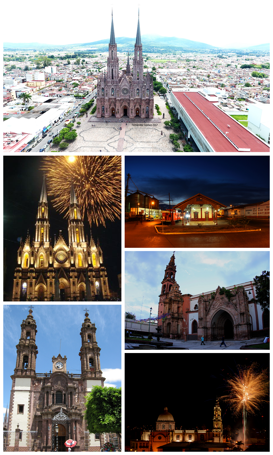


Zamora de Hidalgo, Mexico
Zamora de Hidalgo is a town of 186,102 people in Michoacán, Mexico.
Why visit Zamora de Hidalgo
Townapedia lists 10 museums and landmarks, 18 parks and trails, 117 places to eat, 17 places to stay and 6 attractions in and around town.
Weather in Zamora de Hidalgo
Forecast from MET Norway (CC BY 4.0). Full forecast
About Zamora de Hidalgo
Zamora de Hidalgo (Spanish pronunciation: [saˈmoɾa de iˈdalɢo]) is a city in the Mexican state of Michoacán. The 2010 census population was 141,627, making it the third largest city in the state. The city is the municipal seat of Zamora Municipality, which has an area of 330.97 km2 (127.79 sq mi) and includes many other smaller communities, the largest of which is Ario de Rayón (formerly known as
From the Wikipedia article Zamora, Michoacán (this version), under CC BY-SA 4.0.
Travel tips from other travellers: Zamora de Hidalgo on Wikivoyage (CC BY-SA 4.0).
Things to do6


Museums and landmarks10




Parks, trails and playgrounds18


6 more on the map.
Restaurants and cafes117

Doña Tota
Restaurant · Mexican · 1.0 km
1348 Avenida Francisco I. Madero Sur, Zamora
Mo-Su 08:00-19:00
Magnolia lounge
Restaurant · Sushi, American, Pasta, Salad, Mexican, Breakfast, Seafood, Sandwich · 1.0 km
Avenida Morelos Norte, Zamora
Tu-Su 10:00-22:00
Mr. Fries Burguer
Restaurant · Burger · 0.9 km
09 Calle Paseo de los Almendros, Zamora
We-Mo 13:00-22:00
Pozoleria Iguala galerias
Restaurant · Mexican · 1.2 km
333 Avenida Francisco I. Madero Norte, Zamora
Tu-Su 14:00-20:00
Al chile Toritos artesanales
Restaurant · Mexican · 1.2 km
Ferrocarril Poniente, Zamora
Mo-Sa 09:00-16:30
Cazamora
Restaurant · Brunch · 0.8 km
1146 Calle Pino Suárez, Zamora
Mo-Su 09:00-18:00

D'Garrafa
Ice cream · 1.1 km
260 Avenida Morelos Norte, Zamora
Mo-Su 12:00-20:00
El Ranchito Caldo de cabeza estilo Apatzingán
Restaurant · Soup, Birria · 1.3 km
584 Prolongación 5 de Mayo, Zamora
Th-Tu 08:00-13:00
El tridente Sinaloense
Restaurant · Seafood · 1.3 km
145-A Ferrocarril Oriente, Zamora
Mo-Su 11:30-19:00
Geisha Sushi Roll
Restaurant · Sushi · 1.3 km
24-A Avenida Ferrocarril, Zamora
Mo-Su 13:00-22:00
Hi Burguer
Restaurant · Burger, Mexican, Breakfast, Brunch · 1.2 km
139-A Avenida Ferrocarril, Zamora
We-Mo 08:00-22:00
Hot Long Zamora
Restaurant · Hot Dog · 1.0 km
13 Calle Paseo de los Almendros, Zamora
Mo-Su 09:00-21:00
105 more on the map.
History
Evidence shows the area was first settled around 1500 BC. During the Pre-Columbian Period there were several waves of migrations into the area by surrounding tribes: Pirinda, Nahua, Huetamo, Colima, and Purépecha. Zamora sits in the Tziróndaro Valley which means "swamp place" in the Purépecha language.
The village of Zamora was founded on January 18, 1574, on the orders of Viceroy Martín Enríquez de Almanza, by Spanish settlers from the Spanish city of Zamora. The Spanish were attracted to the area because of fertile valleys in the region that were well suited for agricultural development.
Zamora was awarded city status by the Constituent Congress in 1825, ratifying a decision made on November 21, 1810 by the Mexican War of Independence revolutionary leader Miguel Hidalgo y Costilla. During the 19th century, Zamora developed into a great cultural and economic center due to high agricultural productivity and flourishing commerce. On December 10, 1831, Zamora was declared the municipal seat. Later the city's elite began a political movement to create a new state in which Zamora would be the state capital. In 1846, Archbishop Pelagio Antonio de Labastida y Dávalos initiated a clerical separation from Mexico City. By 1862 a new ecclesiastical office was founded, Dioceses of Zamora based in Zamora. The political aspirations to separate from the rest of the state were impeded.
From the History section of Zamora, Michoacán on Wikipedia, under CC BY-SA 4.0.
Where to stay17
Hotel Las Fuentes
Motel and hotel · 1.0 km
514 Calle Martínez de Navarrete Oriente
Churches and places of worship28
Parroquia de La Purisima
Church · Roman Catholic
101 Avenida Cristóbal Colón Poniente
Capilla de Nuestra Señora de Fátima
Place of worship · 2.2 km
1220 Avenida Juárez Eje Poniente
Shopping40
Bodega Aurrerá Express, San Rafael Zamora
Grocery · 1.9 km
795 Avenida Juárez Eje Poniente
Gas and EV charging6
Schools, colleges and libraries69
Biblioteca Luis González COLMICH
Library · 1.0 km
549 Calle Martínez de Navarrete Oriente
Healthcare46
Centro Oftalmológico San Martín
Clinic and pharmacy · 1.1 km
293 Avenida Morelos Norte, Zamora
Farmacia Zamora
Clinic and pharmacy · 0.6 km
Avenida Benito Juárez Oriente, Zamora
Centro Integral de Diagnóstico
Clinic and pharmacy · 0.9 km
779 Avenida 5 de Mayo
Map of Zamora de Hidalgo
250 places. The map loads OpenStreetMap tiles when you open it.
Getting there and nearby towns
Zamora Airport (ZMM) is the nearest airport with scheduled flights listed in OpenStreetMap, 7 km away.
- Jacona de Plancarte 4 km southwest, about 4 min by car
- Fraccionamiento Monte Olivo 4 km east, about 4 min by car
- Chaparaco 4 km southeast, about 4 min by car
- Tamándaro 4 km south, about 4 min by car
- Colonia Linda Vista 4 km east, about 4 min by car
- Fraccionamiento Ex-Hacienda el Refugio 5 km southeast, about 5 min by car
- La Estancia de Amezcua 5 km northeast, about 5 min by car
- Colonia Primero de Mayo (La Beatilla) 5 km east, about 5 min by car
- El Cerrito de Catipuato (Cerrito de Ortiz) 5 km north, about 5 min by car
- Romero de Torres 6 km northeast, about 6 min by car
Drive times are estimates from straight-line distance, not routes.
Local news
Headlines from INDB.
Reviews, tips and questions
Loading what members have shared...
Sources and licences
- GeoNames (CC BY 4.0): population, coordinates, regions and time zone
- OpenStreetMap contributors (ODbL 1.0): places, airports, map data
- Wikidata (CC0 1.0): elevation, founding date, time zone, website, landmarks and historic places
- Wikimedia Commons (see each image): photos
- Wikipedia (CC BY-SA 4.0): overview and history text
Photo credits
- Zamora recop, Mauricio C., CC BY-SA 4.0
- Santuario deGuadalupe Mexico, Maximiliandrake, CC BY-SA 3.0
- Catedral Zamora-Mich, Moadib, Public domain
- Organo del santuario guadalupano de Zamora, Drini, CC BY-SA 4.0
Page built November 4, 2026. Spotted a mistake? Tell us or suggest a place.