


Why visit Nanuet
Townapedia lists 16 museums and landmarks, 8 parks and trails, 42 places to eat, 8 places to stay and 2 attractions in and around town.
Highlights include Regal Nanuet & RPX, Yeshiva Zichron Yaakov, Eckerson House and Edward Salyer House.
July is the warmest month, with average highs of 86°F; January lows average 23°F, and about 33 inches of snow fall in a normal year.
Weather in Nanuet
Forecast from the National Weather Service. Full forecast
About Nanuet
Nanuet (English pronunciation: /ˈnænjuɛːt/ ) is a hamlet and census-designated place in the town of Clarkstown, New York, United States. The third largest hamlet in Clarkstown, it is located north of Pearl River, south of New City, east of Spring Valley, and west of West Nyack. It is located midway between Manhattan and Bear Mountain, 19 miles (31 km) north and south of each respectively; and 2 miles (3 km) north of the New Jersey border. It has one of three Rockland County stations on New Jersey Transit's Pascack Valley Line.
From the Wikipedia article Nanuet, New York (this version), under CC BY-SA 4.0.
Things to do2


Yeshiva Zichron Yaakov
School · 3.8 mi
All-male Jewish Orthodox high school located in New Hempstead, New York
Museums and landmarks16

Eckerson House
Monument and historic site · National Register of Historic Places · 3.2 mi
Historic house in Montvale, New Jersey

Edward Salyer House
Monument and historic site · National Register of Historic Places · 3.0 mi
Historic house in New York, United States

Forshee-Van Orden House
Monument and historic site · National Register of Historic Places · 3.3 mi
Historic house in New Jersey, United States

Holdrum-Van Houten House
Monument and historic site · National Register of Historic Places · 3.5 mi
Historic house in Montvale, New Jersey

Hopper House
Monument and historic site · National Register of Historic Places · 4.2 mi
House in New Jersey, United States of America

Houser-Conklin House
Monument and historic site · National Register of Historic Places · 3.8 mi
Historic house in New York, United States

Jacob P. Perry House
Monument and historic site · National Register of Historic Places · 3.1 mi
Historic house in New York, United States

Michael Salyer Stone House
Monument and historic site · National Register of Historic Places · 3.4 mi
Historic house in New York, United States
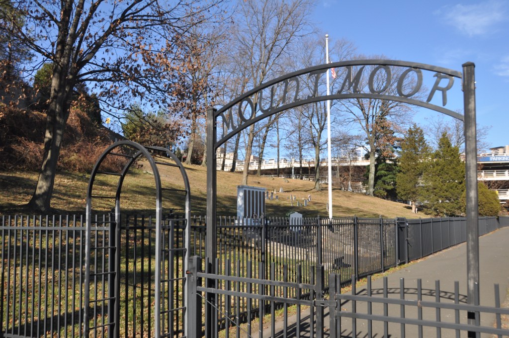
Mount Moor African-American Cemetery
Monument and historic site · National Register of Historic Places · 3.0 mi
Historic cemetery in Rockland County, New York, US

North Main Street School
Monument and historic site · National Register of Historic Places · 2.3 mi
School building in New York, United States of America

Palisades Interstate Parkway
Monument and historic site · National Register of Historic Places · 2.1 mi
Highway in New Jersey and New York
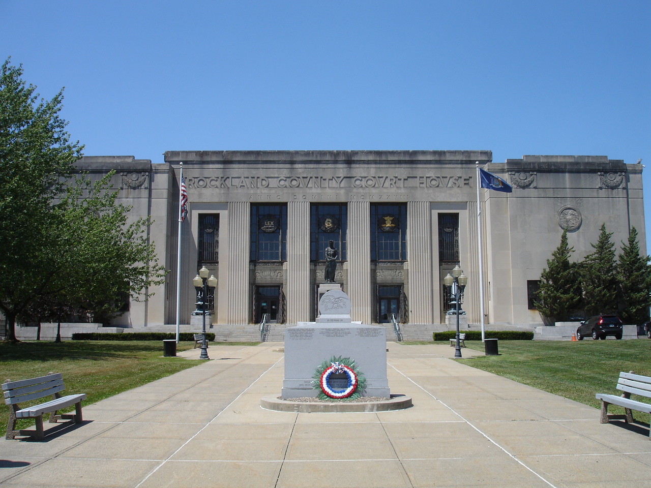


Rockland County Courthouse and Dutch Gardens
Monument and historic site · National Register of Historic Places · 3.8 mi
Historic district in New York, United States of America
4 more on the map.
Parks, trails and playgrounds8



Restaurants and cafes42

Buffalo Wild Wings
Restaurant · Wings
8141 Fashion Drive, Nanuet
Mo-We 11:00-23:00; Th-Sa 11:00-24:00; Su 11:00-23:00

Carvel
Ice cream · Ice Cream · 0.6 mi
49 Rockland Center, Nanuet
Mo-Tu 11:00-22:00, We 10:30-22:30, Th 11:00-22:00, Fr-Sa...
IHOP
Restaurant · Breakfast, Pancake · 0.8 mi
40 Spring Valley Market Place, Spring Valley
Mo-Th,Su 07:00-20:00; Fr,Sa 07:00-21:00
No. 1 Sushi
Restaurant · Japanese, Sushi · 0.6 mi
45 Rockland Center, Nanuet
Mo-Th 11:00-22:30, Fr-Sa 11:00-23:00, Su 12:00-22:30

Bagel Boys New City
Restaurant · Breakfast · 2.1 mi
Popular morning destination for breakfast and coffee. Customers usually consist of local school students and teachers in the mornings....
48 Germonds Road, New City
30 more on the map.
History
The first name of the place was Clarkstown, a name it retained until 1856 when, at the suggestion of James De Clark, the present name was given by Munsee Chief (Nannawitt). Chief Nannawitt sold lands in North Jersey, signed the Wawayanda Patent and witnessed the Cheesecock Patent.
The Erie Railroad arrived in Rockland County in 1841 along its original main line to Piermont. The New Jersey and New York Railroad, the predecessor of the Pascack Valley Line, reached Nanuet in 1869.
From the History section of Nanuet, New York on Wikipedia, under CC BY-SA 4.0.
Where to stay8
Quality Inn Spring Valley - Nanuet
Motel and hotel · 0.7 mi
100 Spring Valley Market Place, Spring Valley
Element Spring Valley
Motel and hotel · 0.7 mi
90 Spring Valley Market Place, Spring Valley
Churches and places of worship28
Brick Church Complex
Church · National Register of Historic Places · 4.0 mi
New Hempstead Presbyterian Church
Church · National Register of Historic Places · 3.8 mi
New North Reformed Low Dutch Church
Church · National Register of Historic Places · 4.1 mi
St. Paul's Episcopal Church
Church · National Register of Historic Places · 1.8 mi
Saint John the Baptist Orthodox Church
Church · Orthodox · 2.2 mi
64 West Church Street, Spring Valley
Saints Constantine and Helen Greek Orthodox Church
Church · Greek Orthodox · 2.3 mi
1 Marycrest Road, West Nyack
Shopping15
Gas and EV charging8
Schools, colleges and libraries59
Healthcare5
Map of Nanuet
191 places. The map loads OpenStreetMap tiles when you open it.
Climate by month
Monthly table
| Month | High | Low | Rain | Snow |
|---|---|---|---|---|
| Jan | 40°F | 23°F | 3.9 in | 9.4 in |
| Feb | 43°F | 24°F | 3.3 in | 10.9 in |
| Mar | 51°F | 31°F | 4.4 in | 5.8 in |
| Apr | 63°F | 40°F | 4.3 in | 0.7 in |
| May | 73°F | 50°F | 4.3 in | 0.0 in |
| Jun | 81°F | 59°F | 4.6 in | 0.0 in |
| Jul | 86°F | 64°F | 4.5 in | 0.0 in |
| Aug | 84°F | 63°F | 4.4 in | 0.0 in |
| Sep | 77°F | 56°F | 4.6 in | 0.0 in |
| Oct | 65°F | 45°F | 4.4 in | 0.0 in |
| Nov | 54°F | 36°F | 3.9 in | 0.3 in |
| Dec | 44°F | 29°F | 4.7 in | 5.6 in |
U.S. Climate Normals 1991-2020 for Dobbs Ferry-Ardsley Hcn (11 mi away), NOAA NCEI.
People and cost of living
American Community Survey 5-year estimates, 2020-2024, U.S. Census Bureau. Estimates have margins of error, larger for small towns.
Disaster history
Rockland County has had 20 federal disaster declarations since 2000, most often for hurricanes.
- 2023-07-22: Severe Storms And Flooding (Severe Storm)
- 2021-09-05: Remnants Of Hurricane Ida (Hurricane)
- 2021-09-02: Remnants Of Hurricane Ida (Hurricane)
- 2021-08-22: Hurricane Henri (Hurricane)
- 2020-10-02: Tropical Storm Isaias (Hurricane)
- 2020-03-20: Covid-19 Pandemic (Biological)
OpenFEMA disaster declarations summaries.
Getting there and nearby towns
Westchester County Airport (HPN) is the nearest airport with scheduled flights listed in OpenStreetMap, 16 miles away.
- Chestnut Ridge 2 mi southwest, about 3 min by car
- Monsey 3 mi west, about 5 min by car
- Airmont 4 mi west, about 7 min by car
- Hillsdale 6 mi south, about 10 min by car
- Haverstraw 7 mi northeast, about 11 min by car
- Ramsey 7 mi west, about 12 min by car
- Westwood 7 mi south, about 12 min by car
- Waldwick 8 mi southwest, about 13 min by car
- Ridgewood 9 mi southwest, about 15 min by car
- Dobbs Ferry 10 mi southeast, about 16 min by car
Drive times are estimates from straight-line distance, not routes.
Local news
Headlines from INDB, the NEMICO news database.
Reviews, tips and questions
Loading what members have shared...
Sources and licences
- NCES EDGE (Public domain): public schools
- NOAA NCEI U.S. Climate Normals 1991-2020 (Public domain): climate by month
- OpenFEMA (Public domain): disaster declarations
- OpenStreetMap contributors (ODbL 1.0): places, airports, map data
- U.S. Census Bureau (Public domain): population, income, housing, education, commute
- Wikidata (CC0 1.0): elevation, founding date, time zone, website, landmarks and historic places
- Wikimedia Commons (see each image): photos
- Wikipedia (CC BY-SA 4.0): overview and history text
Photo credits
- Nanuet NY Shops, Alexisrael, CC BY-SA 3.0
- Brinks Robbery Nanuet, NYErik, CC BY 4.0
- Brinks Robbery Nanuet2, NYErik, CC BY-SA 4.0
- Former Sears Mall Entrance at Nanuet Mall, March 2016, TMBLover, CC BY-SA 3.0
- New Hempstead Presbyterian Church, New City, NY, Daniel Case, CC BY-SA 3.0
- ST. PAUL'S EPISCOPAL CHURCH, Spring Valley, New York, JERRYE AND ROY KLOTZ, M.D., CC BY-SA 4.0
- HOPPER HOUSE, UPPER SADDLE RIVER, BERGEN COUNTY, NJ, JERRYE & ROY KLOTZ M.D., CC BY-SA 4.0
- The Old Stone Church, Upper Saddle River, NJ - south view, Zeete, CC BY-SA 4.0
- Brick Church, Jimstu8, CC BY-SA 3.0
- HOLDRUM-VAN HOUTEN HOUSE, MONTVALE, BERGEN COUNTY, JERRYE & ROY KLOTZ, M.D., CC BY-SA 4.0
- Michael Salyer Stone House, Orangetown, NY, Daniel Case, CC BY-SA 3.0
- North Main Street School, Spring Valley, NY, Daniel Case, CC BY-SA 3.0
- WestNyackNY TerneurHuttonHouse, User:Magicpiano, CC BY-SA 4.0
- Pearl River, NY, post office, Daniel Case, CC BY-SA 3.0
- New York - Palisades Interstate Parkway - 20180904201335, Kapitangrant, CC BY-SA 4.0
- 280 Chestnut Ridge Road, Montvale, NJ - Eckerson House, Zeete, CC BY-SA 4.0
- Edward Salyer House, Pearl River, NY, Daniel Case, CC BY-SA 3.0
- Jacob P Perry House, Pearl River, NY, Daniel Case, CC BY-SA 3.0
- WestNyackNY MountMoorCemetery 01, User:Magicpiano, CC BY-SA 4.0
- HOUSER-CONKLIN HOUSE, MONSEY, ROCKLAND COUNTY, NY, JERRYE & ROY KLOTZ. M.D., CC BY-SA 4.0
- Spring Valley, NY, post office, Daniel Case, CC BY-SA 3.0
- RocklandCountyCourthouse, KForce, CC BY-SA 3.0
- FORSHEE-VAN ORDEN HOUSE, MONTVALE, BERGEN COUNTY, NJ, JERRYE & ROY KLOTZ, M.D., CC BY-SA 4.0
- 9.6.07PalisadesCenterMallFoodCourtbyLuigiNovi, Nightscream at English Wikipedia, CC BY-SA 2.5
- ISS043-E-243777 - View of Earth, Earth Science and Remote Sensing Unit , Lyndon B. Johnson Space Center, Public domain
- ISS043-E-243778 - View of Earth, Earth Science and Remote Sensing Unit , Lyndon B. Johnson Space Center, Public domain
- Ново-Дивеевский монастырь (13370703825), Dennis from New York, USA, CC BY-SA 2.0
- Ново-Дивеевский монастырь (13371079144), Dennis from New York, USA, CC BY-SA 2.0
- Ново-Дивеевский монастырь (13371129804), Dennis from New York, USA, CC BY-SA 2.0
- Ново-Дивеевский монастырь (13370889223), Dennis from New York, USA, CC BY-SA 2.0
- Ново-Дивеевский монастырь (13370693285), Dennis from New York, USA, CC BY-SA 2.0
- Ново-Дивеевский монастырь (13370835623), Dennis from New York, USA, CC BY-SA 2.0
- Ново-Дивеевский монастырь (13371136734), Dennis from New York, USA, CC BY-SA 2.0
- Ново-Дивеевский монастырь (13370901223), Dennis from New York, USA, CC BY-SA 2.0
- Русское кладбище в Ново-Дивееве (13371086744), Dennis from New York, USA, CC BY-SA 2.0
- Русское кладбище в Ново-Дивееве (13370800535), Dennis from New York, USA, CC BY-SA 2.0
- Русское кладбище в Ново-Дивееве (13371173444), Dennis from New York, USA, CC BY-SA 2.0
- Русское кладбище в Ново-Дивееве (13370850773), Dennis from New York, USA, CC BY-SA 2.0
- Русское кладбище в Ново-Дивееве (13371168244), Dennis from New York, USA, CC BY-SA 2.0
- Русское кладбище в Ново-Дивееве (13370766735), Dennis from New York, USA, CC BY-SA 2.0


Page built October 30, 2026. Spotted a mistake? Tell us or suggest a place.