


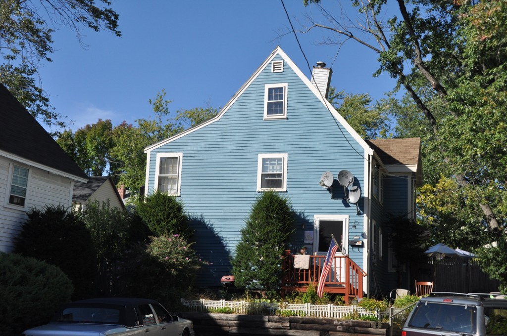
Haverhill, Massachusetts
Haverhill is a city of 67,698 people in Essex County, Massachusetts, founded in 1640.
Why visit Haverhill
Townapedia lists 89 museums and landmarks, 124 parks and trails, 102 places to eat, 2 places to stay and 34 attractions in and around town.
Highlights include AMC Methuen 20, Ski Bradford, Atkinson Academy and Bradford Common Historic District.
July is the warmest month, with average highs of 82°F; January lows average 16°F, and about 58 inches of snow fall in a normal year.
Weather in Haverhill
Forecast from the National Weather Service. Full forecast
About Haverhill
Haverhill is a city in Essex County, Massachusetts, United States. Haverhill is located 35 miles (56 km) north of Boston on the New Hampshire border and about 17 miles (27 km) from the Atlantic Ocean. The population was 67,787 at the 2020 United States census.
From the Wikipedia article Haverhill, Massachusetts (this version), under CC BY-SA 4.0.
Things to do34



22 more on the map.
Museums and landmarks89

Atkinson Academy
Monument and historic site · National Register of Historic Places · 4.9 mi
Public school in Atkinson, New Hampshire, United States
17 Academy Ave., Atkinson

Bradford Common Historic District
Monument and historic site · National Register of Historic Places · 1.2 mi
Historic district in Massachusetts, United States


Peabody School
Monument and historic site · National Register of Historic Places · 1.6 mi
Historic school building in Haverhill, Massachusetts

Abbot-Baker House
Monument and historic site · National Register of Historic Places · 5.2 mi
House in Andover, Massachusetts
Adams-Clarke House
Monument and historic site · National Register of Historic Places · 5.9 mi
United States historic place
American Woolen Company Townhouses
Monument and historic site · National Register of Historic Places · 6.7 mi
United States historic place
Asie Swan House
Monument and historic site · National Register of Historic Places · 5.0 mi
House in Methuen, Massachusetts, United States
Blakeley Building
Monument and historic site · National Register of Historic Places · 6.6 mi
Building in Massachusetts, United States
Bradford Burial Ground
Monument and historic site · National Register of Historic Places · 2.0 mi
Historic cemetery in Massachusetts, United States
Capt. Oliver Emerson Homestead
Monument and historic site · National Register of Historic Places · 4.7 mi
Building in Methuen, Massachusetts, United States
Capt. Timothy Johnson House
Monument and historic site · National Register of Historic Places · 5.9 mi
Historic house in Massachusetts, United States
Charles H. Hayes Building
Monument and historic site · National Register of Historic Places · 0.6 mi
Historic former box factory at 14-44 Granite Street, Haverhill, Massachusetts
77 more on the map.
Parks, trails and playgrounds124

Campagnone Common
Park · 6.3 mi
Park in Lawrence, Massachusetts, United States

Far Corner Golf
Golf course · 3.6 mi
Three 9 hole sub-courses. Can be played Fox/Heron, Heron/Hawk, Hawk/Fox for an 18 hole round.
5 Barker Road, Boxford

Veteran's Memorial Skating Rink
Sports field and stadium · 0.9 mi
City of Haverhill, Veteran's Memorial Skating Rink, Please GPS 137 Monument Street and Enter Through The High School (Brook Street is...
229 Brook Street, Haverhill

John's Woods at Tattersall Farm
Hiking and trails · 2.7 mi
742 N Broadway, Haverhill
dawn-dusk
112 more on the map.
Restaurants and cafes102

Brothers Pizza Haverhill
Restaurant · Pizza, Burger · 1.0 mi
755 Main Street, Haverhill
Mo-Sa 10:30-21:00
Flaco's Mexican Restaurant and Cantina
Restaurant · Mexican · 4.8 mi
172 Plaistow Road, Plaistow
Mo-Th 11:00-22:00; Fr-Sa 11:00-23:00; Su 11:00-21:00
Giovanni's Road Beef & Pizza
Restaurant · Pizza · 0.5 mi
300 Main Street
Su-Th 10:00-22:00; Fr-Sa 10:00-23:00
Joseph's Trattoria
Restaurant · Italian · 0.6 mi
6 Moulton Way, Haverhill
Mo-Sa 16:00-21:00 open "Dinner" || Fr-Sa 11:30-15:00 open "Lunch";...
LongHorn Steakhouse
Restaurant · Steak House · 2.2 mi
59 Plaistow Road
Su-Th 11:00-22:00; Fr,Sa 11:00-23:00

Starbucks
Cafe · Coffee Shop · 4.6 mi
90 Pleasant Valley Street, Methuen
Mo-Th 05:30-21:30; Fr 05:30-23:00; Sa 05:30-22:30; Su 05:30-22:00
la Pizza di Forno
Restaurant · Pizza, Italian · 0.7 mi
109 Merrimack Street, Haverhill
Su-Sa 10:30-20:30
Bruster's Real Ice Cream
Restaurant · 0.6 mi
124 Main Street, Haverhill
Mo-Th 12:00-21:00; Fr 12:00-22:00; Sa-Su 11:00-22:00
Chuck E. Cheese
Restaurant · Pizza · 4.4 mi
90 Pleasant Valley Street, Methuen
Su-Th 11:00-21:00; Fr 11:00-22:00; Sa 10:00-22:00

90 more on the map.
History
Haverhill has played a role in nearly every era of American history, from the initial colonial settlement, to the French and Indian Wars, and the American Revolutionary and Civil Wars.
From the History section of Haverhill, Massachusetts on Wikipedia, under CC BY-SA 4.0.
Where to stay2
Churches and places of worship24
First Baptist Church
Church · National Register of Historic Places · 6.2 mi
First Church Congregational
Church · National Register of Historic Places · 6.2 mi
Grace Episcopal Church
Church · National Register of Historic Places · 6.2 mi
Holy Apostles Saints Peter and Paul Greek Orthodox Church
Church · Greek Orthodox · 0.4 mi
154 Winter Street, Haverhill
Iglesia Casa de Oración El Alfarero
Church · Pentecostal · 0.7 mi
90 Kenoza Avenue, Haverhill
Church of the Holy Redeemer
Place of worship · 4.7 mi
300 Main Street, West Newbury
Shopping23
Gas and EV charging19
Schools, colleges and libraries72
Healthcare14
Map of Haverhill
250 places. The map loads OpenStreetMap tiles when you open it.
Climate by month
Monthly table
| Month | High | Low | Rain | Snow |
|---|---|---|---|---|
| Jan | 35°F | 16°F | 3.5 in | 16.2 in |
| Feb | 38°F | 17°F | 3.6 in | 15.6 in |
| Mar | 45°F | 24°F | 4.8 in | 11.9 in |
| Apr | 57°F | 34°F | 4.3 in | 1.8 in |
| May | 68°F | 45°F | 4.1 in | 0.0 in |
| Jun | 76°F | 54°F | 4.2 in | 0.0 in |
| Jul | 82°F | 61°F | 3.5 in | 0.0 in |
| Aug | 81°F | 59°F | 3.8 in | 0.0 in |
| Sep | 74°F | 51°F | 4.0 in | 0.0 in |
| Oct | 62°F | 40°F | 5.3 in | 0.1 in |
| Nov | 50°F | 31°F | 3.9 in | 1.4 in |
| Dec | 40°F | 22°F | 4.5 in | 10.8 in |
U.S. Climate Normals 1991-2020 for Haverhill (2 mi away), NOAA NCEI.
People and cost of living
American Community Survey 5-year estimates, 2020-2024, U.S. Census Bureau. Estimates have margins of error, larger for small towns.
Disaster history
Essex County has had 26 federal disaster declarations since 2000, most often for severe storms.
- 2023-09-15: Hurricane Lee (Hurricane)
- 2020-03-27: Covid-19 Pandemic (Biological)
- 2020-03-13: Covid-19 (Biological)
- 2018-07-19: Severe Winter Storm And Snowstorm (Snowstorm)
- 2018-06-25: Severe Winter Storm And Flooding (Severe Storm)
- 2015-04-13: Severe Winter Storm, Snowstorm, And Flooding (Severe Storm)
OpenFEMA disaster declarations summaries.
Getting there and nearby towns
Lawrence Municipal Airport (LWM) is the nearest airport with scheduled flights listed in OpenStreetMap, 5 miles away.
- Amesbury 8 mi northeast, about 13 min by car
- Lowell 15 mi southwest, about 25 min by car
- Danvers 16 mi southeast, about 26 min by car
- Beverly 20 mi southeast, about 32 min by car
- Burlington 20 mi south, about 32 min by car
- Lynn 22 mi south, about 36 min by car
- Manchester 23 mi northwest, about 37 min by car
- Arlington 25 mi south, about 41 min by car
- Everett 26 mi south, about 42 min by car
- Cambridge 28 mi south, about 45 min by car
Drive times are estimates from straight-line distance, not routes.
Local news
Headlines from INDB, the NEMICO news database.
Reviews, tips and questions
Loading what members have shared...
Sources and licences
- NCES EDGE (Public domain): public schools
- NOAA NCEI U.S. Climate Normals 1991-2020 (Public domain): climate by month
- OpenFEMA (Public domain): disaster declarations
- OpenStreetMap contributors (ODbL 1.0): places, airports, map data
- U.S. Census Bureau (Public domain): population, income, housing, education, commute
- Wikidata (CC0 1.0): elevation, founding date, time zone, website, landmarks and historic places
- Wikimedia Commons (see each image): photos
- Wikipedia (CC BY-SA 4.0): overview and history text
Photo credits
- Haverhill, MA, Fletcher6, CC BY-SA 3.0
- HaverhillMA PrimroseStreetSchool, Magicpiano, CC BY-SA 3.0
- HaverhillMA WinterStreetSchool, Magicpiano, CC BY-SA 4.0
- HaverhillMA HamelFactory 2, Magicpiano, CC BY-SA 3.0
- HaverhillMA HamelFactory 1, Magicpiano, CC BY-SA 3.0
- HaverhillMA EmersonHouse, Magicpiano, CC BY-SA 3.0
- HaverhillMA BoardOfTradeBuilding, Magicpiano, CC BY-SA 3.0
- HaverhillMA MerrimackAssociatesBuilding, Magicpiano, CC BY-SA 3.0
- Burgess and Lang buildings, Haverhill - postcard, Unknown author Unknown author, Public domain
- Inbound train at Haverhill station, May 2017, Pi.1415926535, CC BY-SA 4.0
- Merrimack River Bridge rehabilitation from Haverhill station garage, May 2017, Pi.1415926535, CC BY-SA 4.0
- Haverhill station platforms, June 2014, Adam Moss from Macomb, IL, United States, CC BY-SA 2.0
- Parking payment box at Haverhill station, June 2014, Adam Moss from Macomb, IL, United States, CC BY-SA 2.0
- Pedestrian crossing and mini-high platforms at Haverhill station, June 2014, Adam Moss from Macomb, IL, United States, CC BY-SA 2.0
- HaverhillMA HayesBuilding, Magicpiano, CC BY-SA 3.0
- Downeaster trainset at Haverhill station, November 2016, Pi.1415926535, CC BY-SA 3.0
- MVRTA garage at Haverhill station, November 2016, Pi.1415926535, CC BY-SA 3.0
- Outbound train at Haverhill station, August 2018, Beantowndude316 from USA, CC BY 2.0
- Haverhill train station, Kevin Smith, CC BY 2.0
- Haverhill station underpass, Kevin Smith, CC BY 2.0
- Merrimack River Bridge work from Haverhill station, November 2016, Pi.1415926535, CC BY-SA 3.0
- Haverhill, Massachusetts, Quintin Soloviev, CC BY 4.0
- Haverhill, Massachusetts (cropped), Quintin Soloviev, CC BY 4.0
- Merrimack River Bridge rehabilitation from Haverhill station, May 2017, Pi.1415926535, CC BY-SA 4.0
- Stairway to Haverhill station during bridge work, May 2017, Pi.1415926535, CC BY-SA 4.0
- Haverhill station undivided back postcard, Unknown author Unknown author, Public domain
- Washington Street bridge in Haverhill during rehabiliation, May 2017, Pi.1415926535, CC BY-SA 4.0
- AtkinsonNH Academy, User:Magicpiano, CC BY-SA 4.0
- HaverhillMA PeabodySchool, Magicpiano, CC BY-SA 3.0
- Kimball Tavern Antiques, Bradford MA, John Phelan, CC BY-SA 3.0
- WestNewburyMA SoldiersAndSailorsMemorial, Magicpiano, CC BY-SA 4.0
- Daddy Frye's Hill Cemetery, EraserGirl, CC BY 2.0
- House at 4 Birch Avenue, EraserGirl, CC BY 2.0
- George A. Waldo House, EraserGirl, CC BY 2.0
- John R. Rollins School Lawrence, MA, EraserGirl, CC BY 2.0
- House at 23 East Street, EraserGirl, CC BY 2.0
- Grace Episcopal Church, Lawrence MA, John Phelan, CC BY-SA 3.0
- Gleason Building, Lawrence, MA, EraserGirl, CC BY 2.0
- House at 113-115 Center Street, EraserGirl, CC BY 2.0
- Methuen Organ Hall, EraserGirl, Public domain


Page built October 30, 2026. Spotted a mistake? Tell us or suggest a place.