




Nashville-Davidson, Tennessee
Nashville-Davidson is a place of 690,130 people in Davidson County, Tennessee.
Why visit Nashville-Davidson
Townapedia lists 116 museums and landmarks, 30 parks and trails, 264 places to eat, 56 places to stay and 10 attractions in and around town.
Highlights include John Seigenthaler Pedestrian Bridge, Ryman Auditorium, Tennessee State Museum and Frist Art Museum.
July is the warmest month, with average highs of 89°F; January lows average 28°F.
Weather in Nashville-Davidson
Forecast from the National Weather Service. Full forecast
About Nashville-Davidson
Nashville-Davidson (balance) is the name used by the U.S. Census Bureau to designate the portion of Davidson County, Tennessee, United States that does not include satellite cities of Nashville. Because Nashville and Davidson County share a consolidated metropolitan government, the parts of these cities that fall within Davidson County are considered part of Nashville, although they still retain their own municipal governments. The cities that are a part of Nashville-Davidson County, but are excluded from the balance are:
From the Wikipedia article Nashville-Davidson (balance), Tennessee (this version), under CC BY-SA 4.0.
Things to do10
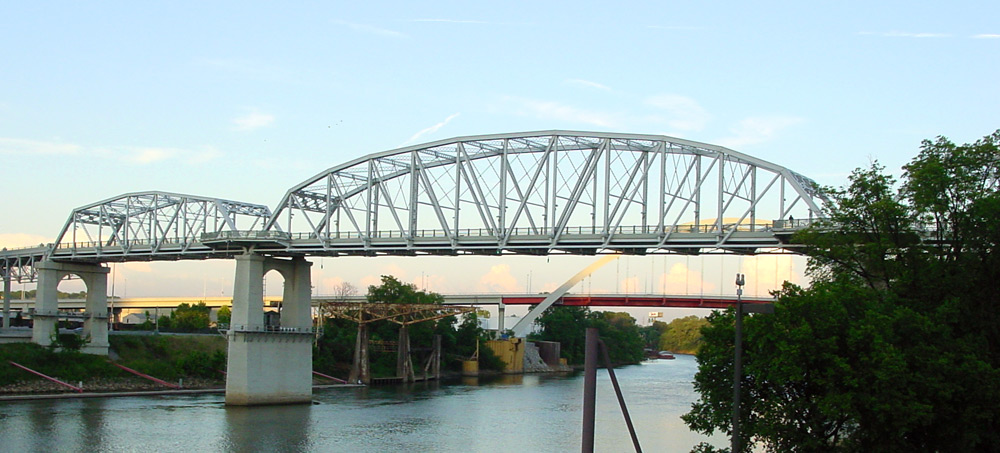
John Seigenthaler Pedestrian Bridge
Bridge · National Register of Historic Places · 1.0 mi
Pedestrian bridge in Nashville, Tennessee


Museums and landmarks116

Tennessee State Museum
Museum
Museum about the history of the Tennessee state
1000 Rosa L Parks Boulevard, Nashville
Tu, We, Fr, Sa 10:00-17:00; Th 10:00-20:00; Su 13:00-17:00

Frist Art Museum
Museum · National Register of Historic Places · 1.0 mi
Art museum in Nashville
919 Broadway, Nashville

Airdrie
Monument and historic site · National Register of Historic Places · 5.6 mi
Historic plantation house in Nashville, Tennessee
Alumni Hall
Monument and historic site · National Register of Historic Places · 2.0 mi
Building at Vanderbilt University, Nashville, Tennessee, USA
Belle Meade Apartments
Monument and historic site · National Register of Historic Places · 6.6 mi
Historic building in Belle Meade, Tennessee
Belle Meade Plantation
Monument and historic site · National Register of Historic Places · 6.4 mi
Human settlement in United States of America

Belmont Mansion
Monument and historic site · National Register of Historic Places · 2.6 mi
Plantation house in Nashville, Tennessee, United States
Belmont–Hillsboro Historic District
Monument and historic site · National Register of Historic Places · 3.0 mi
Historic district in Nashville, Tennessee
Bush–Herbert Building
Monument and historic site · National Register of Historic Places · 0.7 mi
Commercial building in Nashville, Tennessee
Capers C.M.E. Church
Monument and historic site · National Register of Historic Places · 1.1 mi
Church building in Tennessee, United States of America


Carnegie Library
Monument and historic site · National Register of Historic Places · 1.2 mi
Historic building in Nashville, Tennessee, United States
104 more on the map.
Parks, trails and playgrounds30

Nissan Stadium
Sports field and stadium · 0.8 mi
1 Titans Way, Nashville


East Park Playground
Playground · 1.3 mi
Swings, slides, climbing structure
600 Woodland Street, Nashville
Tennessee Tower Plaza
Park · 0.6 mi
Public greenspace at the Tennessee Tower
312 Rosa L Parks Ave, Nashville
18 more on the map.
Restaurants and cafes264


Jeff Ruby's Steakhouse - Nashville
Restaurant · Steak House, Seafood · 0.5 mi
Bar/sushi opens at 16:00
300 4th Avenue North, Nashville
Mo-Th 17:00-22:00; Fr-Sa 17:00-23:00

DeSano Pizzeria Napoletana
Restaurant · Pizza
1012 4th Avenue North
Su-Th 11:00-21:00; Fr-Sa 11:00-22:00

Germantown Café
Diner · American
1200 5th Avenue North, Nashville
Mo-Th 11:00-21:00; Fr 11:00-22:00; Sa 09:00-15:00,17:00-22:00; Su...
252 more on the map.
Where to stay56
Holston House Nashville - In the Unbound Collection
Motel and hotel · 0.8 mi
118 7th Avenue North, Nashville
Churches and places of worship126
Christ Church Cathedral
Church · Episcopal · National Register of Historic Places · 0.9 mi
900 Broadway, Nashville
St. Petka Serbian Orthodox Church
Church · Serbian Orthodox · 0.9 mi
1712 5th Avenue North, Nashville
Shopping10
Gas and EV charging10
Schools, colleges and libraries69
Main Branch Nashville Public Library
Library · 0.7 mi
615 Church Street, Nashville
Watkins Park Community Branch Nashville and Davidson Public Library
Library · 1.1 mi
612 17Th Avenue North, Nashville
Brick Church: A Lead Public School
School · 3.3 mi
2835 Brick Church Pike, Nashville
Healthcare4
Map of Nashville-Davidson
250 places. The map loads OpenStreetMap tiles when you open it.
Climate by month
Monthly table
| Month | High | Low | Rain |
|---|---|---|---|
| Jan | 48°F | 28°F | 4.7 in |
| Feb | 52°F | 31°F | 4.6 in |
| Mar | 62°F | 39°F | 5.4 in |
| Apr | 72°F | 47°F | 4.8 in |
| May | 80°F | 56°F | 5.3 in |
| Jun | 87°F | 64°F | 4.3 in |
| Jul | 89°F | 68°F | 4.3 in |
| Aug | 89°F | 67°F | 3.7 in |
| Sep | 84°F | 59°F | 4.2 in |
| Oct | 73°F | 47°F | 3.8 in |
| Nov | 62°F | 37°F | 3.8 in |
| Dec | 51°F | 32°F | 4.3 in |
U.S. Climate Normals 1991-2020 for Shelby Bottoms Nature (3 mi away), NOAA NCEI.
People and cost of living
American Community Survey 5-year estimates, 2020-2024, U.S. Census Bureau. Estimates have margins of error, larger for small towns.
Disaster history
Davidson County has had 21 federal disaster declarations since 2000, most often for severe storms.
- 2026-02-06: Severe Winter Storm (Winter Storm)
- 2026-01-24: Severe Winter Storm (Winter Storm)
- 2025-06-19: Severe Storms, Straight-Line Winds, Tornadoes, And Flooding (Severe Storm)
- 2025-04-02: Severe Storms, Straight-Line Winds, Tornadoes, And Flooding (Severe Storm)
- 2023-12-13: Severe Storms And Tornadoes (Severe Storm)
- 2023-05-17: Severe Storms, Straight-Line Winds, And Tornado (Severe Storm)
OpenFEMA disaster declarations summaries.
Getting there and nearby towns
Nashville International Airport (BNA) is the nearest airport with scheduled flights listed in OpenStreetMap, 7 miles away.
- Berry Hill 4 mi south, about 6 min by car
- Belle Meade 6 mi southwest, about 10 min by car
- Oak Hill 7 mi south, about 12 min by car
- Forest Hills 8 mi south, about 12 min by car
- Brentwood 12 mi south, about 20 min by car
- Goodlettsville 12 mi north, about 19 min by car
- Green Hill 13 mi east, about 20 min by car
- Hendersonville 14 mi northeast, about 22 min by car
- Murfreesboro 30 mi southeast, about 48 min by car
- Clarksville 41 mi northwest, about 1 h by car
Drive times are estimates from straight-line distance, not routes.
Local news
Headlines from INDB, the NEMICO news database.
Reviews, tips and questions
Loading what members have shared...
Sources and licences
- NCES EDGE (Public domain): public schools
- NOAA NCEI U.S. Climate Normals 1991-2020 (Public domain): climate by month
- OpenFEMA (Public domain): disaster declarations
- OpenStreetMap contributors (ODbL 1.0): places, airports, map data
- U.S. Census Bureau (Public domain): population, income, housing, education, commute
- Wikidata (CC0 1.0): landmarks and historic places
- Wikimedia Commons (see each image): photos
- Wikipedia (CC BY-SA 4.0): overview and history text
Photo credits
- Christ Church Cathedral, Nashville, User:Esrever, CC BY-SA 4.0
- Frist Center for the Visual Arts, Kathleen Conklin from Falls Church, USA, CC BY 2.0
- Shelby street bridge day, Unknown author, CC0
- WTN EVula 097, EVula, CC BY 3.0
- Richland Hall, Skye Marthaler, CC BY-SA 3.0
- Parthenon, Nashville, Mayur Phadtare, CC BY-SA 3.0
- Fisk University Carnegie Library, Nyttend, Public domain
- FederalOfficeBuildingNashville, Andrew Jameson, CC BY-SA 3.0
- FallSchoolNashville, Andrew Jameson, CC BY-SA 3.0
- First Tennessee Park, July 30, 2015 - 1, deldevries from Mount Juliet, TN, USA, CC BY-SA 2.0
- First Tennessee Park, July 30, 2015 - 2, deldevries from Mount Juliet, TN, USA, CC BY-SA 2.0
- Nashville Sounds, July 30, 2015, 1, deldevries from Mount Juliet, TN, USA, CC BY 2.0
- Nashville Sounds, July 30, 2015, 2, deldevries from Mount Juliet, TN, USA, CC BY 2.0
- Nashville Sounds, July 30, 2015 - 3, deldevries from Mount Juliet, TN, USA, CC BY-SA 2.0
- First Tennessee Park, September 1, 2015 - 1, bnpositive, CC BY-SA 2.0
- First Tennessee Park, September 1, 2015 - 2, bnpositive, CC BY-SA 2.0
- Walkway of the Counties 1, Bneu2013, CC BY-SA 4.0
- Rivers of Tennessee Fountains, Bneu2013, CC BY-SA 4.0
- Tennessee State Capitol cupola restoration 2017 (cropped), Bneu2013, CC BY 4.0
- Tennessee State Capitol cupola restoration 2017, Bneu2013, CC BY 4.0
- Sundquist Time Capsule Bicentennial Mall, Bneu2013, CC BY 4.0
- Tennessee Capitol Mall 2022d, Antony-22, CC BY-SA 4.0
- Tennessee State Library and Archives 2022c, Antony-22, CC BY-SA 4.0
- Tennessee Capitol Mall 2022f, Antony-22, CC BY-SA 4.0
- Tennessee Capitol Mall 2022j, Antony-22, CC BY-SA 4.0
- Tennessee State Capitol (554487412), Jim Bowen from Hampstead, London, United Kingdom, CC BY 2.0
- Bicentennial Capitol Mall History Wall 2, Bneu2013, CC BY 4.0
- World War II Memorial, Bicentennial Mall, rjones0856, CC BY 2.0
- Bicentennial Mall Civil War Monument, Bneu2013, CC BY-SA 4.0
- Bicentennial Capitol Mall History Wall 1, Bneu2013, CC BY 4.0
- Tennessee Bicentennial Mall - central lawn facing the Capitol Building, Stephen Yeargin, CC BY-SA 2.0
- Tennessee Bicentennial Mall - walking path, Stephen Yeargin, CC BY-SA 2.0
- Tennessee Bicentennial Mall - WWII Memorial globe, Stephen Yeargin, CC BY-SA 2.0
- Tennessee Bicentennial Mall - carillon pillars, Stephen Yeargin, CC BY-SA 2.0
- Tennessee Bicentennial Mall - Pathway of History beginning, Stephen Yeargin, CC BY-SA 2.0
- Tennessee Capitol Mall 2022e, Antony-22, CC BY-SA 4.0
- Tennessee Capitol Mall 2022g, Antony-22, CC BY-SA 4.0
- Tennessee Capitol Mall 2022h, Antony-22, CC BY-SA 4.0
- McNairy Spring, Bneu2013, CC BY-SA 4.0
- Tennessee Capitol Mall 2022i, Antony-22, CC BY-SA 4.0


Page built October 30, 2026. Spotted a mistake? Tell us or suggest a place.