
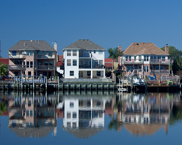


Why visit Nassau Bay
Townapedia lists 29 museums and landmarks, 12 parks and trails, 43 places to eat, 5 places to stay and 2 attractions in and around town.
Highlights include University of Houston–Clear Lake, Space Center Houston and Christopher C. Kraft Jr. Mission Control Center.
August is the warmest month, with average highs of 92°F; January lows average 46°F.
Weather in Nassau Bay
Forecast from the National Weather Service. Full forecast
About Nassau Bay
Nassau Bay is a city in Harris County, Texas, United States, bordering the outermost southeastern edge of the city of Houston. It is located in the Clear Lake Area near Galveston Bay, directly adjacent to the Lyndon B. Johnson Space Center. The population was 5,347 at the 2020 census.
From the Wikipedia article Nassau Bay, Texas (this version), under CC BY-SA 4.0.
Things to do2


Museums and landmarks29

Space Center Houston
Museum · 0.7 mi
Official visitor center of the Lyndon B. Johnson Space Center
1601 NASA Parkway, Houston
Mo-Su 10:00-17:00

Christopher C. Kraft Jr. Mission Control Center
Monument and historic site · National Register of Historic Places · 0.9 mi
Spacecraft control center at Johnson Space Center, Houston, Texas


Space Environment Simulation Laboratory
Monument and historic site · National Register of Historic Places · 1.1 mi
Structure in Houston, Harris County, Texas

Bay Area Museum
Museum · 2.0 mi
Local history museum in Clear Lake Park

Contributions to the Texas Rice Industry by Seito and Kiyoaki Saibara
Monument and historic site · 1.2 mi
17 more on the map.
Parks, trails and playgrounds12


Nassau Bay Yacht Club
Marina and boat launch · 0.6 mi
18250 Nassau Bay Drive, Nassau Bay

Restaurants and cafes43



Ca Phe Phin
Cafe · Coffee Shop, Vietnamese, Bubble Tea · 0.7 mi
1354 East NASA Parkway, Nassau Bay
Mo-Fr 10:00-18:00; Sa-Su 12:00-17:00
Frenchie's Italian Restaurant
Restaurant · Italian · 1.1 mi
1041 Nasa Parkway, Houston
Mo-Sa 11:00-22:00
Ichibon
Restaurant · Japanese · 1.1 mi
18206 Egret Bay Boulevard, Webster
Mo-Th 11:00-22:00; Fr 11:00-22:30; Sa 11:30-22:30; Su 11:30-22:00
Pho NASA
Restaurant · Vietnamese · 0.7 mi
1354 NASA Parkway, Nassau Bay
Mo-Fr 11:00-21:00; Su 12:00-20:00
Pomodoro's Cucina Italiana
Restaurant · Italian · 1.3 mi
2700 Marina Bay Drive, League City
Su-Th 11:00-21:00; Fr-Sa 11:00-22:00

Himalayan Taj Indian & Nepali Cusine
Restaurant · Indian, Nepali, Buffet · 0.7 mi
1425 Nasa Road 1, Houston
Su-Th 17:00-21:30; Fr,Sa 17:00-22:00; Mo-Fr 11:30-14:30; Sa,Su 11:30-15:00

Java Owl Coffee House
Cafe · Coffee Shop · 0.7 mi
1354 East NASA Parkway, Nassau Bay
Mo-Th 06:00-18:00; Fr 06:00-21:00; Sa 07:00-21:00
31 more on the map.
History
Colonel Raymond Pearson established the Spirit of 1776 Ranch on what would become Nassau Bay. In 1962, a community was planned which would be an exclusive residential and commercial area emphasizing its pioneers and at a then-staggering cost of $49 million. In 1962 construction of Nassau Bay began and the first residents moved to Nassau Bay in 1964; its initial population was 400. It was developed by Ernest W. Roe Company, with Thompson McCleary of Caudill, Rowlett, and Scott providing architectural services and Nassau Bay Development Associates establishing the development. The name was chosen by the developers because of the tropical feeling it generated. At the time, NASA was moving personnel from several areas in the United States with a high quality of life, including California and, notably, Florida.
In 1968 the community had 2,979 residents. The city incorporated in 1970. The population was 6,702 in 1980, 4,526 in 1982, 4,506 in 1991, and 4,170 in 2000.
From the History section of Nassau Bay, Texas on Wikipedia, under CC BY-SA 4.0.
Where to stay5
Extended Stay America Houston
Motel and hotel · 0.6 mi
1410 Nasa Parkway, Houston
Microtel Inn & Suites by Wyndham Houston
Motel and hotel · 0.6 mi
1620 NASA Parkway, Houston
Churches and places of worship6
Nassau Bay Baptist Church
Church · Baptist · 0.7 mi
18131 Nassau Bay Drive, Houston
St. Paul the Apostle Catholic Church
Church · Roman Catholic
18223 Point Lookout Drive, Houston
St. Thomas the Apostle Episcopal Church
Church · Episcopal
18300 Upper Bay Road, Houston
Shopping4
Gas and EV charging5
Schools, colleges and libraries46
Healthcare3
Map of Nassau Bay
155 places. The map loads OpenStreetMap tiles when you open it.
Climate by month
Monthly table
| Month | High | Low | Rain | Snow |
|---|---|---|---|---|
| Jan | 64°F | 46°F | 4.8 in | 0.0 in |
| Feb | 67°F | 50°F | 3.0 in | 0.0 in |
| Mar | 73°F | 56°F | 3.3 in | 0.0 in |
| Apr | 78°F | 61°F | 4.2 in | 0.0 in |
| May | 85°F | 69°F | 5.1 in | 0.0 in |
| Jun | 90°F | 75°F | 6.5 in | 0.0 in |
| Jul | 92°F | 76°F | 4.4 in | 0.0 in |
| Aug | 92°F | 76°F | 6.6 in | 0.0 in |
| Sep | 88°F | 72°F | 7.3 in | 0.0 in |
| Oct | 82°F | 63°F | 5.8 in | 0.0 in |
| Nov | 72°F | 53°F | 4.5 in | 0.0 in |
| Dec | 66°F | 47°F | 4.5 in | 0.2 in |
U.S. Climate Normals 1991-2020 for Houston Nwso (5 mi away), NOAA NCEI.
People and cost of living
American Community Survey 5-year estimates, 2020-2024, U.S. Census Bureau. Estimates have margins of error, larger for small towns.
Disaster history
Harris County has had 26 federal disaster declarations since 2000, most often for hurricanes.
- 2024-07-09: Hurricane Beryl (Hurricane)
- 2024-05-17: Severe Storms, Straight-Line Winds, Tornadoes, And Flooding (Flood)
- 2021-02-19: Severe Winter Storms (Severe Ice Storm)
- 2021-02-14: Severe Winter Storm (Severe Ice Storm)
- 2020-08-24: Tropical Storms Marco And Laura (Hurricane)
- 2020-07-26: Hurricane Hanna (Hurricane)
OpenFEMA disaster declarations summaries.
Getting there and nearby towns
Ellington Airport (EFD) is the nearest airport with scheduled flights listed in OpenStreetMap, 6 miles away.
- Webster 2 mi southwest, about 3 min by car
- Taylor Lake Village 3 mi northeast, about 4 min by car
- El Lago 3 mi northeast, about 5 min by car
- Clear Lake Shores 3 mi east, about 5 min by car
- League City 4 mi south, about 6 min by car
- Kemah 4 mi east, about 6 min by car
- Bacliff 6 mi southeast, about 10 min by car
- Dickinson 7 mi south, about 11 min by car
- Seabrook 7 mi northeast, about 11 min by car
- Friendswood 7 mi west, about 12 min by car
Drive times are estimates from straight-line distance, not routes.
Local news
Headlines from INDB, the NEMICO news database.
Reviews, tips and questions
Loading what members have shared...
Sources and licences
- NCES EDGE (Public domain): public schools
- NOAA NCEI U.S. Climate Normals 1991-2020 (Public domain): climate by month
- OpenFEMA (Public domain): disaster declarations
- OpenStreetMap contributors (ODbL 1.0): places, airports, map data
- U.S. Census Bureau (Public domain): population, income, housing, education, commute
- Wikidata (CC0 1.0): elevation, founding date, time zone, website, landmarks and historic places
- Wikimedia Commons (see each image): photos
- Wikipedia (CC BY-SA 4.0): overview and history text
Photo credits
- Lakeside Houses in Nassau Bay TX, Mike Fisher from Webster, TX, USA, CC BY 2.0
- Space Center Houston 2022, Shujianyang, CC BY 4.0
- Christopher Kraft Mission Control Center, James Blair, Public domain
- S98 15754, NASA, Public domain
- Bayou Building, RJN2, CC BY-SA 3.0
Page built October 30, 2026. Spotted a mistake? Tell us or suggest a place.