
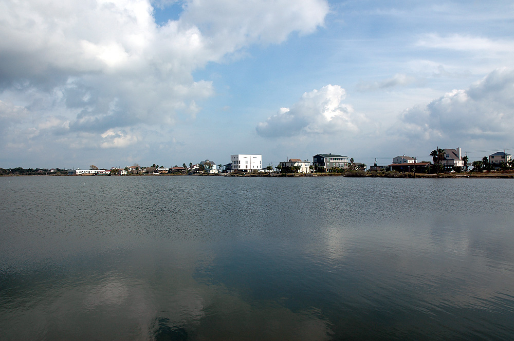


Seabrook, Texas
Seabrook is a city of 13,768 people in Chambers County, Texas, founded in 1961.
Why visit Seabrook
Townapedia lists 5 museums and landmarks, 9 parks and trails, 1 place to eat, 1 place to stay and 1 attraction in and around town.
Highlights include Kemah Boardwalk, Houston Yacht Club, El Jardin Beach Park and Friendship Park.
August is the warmest month, with average highs of 92°F; January lows average 46°F.
Weather in Seabrook
Forecast from the National Weather Service. Full forecast
About Seabrook
Seabrook is a city in Harris County, Texas, United States, with some water surface area located within Chambers County. The population was 13,618 at the 2020 U.S. census. Several fish markets line the city's waterfront, while antique shops and bed and breakfast establishments are found in the city's downtown area.
From the Wikipedia article Seabrook, Texas (this version), under CC BY-SA 4.0.
Things to do1
Kemah Boardwalk
Monument and historic site · 3.4 mi
Theme park in Kemah, Texas
Museums and landmarks5

Parks, trails and playgrounds9

Restaurants and cafes1

Subway
Fast food · Sandwich · 2.1 mi
5735 Bayport Boulevard, Seabrook
Mo-Th 07:00-21:00; Fr-Su 09:00-21:00
History
Seabrook is known for its fish markets on Waterfront Drive where resident shrimpers and fishermen bring in their catches daily. Besides bordering the bay, the city encompasses marshes through which runoff from inland fields drain to the bay. The piece of land was purchased by Seabrook W. Sydnor, who was the son of Galveston mayor and slave trader John Seabrook Sydnor, in 1895. In March 1903, the Seabrook Company of Houston created a layout of the proposed Seabrook Town site. The new town attracted fishermen, merchants and even a few residents.
The Galveston Hurricane of 1900 demolished the local school, but by 1905 it was restored and was run by three teachers who taught 100 students. The local schools became part of the Clear Creek Independent School District in 1947. The population of Seabrook rose from 200 to 560 before the Great Depression, but fell to 200 in 1936, and remained at 400 from 1940 until 1947, when the Albert and Ernest Fay shipyard opened. It could handle 150 boats, and opened up jobs and is the main cause of the population increase. Despite damage from Hurricane Carla, a bridge linking Seabrook and Kemah was completed in 1961. With the opening of the bridge and the Johnson Space Center (JSC) in Houston, Seabrook's population rose to approximately 6,000.
From the History section of Seabrook, Texas on Wikipedia, under CC BY-SA 4.0.
Where to stay1
Gas and EV charging2
Schools, colleges and libraries20
Map of Seabrook
39 places. The map loads OpenStreetMap tiles when you open it.
Climate by month
Monthly table
| Month | High | Low | Rain | Snow |
|---|---|---|---|---|
| Jan | 64°F | 46°F | 4.8 in | 0.0 in |
| Feb | 67°F | 50°F | 3.0 in | 0.0 in |
| Mar | 73°F | 56°F | 3.3 in | 0.0 in |
| Apr | 78°F | 61°F | 4.2 in | 0.0 in |
| May | 85°F | 69°F | 5.1 in | 0.0 in |
| Jun | 90°F | 75°F | 6.5 in | 0.0 in |
| Jul | 92°F | 76°F | 4.4 in | 0.0 in |
| Aug | 92°F | 76°F | 6.6 in | 0.0 in |
| Sep | 88°F | 72°F | 7.3 in | 0.0 in |
| Oct | 82°F | 63°F | 5.8 in | 0.0 in |
| Nov | 72°F | 53°F | 4.5 in | 0.0 in |
| Dec | 66°F | 47°F | 4.5 in | 0.2 in |
U.S. Climate Normals 1991-2020 for Houston Nwso (10 mi away), NOAA NCEI.
People and cost of living
American Community Survey 5-year estimates, 2020-2024, U.S. Census Bureau. Estimates have margins of error, larger for small towns.
Disaster history
Chambers County has had 18 federal disaster declarations since 2000, most often for hurricanes.
- 2024-07-09: Hurricane Beryl (Hurricane)
- 2021-02-19: Severe Winter Storms (Severe Ice Storm)
- 2021-02-14: Severe Winter Storm (Severe Ice Storm)
- 2020-08-24: Tropical Storms Marco And Laura (Hurricane)
- 2020-03-25: Covid-19 Pandemic (Biological)
- 2020-03-13: Covid-19 (Biological)
OpenFEMA disaster declarations summaries.
Getting there and nearby towns
Ellington Airport (EFD) is the nearest airport with scheduled flights listed in OpenStreetMap, 10 miles away.
- La Porte 6 mi northwest, about 10 min by car
- League City 10 mi southwest, about 16 min by car
- Pasadena 10 mi northwest, about 17 min by car
- Deer Park 10 mi northwest, about 16 min by car
- Dickinson 10 mi south, about 17 min by car
- Baytown 12 mi north, about 19 min by car
- Friendswood 14 mi southwest, about 22 min by car
- La Marque 15 mi south, about 25 min by car
- Channelview 16 mi northwest, about 25 min by car
- Cloverleaf 17 mi northwest, about 28 min by car
Drive times are estimates from straight-line distance, not routes.
Local news
Headlines from INDB, the NEMICO news database.
Reviews, tips and questions
Loading what members have shared...
Sources and licences
- NCES EDGE (Public domain): public schools
- NOAA NCEI U.S. Climate Normals 1991-2020 (Public domain): climate by month
- OpenFEMA (Public domain): disaster declarations
- OpenStreetMap contributors (ODbL 1.0): places, airports, map data
- U.S. Census Bureau (Public domain): population, income, housing, education, commute
- Wikidata (CC0 1.0): elevation, founding date, time zone, website, landmarks and historic places
- Wikimedia Commons (see each image): photos
- Wikipedia (CC BY-SA 4.0): overview and history text
Photo credits
- Seabrook-tx-lower-todville, Unknown author, CC BY-SA 2.5
- KemahBoardwalk--KemahTexas--24DEC2021, CharlesShirley, CC BY-SA 4.0
Page built October 30, 2026. Spotted a mistake? Tell us or suggest a place.