


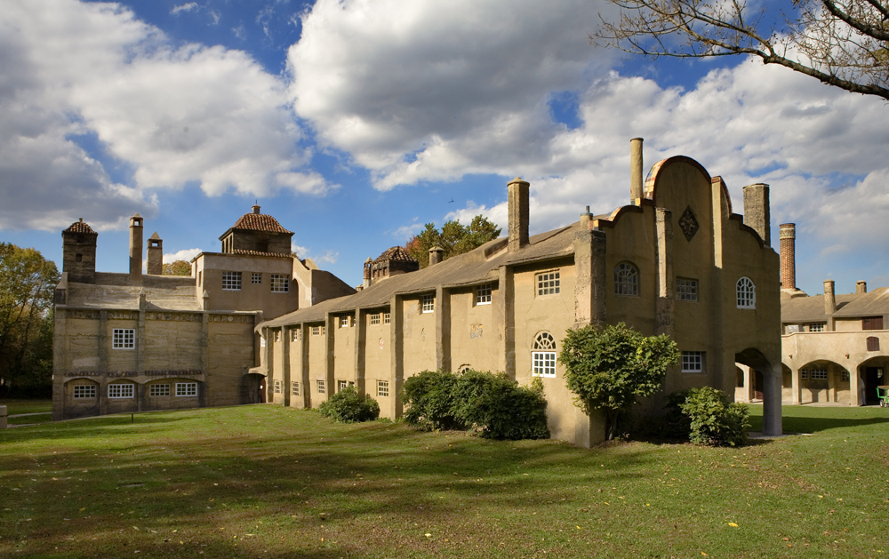


New Britain, Pennsylvania
New Britain is a borough of 2,821 people in Bucks County, Pennsylvania, founded in 1715.
Why visit New Britain
Townapedia lists 18 museums and landmarks, 8 parks and trails, 6 places to eat and 1 attraction in and around town.
Highlights include Pine Valley Covered Bridge, Chalfont Historic District, Doylestown Historic District and Peace Valley Park.
July is the warmest month, with average highs of 86°F; January lows average 23°F.
Weather in New Britain
Forecast from the National Weather Service. Full forecast
About New Britain
New Britain is a borough in Bucks County, Pennsylvania, United States. The population was 2,836 at the 2020 census, a decrease from the figure of 3,152 tabulated in 2010.
From the Wikipedia article New Britain, Pennsylvania (this version), under CC BY-SA 4.0.
Things to do1

Pine Valley Covered Bridge
Bridge · National Register of Historic Places · 0.6 mi
Museums and landmarks18
Chalfont Historic District
Monument and historic site · National Register of Historic Places · 1.8 mi
Historic district in Pennsylvania, United States

Doylestown Historic District
Monument and historic site · National Register of Historic Places · 2.3 mi
Historic district in Pennsylvania, USA

Fonthill
Monument and historic site · National Register of Historic Places · 3.3 mi
In Doylestown Township, Pennsylvania

Fonthill, Mercer Museum and Moravian Pottery and Tile Works
Monument and historic site · National Register of Historic Places · 3.0 mi
Listed on the NRHP in Bucks County, Pennsylvania and home of Mercer tiles

Fordhook Farm
Monument and historic site · National Register of Historic Places · 1.5 mi
Historic districted in Doylestown Township, Penn.

Fretz Farm
Monument and historic site · National Register of Historic Places · 3.3 mi
Building in Pennsylvania, United States

James-Lorah House
Monument and historic site · National Register of Historic Places · 2.6 mi
Historic house in Pennsylvania, United States
Mercer Museum
Museum · National Register of Historic Places · 2.7 mi
Museum in Doylestown, Pennsylvania, USA
Moravian Pottery and Tile Works
Museum · National Register of Historic Places · 3.3 mi
History museum in Doylestown Township, United States of America

Morgan James Homestead
Monument and historic site · National Register of Historic Places · 1.3 mi
Building in Pennsylvania, United States

Pugh Dungan House
Monument and historic site · National Register of Historic Places · 2.6 mi
Historic house in Pennsylvania, United States

Shaw Historic District
Monument and historic site · National Register of Historic Places · 2.3 mi
Historic district in Doylestown, Pennsylvania, United States
6 more on the map.
Parks, trails and playgrounds8


Peace Valley Park
Park · 2.0 mi
Park in Pennsylvania, United States of America, United States of America


Restaurants and cafes6




Philly Pretzel Factory
Fast food · Pretzel · 0.6 mi
424 Town Center, New Britain
Mo,Sa 08:00-17:00; Tu-Fr 07:30-17:00; Su 09:00-16:00
History
Eugene James built an estate about 1731 and included the Mathews homestead, a fine Colonial house built in 1744 upon the site of an earlier house destroyed by fire. The village of James Manor was begun on the estate by Wynne James. Nearby villages were Jamestown, New Britain and Vauxtown. The National Farm School, now the Delaware Valley University was built near James Manor.
The Sign of the Horses and Wagon was a tavern in the west end of the village, where Lafayette headquartered at the time. The Continental Army marched from Valley Forge to Monmouth, New Jersey.
The first dwelling in the village of New Britain was built at the intersection of West Butler Avenue (U.S. Route 202) and Almshouse Road by David Stephens, who purchased land from Joseph Kirkbride, sometime before 1760.
Early on, the village was called Bittings Store or Bittings Corner for a short time. Most of the people living in village were members of the Montgomery Baptist Church. About 1740 they separated from Montgomery calling their church the Society Meeting House, the first pastors William Davis, Joseph Eaton, and Joshua Jones. By 1813, the name was changed to the New Britain Baptist Church.
From the History section of New Britain, Pennsylvania on Wikipedia, under CC BY-SA 4.0.
Churches and places of worship4
Shopping1
Gas and EV charging1
Schools, colleges and libraries28
Healthcare2
Map of New Britain
69 places. The map loads OpenStreetMap tiles when you open it.
Climate by month
Monthly table
| Month | High | Low | Rain |
|---|---|---|---|
| Jan | 39°F | 23°F | 3.2 in |
| Feb | 42°F | 25°F | 2.5 in |
| Mar | 50°F | 31°F | 3.9 in |
| Apr | 63°F | 41°F | 3.9 in |
| May | 72°F | 51°F | 4.3 in |
| Jun | 81°F | 60°F | 4.2 in |
| Jul | 86°F | 65°F | 5.5 in |
| Aug | 84°F | 63°F | 4.9 in |
| Sep | 77°F | 57°F | 4.3 in |
| Oct | 65°F | 45°F | 3.8 in |
| Nov | 54°F | 36°F | 3.4 in |
| Dec | 44°F | 28°F | 4.0 in |
U.S. Climate Normals 1991-2020 for Doylestown Ap (4 mi away), NOAA NCEI.
People and cost of living
American Community Survey 5-year estimates, 2020-2024, U.S. Census Bureau. Estimates have margins of error, larger for small towns.
Disaster history
Bucks County has had 17 federal disaster declarations since 2000, most often for hurricanes.
- 2021-09-10: Remnants Of Hurricane Ida (Hurricane)
- 2020-03-30: Covid-19 Pandemic (Biological)
- 2020-03-13: Covid-19 (Biological)
- 2016-03-23: Severe Winter Storm And Snowstorm (Snowstorm)
- 2014-02-06: Severe Winter Storm (Severe Ice Storm)
- 2013-01-10: Hurricane Sandy (Hurricane)
OpenFEMA disaster declarations summaries.
Getting there and nearby towns
Doylestown Airport (DYL) is the nearest airport with scheduled flights listed in OpenStreetMap, 4 miles away.
- Chalfont 2 mi southwest, about 3 min by car
- Doylestown 3 mi east, about 5 min by car
- Brittany Farms-The Highlands 3 mi southwest, about 5 min by car
- Montgomeryville 5 mi southwest, about 8 min by car
- Dublin 6 mi north, about 9 min by car
- Silverdale 6 mi northwest, about 9 min by car
- Lansdale 7 mi southwest, about 11 min by car
- Hatfield 7 mi west, about 11 min by car
- Horsham 8 mi south, about 13 min by car
- Maple Glen 8 mi south, about 14 min by car
Drive times are estimates from straight-line distance, not routes.
Local news
Headlines from INDB, the NEMICO news database.
Reviews, tips and questions
Loading what members have shared...
Sources and licences
- NCES EDGE (Public domain): public schools
- NOAA NCEI U.S. Climate Normals 1991-2020 (Public domain): climate by month
- OpenFEMA (Public domain): disaster declarations
- OpenStreetMap contributors (ODbL 1.0): places, airports, map data
- U.S. Census Bureau (Public domain): population, income, housing, education, commute
- Wikidata (CC0 1.0): elevation, founding date, time zone, website, landmarks and historic places
- Wikimedia Commons (see each image): photos
- Wikipedia (CC BY-SA 4.0): overview and history text
Photo credits
- County Cinema Dtown, Smallbones, Public domain
- MercerMuseum, KForce at en.wikipedia, CC BY-SA 3.0
- MonorovianTileWorks, Unknown author, CC BY-SA 2.5
- Fountain House 2010, Smallbones, Public domain
- Main Street Chalfont, User:MikeParker , Michael H. Parker, CC BY 2.5
- Shaw HD Dtown, Smallbones, Public domain
- Pugh Dungan Hs BucksCo PA, Smallbones, CC0
- Fonthill, KForce at English Wikipedia, CC BY-SA 3.0
- Fretz Farm, Smallbones, Public domain
- FORDHOOK FARM, JERRYE & ROY KLOTZ MD, CC BY-SA 3.0
- Fretz Mansion, Doylestown PA 02, Shuvaev, CC BY-SA 3.0
- Morgan James Homestead, Hshuvaeva, CC0
- James Lorah Doylestown, Smallbones, Public domain
- Michener Museum Dtown, Smallbones, Public domain
- Lake Galena in Peace Valley Park from dam, Dough4872, CC BY-SA 3.0


Page built October 30, 2026. Spotted a mistake? Tell us or suggest a place.