


New Milford, New Jersey
New Milford is a borough of 16,995 people in Bergen County, New Jersey, founded in 1922.
Why visit New Milford
Townapedia lists 46 museums and landmarks, 21 parks and trails, 20 places to eat and 6 attractions in and around town.
Highlights include Swing Bridge at New Bridge Landing, Anderson Street Bridge, Abram Demaree House and Anderson Outkitchen.
July is the warmest month, with average highs of 87°F; January lows average 26°F.
Weather in New Milford
Forecast from the National Weather Service. Full forecast
About New Milford
New Milford is a borough in Bergen County, in the U.S. state of New Jersey. As of the 2020 United States census, the borough's population was 16,923, an increase of 582 (+3.6%) from the 2010 census count of 16,341, which in turn reflected a decline of 59 (−0.4%) from the 16,400 counted in the 2000 census.
From the Wikipedia article New Milford, New Jersey (this version), under CC BY-SA 4.0.
Things to do6

Swing Bridge at New Bridge Landing
Bridge · National Register of Historic Places · 1.5 mi
Bridge at New Bridge Landing, New Jersey
Anderson Street Bridge
Bridge · 3.0 mi
Bridge in United States of America

Bergen Performing Arts Center
Cinema and theater · 3.6 mi
Theater and former movie theater in Englewood, New Jersey, United States

Fairleigh Dickinson University
School · 2.6 mi
Private university in New Jersey, United States
Bergenfield Cinemas
Cinema and theater · 1.3 mi
63 South Washington Avenue, Bergenfield

Museums and landmarks46

Abram Demaree House
Monument and historic site · National Register of Historic Places · 3.5 mi
House in Closter, New Yorsey

Anderson Outkitchen
Monument and historic site · National Register of Historic Places · 3.4 mi
House in Hackensack, New Jersey

Anderson Street
Monument and historic site · National Register of Historic Places · 3.0 mi
Rail station in NJ

Banta-Coe House
Monument and historic site · National Register of Historic Places · 2.8 mi
Historic house in New Jersey, United States

Beauclaire-Vreeland House
Monument and historic site · National Register of Historic Places · 1.5 mi
Historic house in New Jersey, United States

Benjamin P. Westervelt House
Monument and historic site · National Register of Historic Places · 3.3 mi
Historic house in New Jersey, United States
Blackledge-Gair House
Monument and historic site · National Register of Historic Places · 2.8 mi
Historic house in Cresskill, New Jersey, United States
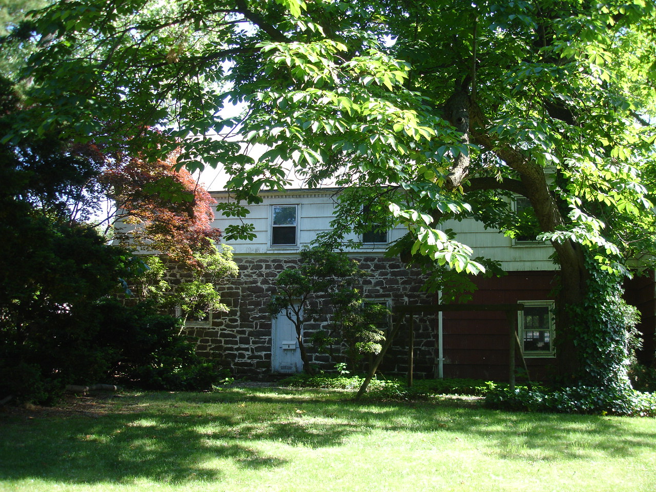
Bogert House
Monument and historic site · National Register of Historic Places · 3.6 mi
Historic house in New Jersey, United States

Campbell-Christie House
Museum · National Register of Historic Places · 1.6 mi
Historic house in River Edge, New Jersey
Christie-Parsels House
Monument and historic site · National Register of Historic Places · 2.5 mi
Historic house in New Jersey, United States
Daniel Demarest House
Monument and historic site · National Register of Historic Places · 1.8 mi
Historic house in Bergen County, New Jersey


David and Cornelius Van Horn House
Monument and historic site · National Register of Historic Places · 3.6 mi
Historic house in Closter, New Jersey
34 more on the map.
Parks, trails and playgrounds21

Camp Merritt Memorial Circle
Park · 2.3 mi
Park in New Jersey, United States of America, United States of America

9 more on the map.
Restaurants and cafes20

Green Dragon BBQ Restaurang
Restaurant · Chinese · 1.1 mi
1041 River Road, New Milford


Tommy Fox's Public House
Bar and pub · 1.3 mi
32 South Washington Avenue, Bergenfield


Domino's
Fast food · Pizza · 1.3 mi
13 Washington Avenue, Dumont
Mo-Th 10:30-24:00; Fr-Sa 10:30-01:00; Su 10:30-24:00
Dunkin'
Fast food · Donut, Coffee Shop · 1.4 mi
125 Washington Avenue, Dumont
Mo-Fr 05:00-20:00; Sa-Su 05:30-20:00
8 more on the map.
Churches and places of worship34
Schraalenburgh North Church
Church · National Register of Historic Places · 1.3 mi
South Schraalenburgh Church
Church · National Register of Historic Places · 0.9 mi
Saint John the Evangelist Roman Catholic Church
Church · Catholic · 1.3 mi
29 North Washington Avenue, Bergenfield
Shopping5
Mervin Oakes Pool Supplies
Hardware store · 1.0 mi
222 Virginia Avenue, New Milford
Gas and EV charging3
Schools, colleges and libraries63
Bergen County Technical High School - Paramus
School · 2.6 mi
E.285 Pascack Road, Paramus
Healthcare3
AM/PM Walk In Urgent Care Center
Clinic and pharmacy · 1.3 mi
19 South Washington Avenue, Bergenfield
Map of New Milford
201 places. The map loads OpenStreetMap tiles when you open it.
Climate by month
Monthly table
| Month | High | Low | Rain |
|---|---|---|---|
| Jan | 40°F | 26°F | 3.3 in |
| Feb | 43°F | 27°F | 2.8 in |
| Mar | 51°F | 34°F | 4.1 in |
| Apr | 62°F | 44°F | 4.0 in |
| May | 73°F | 53°F | 3.9 in |
| Jun | 82°F | 63°F | 4.2 in |
| Jul | 87°F | 69°F | 4.5 in |
| Aug | 85°F | 67°F | 4.2 in |
| Sep | 78°F | 60°F | 4.1 in |
| Oct | 67°F | 48°F | 3.7 in |
| Nov | 56°F | 38°F | 3.3 in |
| Dec | 45°F | 31°F | 4.1 in |
U.S. Climate Normals 1991-2020 for Teterboro Ap (6 mi away), NOAA NCEI.
People and cost of living
American Community Survey 5-year estimates, 2020-2024, U.S. Census Bureau. Estimates have margins of error, larger for small towns.
Disaster history
Bergen County has had 21 federal disaster declarations since 2000, most often for hurricanes.
- 2021-09-05: Remnants Of Hurricane Ida (Hurricane)
- 2021-09-02: Remnants Of Hurricane Ida (Hurricane)
- 2020-12-11: Tropical Storm Isaias (Hurricane)
- 2020-03-25: Covid-19 Pandemic (Biological)
- 2020-03-13: Covid-19 (Biological)
- 2018-06-08: Severe Winter Storm And Snowstorm (Severe Storm)
OpenFEMA disaster declarations summaries.
Getting there and nearby towns
Teterboro Airport (TEB) is the nearest airport with scheduled flights listed in OpenStreetMap, 6 miles away.
- River Edge 1 mi southwest, about 2 min by car
- Bergenfield 1 mi southeast, about 2 min by car
- Dumont 2 mi northeast, about 3 min by car
- Hackensack 3 mi southwest, about 5 min by car
- Maywood 3 mi southwest, about 5 min by car
- Englewood 4 mi southeast, about 6 min by car
- Tenafly 4 mi east, about 6 min by car
- Westwood 4 mi north, about 6 min by car
- Fair Lawn 5 mi west, about 8 min by car
- Lodi 5 mi southwest, about 8 min by car
Drive times are estimates from straight-line distance, not routes.
Local news
Headlines from INDB, the NEMICO news database.
Reviews, tips and questions
Loading what members have shared...
Sources and licences
- NCES EDGE (Public domain): public schools
- NOAA NCEI U.S. Climate Normals 1991-2020 (Public domain): climate by month
- OpenFEMA (Public domain): disaster declarations
- OpenStreetMap contributors (ODbL 1.0): places, airports, map data
- U.S. Census Bureau (Public domain): population, income, housing, education, commute
- Wikidata (CC0 1.0): elevation, founding date, time zone, website, landmarks and historic places
- Wikimedia Commons (see each image): photos
- Wikipedia (CC BY-SA 4.0): overview and history text
Photo credits
- DEMAREST-BLOOMER HOUSE, NEW MILFORD, BERGEN COUNTY NJ, JERRYE & ROY KLOTZ, M.D., CC BY-SA 4.0
- 2018-09-12 11 56 10 View south along Bergen County Route 41 (River Road) at McKinley Avenue in New Milford, Bergen County, New Jersey, Famartin, CC BY-SA 4.0
- Bergen CR 74 wb entering New Milford, NJ, Nov. 2025, Mr. Matté (if there is an issue with this image, contact me using this image's Commons talk page , my Commons user talk page , or my English Wikipedia user talk page ; I'll know about it a lot faster), CC BY-SA 4.0
- Former New Milford, NJ Water Plant, Nov. 2025, Mr. Matté (if there is an issue with this image, contact me using this image's Commons talk page , my Commons user talk page , or my English Wikipedia user talk page ; I'll know about it a lot faster), CC BY-SA 4.0
- New Milford Avenue Bridge 20070703, Jag9889, CC BY-SA 4.0
- Inside the New Milford Plant - 002, Siddharth Patil, CC0
- Inside the New Milford Plant - 003, Siddharth Patil, CC0
- Disused control panel in the New Milford Plant, Siddharth Patil, CC0
- The New Milford Plant from the road, Siddharth Patil, CC0
- Front of the New Milford Plant, Siddharth Patil, CC0
- Disused pump in the New Milford Plant, Siddharth Patil, CC0
- Disused building at the New Milford Plant, Siddharth Patil, CC0
- Water release valve at the New Milford Plant, Siddharth Patil, CC0
- Inside the New Milford Plant - 001, Siddharth Patil, CC0
- Side of the New Milford Plant, Siddharth Patil, CC0
- Inside the New Milford Plant - 004, Siddharth Patil, CC0
- Art Center of Northern New Jersey (New Milford, New Jersey), Bvar on Wiki, CC0
- 2018-09-12 11 50 14 View north along Bergen County Route 41 (River Road) at Rambler Avenue in New Milford, Bergen County, New Jersey, Famartin, CC BY-SA 4.0
- ABRAM DEMAREE HOUSE, CLOSTER, BERGEN COUNTY, JERRYE & ROY KLOTZ MD, CC BY-SA 4.0
- JACOBUS DESMAREST HOUSE, NEW MILFORD, BERGEN COUNTY, NJ, JERRYE & ROY KLOTZ, M.D., CC BY-SA 4.0
- DEMAREST-ATWOOD HOUSE - CRESSKILL BERGEN COUNTY, JERRYE & ROY KLOTZ M.D., CC BY-SA 4.0
- GARRET ZABRISKE HOUSE, HAWORTH, BERGEN COUNTY, User:KLOTZPLATE JERRYE & ROY KLOTZ, M.D., CC BY-SA 4.0
- Cambell Christie House c.1774 with Outkitchen Historic New Bridge Landing River Edge, NJ, JILLIEE, CC BY-SA 4.0
- 863 Midland Avenue - Oradell - Bergen County - New Jersey, Peter Hare, CC BY-SA 3.0
- ELIZABETH CADY STANTON HOUSE NHL, TENAFLY, BERGEN COUNTY, JERRYE & ROY KLOTZ, M.D., CC BY-SA 4.0
- BantaCoe, KForce, CC BY-SA 3.0
- ANDERSON OUTKITCHEN, HACKENSACK, BERGEN COUNTY, JERRYE & ROY KLOTZ, M.D., CC BY-SA 4.0
- DEMAREST RAILROAD DEPOT, BERGEN COUNTY, NJ, JERRYE & ROY KLOTZ MD, CC BY-SA 4.0
- Anderson Street Station April 2014, Adam Moss, CC BY-SA 2.0
- DEBAUN-DEMAREST HOUSE, RIVER EDGE, BERGEN COUNTY, JERRYE & ROY KLOTZ, M.D., CC BY-SA 4.0
- Demarest House Museum c.1794, JILLIEE, CC BY-SA 4.0
- NYSW ALCO Type S-2, Lithium6ion, Public domain
- GARRET J. DURIE HOUSE, HAWORTH, BERGEN COUNTY, JERRYE & ROY KLOTZ, M.D., CC BY-SA 4.0
- BEAUCLAIRE-VREELAND HOUSE, BERGENFIELD, BERGEN COUNTY, User:KLOTZPLATE JERRYE & ROY KLOTZ, M.D., CC BY-SA 4.0
- BogertHouse, KForce at en.wikipedia, CC BY-SA 3.0
- HARDENBURGH AVENUE BRIDGE, DEMAREST, BERGEN COUNTY, NJ, JERRYE & ROY KLOTZ MD, CC BY-SA 4.0
- DERICK BANTA HOUSE, DUMONT, BERGEN COUNTY, NJ, JERRYE & ROY KLOTZ, M.D., CC BY-SA 4.0
- Zabriskie-Kipp-Cadmus House, Alansohn at en.wikipedia, CC BY-SA 3.0
- DAVID & CORNELIUS VAN HORN HOUSE, CLOSTER, BERGEN COUNTY, NJ, JERRYE & ROY KLOTZ MD, CC BY-SA 4.0
- Oradell Erie TNJ depot south dusk dusk jeh, Jim.henderson, CC0


Page built October 30, 2026. Spotted a mistake? Tell us or suggest a place.